Continued from the previous page.
"LITTLE SIBERIA"
The nickname for this short section of the West Rim Trail is fairly accurate.
This is the only place I saw any snow and ice this week while hiking
at Zion, including Refrigerator Canyon and places that were at higher
elevations. This deep, narrow southwestern arm of Telephone Canyon is in the shade
almost all day.
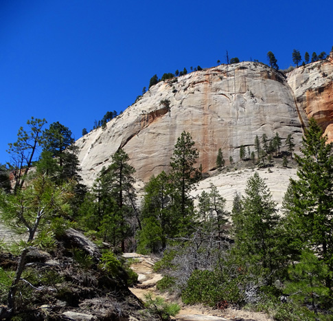
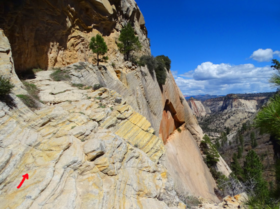
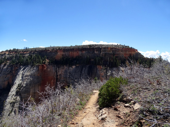
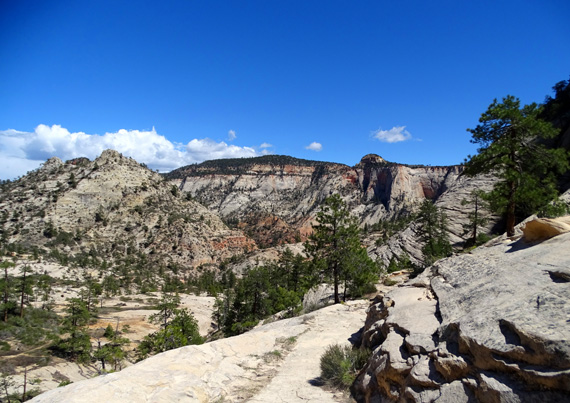
Approaching "Little Siberia"
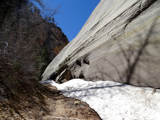
After crossing the sloping slick rock above Telephone Canyon on
my way to the top of the west rim I came to this more
vegetated area and found snow close to the trail in
several places, as well as in some crevices higher up in the rock walls:
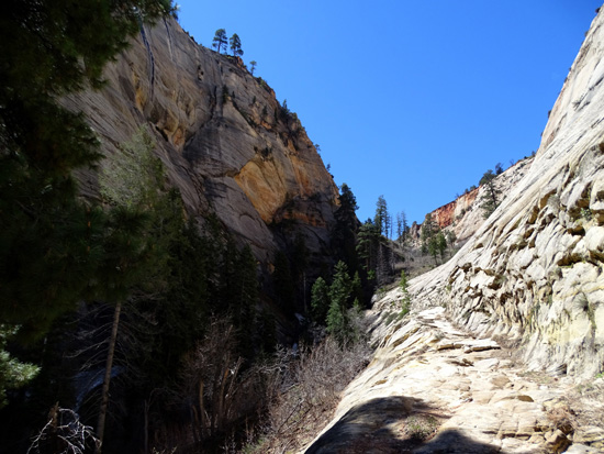
Rough trail approaching the
saddle, and more snow in the shade on the left
The trail starts to switchback up the cliff on the right --
part of the west rim -- before it reaches the saddle at the upper end of
this narrow canyon, then continues to wind its way up to the top of the rim.
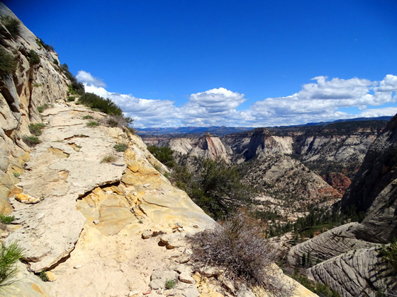
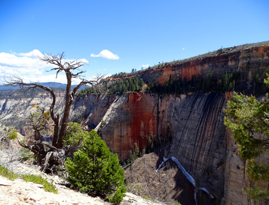
Looking down, you can see how dark this narrow canyon is:
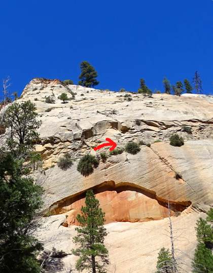
Looking up to the west wall, you can see . . . an eroded cove that
looks like lips! The trail continues above it (where I drew an arrow):
At a sharp hairpin turn in the saddle, stop and look in all directions. You can see part way
down the head of Behunin Canyon to the south,
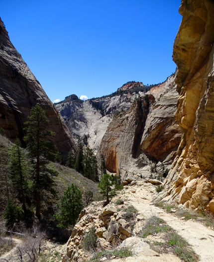
striking "drips of paint" on the cliff to the north,
and all the way across Telephone Canyon to Zion Canyon in the east:
The trail continues northeast from there, up to the plateau of the
west rim. It's a memorable trail for the next quarter of a mile or more!
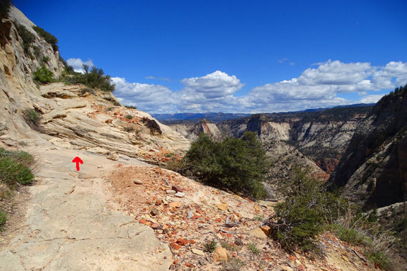
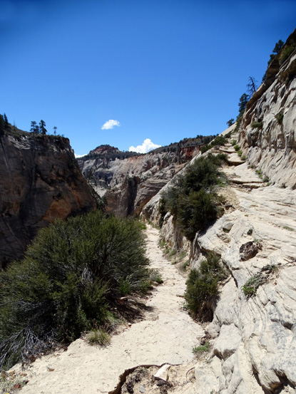
ON THE EDGE
At the beginning of this entry two pages ago I mentioned there is a
section of the West Rim Trail that might be scary for people who are
afraid of heights or possibly dangerous when wet or icy.
This is it, and the next picture shows probably the scariest place on
this section:
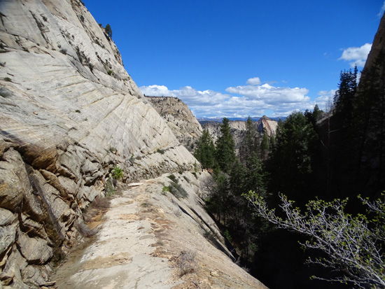
Because this part of the trail up to the plateau was chiseled out of
the west rim's near-vertical sandstone wall, it is mostly narrow, with
steep and long drop-offs on the open side.
Be careful when looking at the stunning scenery in the distance so
you don't fall off the cliff!
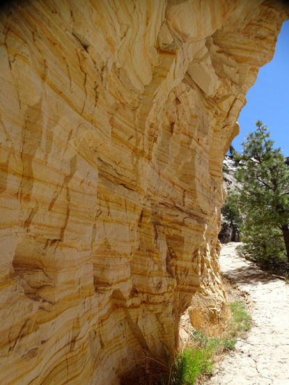
The chiseled trail is also rough in some places -- like the
deteriorating concrete above -- and smooth "slick
rock" in others. Watch your footing so you don't trip over the uneven spots.
It's the smooth slick rock that could be the most treacherous when wet from
rain, ice, or snow, especially going downhill and more especially
(is that grammatically correct??) where it's also slanted toward
the steep drop-off:
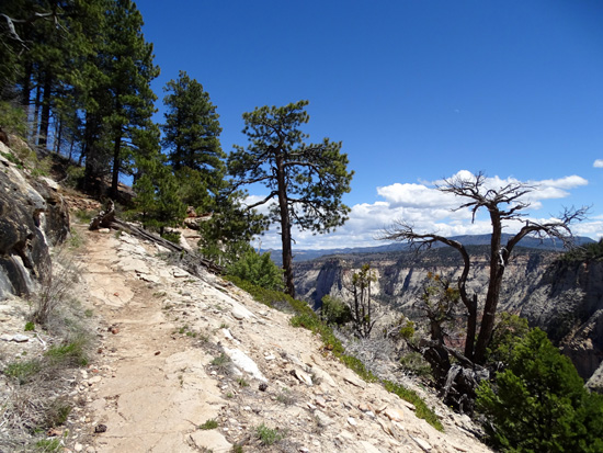
Here are some more photos from the ledge as the trail switch-backs up to the
top of the rim.
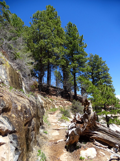
You'll know you're getting close to the plateau when the trail
becomes sandy and there are more trees and flowers:
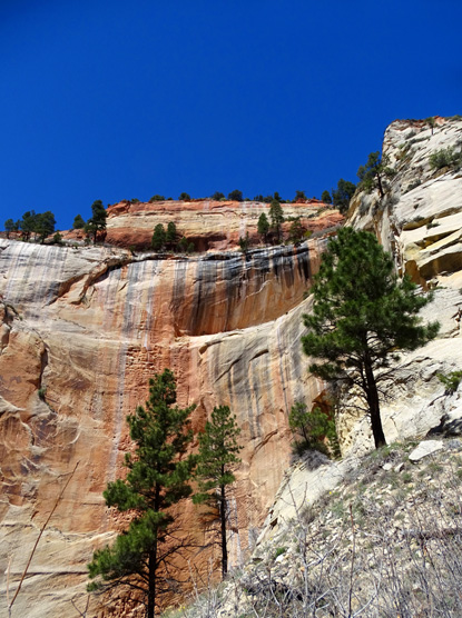
Snow in the crevices of the dark "painted"
cliff
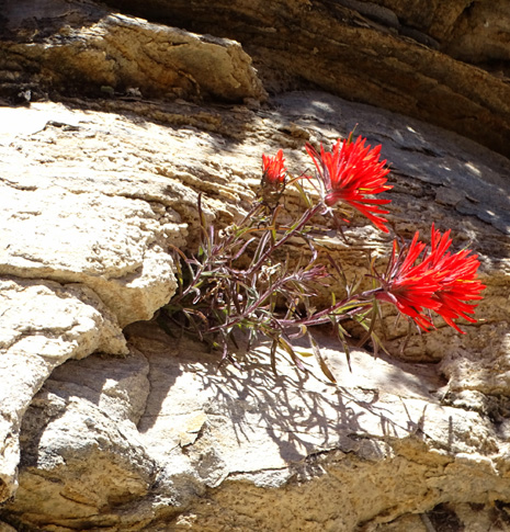
Some tenacious Indian paintbrush
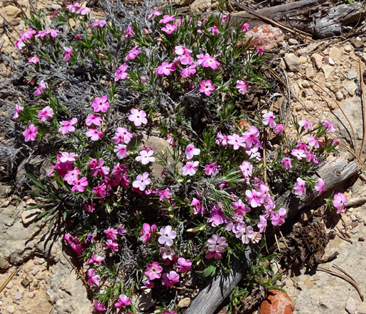
A type of phlox?
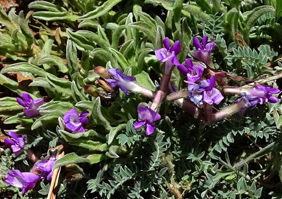
The flowers growing out of the rock wall might scream "SPRINGTIME!!
but the deciduous shrubs and trees up on the plateau haven't leafed out yet. The
elevation here is about 6,700 feet.
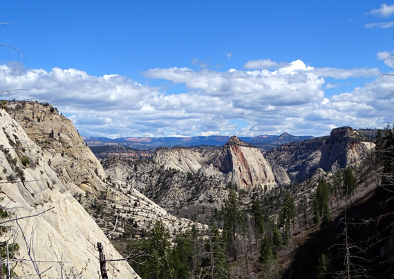
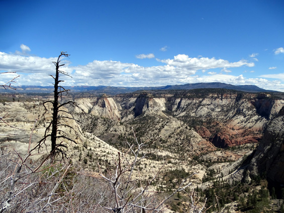
This is a stark but expansive view overlooking the large bowl of Telephone Canyon right
below and deep, narrow Zion Canyon farther away where the reddish rock is located:
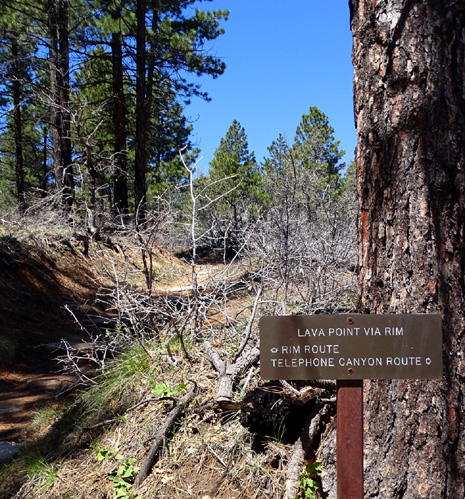
A little farther up the West Rim Trail are two intersections that are quite
close together: the short spur trail to Cabin AKA West Rim Spring and the
seven-mile-long Telephone Canyon Trail, which intersects again farther north with the
West Rim Trail to form a loop:
The sign at Cabin Spring says to purify the water first:
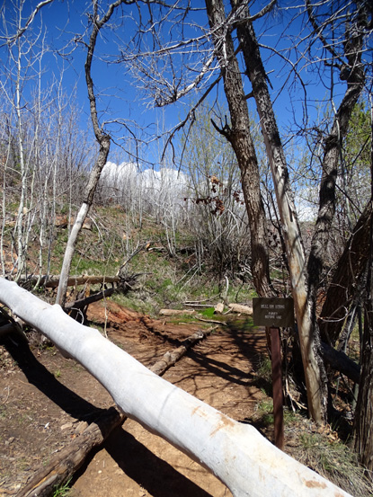
Ya think??
At that point I'd been hiking outbound from The Grotto for 5.5 miles and I
decided to turn around. I was happy to have a phone signal up on the rim so I could
let Jim know approximately when I'd get back to the campground in Springdale.
If I ever get back on this trail I'd like to follow the West Rim Trail at least
another mile farther north so I could see the views down into Behunin, Phantom, and
some other canyons. I should have just kept going farther today because
I got back down to Zion Canyon pretty fast.
Here are a few other photos I took that show
views southbound on the descent to Angels Landing:
Leaving the plateau
Top of Behunin Canyon ahead
Gold stripes
Telephone Canyon to the left, Zion Canyon
ahead
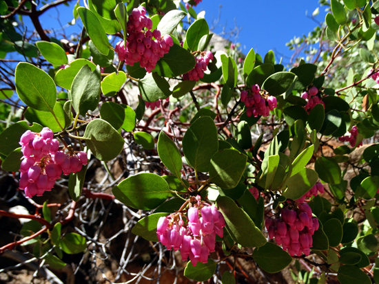
Manzanita blooms
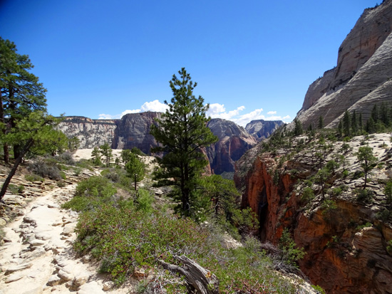
Near the head of Refrigerator Canyon
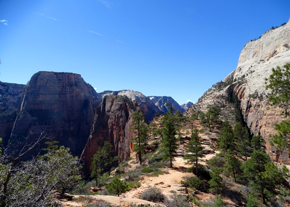
Descent to Angels Landing; Great White
Throne on the left (in the morning shade)
The West Rim Trail from The Grotto in Zion Canyon up to Cabin Spring is one of the
most interesting five miles of trail you'll find in Zion National Park. It was my
second favorite of the trails I hiked here this week (Observation Trail was my #1).
Although rated as strenuous by the Park Service, I'd call it
only moderately difficult if 1) you're in good hiking condition, 2) the trail is dry and
the weather is calm, and 3) you don't go up the spur trail to the top of Angels Landing.
That's really not part of the West Rim Trail but many hikers attempt it because
it's just off the main trail and it's so tempting.
I don't regret skipping the climb up to Angels Landing today because it was just too
crowded. I do regret not going another mile or two farther on the West Rim
Trail up on the plateau because I missed some scenic views down into other
canyons.
I'll save both additions along this trail for another trip to Zion in the future.
Next entry: hiking around the lower,
middle, and upper Emerald Pools
Happy trails,
Sue
"Runtrails & Company" - Sue Norwood, Jim O'Neil,
Cody the ultra Lab, and Casey-pup
Previous
Next
© 2016 Sue Norwood and Jim O'Neil
