We're continuing our annual fall migration to warmer climes for the winter.
We aren't exactly following the fall leaf color any more, though -- the
last colorful leaves were in British Columbia -- and we're probably
ahead of the migrating birds, too. Oh, well. We mainly want to find some nice
sunny, dry weather for a while.
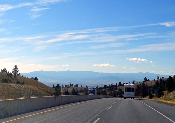
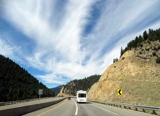
Following the Cameo on I-15 south of Great Falls on
Tuesday; I drive the car, Jim the truck.
Tuesday and Wednesday's
weather was perfect -- mid-40s F. in the morning, mid-70s F. in
the afternoon, mostly sunny with some interesting clouds along the way,
and enough breeze to feel refreshing.
There was little to no fire haze the entire way down to the Tetons. Last
week was very smoky in MT, ID, and WY so we didn't know what to expect
this week Our timing is good in that respect.
DAY 1 (TUESDAY) FROM GREAT FALLS, MT TO IDAHO FALLS, ID
We took US 3/89 west through Great Falls
to I-15, which we followed the rest of the way to exit 118 in Idaho
Falls.
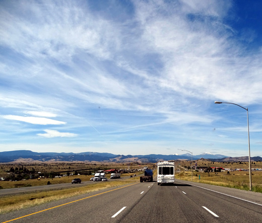
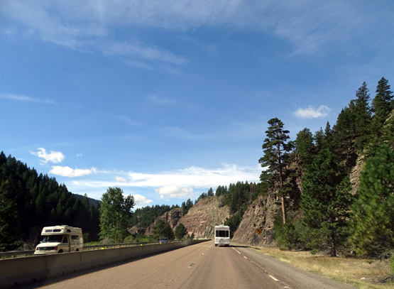
Traffic was light everywhere except near the small cities of Great Falls,
Helena, Butte, and Idaho Falls. We saw lots of RVs heading northbound and
some our way. The speed limit was mostly 75 MPH in MT and 80 in ID. Jim
averaged mostly 61-2 MPH except up hills and through the canyons. The
road surfaces were very good.
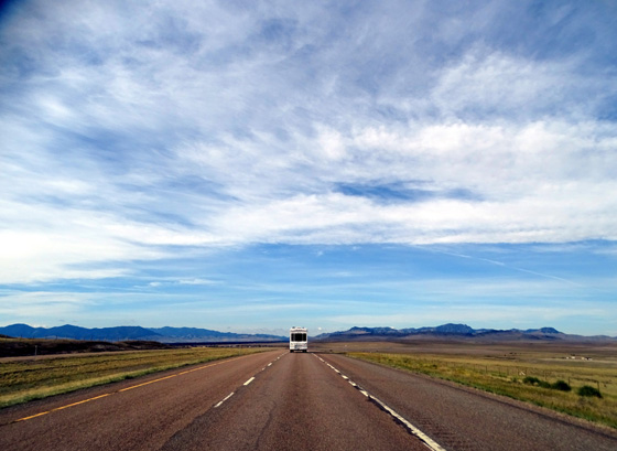
No one else in sight
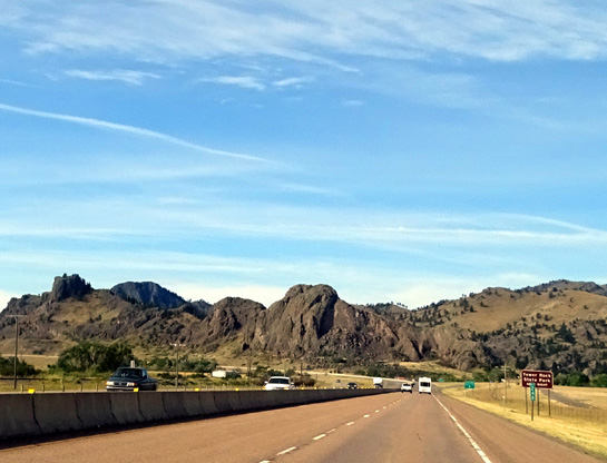
Near Tower Rock State Park in Montana
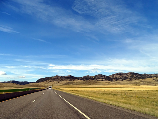
Typical Montana rangeland
Another 5th-wheel is going northbound as we drop into a
valley going southbound.
Heavier traffic near Butte, but probably looks
light to folks from bigger metro areas!
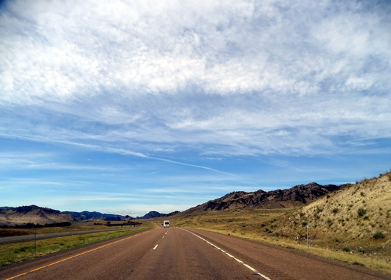
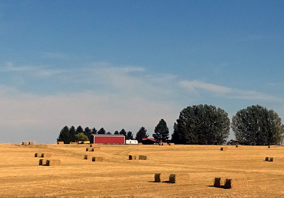
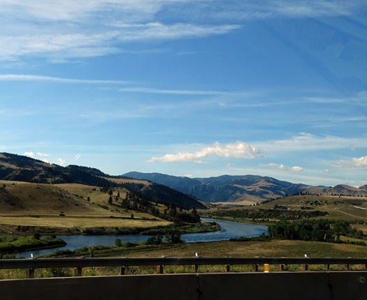
This is a gorgeous route through western Montana to the Idaho
border, with several scenic canyons, lots of mountains and
foothills, numerous streams and lakes, rolling rangeland, and
some well-watered green crops:
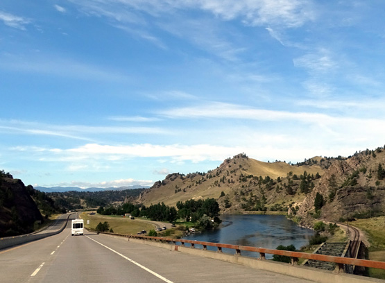
Especially scenic were the Wolf Creek-Canyon Creek area, another
canyon south of there (both cut by the Missouri River), and the Clark
Canyon Reservoir:
Entering Wolf Creek Canyon, where crews were
working to prevent rock slides.
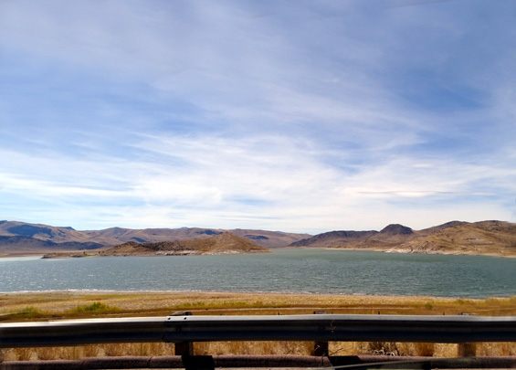
Clark Canyon Reservoir looks like a beautiful place
to boat and fish.
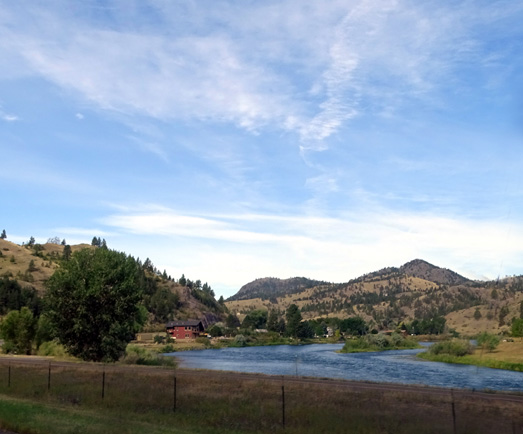
We crossed the Missouri River several times and saw other pretty streams
along the way:
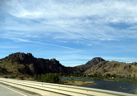
We crossed the Continental Divide three times but the highest point was
only 6,386 feet.
I'm a sucker for
interesting clouds and we sure saw some on the first day's journey. I was a totally
distracted driver with all the great scenery and clouds. I took all but a few of the photos in this entry while I was driving behind Jim.
He hates
me doing that. I know it's dangerous but hey, the freeway was
practically empty, I don't do it when someone is close to me, and I
didn't want to stop frequently by the side of the road.
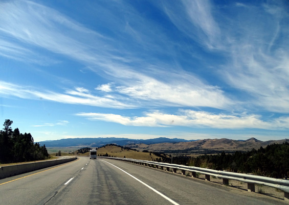
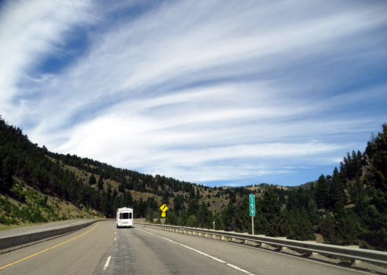
Pretty interesting clouds, eh?
OUR "FREE" OVERNIGHT STOP
When we got to Idaho
Falls we stopped at the super Walmart on Utah Ave. first to see if we could
stay there overnight. There were enough trucks and RVs already parked there
to make us consider Sam's Club instead. We parked the camper and drove the
car two miles to Sam's Club. No semis or RVs were there.
Management OK'd us
staying there, so we went back for the Cameo and spent the night at Sam's. It
was well worth the little extra distance off our route.
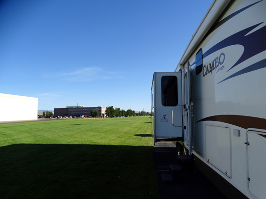
We were the only RV at Sam's Club overnight and we had a perfect spot along
wide, deep, green grass out near the fuel station. It was far enough off
17th Street to be relatively quiet and the store closed at 8 PM so
there was virtually no traffic in and out of the parking lot after that.
We're very glad we stayed there instead of at Walmart.
I walked the dogs through the grass to the back of the store and Jim
played ball with Casey right outside our door:
After we ate supper and watched the news we went into Sam's Club and
spent over $200 (including a new Garmin GPS for our vehicles, so we'll
both have one). That should cover our nice "free" overnight parking
spot!
To our surprise we could get free WiFi from Sam's Club, so Jim used
it to load the software on the new GPS.
He also filled the tanks in the truck
($2.53/gallon for diesel) and car ($2.81/gallon for gasoline) a few
blocks away. This
Sam's Club doesn't have a fuel station.
BY
THE SEAT OF OUR PANTS
Our plan was to drive to Grand Teton National Park the next day
(Wednesday) and try to snag one of the first-come campsites at Gros Ventre
Campground in the southern end of the park. Because the sites fill up early
in the morning, however, our chances weren't looking too good unless we left at
oh-dark-thirty from Idaho Falls.
Just before bedtime Jim commented re: how close we'd be to Reunion Flat,
a National Forest Service campground we like on the west side of the Tetons,
on our way to the east side where the national park is located. Did I
want to go there first for a few days??
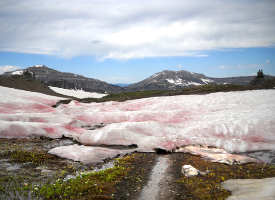
Parts of Alaska Basin above Reunion Flat were still
covered in snow
as late as 8-24-11 when I hiked up there that
"summer." Cool!
I love Reunion Flat
and the trails on the west side of Tetons in the Jedediah Smith
Wilderness. It's just over the Wyoming-Idaho state line in Idaho. We've been there five times before in late August/early September.
Since it's in a wilderness area, I can hike on those trails with the dogs,
whereas I can't on the national park side of the mountains in Wyoming.
Sometimes I'll agree to a change in plans right
away but I had to think about that new wrinkle in our plans overnight
because it simply had not been on my radar. We
didn't know if we could get a site there, either. We've always had a
reservation before going to Reunion Flat. Would it be full after Labor
Day, or some sort of event going on like a wedding or reunion?
By morning, however, I was
definitely on board with that plan and excited about it. Our chances of
getting a site at Reunion Flat were better than at the national park. If
we tried there first, I figured it would increase our chance by 50% of getting a spot at
one place or the other.
DAY 2 (WEDNESDAY) FROM IDAHO FALLS TO TETON CANYON,
WY
This was a shorter day on the road because we did decide to stay at Reunion Flat Campground east of
Alta, WY instead of going around the southern end of the Tetons to the
national park.
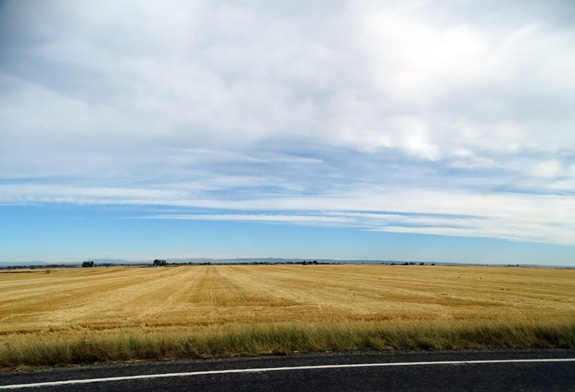
From Sam's Club in Idaho Falls we drove north to
US 20, which is a freeway as far as we took it. We were surrounded by
large farms and rangeland:
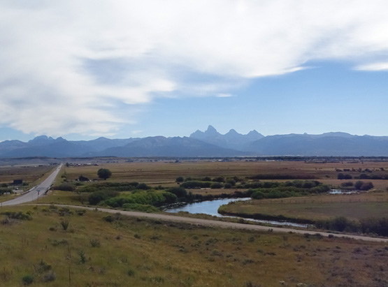
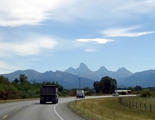
Then we went east on ID 33, a smooth, rolling two-lane highway we've
driven several times previously to Driggs, ID. In Driggs we turned east
on Ski Hill Rd. We crossed into Wyoming in the tiny town of Alta. About
a mile later we turned onto Teton Canyon Rd. and back to our campground.
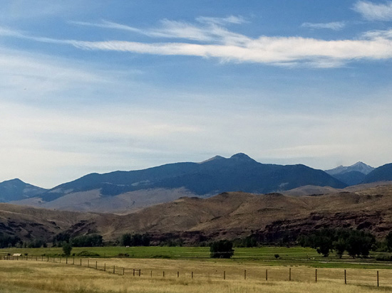
The scenery
wasn't as dramatic as yesterday's canyons, mountains, and rivers until
we were heading east toward the Tetons on ID 33. I always love the views
of the Teton Range as we get closer and closer to the four most
identifiable mountains in the park. Grand Teton, the tallest, has the
curved sharkfin-like profile from this direction (left of the arrow in the
next picture):
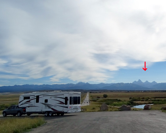
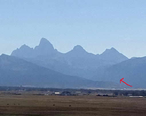
Arrow marks the approximate way to Teton Canyon on
the west side of the mountain range.
Traffic was moderate the whole way and road conditions were good.
We left Sam's Club at 9 AM and arrived in Driggs about 11 AM. We stopped
once at an overlook (shown above) so I could take better photos of the Tetons,
although it was a challenge taking pictures toward the morning sun.
The weather couldn't have been nicer this week (we stayed in the area
parts of five days), just what we've been wanting -- sunny, low 70s F.,
minimal breeze, very dry.
We are happy campers!
Next entry: camping at
Reunion Flat, our 6th time there, and activities in the area this week
Happy trails,
Sue
"Runtrails & Company" - Sue Norwood, Jim O'Neil,
Cody the ultra Lab, and Casey-pup
Previous
Next
© 2015 Sue Norwood and Jim O'Neil
