Happiness this week for us was finding a warmer, drier place to park our RV on
our way south to our winter snow-bird haven. We are really tired of cold
rain -- but we aren't yet ready for the almost-100 degree Fahrenheit
temperatures that continue in Black Canyon, Arizona.
We found some middle ground.
It was still overcast and raining in the greater Salt Lake City area
when we left Hill AFB this morning. I took this shot of the clouds --
and new snow on the Wasatch Mountains -- as we were driving off the
base:
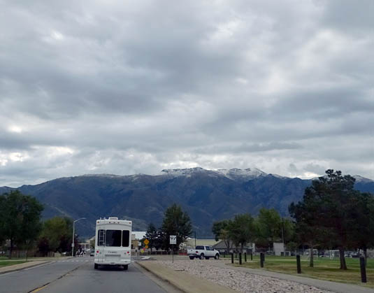
A gloomy start
By the time we reached the southern end of the very long metro area
the sky was mostly blue and remained gorgeous the remainder of the way
to Red Canyon. Thank you, Mother Nature!
TODAY'S DRIVE
I've driven in 49 of the 50 United States (Jim has been in all 50)
and I think Utah has got to be in the Top 10 Most Beautiful. The
mountain ranges and canyons are so scenic on I-15 and the western end of
1-70, as well as numerous two-lane roads through the region.
And now we're in gorgeous red-rock country. Utah rocks!
Today's trek included a few bonus miles at the end when we
weren't able to get a campsite at our intended destination and had to
backtrack a few miles.
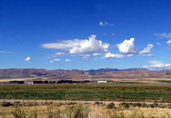
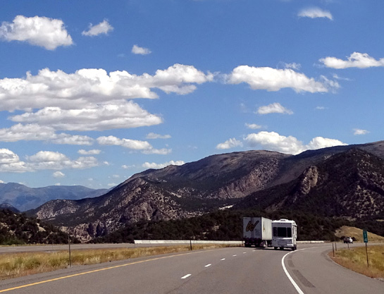
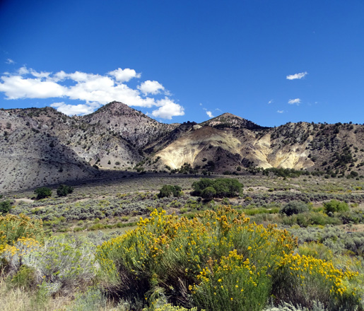
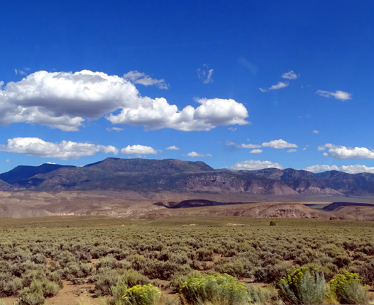
Above and below: sunny
scenes from I-15 south of Salt Lake City
Here's our route: UT
193 west from Hill AFB to I-15; south on I-15 through SLC to exit
132; east on I-70 to exit 23; south on US 89 through
Panguitch to UT 12; east to Red Canyon.
Traffic and road conditions: We thought we left Layton,
which is north of the long Salt Lake City metro area, late enough at
9:50 AM to avoid "rush hour(s)." Ha! I
don't think there is any time during daylight hours when you can avoid
traffic through this area. Even from 10-11:30 AM it was heavy.
We finally knew we were out of the metro area when the speed limit
jumped to 80 MPH. Jim maintained an average of 62 MPH hauling the Cameo
and folks just zoomed around both of us on the freeway. (I drive the
Odyssey minivan separately behind Jim when we're moving from Point A to
Point B.)
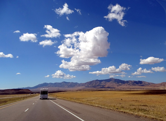
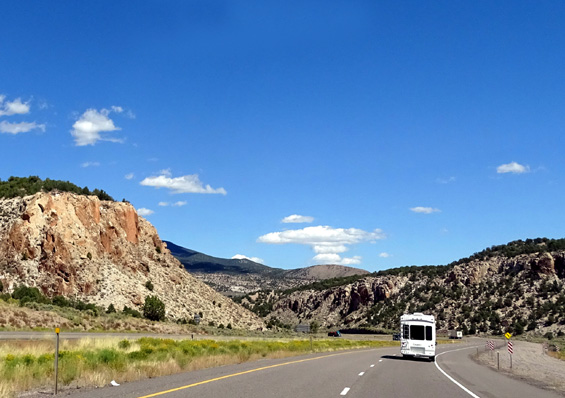
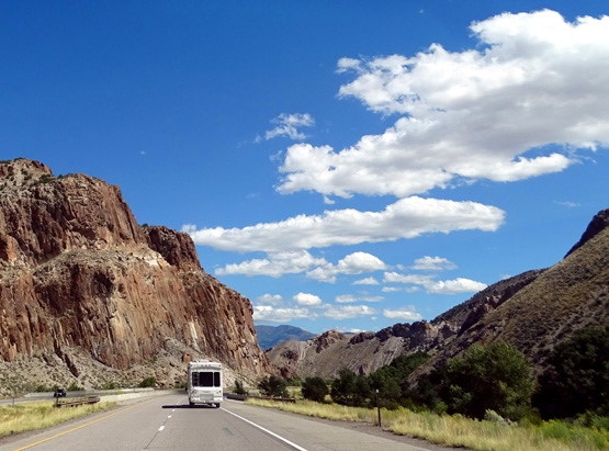
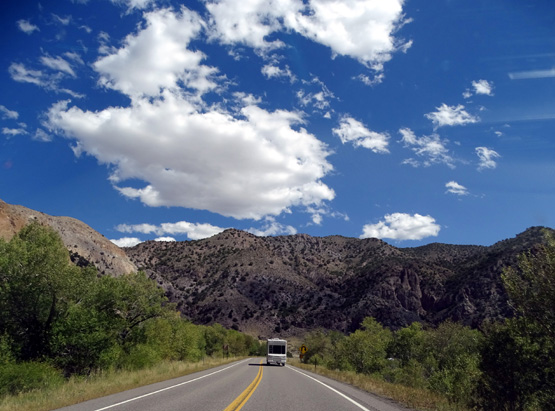
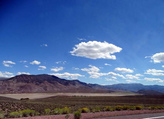
Above and
below: the far western part of I-70
There was some construction in several places on I-15 south of metro SLC
but it didn't slow us down much. The pavement was mostly smooth today
and we had just three stops along the way.
One was at exit 188 on I-15. It looked like a regular rest area on the
AAA map but was at Flying J!
There was another "rest area" at another truck stop farther south. We
haven't seen this before. Even odder, it had a petting zoo with a camel,
llamas, and other animals. It looked like it had been there all summer.
I wasn't able to get a good picture of the critters as I passed by.
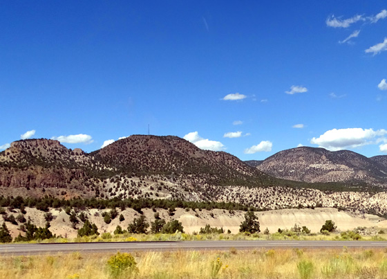
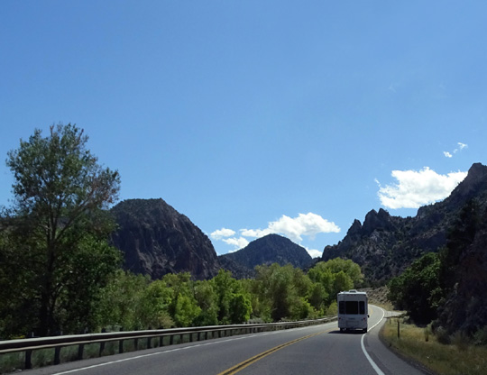
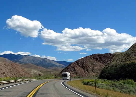
This and the next two photos are along I-70.
I haven't been on the far western end of I-70 for many years. It
begins/ends at I-15 in Utah. I think the fifteen miles we drove on it
are probably the least-traveled section of the entire length of 1-70
from here to the east coast.
It's very scenic. I took lots of canyon and red-rock photos as we
drove that part of the route (photos above).
We also stopped at a scenic pulloff along US 89. The northern section of
that road winds through mountains along a creek:
Farther south on US 89 between Circleville and Panguitch the terrain is
flatter near the road, with more distant views of the red rocks to the
east and national forests (Fishlake and Dixie) to the west:
Piute Reservoir looked mostly dry.
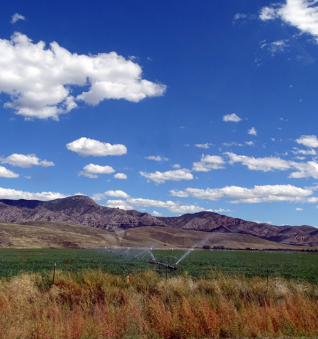
Irrigating
a field
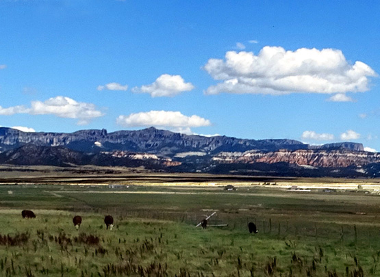
Cows grazing near Panguitch; starting to see red
rock formations to the east.
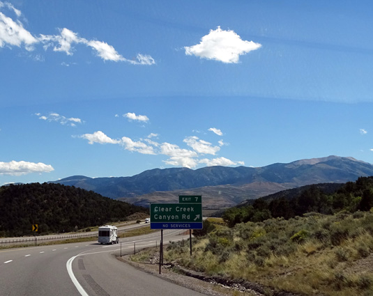
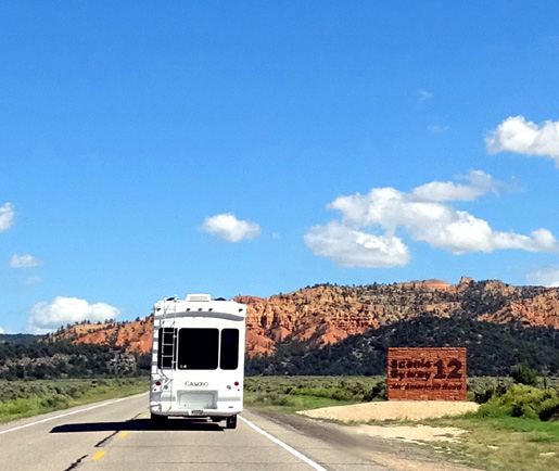
DESTINATION: RED CANYON
A few miles south of Panguitch we turned left (east) on UT 12, the
scenic route that goes through Red Canyon, past Bryce Canyon, and
through colorful Staircase-Escalante National Monument to Torrey, Utah.
Our goal was to camp at the Red Canyon National Forest Service
campground about ten miles west of Bryce Canyon. You can't make
reservations here, so it was a crapshoot. It's a Thursday in
mid-September. How full can the campground be this late in the season??
Just about as full as the campgrounds in and near all the other
popular western national parks, we discovered.
This close to both Zion and Bryce Canyons the public campgrounds
remain full until they close for the winter, it turns out. So do most of
the private campgrounds in the area.
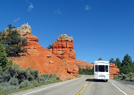
After we entered the rock "portal" to Red Canyon
(next picture) we parked at the nice NFS visitor center and drove the car another half
mile to the campground to see if there were any available sites large
enough for the Cameo.
We were disappointed to find the campground completely full. It's a nice
campground
and it remained
full or mostly full the whole time we were in the area.
We were naive to not even consider any other options in this area before
we came down here. We knew it would be hard to get a spot IN the park
but didn't think a Forest Sservice campground fifteen miles away would
be full.
Our assumption that the parks would be less crowded this time of year
was a mistake, of course. Airline fees are lower in the fall and foreign
visitors are all over Bryce and Zion Canyons, just like they are at
Teton, Yellowstone, Alaska, etc.
Our bad.
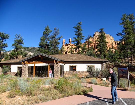
Jim enters the Red Canyon NFS visitor center the next day; note the
hoodoos in center background.
I talked with the campground host couple, who have a Carriage Compass
(same brand as our Cameo, but different model). They
suggested several other Forest Service campgrounds in the area, including two
closer to Bryce Canyon and two near Panguitch.
The two toward Bryce
are several miles back dirt roads. The two
between Panguitch and Cedar Breaks National Monument are quite farther
away. None of them appealed to us unless they were our last resort in
the area.
The CG hosts didn't think much of the private campground three miles down
the road when I inquired about it -- Red Canyon Village
RV Park -- but we checked it out next:
Bright sunshine most days at Red Canyon:
that's what we're talkin' about!!
I had noticed this campground when we passed it on our way to the NFS
campground. It looked fine from the road -- trees, grass,
decent-sized sites, full hookups, WiFi, and cable TV! (the local Forest
Service sites don't have hookups, let alone WiFi or cable TV) --
so we went back there to inquire about sites.
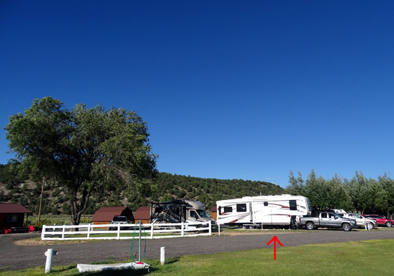
Most of the pull-thrus were full but we saw several
that were empty, plus back-ins along the large field farther off the
road. We were able to snag the long pull-thru site shown in the photo
above. And to our surprise, the price was very reasonable for a private
campground.
We liked the RV park and the whole area so much we ended up staying
for 31 days!! [We also retuned for another month in May, 2016
and a month in fall, 2016.]
I'll talk about our
stay at Red Canyon Village in the next entry. I'll also have about
twenty
additional entries with photos from our day trips, bike rides, and hikes in this part of
southern Utah from September 17 to October 17, when they threw us out.
(Not quite, but they did close the campground down for the winter before
we wanted to leave!)
Next entry: living at Red Canyon Village RV Park for a
month + activities in the nearby town of Panguitch
Happy trails,
Sue
"Runtrails & Company" - Sue Norwood, Jim O'Neil,
Cody the ultra Lab, and Casey-pup
Previous
Next
© 2015 Sue Norwood and Jim O'Neil
