This is a beautiful route, one we've driven in both directions
several times previously, so it was fun to consult my Idaho, Wyoming,
and Utah maps and note the various roads that provide not only a fairly
direct route, but also the most scenic one.
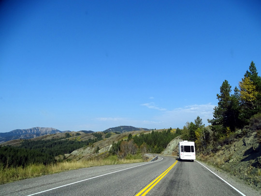
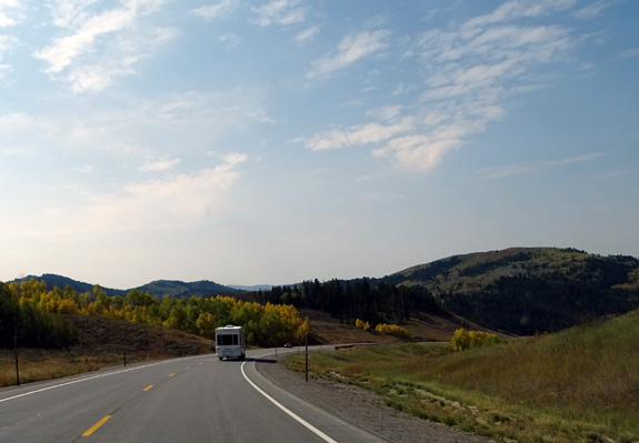
ID 31 between Victor and Swan
Valley, ID
We're on our way to Hill AFB north of Salt Lake City in Layton, UT but
the winding mountain roads we drove today were plenty for one day so we spent the
night at a National Forest Service campground in Logan Canyon where
we've stayed before.
It's a few miles east of the city of Logan, UT and makes our drive to Hill AFB
shorter tomorrow.
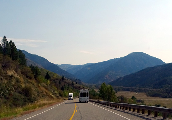
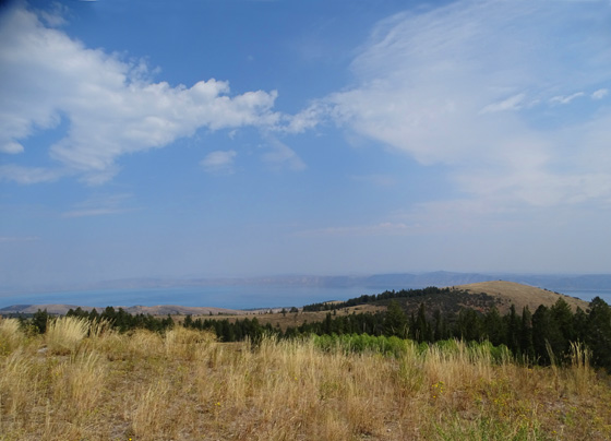
US 89 southwest of Bear Lake in
the upper Logan Canyon area;
the Bear 100-mile ultramarathon
is run on trails in this area.
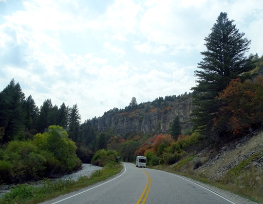
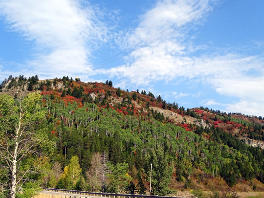
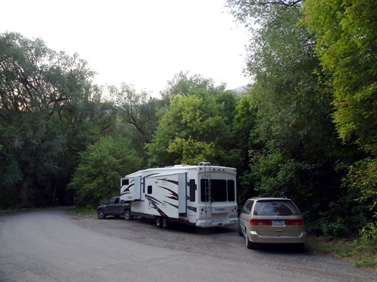
Following the Cameo through Logan Canyon
Here's the route we took: west
to Driggs, ID on Teton Canyon and Ski Hill Roads; south on ID 33
to Victor; south on ID 31 to Swan Valley; east on ID 26
past Palisades Lake to Alpine, WY; south and west on US 89
through Wyoming and Idaho to Bear Lake and over the Utah line to the
lower part of Logan Canyon.
Guinavah (pronounced GWIN-a-va) Campground
is a few miles east of the city of Logan.
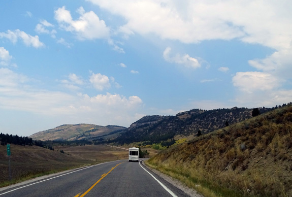
Approaching Alpine, WY on US 26
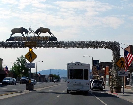
Wide arch made of elk horns in
Afton, WY
Traffic and road conditions: All the roads were fine.
Traffic was moderate to Bear Lake, then heavy from there down to Guinavah-Malibu campgrounds.
Bear Lake and Logan Canyon are very popular places on the weekend. We
saw numerous boats and RVs on the entire route because of all the lakes,
streams, and two national parks in the region (US 89 goes up to Grand
Teton and Yellowstone).
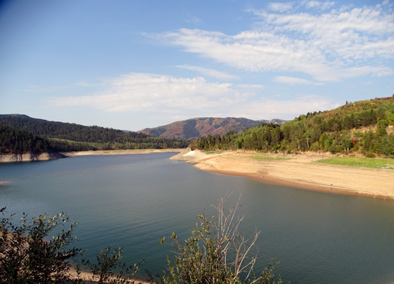
Palisade Reservoir in Idaho looks pretty low.
We left Reunion Flat Campground at 8:15 AM and got to Guinavah
Campground about 2:30 PM with a bunch of stops for various things,
including fuel in Swan Valley, ID (diesel for $2.59/gallon), snacks, potty
breaks, scenic overlooks, letting faster traffic behind us pass,
checking out Sunrise Campground above Bear Lake, etc.
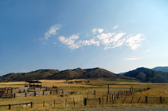
I love all the rivers, mountain vistas, and wide valleys with ranches
and farms along this route.
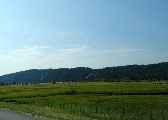
Above and
below: ranches along US 889 in the Salt River Range valley
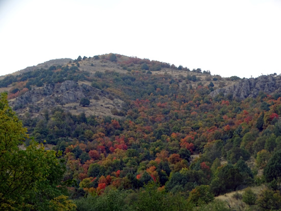
Along Palisade Reservoir in Idaho and through the Salt River Canyon south
of Alpine, Wyoming we began seeing beautiful red maple leaves and
yellow aspens (birch?) on the hillsides. They are pretty in Logan
Canyon, too.
That's a nice surprise after all the brown on either side
of the Tetons.
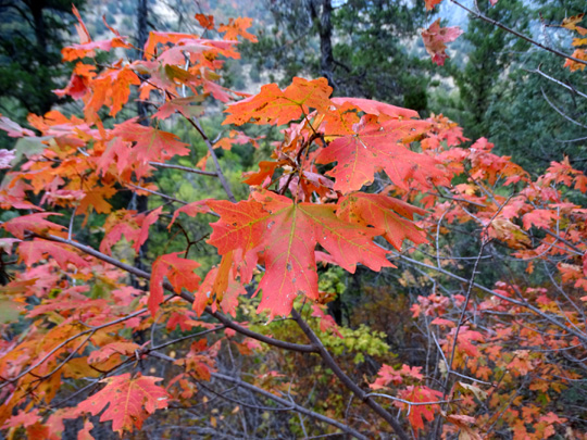
Red leaves, probably box elders (a kind of maple
tree), on a hillside above Palisade Reservoir
Yellow aspen or birch leaves along US 89 south of Afton, WY
The weather was good -- sunny, dry, minimal breeze. It was 42 F.
this morning in Teton Canyon and 80 F. when we arrived at the campground
in Logan Canyon. By 5 PM our camper was in shade and it cooled off.
We stopped for a scenic break and short walk at
the overlook above Bear Lake:
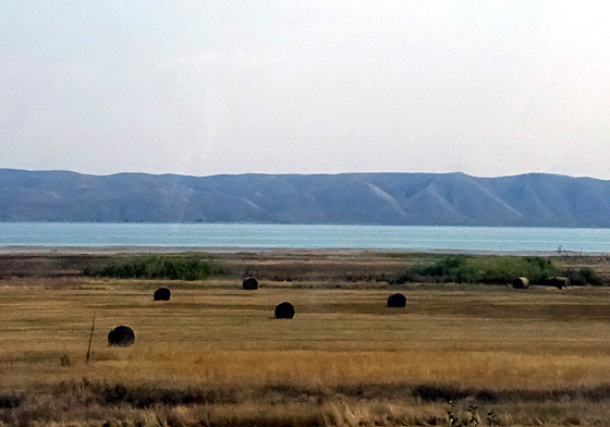
Above and
below: northwestern shore of Bear Lake along US 89
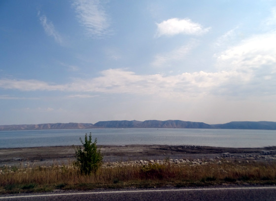
The water in Bear Lake blends in with the distant
hills and sky
in this view from the overlook.
The dogs got to play with a
lively four-month-old yellow Lab named "Copper" at the rest area.
That was cute. The young couple with Copper were recently stationed at Hill AFB
after being at JBER in Anchorage for three years so we had several
things to talk about.
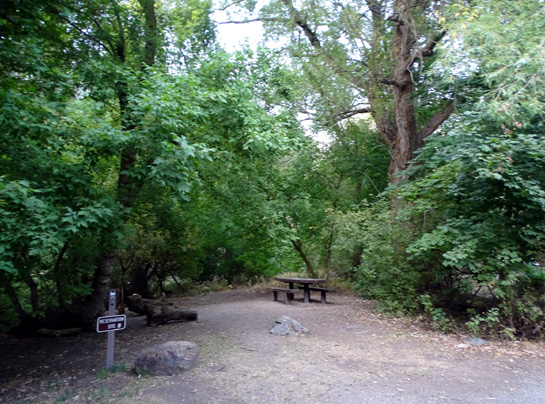
GUINAVAH CAMPGROUND
Jim was able to get online at the overlook above Bear Lake. Since we
knew there's no phone or MiFi signal down in the canyon at Guinavah, we
decided to look for an overnight site at nearby Sunrise Campground,
also run by the National Forest Service.
We drove through
Sunrise but soon nixed that idea because the sites are too small for the
Cameo and the roads are too narrow (trees) to drive a big rig through
the loops. In addition, there isn't a phone or MiFi signal there,
either, so we continued on down to Guinavah.
Pretty leaves on hillside near Guinavah Campground
Bright leaves on the Riverside Trail at Guinavah
We know there are a
few sites there that are large enough for our rig. We've been in
three of them previously. The only question was whether one of them was
available.
When we got down to Guinavah Jim parked the camper near the entrance and
we drove around with the minivan to check out the situation.
Most sites are empty this afternoon. One large one we used with the
HitchHiker in 2009 was occupied. Two others we used in 2010 were open.
We picked a pull-thru site we've never occupied previously and even though it's a reservable one, the CG
host said we could have it tonight.
Senior (half price) cost for single sites is up to $9.50/night + we had
to pay $7 for having a second vehicle -- even though there is
plenty of room for it at our site and there are only two of us. That
sucks. We've run into that extra vehicle fee more and more at other public
campgrounds (and a few private ones) but never at military ones.
There are no hookups. We don't have a phone or MiFi signal or TV
reception. Generator hours are generous, like Reunion Flat -- 6
AM to 10 PM. Traffic is very noisy here, even in the back of the
campground. Logan Canyon is narrow in this area and sounds really
reverberate off the rock walls.
Our "front yard"
After we got set up we walked about a mile through Guinavah and adjacent
Malibu campgrounds and let the dogs swim in the river to cool off.
When it
cooled down after supper Jim rode with Casey around the two campgrounds
several times on his bike . . .
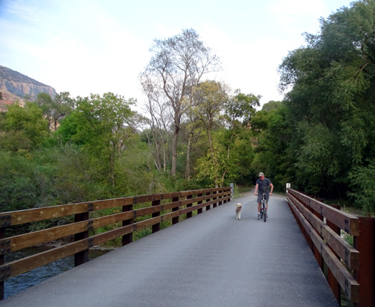
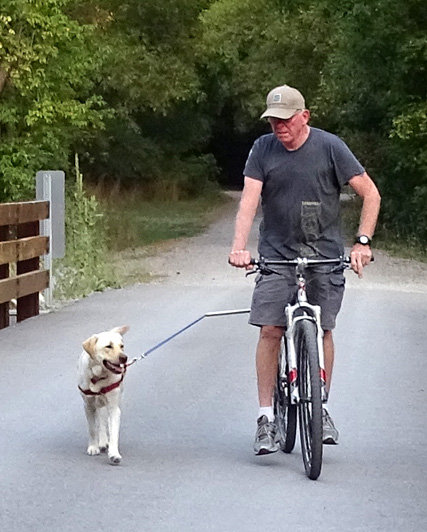
Casey is in
her element when she's running alongside Jim.
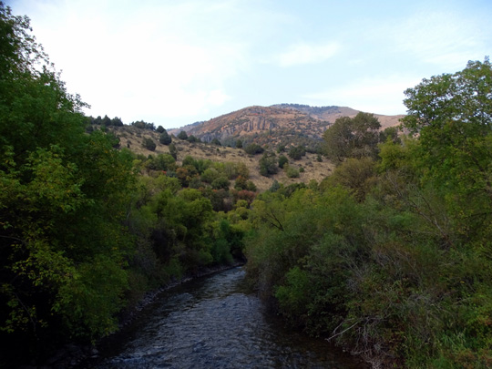
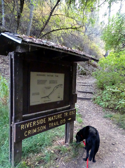
. . . and I walked Cody about two miles on the Riverside and
Crimson trails above the river:
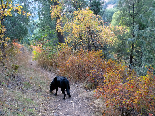
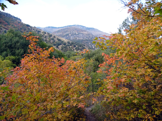
Above and
below: Strangely, more leaf color here than at higher elevations
farther
north in the Teton Range; maybe more moisture has fallen here?
Next entry: waiting out the rain at Hill AFB in Layton,
UT, north of Salt
Lake City
Happy trails,
Sue
"Runtrails & Company" - Sue Norwood, Jim O'Neil,
Cody the ultra Lab, and Casey-pup
Previous
Next
© 2015 Sue Norwood and Jim O'Neil
