Or for us this time, just the desire to find a warm place to spend the winter!
We are snowbirds, migrating south every winter in search of warmer
climes just like many of our feathered friends. After three winters in
southern Georgia and northern Florida we have decided to remain out
West this winter and spend several months in Arizona and southern
California again.
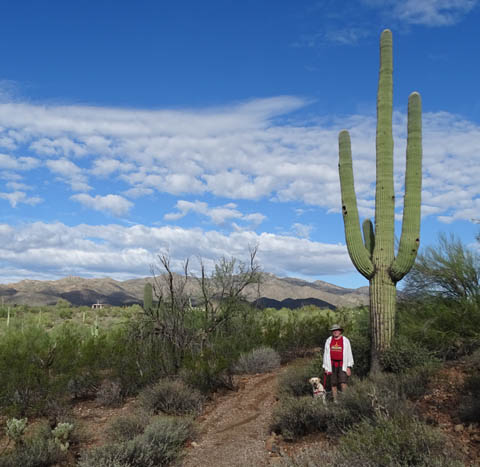
Jim and Casey pose by a towering
saguaro cactus at High Desert Park in Black Canyon.
It was hard to leave Red Canyon and the amazing terrain in southern
Utah today but the RV park we liked so much is closing because winter is
nigh. It's already gotten down to freezing at night a few times at 7,000
feet elevation and the owners don't want to deal with frozen pipes.
(Visiting RVers didn't seem to mind, though; the campground
remained full this week.)
We began our search for a place to spend the winter several months
ago. We wanted an RV park in northern metro Phoenix so we could
explore some places that are new to us in that area.
After a lot of online research and several phone calls we made
reservations at Black Canyon Ranch RV Resort about 20 miles northwest of
Phoenix for October, November, and
December. If we decide to stay longer, we can.
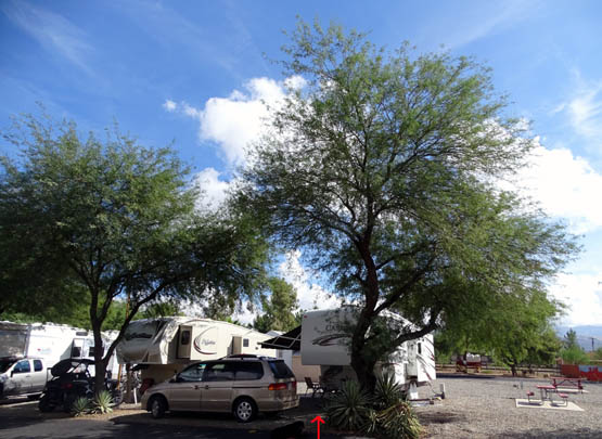
Our rather tight spot at Black Canyon Ranch RV
Resort
We didn't realize the Phoenix area would remain hot this late in the
year so we've been delaying our arrival in Black Canyon as long as possible. It
is still in the 90s F. but for various reasons we decided to come on
down now rather than kill time along the way. At least we have AC.
This entry focuses on the scenic drive through southern Utah and
northern Arizona from Red Canyon to Black Canyon City.
FROM THERE TO HERE
Route: US 89 south to Flagstaff, AZ; I-40 a few miles
west to I-17, then south to exit 244 (Old Black Canyon Rd.), a distance
of 371 miles. (A variation is to take Alternate 89 from Kanab to a
juncture with US 89 south of Page, AZ.)
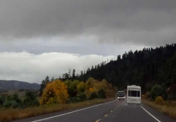
Rain on US 89 south of Red Canyon; yellow aspen leaves
brighten the scene a bit.
Traffic and road conditions: Traffic was lighter than expected
to Kanab, UT, then increasingly heavy to Flagstaff on Sunday afternoon.
There were periodic passing lanes on US 89 so no more than 3-4 vehicles
at a time ever got stuck behind us.
I-17 south was very heavy with folks returning to metro Phoenix from
their weekends at points north. I-17 is only two lanes each direction
from Flagstaff to Black Canyon City, with a 75 MPH speed limit. It needs
another lane and lower speed limit.
Above and below: two more scenes along US 89 north of Kanab, UT
Road conditions were mostly good, although there were some wavy sections on US 89 from Page to Flagstaff.
There are some long descents on US 89 south of Page and I-17 south of
Flagstaff but no long ascents. This route is fine for big rigs.
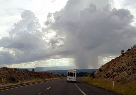
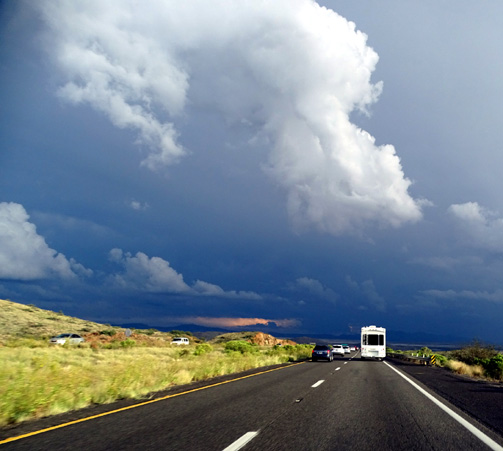
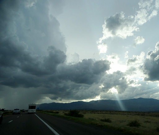
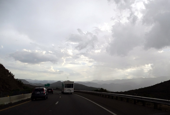
We had rain off and
on but none of it was as heavy as some of the storms in the distance
on I-17 this afternoon in Arizona:
Note the
shaft of light to the right.
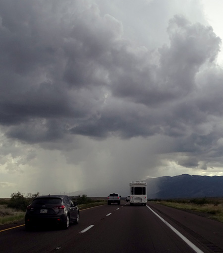
It looked
like we'd get drenched in that storm
but it moved
off the freeway before we reached it.
It started raining lightly at Red Canyon just as we were pulling out in
the morning. We even had some fat wet snowflakes in a couple places in AZ. Our
highest point was about 7,200 feet. Most of the time the roads were dry,
though, and visibility was always good.
We apparently lucked out with the rain we got, because we heard the next
morning that there was high wind and large hail damage in the Phoenix valley
and thousands of people without electric power.
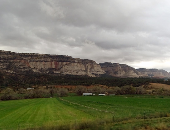
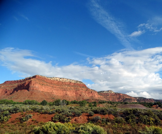
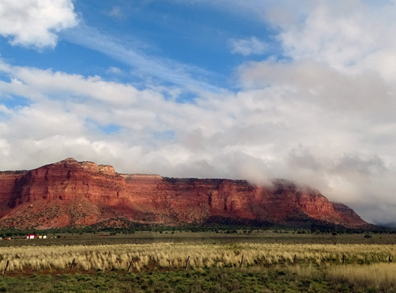
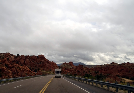
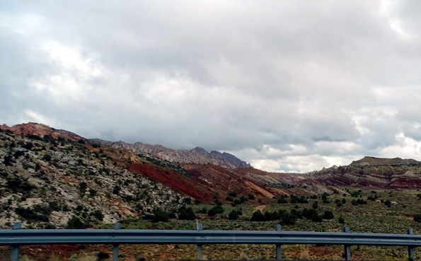
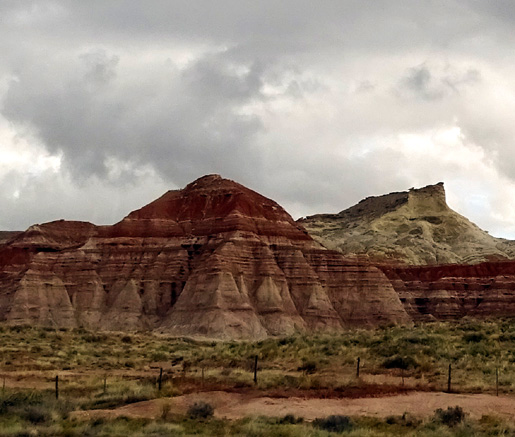
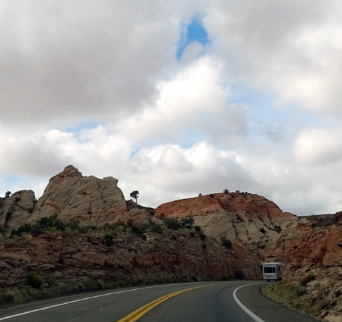
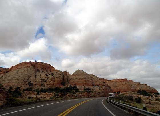
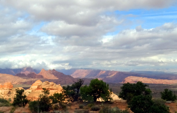
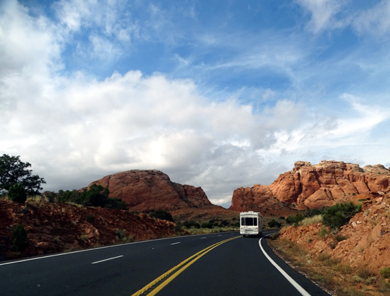
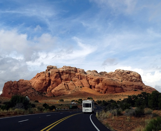
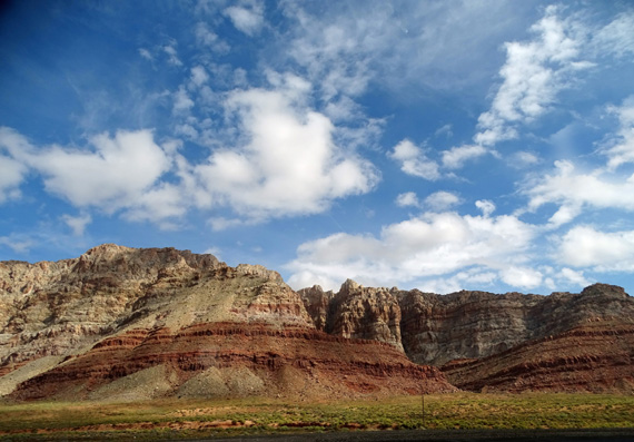
Scenery: The scenery was especially nice along US 89 through southern
Utah from Kanab to Page, an area we haven't seen before -- lots
of colorful mesas and canyons as we drove up and down through colorful national forest
and Grand Staircase-Escalante National Monument lands:

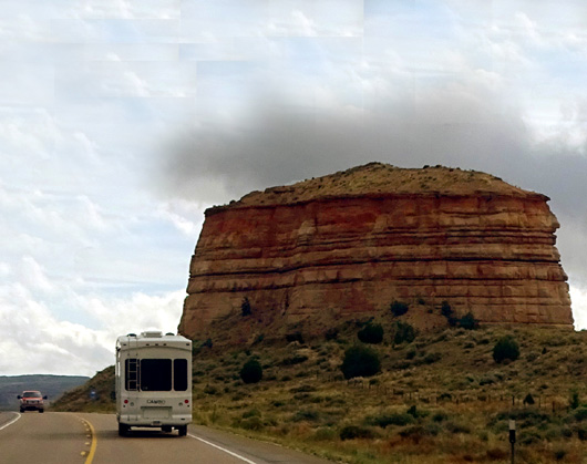
Odd rock!
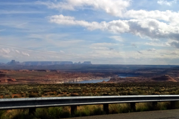
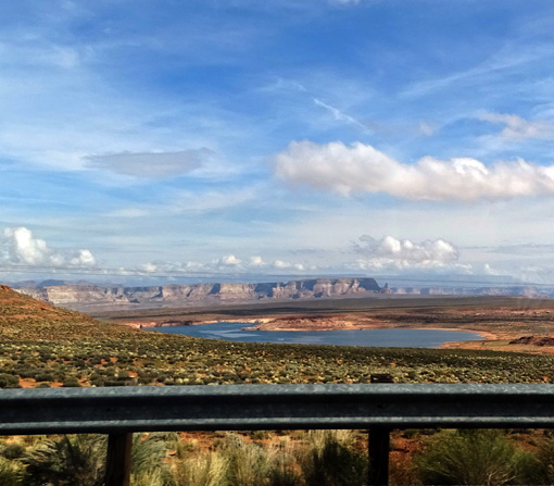
A few miles before we reached the Arizona border we drove through the
southern part of Glen Canyon National Recreational Area and could see a
bit of Lake Powell:
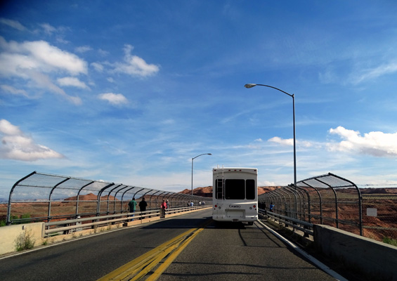
We stopped at the Glen Canyon Dam so we could join other visitors on the
bridge across the deep canyon cut by the Colorado River:
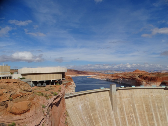
The river runs through a very narrow strip of protective land that is
part of Grand Canyon National Park up to Lake Powell. There is a visitor
center at the dam but we didn't go into it.
Page is larger than I expected, and has a super-Walmart. About a dozen RVs
were parked there when we went through about noon today.
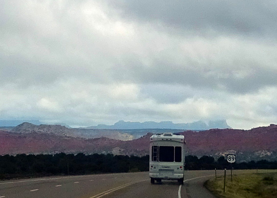
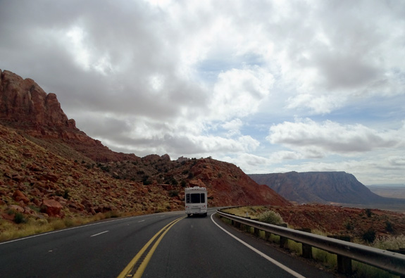
US 89 and 89A parallel the Colorado River for several miles south of
Page. We were high above the canyon on US 89 at Antelope Pass (elevation
6,533 feet), then descended in a few miles through a large Navajo Indian
Reservation to The Gap and Gray Mountain.
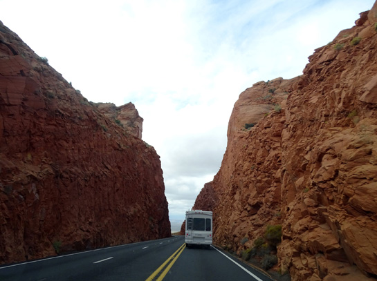
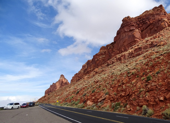
Narrow slot at Antelope Pass
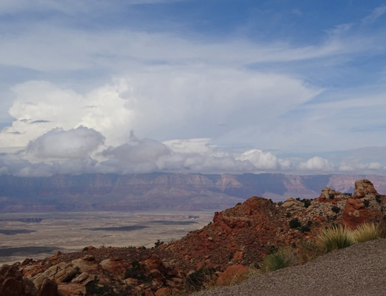
View toward Colorado River gorge from overlook
below Antelope Pass
We continued through the Coconino and Prescott National Forests on US 89
and I-17 the rest of the way to Black Canyon City.
With all the forests and mountains the
scenery was also quite nice along I-17 as we headed toward another large
storm in the distance (photos farther above).
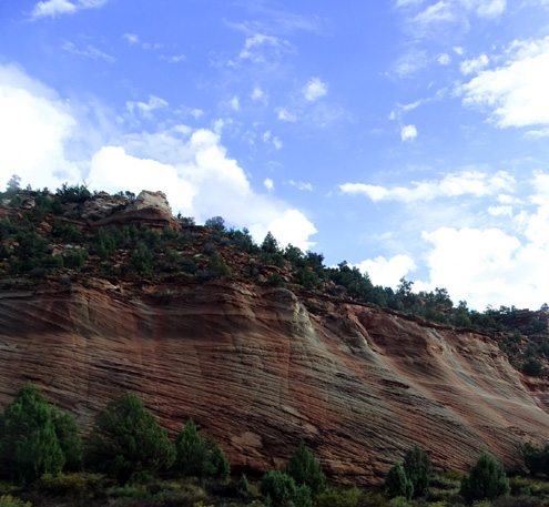
Approaching Black Canyon
This is a popular area from Flagstaff to Phoenix that we've visited on
day trips before, with interesting old mining towns like Jerome, red
rock scenery around Sedona, and several historic Native American sites
like Montezuma Castle and Tuzigoot National Monuments. There are also
some new places we'd like to visit on this trip.
Next entry: camping and hiking in Black Canyon, AZ
Happy trails,
Sue
"Runtrails & Company" - Sue Norwood, Jim O'Neil,
Cody the ultra Lab, and Casey-pup
Previous
Next
© 2015 Sue Norwood and Jim O'Neil
