I've used a lot of superlatives to describe about a dozen of the
other trails in Red Canyon that I've hiked. How can it get any better,
you ask?
I saved my favorite trail for last, so expect even more
superlatives and lots of photos!
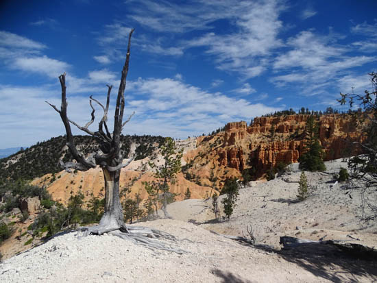
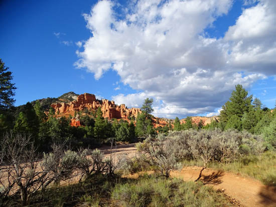
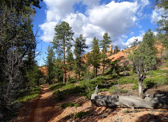
View of upper amphitheater from
the white-rock part of the ridge
I've already written some about this trail in an
entry about the different places Jim and/or I rode our bikes
in the Red Canyon-Bryce Canyon area.
Folks interested only in hiking may have skipped that entry since it
focused on cycling. This entry will be more specific to hiking this
spectacular trail. I'll include lots more photos of the scenery,
including a virtual tour from the low end to the high end -- the
opposite way most cyclists ride it.
BEFORE YOU GO
Hikers should note that this is a multi-use trail for hikers/runners,
cyclists, and equestrians.
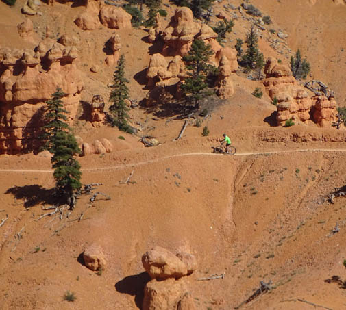
It is a real favorite of mountain bikers who crave a challenge. After
you hike it you'll understand why cyclists consider it a badge of honor
to have ridden it successfully. I can't imagine riding a bike on some
parts of this trail!
One of two "spines"
with very narrow trail and long drop-offs
I'm a little paranoid when I'm hiking the trail because of the
cyclists. There are lots of blind curves you -- and they --
can't see around, some very narrow trails with steep drop-offs on one or
both sides where there
is no place to step out of their way, and a few places where cyclists can
really fly.
Most of them are courteous but a few are obviously
annoyed when they have to slow down for other trail users.
Just be
cautious when you're hiking because there are usually more cyclists on
this trail than hikers or runners.
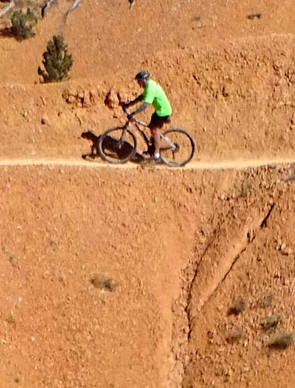
Above and below: Jim rode
safely across both narrow spines
but he doesn't plan to go back
and ever ride this trail again!
The trail is also open to equestrians. They are not a problem for
hikers and runners. In six decades of hiking I've never encountered a careless or
discourteous horseback rider on any trail, anywhere. Just watch where
you step . . . And if you're hiking with a dog, watch that they don't eat too
much horse poop. Our Labs love the stuff.
I mentioned in the last entry that I wanted to hike this trail our
first full day in the area but a ranger at the visitor center
discouraged it. He said bikes and horses had messed up the trail
after a rain. He referred me to the Cassidy-Rich trail system as an
alternative for a relatively long hike instead. I didn't know any better
so I waited a couple weeks before hiking Thunder Mountain.
But I want to hike this
trail!
I heard later that the rangers discourage all hikers to avoid
this trail because of all the mountain bikers. Some cyclists simply don't
like sharing the trail with pedestrians because it slows them down.
I don't know if the rangers are trying to protect hikers or caving in to
the cycling community. Maybe both.
I do know that after three long visits in the area and multiple
hikes on the trail when it's both wet and dry, it is almost all rock
and sand and it dries out very fast.
Too fast, in fact. It's
easier to hike when it's wet or damp because the loose rocks aren't as
much like ball bearings. In my experience, tire tracks and horse divots
aren't much of a problem for hikers. I've also been able to easily
bypass any short-lived mud or puddles on rocks next to the trail.
So don't let a ranger discourage you from hiking this trail.
Pedestrians and horses have the right of way and cyclists are supposed to yield to
both, whether they like it or not.
It's an easy-peasy ride (or hike) at the
lower end of the Thunder Mountain Trail.
Just be careful when hiking, especially at the lower end where the trail is more
smooth and straight for over a mile along a wash. Cyclists are so
relieved to be done with the difficult parts of the trail that they want
to bomb down the last 1+ mile to the lower trailhead.
It's there that the most danger lies from a speeding bike.
It's also there that the most hikers are likely to be walking. It's the first
trailhead visitors see as they come into Red Canyon, the trailhead is close to
the road, the trail starts off easy at that end, and there is plenty of parking.
Many of the hikers new to the area have no clue about the risks.
JUST THE FACTS, M'AM
OK, I'll get off my soapbox. I'm not anti-cyclist. I like to ride
my bike on trails, too. I've just had too many negative experiences in my lifetime,
while running and hiking, with careless mountain bikers. When I encounter the
courteous ones, I thank them with sincerity.
The Thunder Mountain Trail runs point-to-point for about 8 miles as
marked in yellow below. There are ways to make it longer or shorter that I'll
mention later.
Here's a map section from the Forest Service
web page re: Red Canyon trails
:
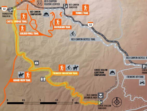
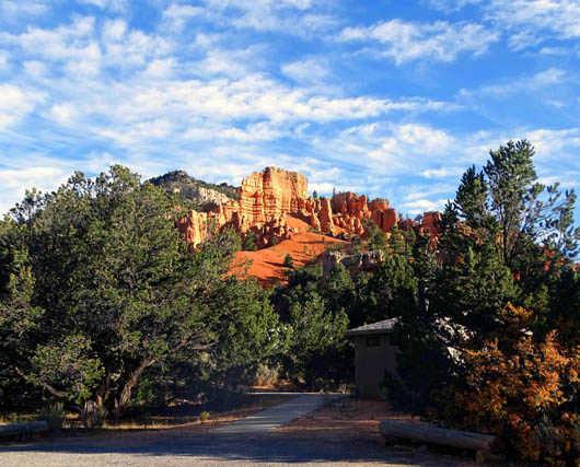
Thunder Mountain has two trailheads.
The trailhead at the top left on the map is the low end of the trail
at about 7,000 feet elevation. It is located near the entrance to Red
Canyon. There are three separate parking areas here; the
trailhead starts at the parking area farthest from the road, near a
restroom:
There is another trailhead about two miles back Coyote Hollow Road,
which intersects with Scenic Byway 12 at the "top" of Red
Canyon:
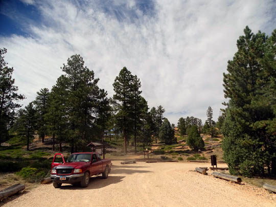
The elevation at this upper trailhead is about 8,050 feet. Since the trail
has a net downhill from this trailhead it's where most of the
cyclists start their rides.
A few hardy -- or clueless --
souls start from the low end and have to ride up a bunch of gnarly
switchbacks but they're a distinct minority.
Here's an elevation
profile of the trail from the USFS website:
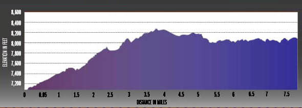
As you can see, the high point is approximately halfway between the
lower and upper ends of the trail. Near the "White Point" sign
on the trail the elevation tops out at about 8,250 feet.
TWO HIKES, TWO MO's
I hiked this trail twice during our Fall 2015 visit. The photos in
this entry are from both of these hikes.
On my first hike Jim and I parked a vehicle at either end of the
trail. I drove our truck to the lower trailhead and hiked up the trail
(eastbound) to Coyote Hollow. It's easier for me to hike uphill and that
way I could also see any cyclists coming at me, since most of them go
downhill (westbound).
I had a total of 8.75 miles (including half a mile on the spur trail to
Inspiration Point), 2,165 feet of elevation gain, and 1,101 feet of loss
in that point-to-point hike.
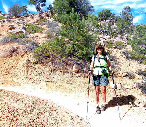
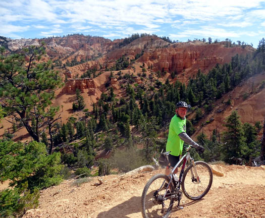
Jim got this picture of me when we crossed paths
our first time on Thunder Mtn.,
and I took the photo of him below.
Jim drove the car to the upper trailhead so I'd have it when I got
done hiking. He took his bike so he could ride back to the campground on
Coyote Hollow Road and the bike path down through Red Canyon.
After he got up there, however, he decided to ride the Thunder Mountain
Trail instead. I was 90% surprised to see him when we crossed paths --
I thought he might decide to do the trail and surprise me. (I included
photos of him riding over one of the "spines" above and in an
earlier entry.)
That day about 30 equestrians started up the trail before me from the
lower end. I never saw them but Jim passed them on his way down the trail
on his bike. I saw a total of six cyclists that day, including Jim --
and no one else in four hours. It was a warm, mostly sunny Thursday.
The next time I hiked the trail was six days later, another warm,
mostly sunny weekday.
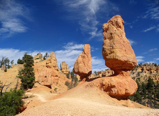
Since the best canyon views and the most interesting rock formations
are in the lower four miles of the trail, I hiked up from the lower end
of the trail to the twin hoodoos next to the trail right at four miles
(shown below, a few hundred feet past White Point going eastbound), then
turned around and went back down.
I included the Inspiration Point spur trail again that time, giving
me a total of 8.51 miles and a total elevation gain and loss of
3,553 feet.
That day I saw 11 cyclists, all going the downhill
direction -- and no one else.
[Out and back is my preferred method on this trail; I've gone
out four miles and back several times since then in May, 2016
and September-October, 2016.]
VARIATIONS
I mentioned that there are ways to vary the distance hiking this
trail.
The easiest way is to start at either trailhead and go
out and back for whatever distance you want, giving you anywhere from
a mile to 16 or 17 miles total. That way you don't have to spot two vehicles
or have someone drop you off or pick you up. I like to do that from the
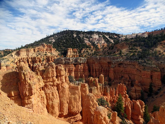
low end so I can see the spectacular canyon views.
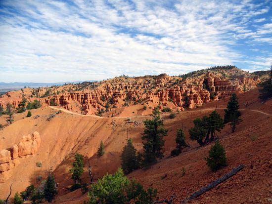
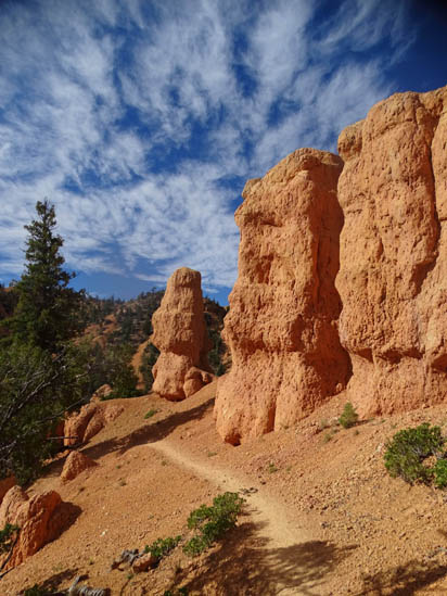
Red Rock Canyon, less than two
miles from the lower trailhead
Another way is to do the Inspiration Trail, a spur trail about 2˝ miles from the lower end of the Thunder
Mountain Trail. It has good views of the upper amphitheater if you
go all the way to the overlook at the end of the spur.
Out and back adds half a mile to the
total distance. I did the Inspiration Trail on both hikes this fall.
Just a bit of the 360-degree
view from Inspiration Point
Here are two other ways to increase the
distance on the Thunder Mountain Trail:
1) go some distance out and back on the
Grandview Trail, which intersects with the Thunder Mountain Trail 1.
4 miles from the lower trailhead (Grandview runs for 78 miles to the south!)
or
2) do the 15-mile loop that
many cyclists ride that includes dirt Coyote Hollow Rd. and the paved Red
Canyon bike path.
VIRTUAL TOUR OF THE THUNDER
MOUNTAIN TRAIL
On two hikes I took hundreds of photos of this trail. Jim also took a
few. I've edited them down to 488 pictures -- still quite
a large number. I'll have to be very selective re:
which ones I show in this multi-page entry. I hope you enjoy them!
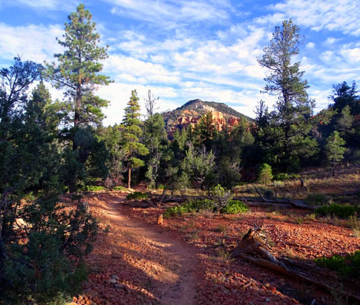
Photos in this virtual tour are arranged from the
low end to the high end of the trail and show views in both directions.
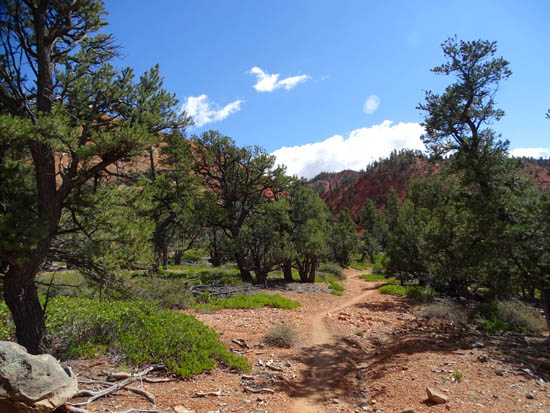
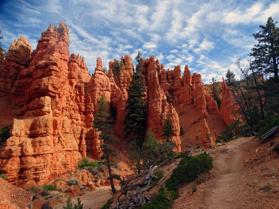
RED CANYON TRAILHEAD TO RED ROCK CANYON
The first set of photos covers 1.5 miles from the lower trailhead to
the juncture with Grandview Trail and the approach to spectacular Red
Rock Canyon:
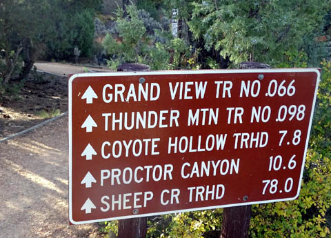
At 1.5 miles the Grandview Trail continues straight (south)
and the Thunder Mountain Trail goes left (east) toward Red Rock Canyon.
Virtual tour continued on the next page.
Happy trails,
Sue
"Runtrails & Company" - Sue Norwood, Jim O'Neil,
Cody the ultra Lab, and Casey-pup
Previous
Next
© 2015 Sue Norwood and Jim O'Neil
