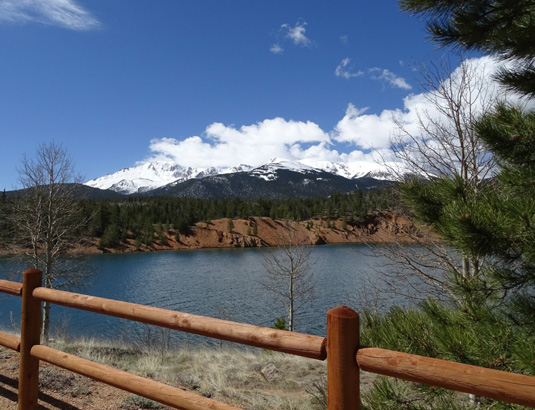
Every time I'm in or near Colorado Springs I'm drawn like a magnet to
this magnificent mountain. It simply mesmerizes me. There are great
views from the Academy, from Garden of the Gods, and from any of the
streets on the hillsides east of town.The mountain is most photogenic
when its high peaks are covered in snow, as they all were this month
while we were visiting.
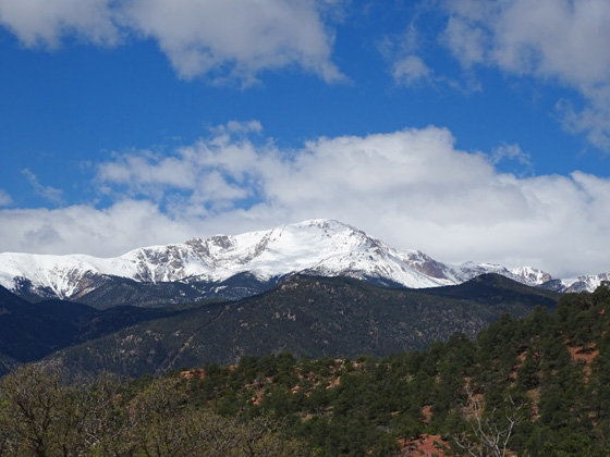
View of the east side of Pikes
Peak from Garden of the Gods (5-17-15)
Unfortunately, with all the rain we've had, and so much snow at the
higher elevations, I wasn't able to hike up the trail on the east side
of the mountain from Manitou Springs to the summit this time like I have
several previous times.
So I figured I'd just drive the highway to the top.
We've done that several times previously, too. Driving gives a
different perspective and views than you get when hiking. The highway
goes more up the north and west sides of the mountain.
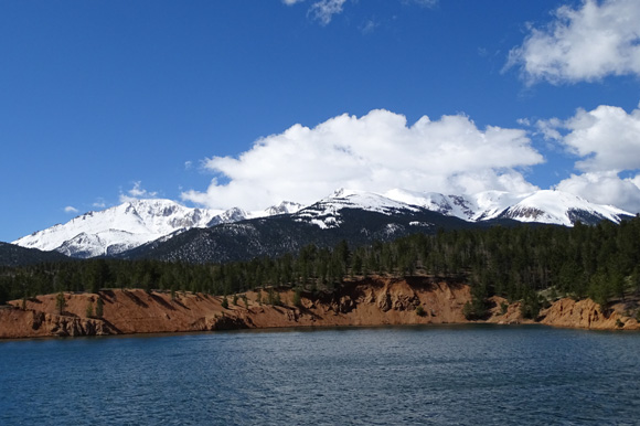
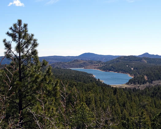
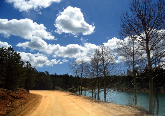
North side of Pikes Peak, as
viewed from the South Catamount Reservoir
I waited and waited for some of the snow on the mountain to melt but
by today, our last full day in Colorado Springs, the road was still open
only part way up.
Oh, well, it was a beautiful day in the upper 70s so I just went
anyway and took the dogs with me. Jim wasn't interested in going so he
stayed home. He had a long list of things he wanted to do before we
begin the next leg of our journey to Alaska tomorrow.
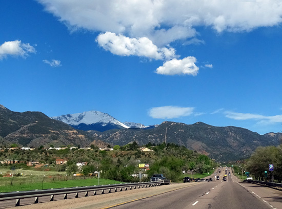
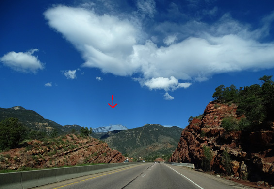
Above and below: Although it was mostly sunny this morning, Pikes
Peak was shaded by
clouds as I drove west on US 24 through Manitou Springs to the highway
up the mountain.
The Pikes Peak Highway is 19 miles long. It was open to 13.5 miles today, a little
past the building where brakes are checked when people are descending
the road (not today, though).
There is still 10-12 feet of snow at the summit, and more seems to fall
each day. When it rains down in town and at the Academy, it's snowing up there.
Even the cog railway didn't run today.
A few clouds were starting to form when I got to the entry station about
8:30 AM but it was still mostly sunny. Entry is $12 per adult driver and
$7 each for additional adults. There is no senior
discount but kids cost less. I had a $2 coupon so my cost was $10 and I
definitely got my money's worth.
Logo at entry gate
Note that the full fee is charged when the road is open at least half
way. I knew that from the website so I wasn't surprised when I got to
the gate.
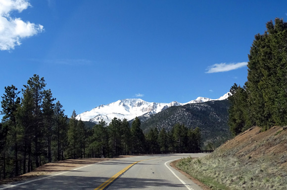
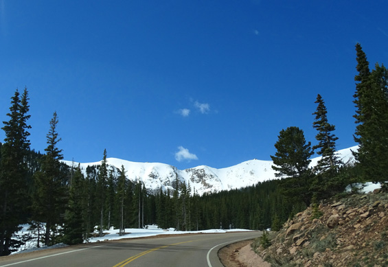
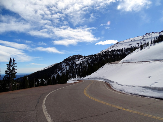
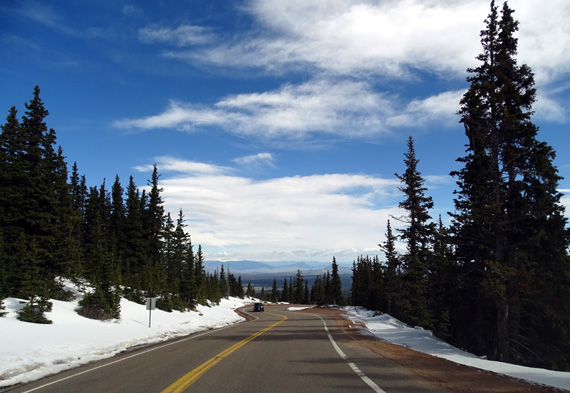
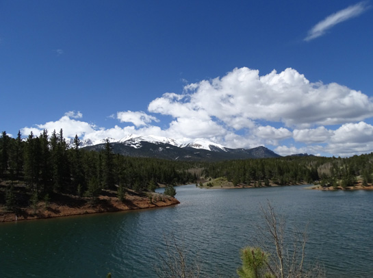
Traffic going up the mountain was light. A few cars came up behind me
but there are plenty of pull-offs so I let them pass. I went slowly so I
could take pictures as I was driving.
There are lots of views of the
summit and broad shoulders of the peak and they look fabulous when
covered in snow -- prettier than in the summer when the mountain
is all green.
View of Pikes Peak from Crystal Reservoir, which is
right along the road.
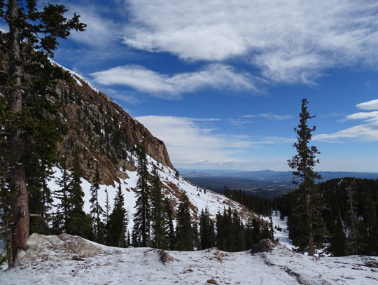
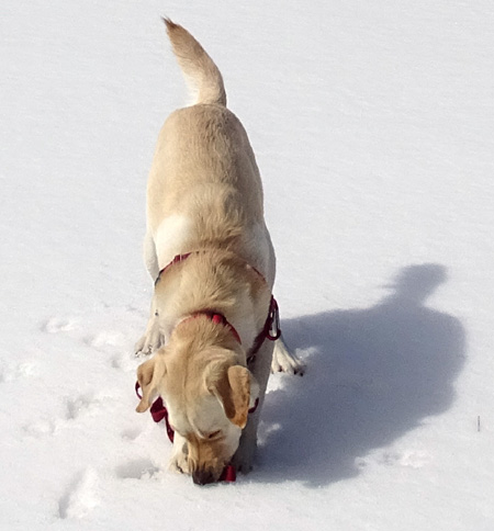
I began seeing snow along the road at about 9,600 feet elevation. I let the dogs out to play in
it several times while ascending and descending the mountain.
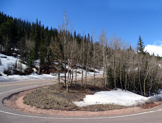
Snow, hairpin curve, and leafless aspens -- as late
as May 27 this year
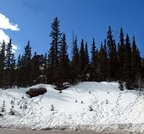
Footprints and butt-slides on a snowy slope
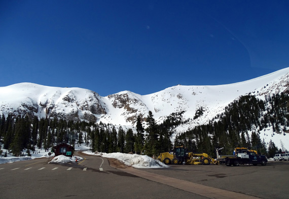
Location of the brake check building and historic
Glen Cove Inn; note the heavy road equipment.
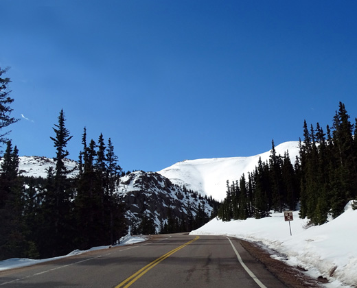
The road was closed
at 13.5 miles at
11,600 feet elevation:
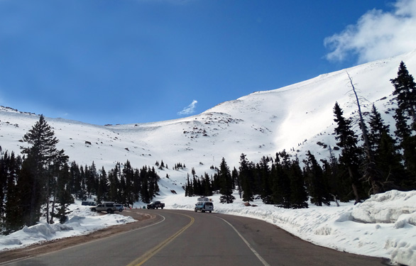
Turnaround
point today
After taking some pictures I began my descent.
When I passed the inn again at 13 miles I saw three vans with two groups
of cyclists who were going to ride down to the entrance gate.
Although I got ahead of them I made enough stops that we kept playing
leapfrog. They made several stops, too. I took this picture of a few of
them several miles down the road:
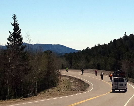
I was surprised on the descent to realize there were several plateaus
and even uphills that the riders had to negotiate. It's not as easy of a
ride as you'd think. There were about 20 riders and guides in one group,
and about 5 in the faster group.
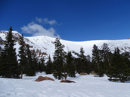
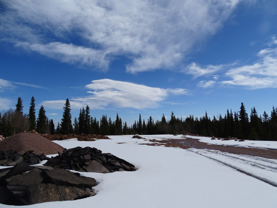
One of the places I stopped going down was this large parking area at
about 11,000 feet elevation. The dogs had fun running around in several
inches of snow:
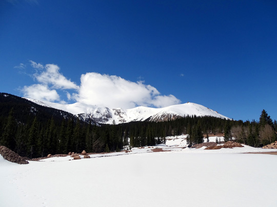
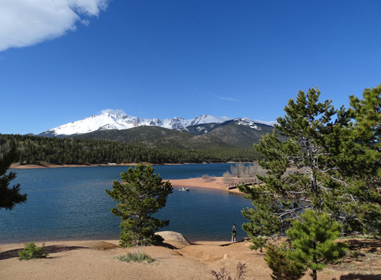
On the way up and
down the mountain there is a stretch of road where you can look down to two
pretty lakes in the valley below. They are the north and south Catamount
Reservoirs, part of the North Slope Recreation Area:
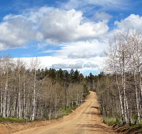
I turned off the Pikes Peak Hwy. around MM7 to reach these pretty lakes,
which I've never seen up close.
The three-mile dirt loop road to the dams had some
steep sections but was stable (few loose rocks) and easy to drive in the minivan.
If the road is wet and muddy you'd probably need a four-wheel drive,
higher-clearance vehicle:
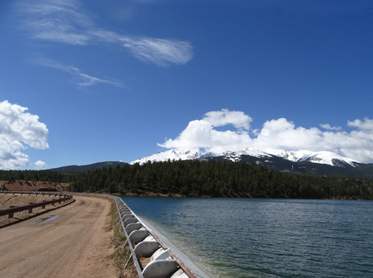
I got some excellent pictures of Pikes Peak across beautiful turquoise
blue water in both of the reservoirs:
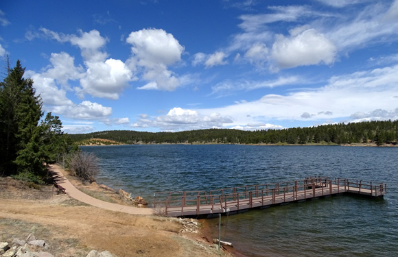
I was hoping to find a nice trail where I could walk the dogs but
I didn't see any obvious trailheads around the lakes. I'm glad I explored the
area a little bit, though. It's quite beautiful and you can see views of
Pikes Peak that are different than those from the city.
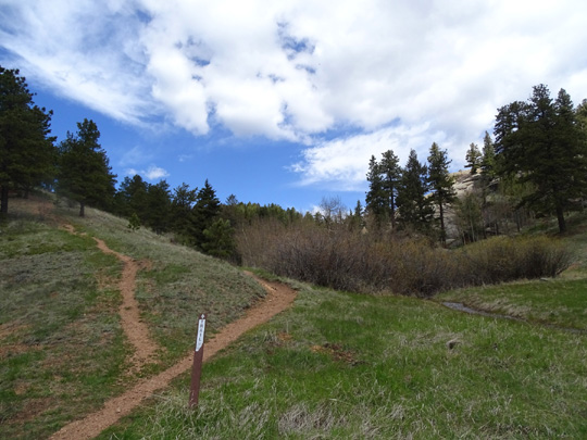
I continued down the Pikes Peak Hwy. to about MM3 and hiked a little way
with the dogs in Crowe Gulch:
As I was heading back to the Academy on US 24 through Manitou Springs I
could see where the rockslides occurred that closed the busy road several
days ago. US 24 follows Fountain Creek down the mountainside through a
scenic canyon. The creek
has caused flooding problems in Manitou Springs this month and is still
running fast and high.
Despite all the rain and some hail and snow in this area we're still
glad we came here instead of Austin. At least we didn't have tornadoes,
mudslides,
or serious flooding issues at the Academy.
I
took the next picture as I entered the Academy grounds. Shortly after I
got down from Pikes Peak another storm blew in. I could barely see the snow on the high peaks
any more:
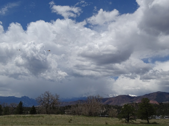
Glad I didn't get caught in all that rain! It was probably snowing on
the summit again.
If you look closely at that photo you can see a plane towing a glider to
the left in the clouds. Almost every day we see the cadets practicing
their flying skills with those gliders.
We're going to miss this place but we have even bigger plans for the summer.
Tomorrow we're heading toward Montana, our last stop before we begin our
Alaska Adventure #2. Ironically, it's still warmer up there than here . . .
Next entry: camping at Malmstrom AFB in Great Falls, MT
Happy trails,
Sue
"Runtrails & Company" - Sue Norwood, Jim O'Neil,
Cody the ultra Lab, and Casey-pup
Previous
Next
© 2015 Sue Norwood and Jim O'Neil
