Continued from the previous page.
WHITEHORSE RAPIDS FISH LADDER & DAM
A little farther upstream is the location of the Whitehorse Rapids,
which aren't so "rapid" any more.
Back in the 1800s the rapids created navigation challenges for miners
in a hurry to get up to the Klondike gold fields via the river, and
probably also for the Native Americans before that who just wanted to go
up and downstream in the course of their daily lives.
Since construction of the Yukon Energy Corporation's hydroelectric
dam the rapids are no longer visible -- and boats no longer go up
and down that stretch of the river.
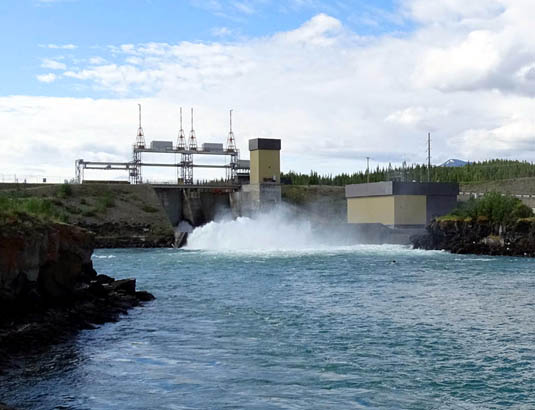
Spawning salmon still do, however, and that's why the fish ladder AKA
"fishway" was built.
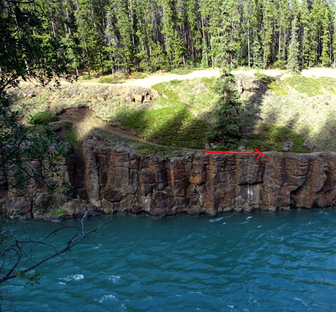
Chambers in the river gently nudge the fish toward the lower end of the
ladder and the flow of water encourages them to continue swimming
upstream:.
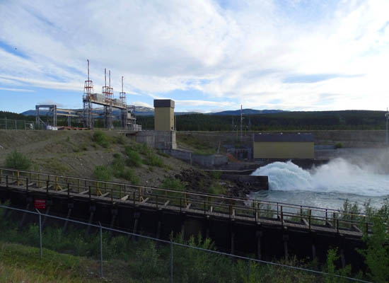
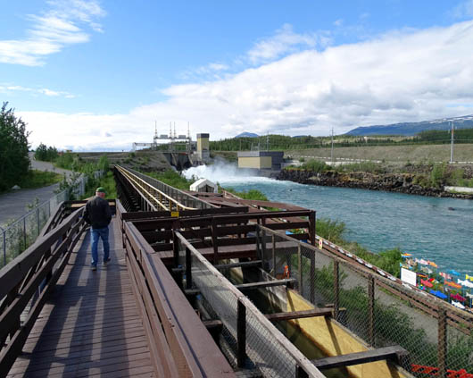
The ladder is a series of watery steps that gradually rise 60 feet
from the river to Schwatka Lake, allowing the salmon to swim safely past
the dam to their spawning grounds.
Each step is formed by a baffle that holds back a small pool of
water. The fish can either jump over each baffle or swim through
submerged openings in them.
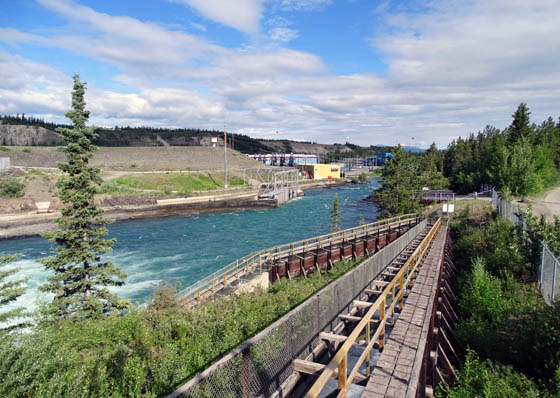
View of part of the fish ladder
We've seen fish ladders several places in Alaska but none so long
as the one in Whitehorse. In fact, at 1,182 feet in length it's reported to be the longest
wooden fish ladder in the world. The design of the steps allows
eddies to form in the water so the fish can rest between baffles, if needed.
The fish ladder is located on the other
side of the river in the suburb of Riverdale. We wanted to see it Friday
evening but the interpretation building was closed and we could only
look through the fence.
We returned today when two
young folks were staffing the building.
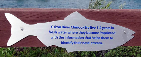
We read the exhibits, picked up an informative brochure about the
fishway, asked questions, and watched some Chinook salmon "fry"
(juveniles) through the observation window; they hatched nearby and
are on their way downstream to
the Bering Sea. Most of them went through the fishway in May.
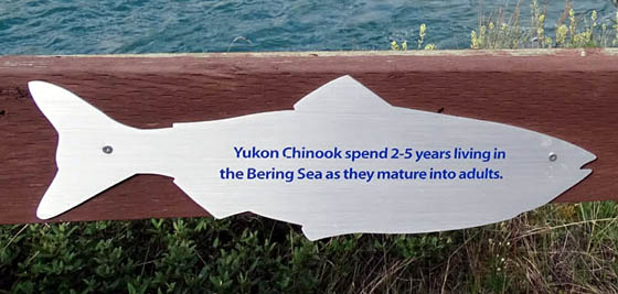
Adult Chinooks return to their natal waters upstream in August, so we
were too early to see them. By the time they get back here, they've
already traveled about 1,875 miles in three months from the ocean and
still have a ways to go to their birthplace.
No wonder they die soon after spawning!
The salmon fry we saw were in a holding area about halfway through the
fish ladder. While in the holding area, staff members record the size,
sex, origin (wild or hatchery), and condition of each juvenile salmon. Some are
collected for the brood stock program at the hatchery to ensure the
health and continuation of the species. Most continue heading downstream
toward the Bering Sea.
Since the building was open we could go out to the observations decks
and down the walkway next to the long fish ladder and viewing
decks:
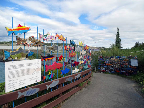
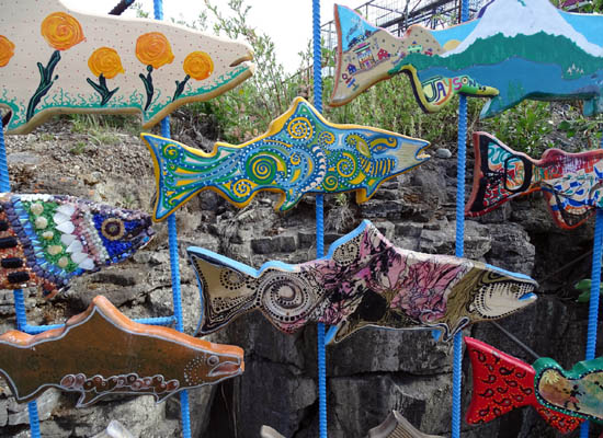
On the way down the walkway I was fascinated with the brightly colored fish
in this public art installation entitled, "One Fish, Two Fish."
The first phase was commissioned in 2009 to commemorate the 50th
anniversary of the Whitehorse Rapids Fishway. It was so popular that
Yukon Energy decided to have more fish created in the second phase, this
time by school kids.
Even though the Chinook (AKA king) and other species of salmon don't come back until
mid-summer to early autumn there is plenty to see and learn at the
fishway any time of the year.
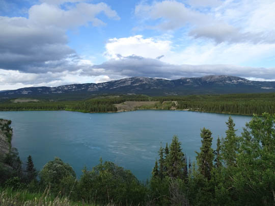
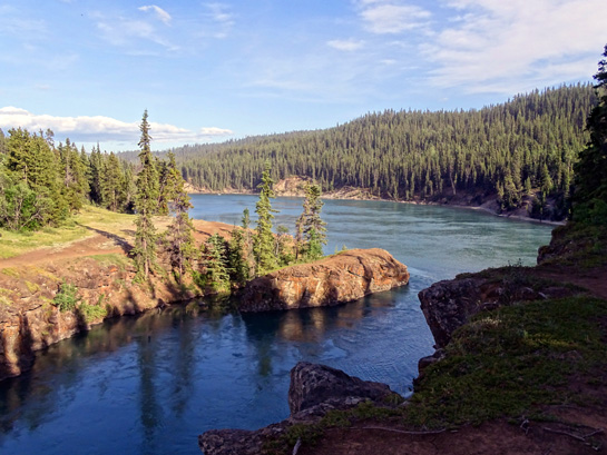
SCHWATKA LAKE
After the dam was constructed in 1959 a lake was created upstream.
Its name honors a U.S. Army Lieutenant, Frederick Schwatka, who named
many of the points along the Yukon River during his 1883 exploration of
the region.
There are lots of viewing points next to and above the lake along Miles
Canyon Road. Grey Mountain dominates the view to the east across the lake:
One day we watched as several young women boarded a float plane
by the shore and taxied out in the lake before taking to the sky:
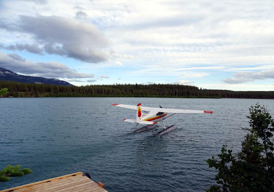
They were celebrating the birthday of one of their friends.
MILES CANYON
Let me begin by saying I love, love, love Miles Canyon!!
I had read about it before we arrived in Whitehorse and it was
the first thing on my list of things I wanted to see while we were here.
It's a very scenic narrow canyon at least a mile long through which the
deep turquoise waters of the Yukon River flow toward Schwatka Lake and the
city of Whitehorse. It is gorgeous and there are lots of hiking and biking
trails above it, mostly on the east side of the river.
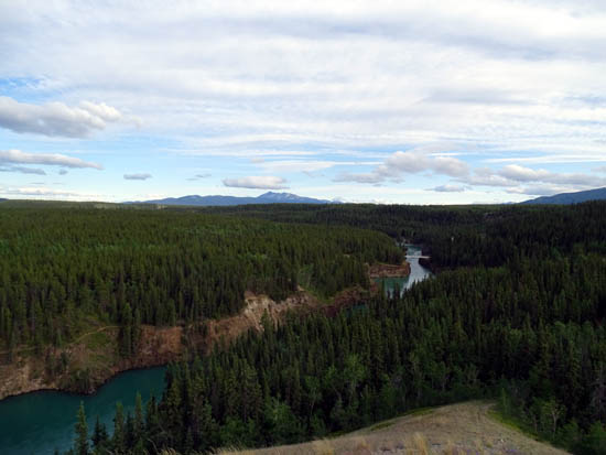
View of Miles Canyon looking upstream
south) from an overlook on Miles Canyon Rd.
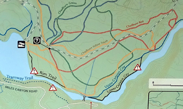
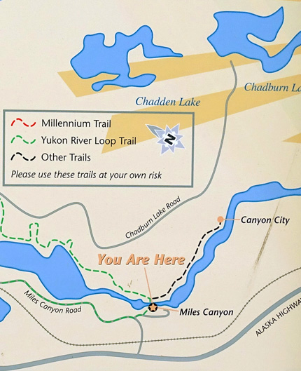
This map section from a sign near the
suspension bridge shows part of Miles Canyon
and some of the roads and
trails on both sides of the river.
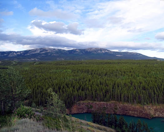
View of Grey Mountain from Miles Canyon Rd.
This narrow canyon used to be as challenging to early inhabitants,
miners, and settlers as the rapids a little bit downstream
because water flowed through it very fast until the dam was built in 1959.
The first evening we were in town we drove along Miles Canyon
Road on the west side of the river because it was close to our campground.
We stopped at a trailhead above one of the two pedestrian-only bridges that
crosses the river and accesses the trails.
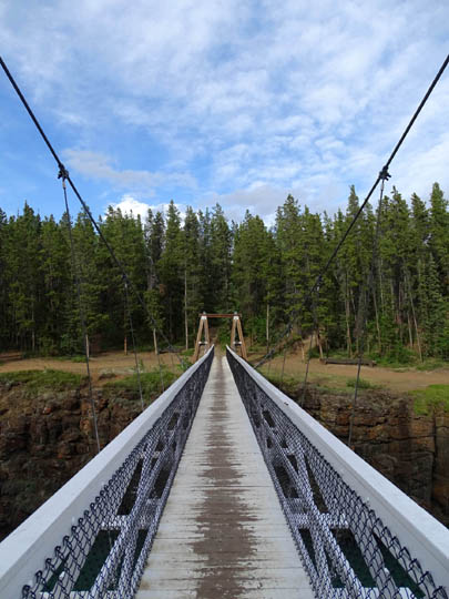
There is a long suspension bridge about 60 feet above the
water:
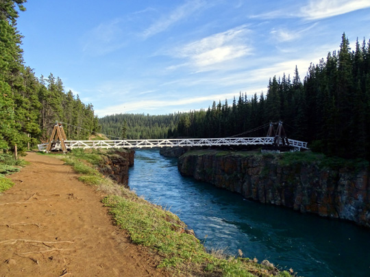
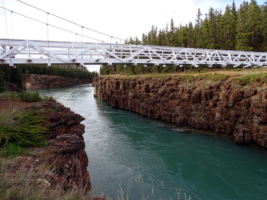
The basalt canyon walls rise as much as 50 feet above the water.
The lava that formed the walls cooled into five- and six-sided columns that look
like bundles of upright posts. You can see that in some of the photos:
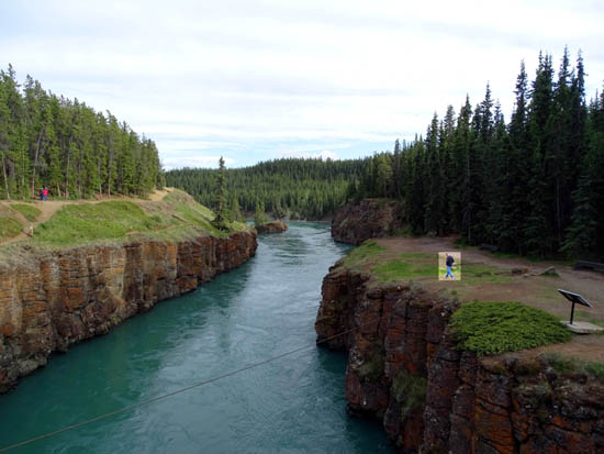
View upstream from bridge; I highlighted
Jim to show some perspective
of the height of the canyon walls where he is standing.
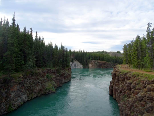
View downstream (north) toward town from the bridge
You can also drive across the river downtown to access all of the trails on the
east side of the canyon.
On our last evening in town I took both dogs to Miles Canyon and hiked a couple
miles with them on the Lower and Upper Canyon City and Rim trails:
Beginning of Miles Canyon at upstream
(south) end; I love the soft evening light.
Some of the trails above the canyon are
extremely close to the edge, as above.
That concerned me with the dogs so I hiked
with them on the higher trail shown below.
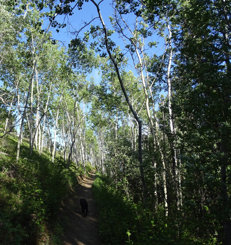
Birch trees on the Upper Canyon
City Trail
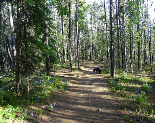
Pine forest and lupines on Lower Canyon City Trail
We saw some other hikers but no cyclists that evening.
If we come back to Whitehorse another time I want to explore more of
the trails above
Miles Canyon. I think Jim would enjoy cycling on some
of them, too.
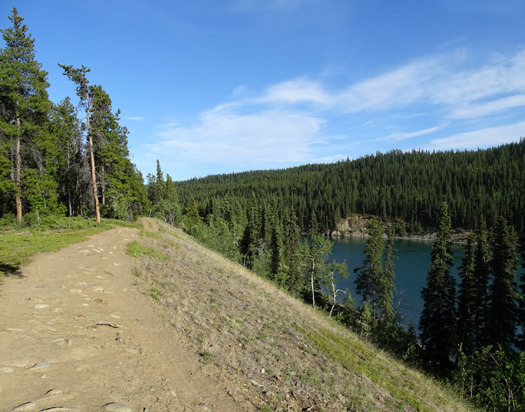
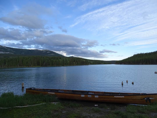
CHADBURN LAKE RECREATION AREA
If you visit the dam and fish ladder in Riverdale you might be interested in taking
a left on gravel Chadburn Lake Road and driving a few miles past Schwatka Lake to
Chadburn Lake.
You can see its proximity to Miles Canyon in this map section from a
sign I photographed:
There are numerous hiking-biking-skiing trails in this rec area and
several lakes where you can picnic, watch birds, boat, or fish.
When we visited on Friday evening a group was getting ready to launch their canoes
for a weekend of camping and boating on Chadburn Lake:
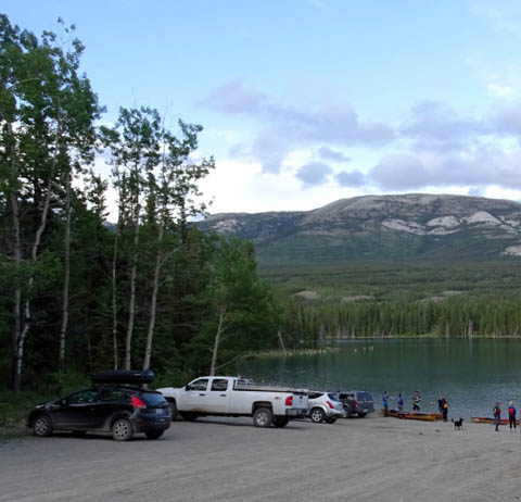
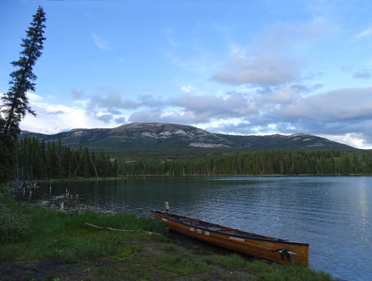
Grey Mountain is in the distance.
Whitehorse is worth a stop of several days on the way to or from Alaska,
or as a destination all on its own.
I'm glad we stayed a few days this time, and I'd like to return some day
to see more of the cultural and historical attractions and hike-bike
more of the numerous trails in the area.
Next entry: day trip from Whitehorse to Skagway, Alaska
Happy trails,
Sue
"Runtrails & Company" - Sue Norwood, Jim O'Neil,
Cody the ultra Lab, and Casey-pup
Previous
Next
© 2015 Sue Norwood and Jim O'Neil
