Grey Mountain dominates the view east of Whitehorse. I noticed it
yesterday afternoon while we were driving along the road above Miles
Canyon and immediately thought, "I wonder if there are any hiking
trails to the top of that thing??"That's just how I'm wired!
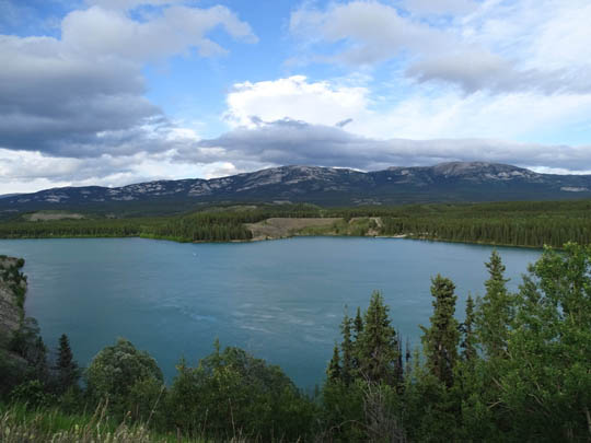
Grey Mountain, looking east from
the Whitehorse side of the Yukon River
I discovered there is a nice trail on the summit but it
starts at the end of a rough road that requires a high-clearance
vehicle. Our pickup truck isn't a 4x4 so driving to the trailhead wasn't
a good option.
There are several mountain bike trails that go up the west side of
the mountain but I decided not to hike any of them today because I had
Casey with me. I assumed on a Saturday there would be some kamikaze
cyclists bombing down those trails. I might try one or more of them if
we stop back here in the fall.
Today I just parked the truck in a pullout a little after the road got
more narrow and rough
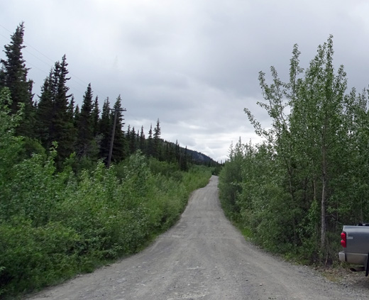
and hiked up the road with Casey to the TV tower parking lot where
the summit trail begins. Out and back totaled nine miles. Here's how that
played out . . .
CAN'T BELIEVE I DODGED THE RAIN
Despite a 40% chance of rain today the campground didn't get any, Jim
didn't get wet when he rode his bike 25 miles around town this morning,
and I had only a little sleet and snow on Grey Mountain while hiking
with Casey.
We both made good use of our time today -- and enjoyed relaxing
when done!
How I escaped getting wet is beyond my comprehension.
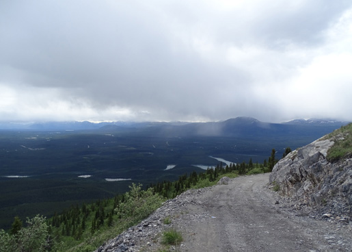
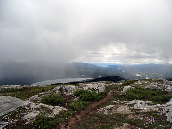
I could see rain falling in three directions while on the ridge, some of
it fairly close, and
up/down the road from where I parked -- but I didn't get into any of it:
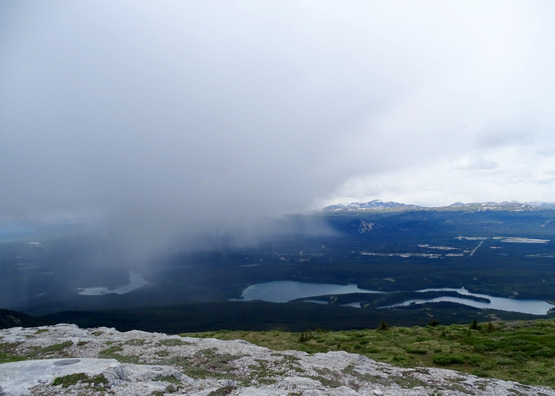
Rain to the
southwest, about where our campground is located, but it didn't get wet
either.
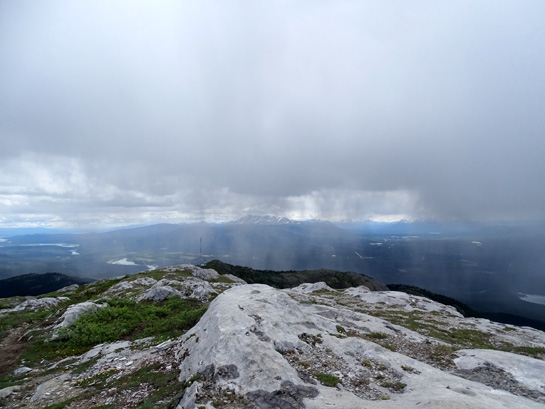
A good
shower just south of me in the Yukon Valley
Above and
below: rain to the east, close to the ridge I was on
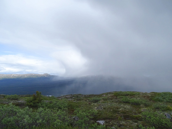
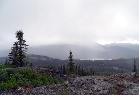
A couple minutes of sleet and snow on the ridge were a surprise, though.
I was hiking northbound along the summit to the first peak and all I
could see in that direction was sunshine!
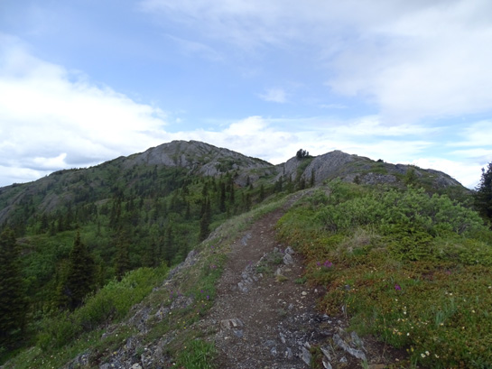
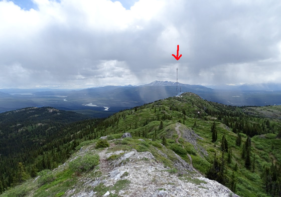
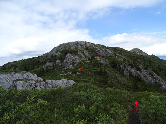
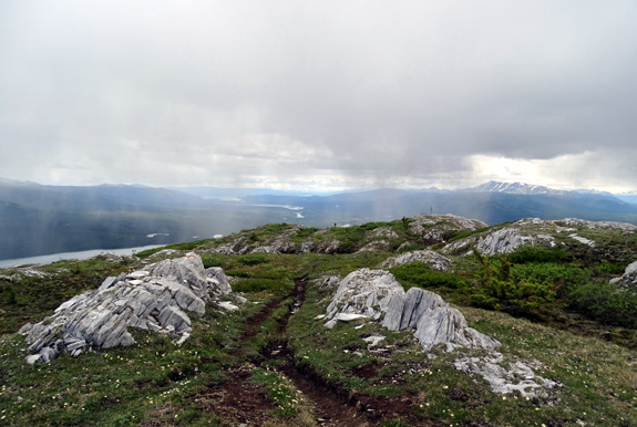
Grey Mountain has at least two high peaks. The
trail undulates across the long ridge.
I would have gone farther on the ridgeline if I hadn't had six miles
just on the road today.
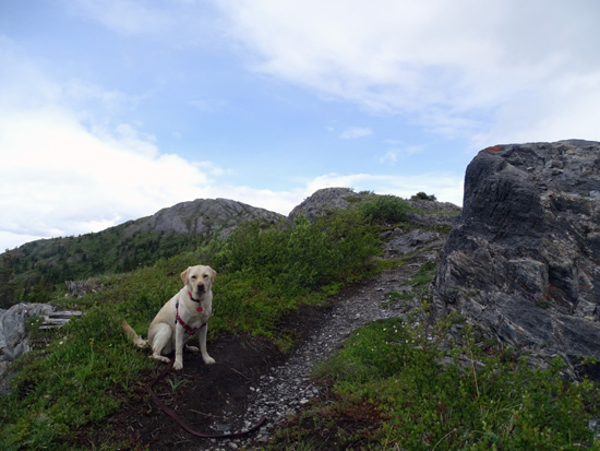
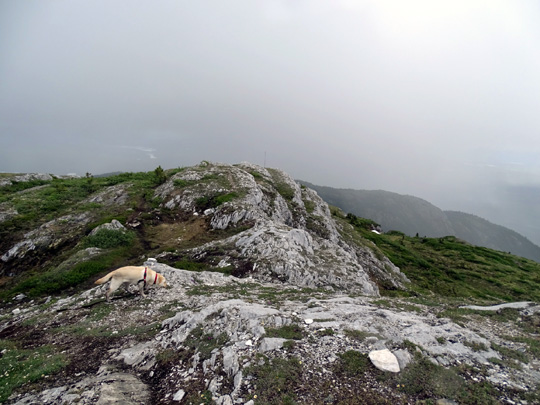
Good girl! Casey waits patiently while I take
yet another picture.
Temps ranged from 39-64 F. in town and were surely cooler at close to
5,000 feet elevation on the ridge. The sun shining on the ridge kept me warm
while I was up there.
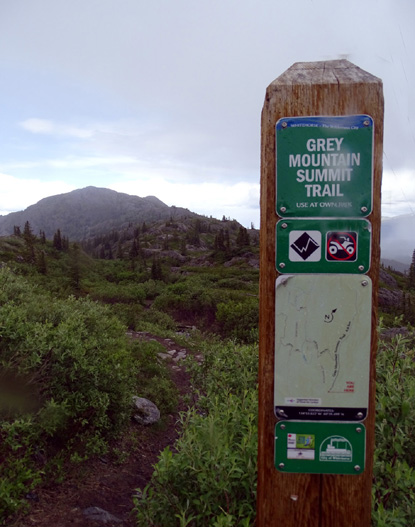
ACCESSING THE SUMMIT TRAILHEAD
I drove across the Yukon River to the suburb of Riverdale and found Grey
Mountain Rd.
I had no idea what the road was like until I began driving up. I
discovered that it is smooth
gravel/dirt for 4+ miles, then pretty rough for at least 3˝ miles.
I drove only half a mile on the rough part before parking at the pull off
for the Payback Trail, which is open to mountain bikes.
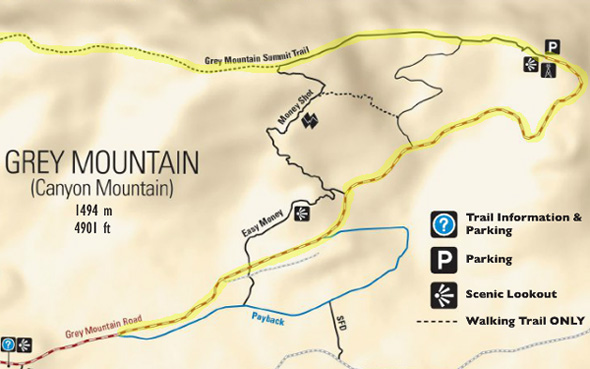
Here's a map from the website quoted above, with my route highlighted in
yellow:
Casey and I walked three miles up the road to the trail on the ridge, three
miles (total) out and back on the ridge to the first high peak, and three miles back
down the road at the end = nine miles.
The TV tower at the beginning of the summit trail makes a good beacon both from the
road below it
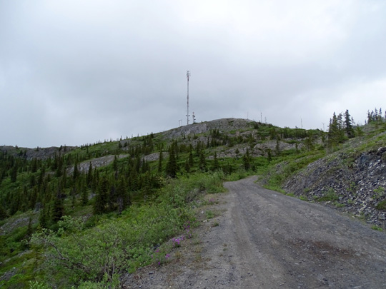
and from the summit above it, although it's hard to lose your way on a
ridge where you have 360°
views!
The road walk wasn't real pleasant but there weren't very many vehicles
going up/down either in the morning or afternoon and I had some nice
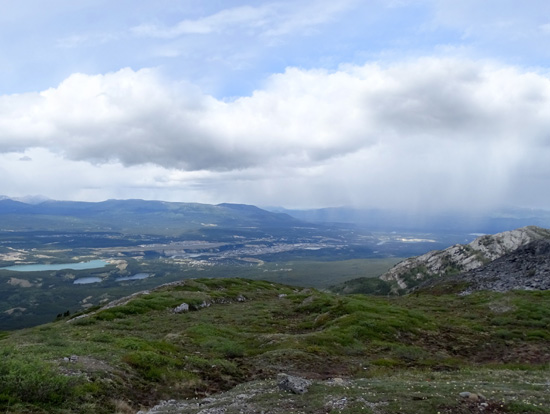
views into the Yukon Valley:
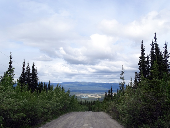
Looking back at Whitehorse
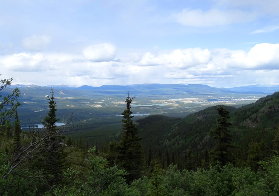
View west toward Whitehorse and the mountains in
the distance
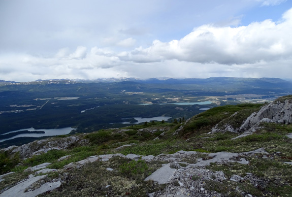
The higher up, of course, the more expansive the
views
Marsh Lake is in the distance but hard to see in
this little picture.
There are lots of lakes in that valley above the river (upstream), and
at least one other pretty lake in the
valley on the other side of Grey Mountain:
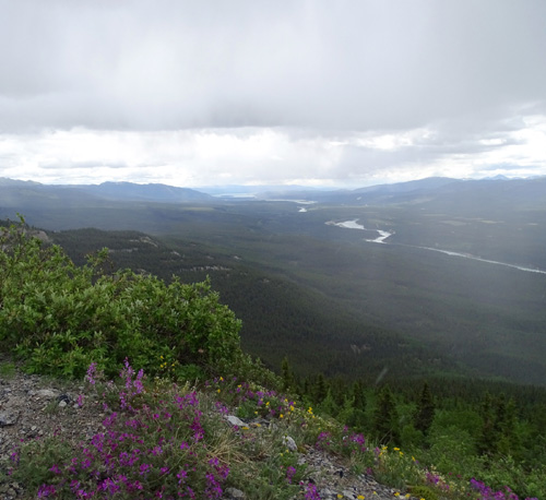
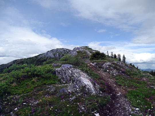
HIKING ON THE RIDGE
The views were even more spectacular from the ridge because I had the
total panorama from up there and could see all the way to Marsh Lake and
beyond. I started at 2,852 feet elevation and topped out at 4,848
feet.
Once I got to the parking lot by the TV tower it was easy to find and
follow the Summit Trail.
Although there are a few short steep places and plenty of rocks it is
generally easy to negotiate:
Here are two more shots down to the Yukon Valley and Whitehorse from the
ridge:
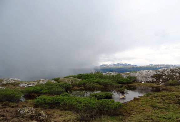
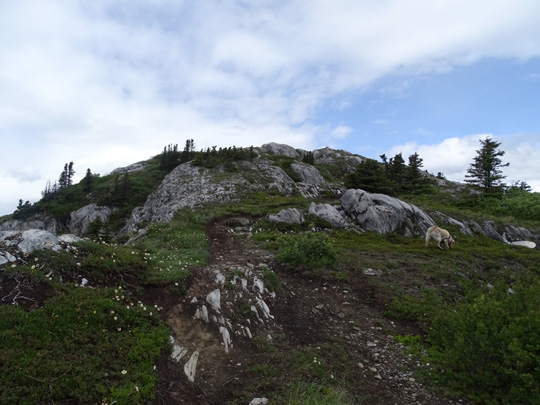
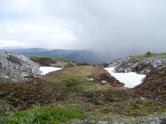
I let Casey run free most of the time on the ridge trail. She loved the
small snow banks we encountered and swam in a pool of
water in a depression along the ridge:

She also got to play with another dog on the summit trail. I saw only
eight people up on the ridge. I thought there would be more on a
Saturday.
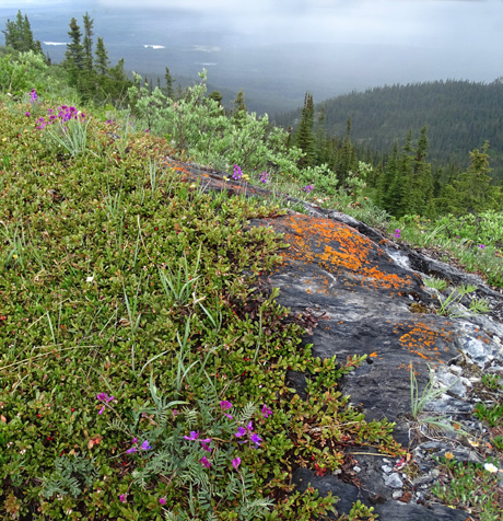
I enjoyed all the wildflowers along the road and trail -- blue lupines
and mountain bluebells; pink, purple, and fuchsia vetch (sweet pea); yellow
daisies, dandelions, and cinquefoil; white marsh marigolds; and other
flowers up to about 4,000 feet:
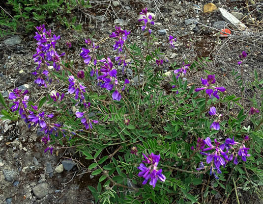
Vetch
The ridge is in the sub-alpine and alpine zones above 4,000 feet. I saw lots of bright pink moss campion
and white mountain avens up there:
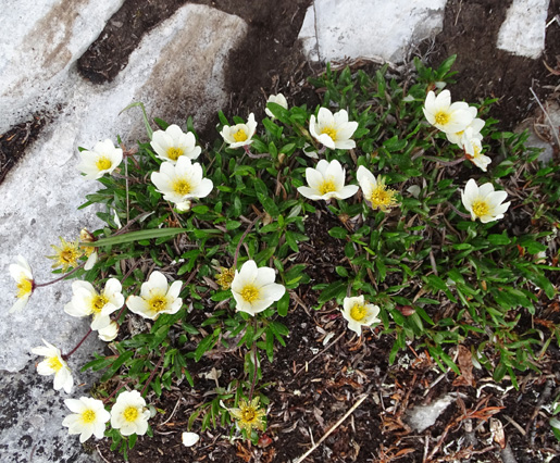
Mountain avens
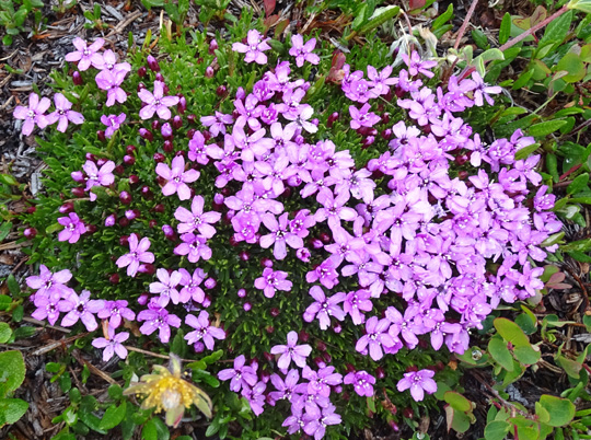
Moss campion
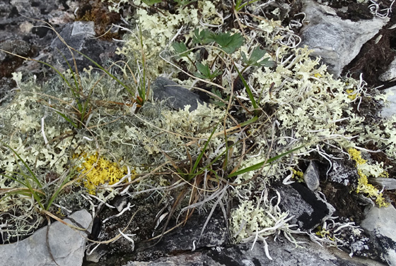
There were also some interesting lichens at the higher
elevations:
I enjoyed this hike and would do it again, but probably go up one of
the mountain bike trails instead of the road.
After I got back I walked Cody over a mile in the campground. If I
could have driven up to the parking lot at the trailhead he could have
gone on the summit hike, too.
Next entry: scenes from in and near Whitehorse,
including gorgeous Miles Canyon, the downtown river walk, the bike path
along the Yukon River, Schwatka and Chadburn lakes, the dam and fish
ladder, and more
Happy trails,
Sue
"Runtrails & Company" - Sue Norwood, Jim O'Neil,
Cody the ultra Lab, and Casey-pup
Previous
Next
© 2015 Sue Norwood and Jim O'Neil
