There are hundreds of miles of trails throughout the large expanse of
mountains in Chugach State Park, located just east of the Anchorage city
limits. It's a year-round wonderland for residents and visitors who like
the great outdoors.
As has been the pattern recently in Anchorage, it was overcast most of
the day and then became a little sunnier in the late afternoon and
evening. Temps were about average, from the mid-50s to mid-60s F.
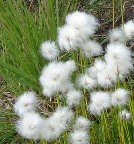
Fluffy cottongrass (above) and other flowers
(below)
at 2,800 feet elevation on Mount Gordon Lyon
Jim took Casey for a four-mile bike ride/run in the morning, then did a
solo 35-mile ride on base after lunch. I took the dogs on walks in the
campground but didn't get motivated to do a decent hike until I saw some
sunshine at 4:30 PM.
Since it was getting late and Mt. Gordon Lyon is close to JBER, I decided to
drive back up Arctic Valley Road and hike the slopes
just north of Rendezvous Mountain.
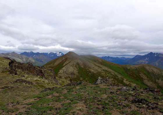
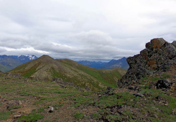
View of Rendezvous Mtn. from ridgeline of Mount
Gordon Lyon
It was 5:45 PM before I got on the trail with both dogs and almost 9 PM
when I returned home. It took about 2:30 hours to hike 3.69 miles on the
southern flank and lower summits of Mt. Gordon Lyon.
After hiking I was so wired I had great difficulty getting to sleep when
I was done! I didn't go to bed till 11:30 PM -- and it wasn't
even dark yet. Jim beat me to bed for the first time in as long as I can
remember.
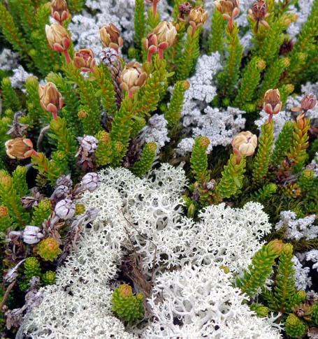
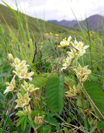
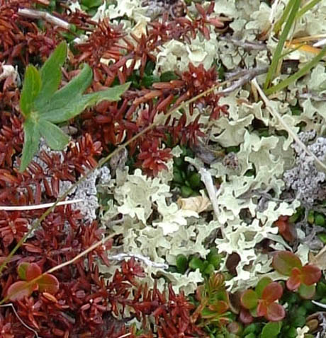
Above and below: medley of alpine plants at 3,800-4,000 feet
elevation
There were about a dozen vehicles in the Arctic Valley ski parking area
when I got there. The occupants were all apparently using the trails on the
Rendezvous side of the creek.
I went up the other side where I've seldom seen anyone hiking. That was
easier with a rambunctious young dog like Casey who wants to greet every
person and dog she sees (i.e., she needs to be on a leash much of the
time).
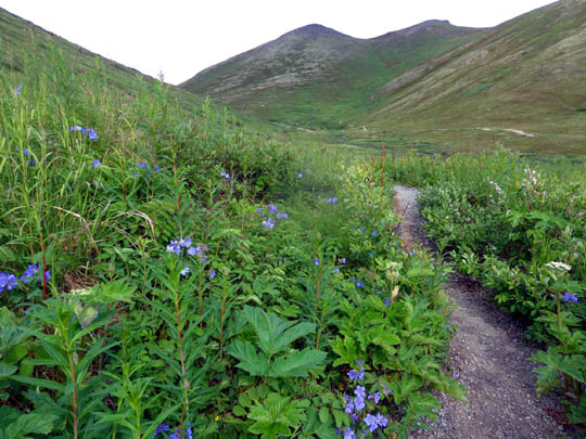
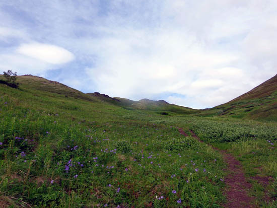
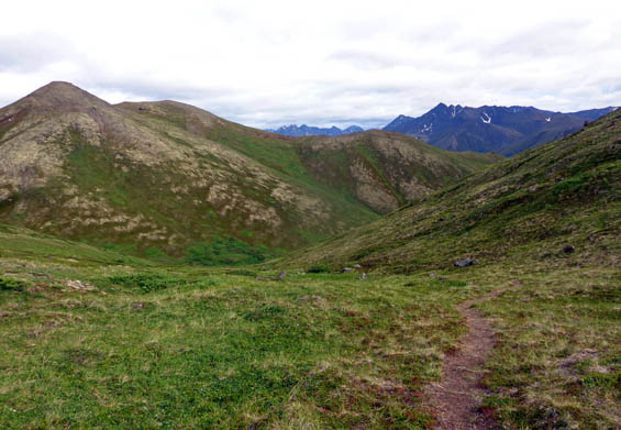
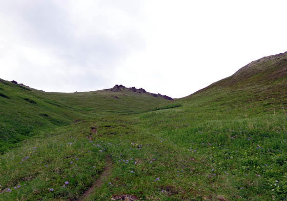
Here are a couple photos
of the beginning of the ascent:
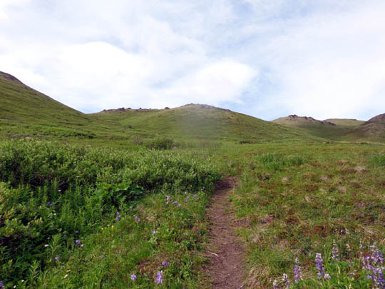
About halfway up the drainage between the two mountains I turned
left on a more obscure trail to the ridgeline of Gordon Lyon:
Looking up toward the ridge
Looking back from part way up the south side of
Gordon Lyon
I didn't go to the summit of Gordon Lyon but did get up on the ridge for
about half a mile so I could see to the northern end of Cook Inlet and
down to the town of Eagle. My GPS said I went from 2,654 to 4,029 feet
elevation and had a total gain and loss of 2,926 feet.
The next series of photos shows the views in various directions as I
hiked east along the ridge:
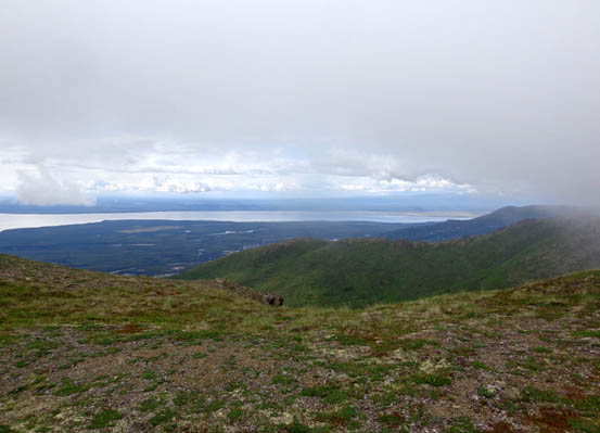
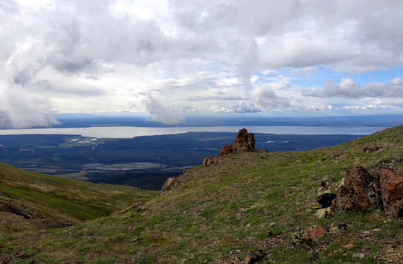
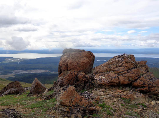
View toward northern end of Cook Inlet
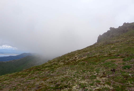
Low cloud creeping past
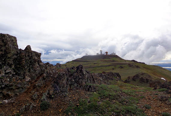
View of old Nike missile base on one of Gordon
Lyon's peaks
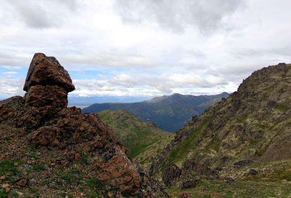
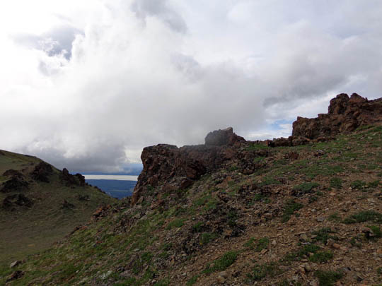
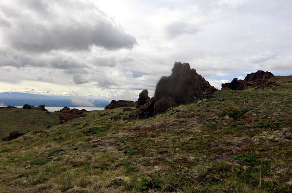
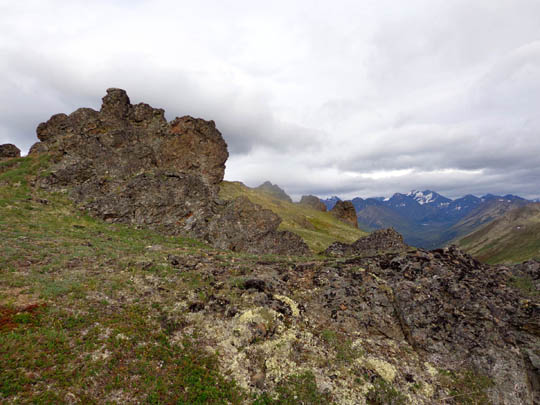
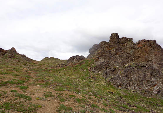
Above and below: There are lots of large,
interesting rocks on Gordon Lyon's ridgeline.
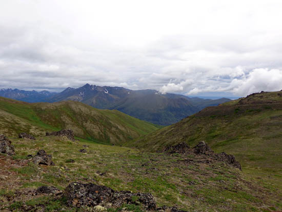
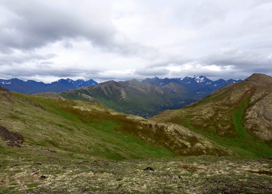
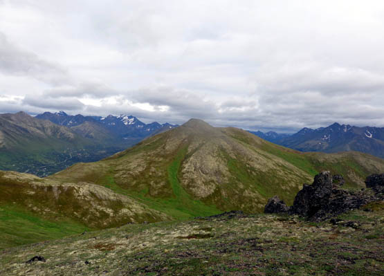
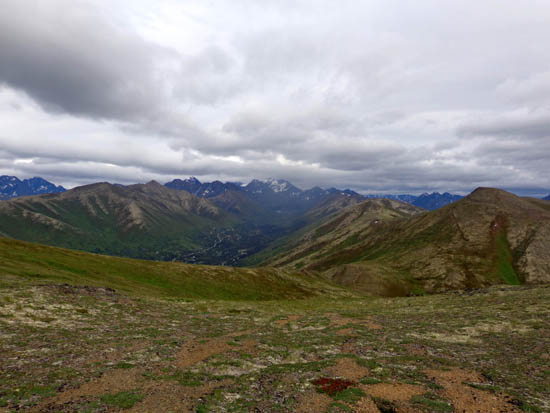
The next three photos are a panorama from left to right, looking toward
the high point on Mt. Gordon Lyon (first picture) to the north side of
Rendezvous Mtn. (third picture):
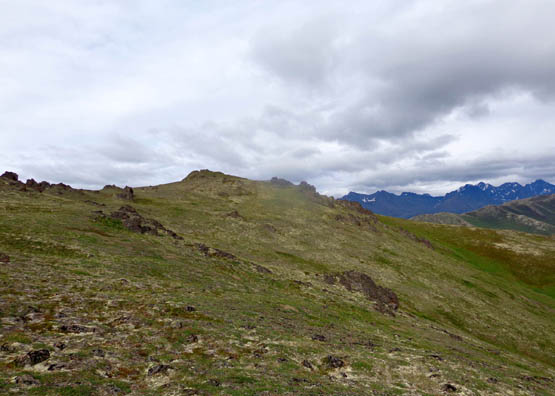
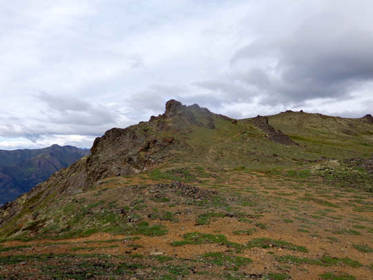
A faint trail continues east along the ridge
Rocks just below the summit of Gordon Lyon
Cody has always done fine off-leash, staying close to me as we hike.
When we turned around tonight, however, he led the whole way back as we
descended cross-country on Gordon Lyon's south slope. He was on a
mission to get back to the truck and he knew exactly where it was.
Casey, on the other hand, also knew where it was and did not want
to turn around. She tried to lead me farther up the mountain. That's
typical of her recently. She has her own agenda sometimes and it's
comical to watch her body language as she tries to convince me to change
my mind!
I took the next set
of photos as I headed down from the ridge toward the saddle between
Gordon Lyon and Rendezvous Mountains:
Looking back up toward the summit
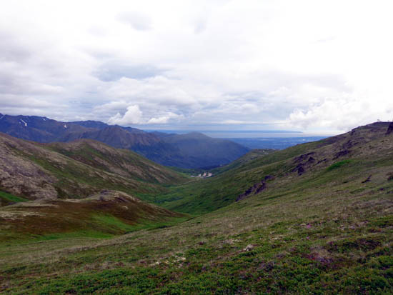
Looking down toward the Eagle River valley;
Rendezvous Mtn. is to the right.
View west toward the ski area (trailheads),
Anchorage, and Cook Inlet
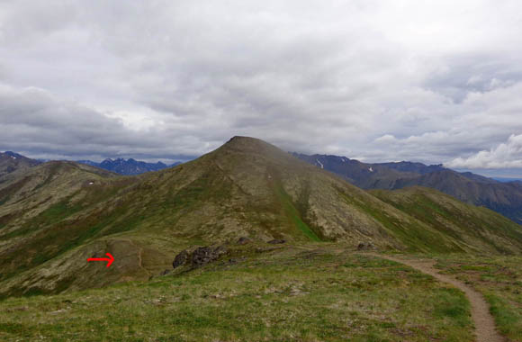
Arrow marks trail 'way down on the saddle;
Rendezvous dominates the near background,
with its ridge to the left (where I hiked June 25).
Looking
back up to Gordon Lyon's summit
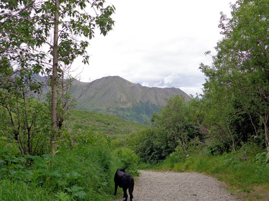
Last section of trail; Cody knows the truck is
close!
At least half the distance was cross-country through the tundra and
sub-alpine zones. That's very easy to do on this mountain because it's
above treeline and there aren't very many rocks. It gave me a chance to
see different types of plants and avoid hikers on the main trail.
I enjoyed doing an evening hike for a change but will probably stick
to walking earlier in the morning when it's cooler and I have longer to
unwind before going to bed.
Next entry: hiking at the Eagle River Nature Center
Happy trails,
Sue
"Runtrails & Company" - Sue Norwood, Jim O'Neil,
Cody the ultra Lab, and Casey-pup
Previous
Next
© 2015 Sue Norwood and Jim O'Neil
