Most of the five-and-a-half days we've been in
Valdez have been relatively warm and sunny, perfect for our hikes, bike
rides, and sight-seeing adventures.
Friday was no different. Clouds moved in and out
during the day -- typical for coastal Alaska -- but we had
plenty of sunshine and time for long bike rides in the morning and a fun
road trip to Worthington Glacier and back in the afternoon.
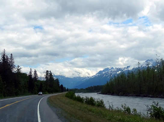
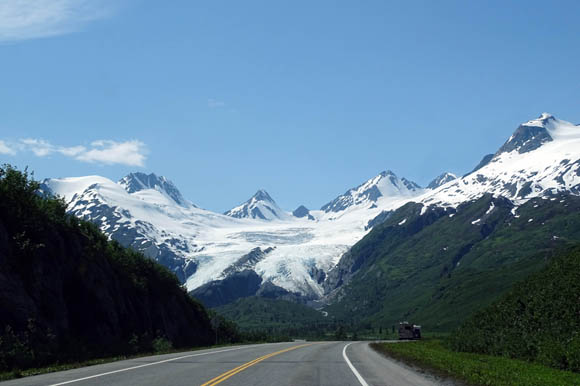
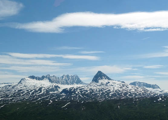
Heading NE along the Lowe River toward Keystone
Canyon
This close to the summer solstice, daylight is very, very long so
visitors can pack a lot into one day.
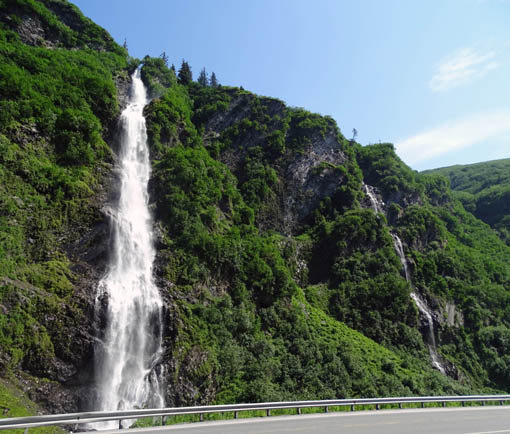
The sky was mostly blue when we reached Keystone Canyon about twelve
miles northeast of Valdez. I got some good pictures of waterfalls,
mountains, glaciers, lakes, and other scenery and we met an interesting
full-time RV couple, Chuck and Jodie. They sold their house in Maine
five years ago and love their carefree lifestyle traveling around North
America.
Keystone Canyon and the glacier-blue Lowe River; wonder how often the highway floods
in the spring??
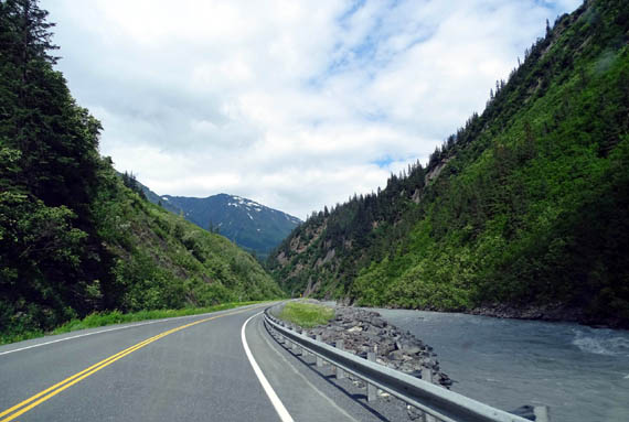
When we saw the couple we'd just driven north through
most of Keystone Canyon, formed over the millennia by the Lowe River.
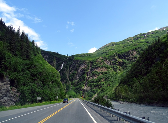
Two beautiful waterfalls pour down the high
cliffs right along the Richardson Highway. Large pullouts encourage travelers
to pull over to admire Horsetail Falls and Bridal Veil Falls:
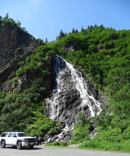
Horsetail
Falls
Above and
below: Bridal Veil Falls and a smaller waterfall nearby
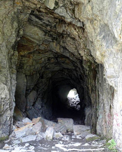
Near the northeastern end of the canyon is an old
train tunnel, which also has a pullout and historical sign with these words:
This tunnel was hand cut into the solid rock
of Keystone Canyon and is all that is left of the railroad era when nine
companies fought to take advantage of the short route from the coast to
the copper country. However, a feud interrupted progress. A gun battle
was fought and the tunnel was never finished."
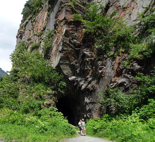
That's where we met Chuck and Jodie, who were
investigating the tunnel when we arrived.
We'd seen their truck camper in town about an hour earlier and
remembered their distinctive personalized South Dakota license plate.
We began talking and spent about 30 minutes with them. To our surprise
we discovered that they also have a 2012 Cameo 35SB3, the same model as
ours but two years newer. They purchased it three months before Carriage
went bust. They left the Cameo in Florida in storage and bought
the Adventurer truck camper for this trip to Alaska.
The truck camper has two slide outs. Chuck and Jodie love it and proudly
showed us around inside. It has a kitchen
in the back slide. The other slide expands their living area.
We have heard of other couples who have done this, too. The smaller RV
gets better MPG and camping options are almost limitless.
We considered doing the same thing three years ago -- purchasing a truck camper
for the trip to Alaska, storing the Cameo, then selling the truck camper when
we got back to the Lower 48. We didn't have any trouble with the Cameo
on the long drive, however, and we usually found suitable campsites for
our 36-foot 5th-wheel. So we just brought the Cameo with us again this
trip.
Although this couple thinks the truck camper has plenty of room for them
and their large standard poodle, Jim and I know we would get
claustrophobic pretty fast. After living in it for four or five months
and 15,000 miles of travel, Chuck and Jodie might think so, too!
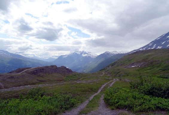
Chuck and Jodie's overnight spot between Thompson
Pass and Worthington Glacier
Still, it has us thinking about this option again when we need a new truck
(a large truck camper like this needs a one-ton dually). Camper tops are
getting larger and more sophisticated than they used to be. They are
practical on a long trip like Alaska but to us, having two RVs would be almost the
same as having a house or condo somewhere.
The couple will be in Alaska all summer so we may run into them again.
They were on their way north a few miles, spending the night boondocking
between Thompson Pass and Worthington Glacier.
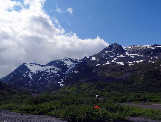
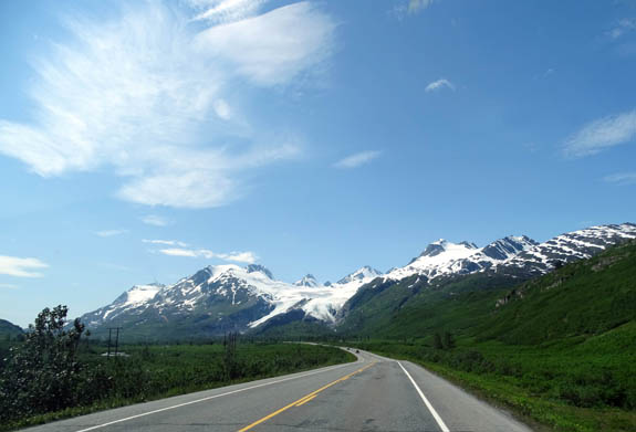
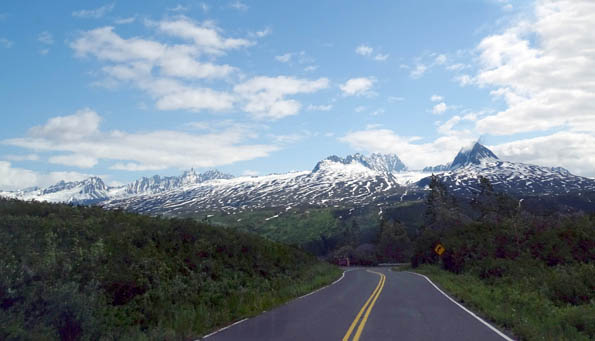
SNOW CENTRAL: THOMPSON PASS
After we investigated the old railroad tunnel we continued driving up
and over Thompson Pass to Worthington Glacier.
The pass and glacier are so different this time because the area isn't
covered in snow like it was three years ago when we were here the same
time of year:
Above and below: Then (June 14, 2012)
Despite its relatively low elevation of 2,678 feet, Thompson Pass is
above treeline and has probably the highest recorded amount of snow in
Alaska since official records have been kept. During the winter season
of 1952-53 the National Climactic Center's station at the pass recorded
a whopping 974.5 inches of snow! That February alone, 298 inches
of new snow were recorded.
Mama Mia!!
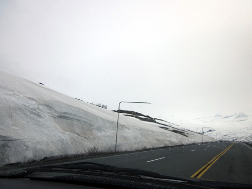
The pass looked much different this time
:
I don't know how much
snow fell the winter season of 2011-12, when Southcentral Alaska
reportedly got more snow than ever, because there was no longer a
station officially recording the snowfall there. That's too bad, because
the depth might have been even more.
Note that Valdez,
dubbed "American's Snowiest City," has an annual average of
326 inches of snow. Average. Obviously, some years they get
even more.
That's a lot
of snow!
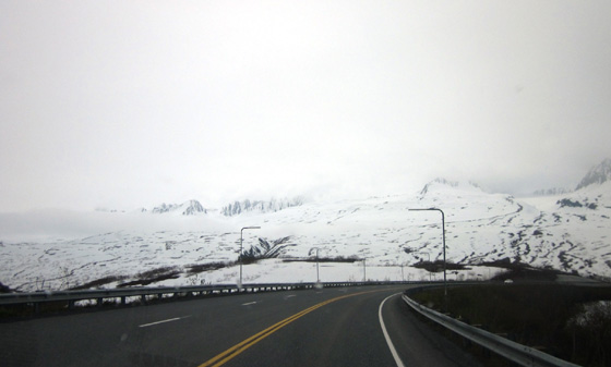
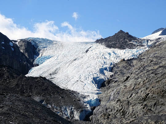
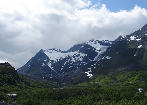
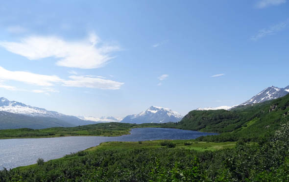
WORTHINGTON GLACIER
Three years ago, in mid-June, we couldn't even get into the parking lot
to see this glacier because everything was still buried in several feet
of snow:
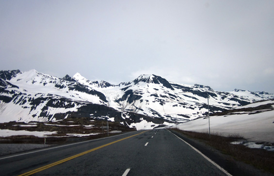
View toward Worthington Glacier from Thompson Pass
(6-17-12)
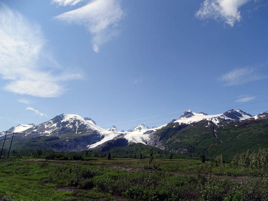
When we passed the glacier on our way to Valdez several days
ago we could see the ground! We knew we wanted to come back to see the
glacier close up.

Above and below: Same place and time as snowy
photo above, but different year
The foot of this hanging glacier is located back a short paved road off the
Richardson Highway, making it easy for visitors to access. That is why
it is part of the Worthington Glacier State Recreation Site --
the glacier is more protected in state custody, and so are the visitors.
(Some folks don't realize how dangerous walking on glaciers can be.)
The good news is,
there is no fee to visit this National Natural Landmark. The bad news?
Because it's so accessible, it gets a lot of visitors.
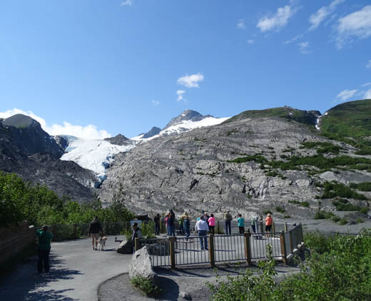
Fortunately,
when we arrived on a weekday there was just one Class C motorhome and a
tour bus in the large parking area. Most of the older folks on the bus were
done sight-seeing and on their way back to their seats. Some
enjoyed petting our dogs.
Since leashed dogs are allowed here, we took Cody and Casey on the
quarter-mile paved walk to the observation deck.
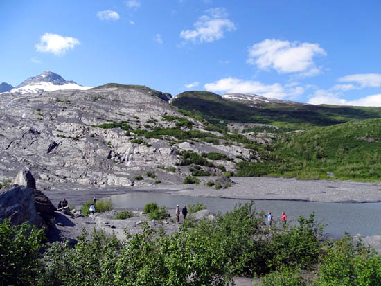
Visitors
waking along the glacial creek at the foot of Worthington Glacier
Lake formed by melting snow and ice at Worthington
Glacier
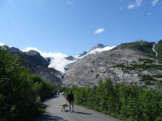
We decided not to walk down closer to the foot
of the glacier but we could have done that. However, because of the
danger, visitors aren't allowed onto the ice itself.
You can see a separate, large part of Worthington Glacier from the road
that you can't see from the paved path or observation deck. The whole
thing is more impressive from a distance.
Here are some of the
photos I took of Worthington Glacier when we were approaching it from the
northeast on our way to Valdez last week. You can see another whole
"leg" from this angle:
Worthington Glacier is not as large as Exit Glacier in Seward, or some
other nearby glaciers. It's just more accessible. Like most Alaskan
glaciers, Worthington has significantly retreated in the last century.
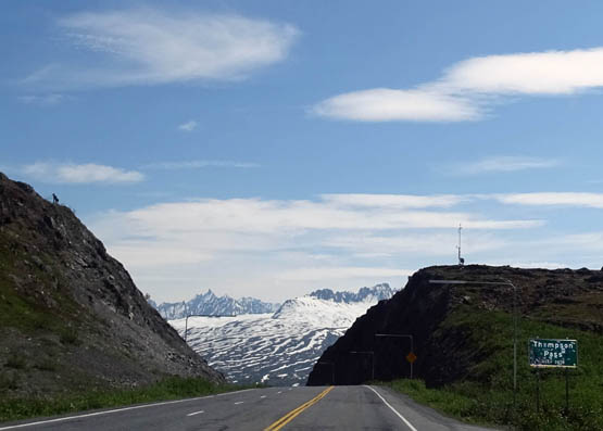
On the way back down to Valdez from Thompson Pass we stopped
several times to view the awesome mountains and glaciers above Keystone
Canyon . . .
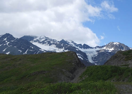
. . . the 1898 Pack Road, Blueberry Lake and
Campground, and other gorgeous alpine scenery:
Section of the Trail of '98
beginning at a large overlook located a little below Thompson Pass
Blueberry Lake now; three years
ago on this date it was surrounded by snow.
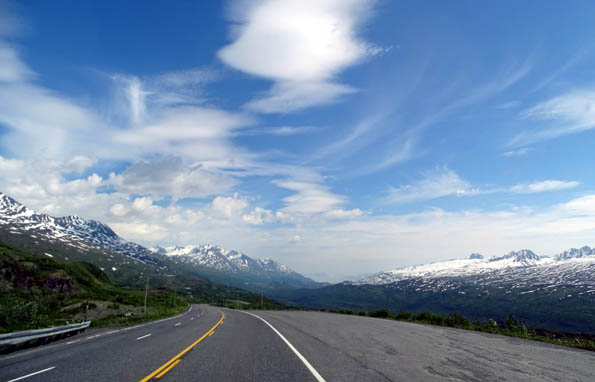
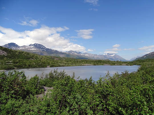
Blueberry Lake State
Recreation Site lies just below Thompson Pass. The lake and campground
are surrounded by tall Chugach Mountain peaks and colorful
wildflower meadows. I can't imagine a more beautiful setting to camp but
the sites are small and the season is very short. Even in the summer
it's quite chilly and windy here.
For more
photos of the glacier, pass, and canyon see the
June 17 entry.
This is my last entry for Valdez. Because we had warmer, more sunny
weather we enjoyed staying here more this summer than three years ago.
If we ever come back to Alaska a third time, I will want to visit Valdez again
-- but only when it's not covered in snow!
Next entry: the scenic drive from Valdez to Anchorage
-- and Jim's 48-mile bicycle training ride along the way
Happy trails,
Sue
"Runtrails & Company" - Sue Norwood, Jim O'Neil,
Cody the ultra Lab, and Casey-pup
Previous
Next
© 2015 Sue Norwood and Jim O'Neil
