One of my goals this summer is to hike some different trails than I
hiked when we were in Alaska three years ago.
I've been reading news on the ADN website nearly every day for the
past several months, so when I saw Matt's article a month ago, I
bookmarked the site, researched a couple of other sites about the little
mountain, and added Bodenburg Butte to my list of trails to hike when we
were in the Anchorage area.
How could I go wrong when Matt wrote that "few hikes offer as much
bang for the buck?"
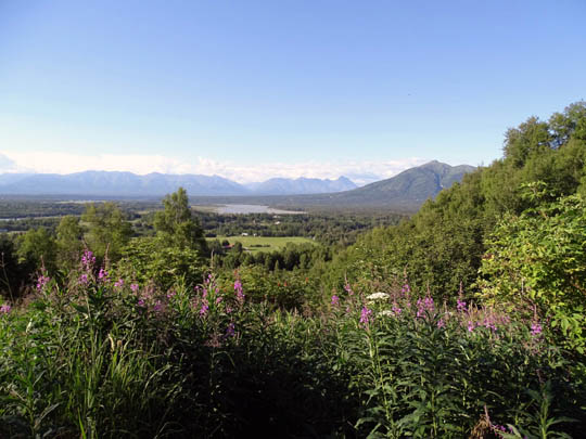
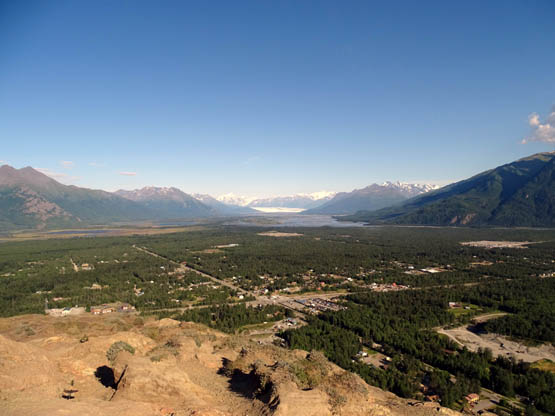
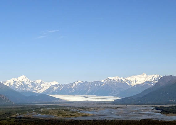
View north from halfway up the
West Butte Trail
Today was the day or, rather, the evening I chose to ascend
the 900-foot butte to see the amazing views promised to all hikers
willing to make the sometimes-difficult climb.
The weather was great -- sunny all day and warm enough
to run the air conditioner in our camper in the afternoon. I got a
massage in the morning, which eased my increasingly sore muscles, and
relaxed all afternoon. By 5 PM I was itching for an adventure.
It was so pretty that I decided I wanted to hike to the top of Bodenburg
Butte near Palmer, mostly because of the spectacular 360-degree views
people have reported from the summit. It's the easiest and cheapest way
I know to see miles of Knik Glacier because it's not very visible from
the roads.
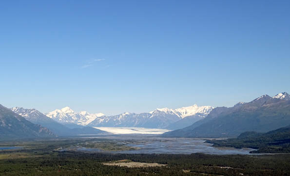
Knik Glacier from Bodenburg Butte
My online research
described Bodenburg Butte as a very popular hike with parking very
limited for both trails going to the summit.
I wanted to go up the better-maintained West
Butte Trail. Neighbors near that trailhead have complained so much to
local officials that parking on the street is now prohibited. Hikers are
confined to about 18 vehicle spaces in the official parking area.
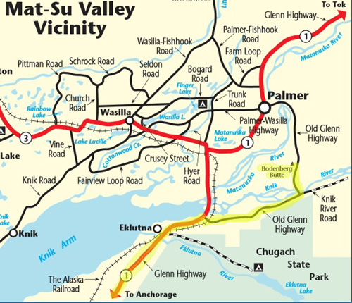
Map from
The Milepost website
I figured getting to the parking lot on a weekday when most people are
eating supper might be good timing -- that worked well today. When we arrived
at the West Butte parking area about 6 PM we were happy to see only half
a dozen vehicles in the lot.
Jim found a shady spot to park where he could be comfortable and watch a
movie on his computer. People came and went while he and the dogs waited
for me to complete my hike.
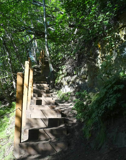
Step right up, folks!
Leashed dogs are allowed on the trail. I went up alone, however, because
the West Butte Trail has a gazillion wooden steps in the second half
when it makes most of the 700-foot elevation gain. The steps would have
been difficult for Cody and I simply could not have descended on them
with Casey on a leash.
(OK, so there aren't quite a gazillion steps. I counted 518 on the way
down and may have missed some while talking to other hikers.)

The steps are a chore
for someone with bad knees but a definite improvement from trail
conditions before they were installed and people had to use ropes to get
up and down some of the boulders and really steep spots.
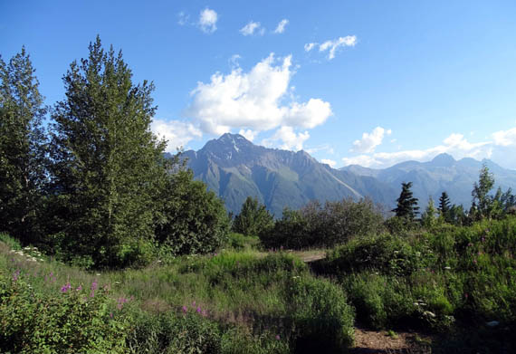
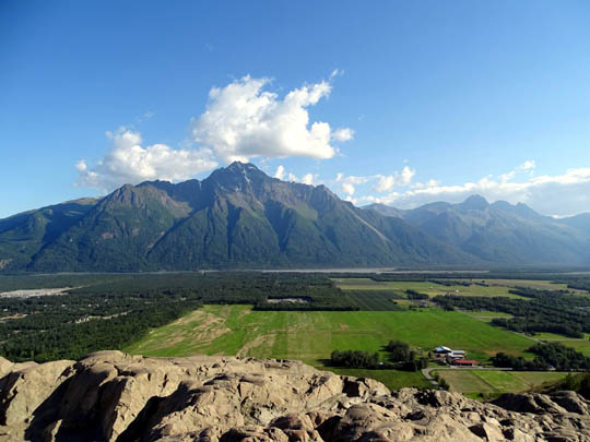
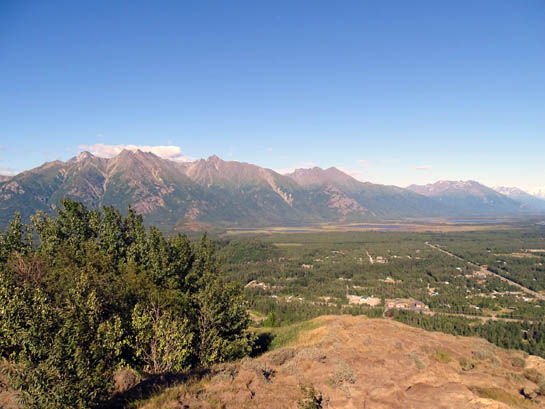
The views at the top were definitely worth it -- Matanuska
Valley, the Talkeetna Mountains, and the Alaska Range to the north, Cook
Inlet to the west, nearby Chugach Mountains to the south, and Knik
Glacier and surrounding snow-capped peaks to the east. I was not able to
see Denali.
It's about 1.5 miles to the top of the butte on
this trail, for a roundtrip total of about 3 miles.
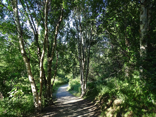
The first half is wide, partly shady, and relatively easy, with a gradual
increase in elevation through old growth forests and alder thickets:
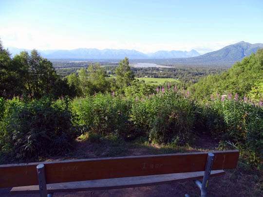
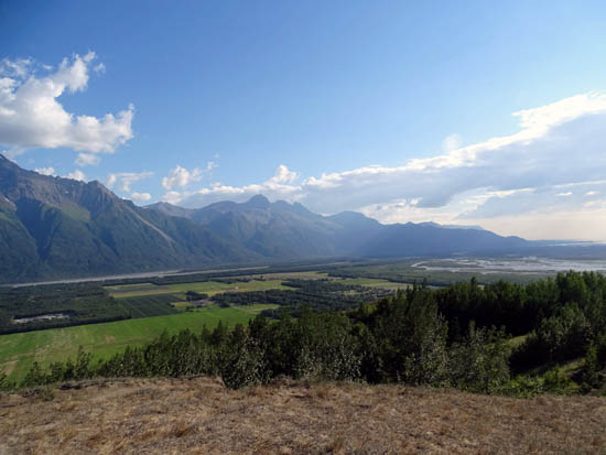
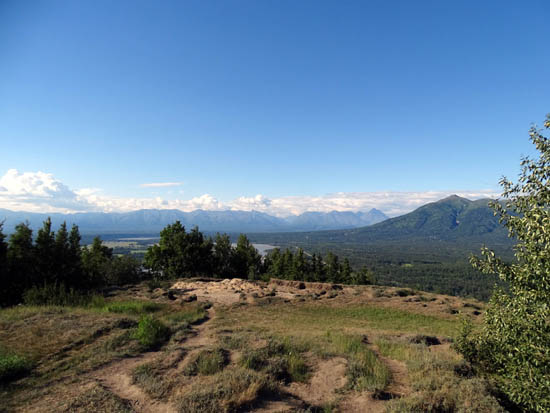
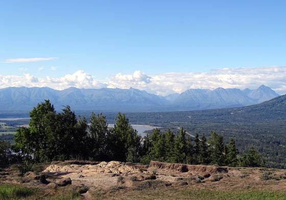
Some people stop at the bench on top of a small
hill about halfway up the mountain. There are nice views of the
Matanuska River valley and Talkeetna Mountains to the north:
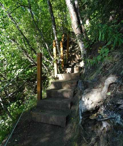
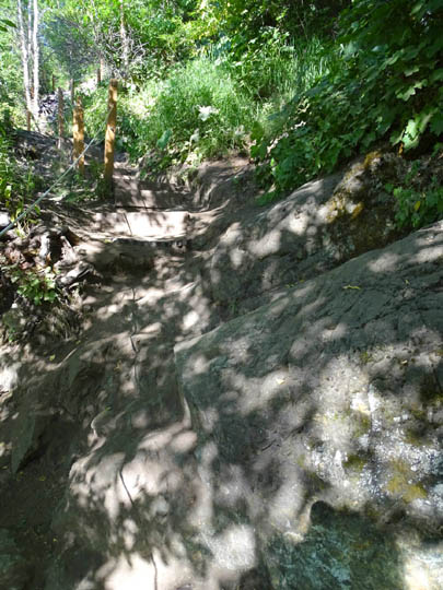
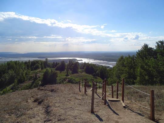
After the bench the trail becomes significantly
more of a challenge, with most of the elevation gain in the last 3/4 mile.
The first part is heavily shaded, with some
steep steps as well as steep drop-offs on one side of the trail. Note
all the ropes strung between the posts in the photos on this page:
The large expanse of rock below has
steps chiseled into it, with ropes to assist:
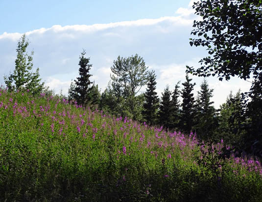
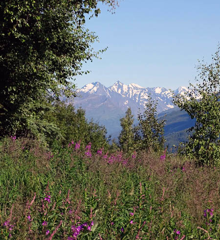
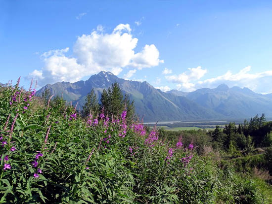
The views really opened up near treeline, making the effort worthwhile.
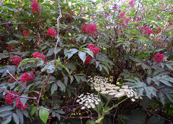
I loved the meadows full of blooming fireweeds and the views of the
surrounding valleys and mountains:
It took me 40 minutes to reach the top, including waiting a couple times
for people who were descending in narrow places.
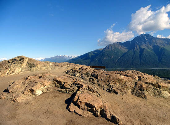
There was one last set of steps and then I was on the wide, rocky top of
the butte:
That bench has a fabulous 180-detree view.
I had the summit to myself for about five minutes before a young couple,
then a mom and young child, arrived.
I wandered around the perimeter of the rocky plateau and took lots of photos in all
directions. These pan CCW from the southwest to the south, southeast,
east, northeast, north, and northwest:
Above and
below: Knik Glacier
I called Jim to let him know I was on my way back down. I had a great
signal on the summit, where it was windy and dusty but pleasant
nonetheless.
The fireweeds in the meadow below the summit are just beginning to
bloom. They should peak in a couple weeks. I might go back up when we
get back at the end of July so I can see them in full bloom.
Here are three web pages describing this interesting trail:
http://aktrailhead.com/bodenburg/bodenburg.shtml
http://www.adn.com/article/20150602/short-and-sweet-bodenburg-butte-offers-easy-access-and-spectacular-scenery
http://www.alaskavisit.com/includes/media/docs/WestButteTrl.pdf
The sites say the distance is three miles roundtrip but my GPS said a
little less than that. My total time was about 1:30 hours. YMMV,
depending on how much you wander around the top of the butte and how
long you spend gawking at the panorama before you.
I highly recommend this hike. It's a lot easier than uber-popular
Flattop (next entry) and the views are even better.
Next entry: a different kind of Flattop Mountain hike
Happy trails,
Sue
"Runtrails & Company" - Sue Norwood, Jim O'Neil,
Cody the ultra Lab, and Casey-pup
Previous
Next
© 2015 Sue Norwood and Jim O'Neil
