Alaska has a variety of
types of glaciers, some of which I've shown in
the 2012 and 2015 journals -- tidewater glaciers such as Aialik
Glacier in Kenai Fjords National Park south of Seward, hanging glaciers
like the ones along the Trail of Blue Ice in Portage Valley, cirque
glaciers in bowls high on mountainsides, huge areas of ice like the
Harding Ice Field, and several other types.
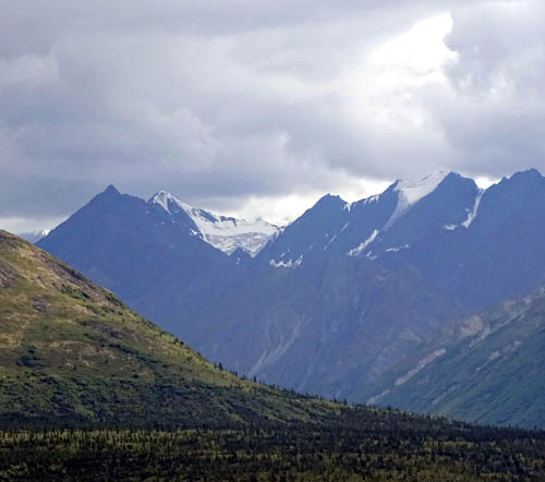
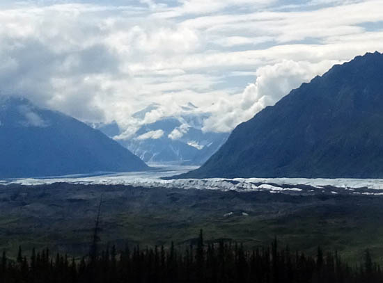
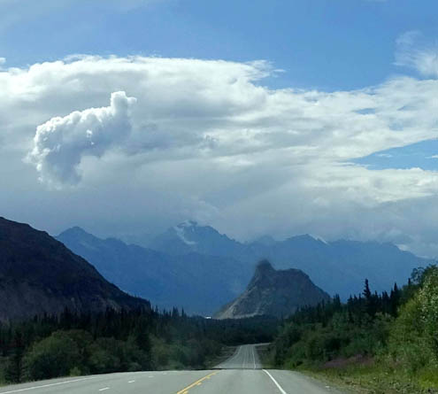
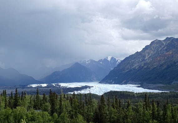
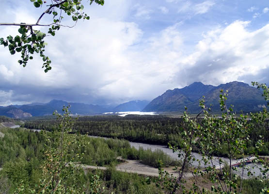
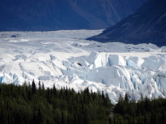
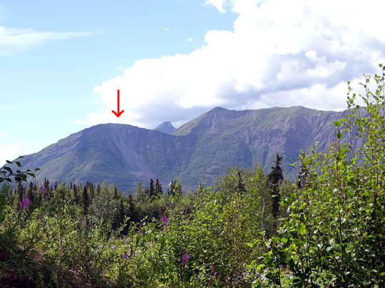
Two cirque glaciers above
Matanuska Glacier, which is hidden in the valley in this view
The Matanuska Glacier is a great example of valley glaciers, which often
extend for many miles in mountainous regions of the state.
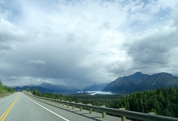
Because so many miles of Matanuska Glacier parallel the Glenn Highway National
Scenic Byway, travelers can see different aspects of the glacier from several waysides along
the road:
There are also excellent views of Matanuska Glacier from the
state
recreation site named for it at MP 101 on the Glenn Hwy.
Although there is no direct access to the glacier from the 300-acre
recreation site, viewing decks along the Edge Nature Trail offer good
views of the terminus of the glacier and the Matanuska
River.
The only direct access to the glacier is at
Glacier
Park, a private operation located at MP 102 on the Glenn
Highway. For a fee visitors can drive close to the glacier and either
walk over to it on their own or hire a local guide company for a hike on the ice.
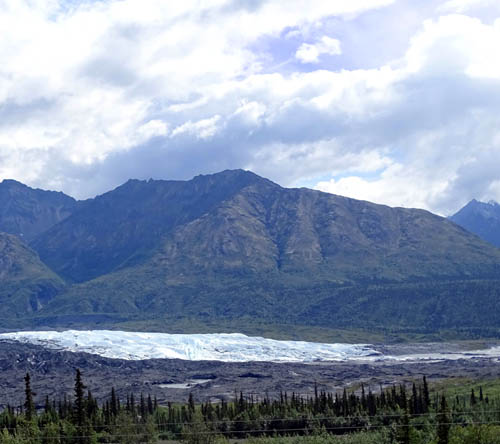
I took these pictures from the road of people (above the arrows) walking near the
terminus on Friday:
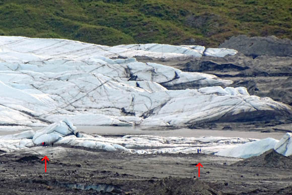
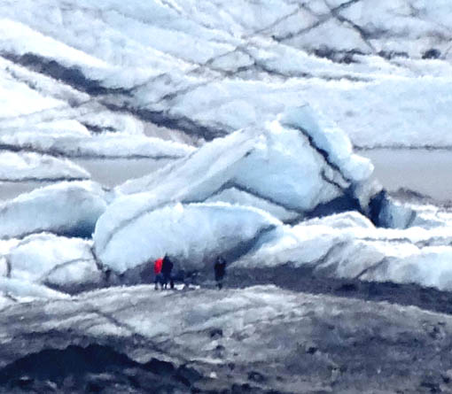
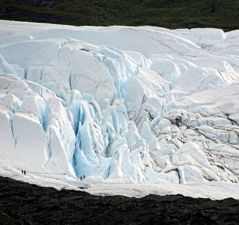
When you look at the wide-angle pictures of the glacier, and
then the close-ups, the tiny people show the large scale of the ice formations.
We've seen the glacier several times from the road and from the trail
in the state recreation site. I'll include additional photos from those vantage
points in this entry.
We've never gone down to hike on the glacier itself but that would
certainly be a "cool" thing to do if you have the time and $$$.
We've seen enough glaciers close up that we didn't think it was worth
the cost for us to get right next to this one.
MORE GLACIER VIEWS FROM THE GLENN HWY.
At the beginning of the
July 10 entry I showed several pictures of the glacier that I
took in the morning when we were driving eastbound to Grand View RV
Park, as well as photos of another part of the glacier from the bluff
behind the campground.
Later that afternoon, while Jim was preparing for the Fireweed 400
bike race, I drove nine miles down the highway to the state recreation
site, taking more photos from overlooks on the way there and back,
including all but one of the pictures above.
Here are some more photos I took of the glacier and nearby scenes
along the road that day:
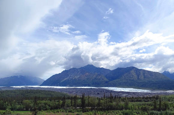
Lion's Head
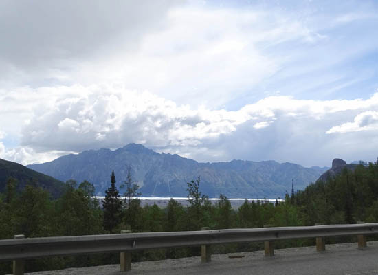
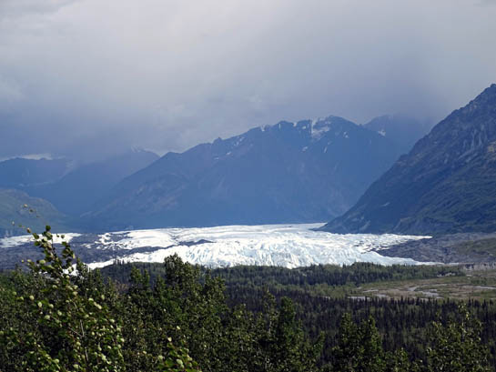
The thin blue-white line is
Matanuska Glacier
The glacier curves out of the
mountains into the valley paralleling the Glenn Hwy.
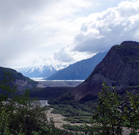
Part of the 4-mile wide terminus
of the glacier
Another view of the terminus --
and rain approaching
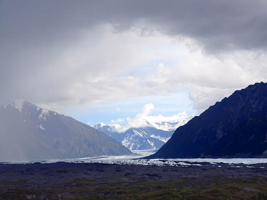
Another view of the glacial curve, framed by gray
clouds
I could see rain heading toward me the whole time I was out there but
somehow dodged it.
GLACIER VIEWS FROM THE RECREATION SITE
One reason we spent three nights at the Grand View RV Park was to
have the opportunity to see Matanuska Glacier more closely than we
did in 2012. (Another was to give Jim a day's rest after his 100-mile
Fireweed bike race before we head to Denali National Park.)
Although we didn't get down to the glacier at Glacier Park, its only
access point, we did enjoy the views from the Matanuska Glacier State
Recreational Site from the viewing area at the parking area and from the
platforms on the Edge interpretive nature trail.
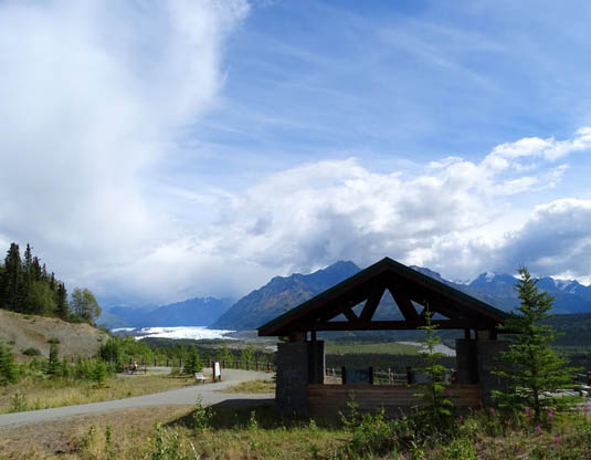
Shelter with view of Matanuska
Glacier and river at the rec. area
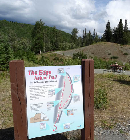
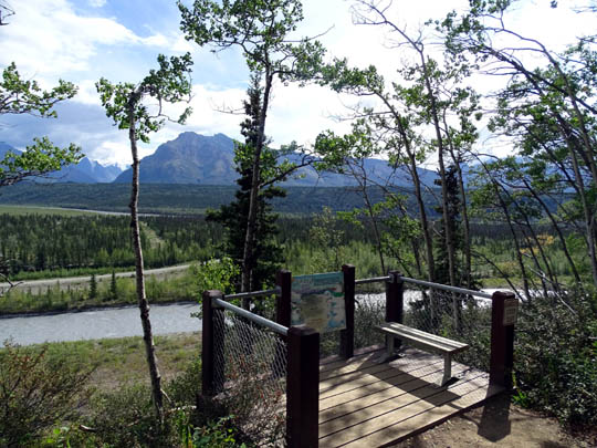
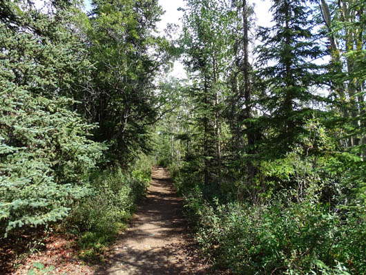
Beginning of the nature trail
The wide, smooth gravel trail begins
up a small hill and comes to an intersection in about a quarter mile.
I went straight, going clockwise around the loop.
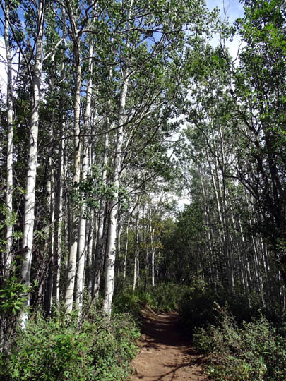
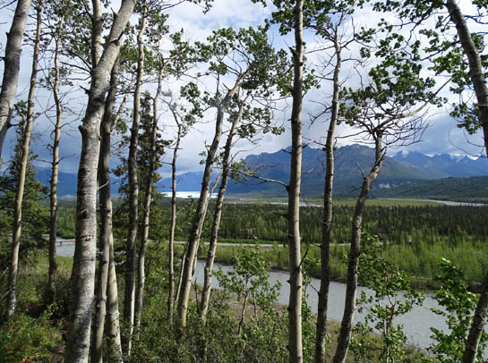
The first part of the trail stays high and winds
through pretty pine and aspen forest:
At the far end of the loop the trail descends and then
parallels about 100 feet above the Matanuska River.
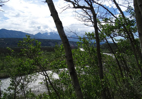
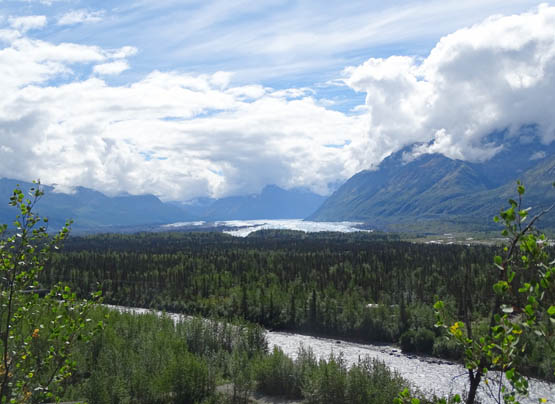
There are several interpretive signs along the trail
and a couple decks on the river side with views upstream toward the
glacier. The better your binoculars or zoom camera lens, the better
you'll be able to see the terminus of the glacier:
There are good views of the cement-colored river (the
color is the result of glacial silt) both upstream and downstream:
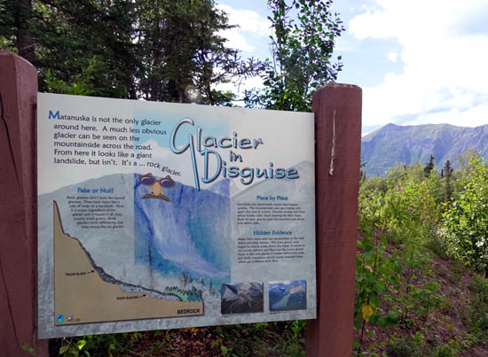
On the hill near the end/beginning of the trail is a sign about the
rock glacier you can see across the highway It's yet another
type of glacier in Alaska.
The "glacier in disguise" is basically an icy glacier that has been
covered partly or mostly in rocks. If the sign wasn't there you
probably wouldn't even notice the formation. I marked it with an arrow
in the second photo below:
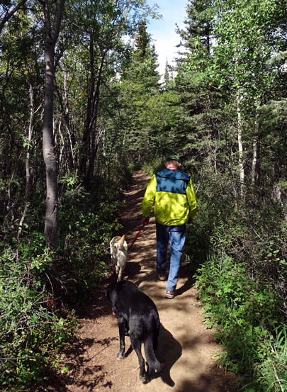
I enjoyed the one-mile loop trail so much on Friday that I talked Jim
into hiking it with me this morning (Sunday). It was a good way for him to stretch
out after his long bike ride yesterday and there were hardly any other
people around.
Since dogs are allowed on the trail, we took Cody and
Casey with us:
These mountains are real cloud
magnets!
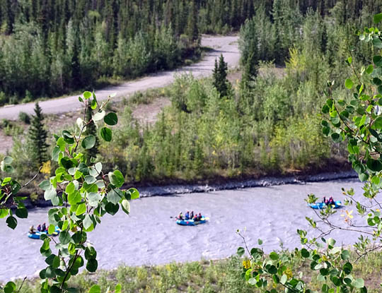
We saw these three rafts floating
down the river this morning.
If you're traveling along the Glenn Highway in this area, at
minimum take some time to view the Matanuska Glacier from one or
more of the large waysides. If you have more time, the one-mile
nature trail at the state recreation area is a good option.
We mostly relaxed today at Grand View RV Park and talked with some
of our neighbors and other people who stopped to eat at the restaurant,
which is close to our site. It was busy all day, probably because there
are very few places to eat between Glennallen and Palmer.
We talked with two young male cyclists from Great Britain who
stopped for an hour to eat and rest. They have just begun a
two-month cycling trek -- sans crew -- from Anchorage to Mexico.
Cool!
We're excited about our plans, too. We're heading to Denali
National Park tomorrow, our favorite place in Alaska. We hope to
have some great photos and stories to share with you here.
Next entry: the drive from Grand View to Denali NP,
with an overnight stop in Cantwell
Happy trails,
Sue
"Runtrails & Company" - Sue Norwood, Jim O'Neil,
Cody the ultra Lab, and Casey-pup
Previous
Next
© 2015 Sue Norwood and Jim O'Neil
