We needed a shorter drive and lots of sunshine today
and we got both. Two days in a row of sun -- what a concept!
We got more wind than desired, too, but we could still ride our bikes on
the nice multi-use path and enjoy our grassy campsite when we got to
Grande Prairie. We had a strong headwind and cross winds until the last
half hour of our drive today that made hauling a large 5th-wheel more challenging.
We took our time getting ready to leave Charlie Lake. We were very happy
to awaken to sunshine. No rain on our parade today.
Jim dumped the tanks on the way out of the Mclean Rotary RV Park and we
were on the road at 9:45 AM:
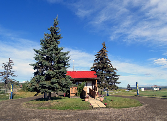
Cute little office at the entrance to the
campground in Charlie Lake;
the lake is in the background, right.
We got to the Rotary Campground in Grande Prairie about 1:15 PM, Mountain Time
= 3˝
hours in transit. We "lost" another hour today when we entered Mountain
Daylight Savings Time at the Alberta border.
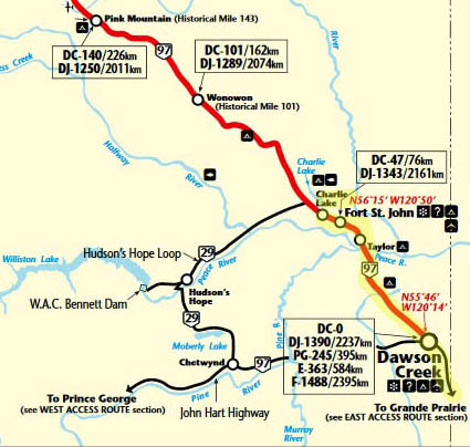
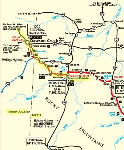
TODAY'S ROUTE & TERRAIN
We followed the Alaska Hwy. (BC 97) to its southern end/beginning at Dawson Creek,
BC 2 from Dawson Creek to the Alberta border, and AB 43 to Grande
Prairie.
The section from Dawson Creek to Grande Prairie is part of the "East
Access" route to Alaska on the
Milepost
website:
Traffic was heavier than we've been used to for most of the summer. Passing lanes helped faster
folks get around us but Jim was able to do the speed limit (62 MPH) most
of the time.
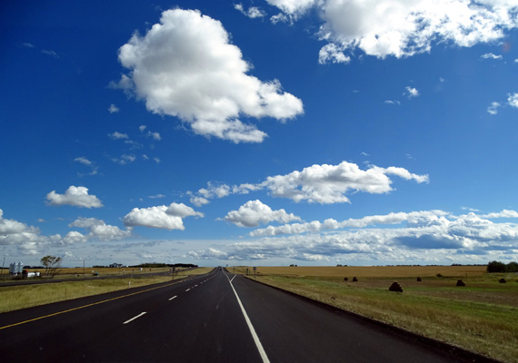
He was real happy that we had freeway-like conditions from Beaverlodge to Grande Prairie
-- very new and smooth four-lane divided
highway on Rt. 43:
There was some construction on the long hill on the south side of the
Peace River and at the south end of the town of Dawson Creek but we
didn't have to wait for any pilot trucks or drive through mud or dust
today.
The terrain was hilly from Charlie Lake/Fort St. John to Dawson Creek,
then more rolling farmland to Grande Prairie. This is quite a contrast
from the past three months -- we definitely aren't in
Alaska any more! The terrain and large farms/ranches are more like the
upper Midwest and Plains states:
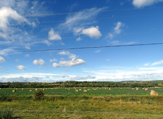
It's still mostly green in this area. We didn't see much leaf or
flower color today, just grasses and fields that are turning tan and
brown.
Jim got a partial tank of diesel in Dawson Creek, BC, enough to get to
Grand Prairie where we knew it was a little cheaper. The cost was
$1.059/liter CA at GasBar in Dawson Creek. It wasn't as cheap in Grand
Prairie as we were hoping -- $1.03/liter CA at Shell.
All of a sudden we're seeing diesel for less than regular gas. We haven't
seen that in the U.S. or Canada for a good while.
GRANDE PRAIRIE ROTARY CG
Jim tried to call the
Rotary Campground in Grande Prairie before
we left Charlie Lake but no one answered the phone that early. I figured
on a Sunday the weekend guests would be leaving and we'd arrive before
most other one-nighters got there and should be able to get a site.
I was right. There was a lineup at the dump station for folks who were
leaving and lots of available spaces for those of us coming in.
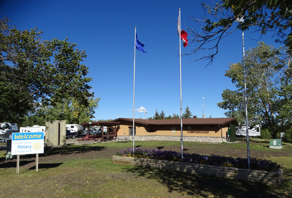
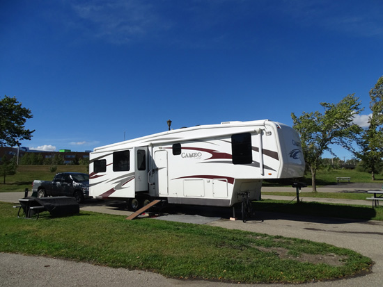
We chose the same site we occupied in June, 2012 in the lower parking area
near the lake.
It's a long, paved pull-through with about 15 feet of grass on our
doorside. We have 30A electricity, water, and a strong, free WiFi signal
for $45.15 CA (no discounts). There are some full hookup sites on the
hill closer to the entrance but they aren't as spacious.
That's more expensive than most campgrounds we've used this summer but
it's a nice one. The main downside is the road noise behind us on busy
Rt. 43 Bypass. The upsides are that we practically have the whole lower
part of the campground to ourselves -- and we are very close to
the bike path.
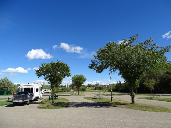
Only one other RV was in our large section
overnight.
View of our camper (L) from the bike path
When we checked in Jim asked about a nearby car/RV wash and the woman
said we could wash both the truck and camper at our site. Yes!
That alone saved us a bunch of
money and made Jim a happy camper. He mentioned as we were driving today
that it drives him crazy to have the camper and truck dirty so much of
the time in Canada and Alaska. Most RV parks in the Far North don't allow
folks to wash their vehicles on-site. He's had to do it very surreptitiously,
and often incompletely, this summer.
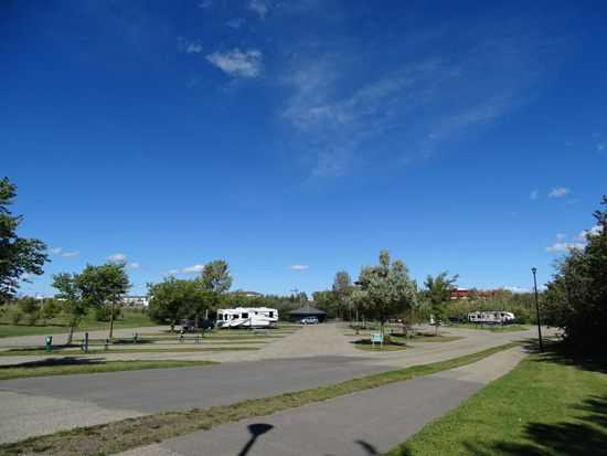
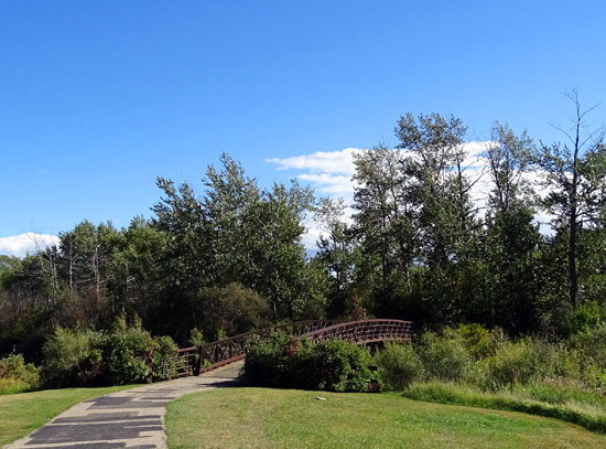
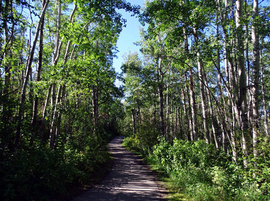
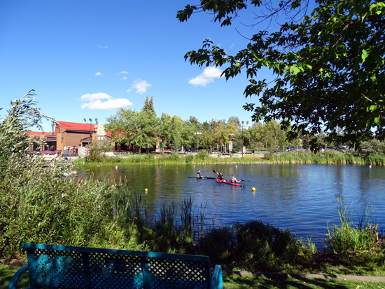
GRANDE PRAIRIE BIKE PATH
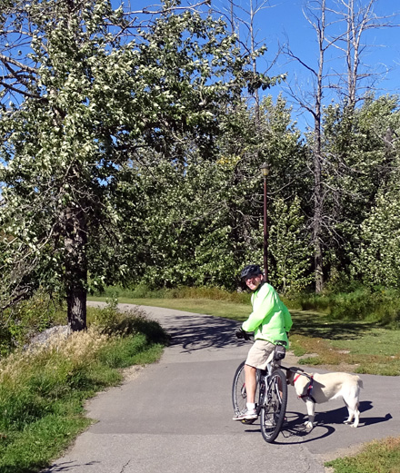
After we got set up Jim took Casey for a six-mile bike ride/run. They
both needed that after so many days and miles of riding in the truck this week.
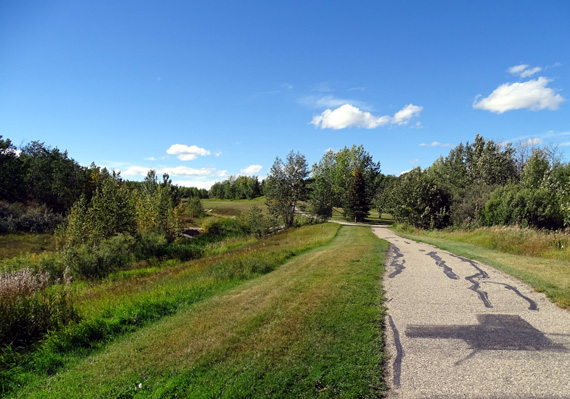
We've ridden on this
paved bike path previously. It runs right through the campground so it's
quite handy. It's the main reason we wanted to stop here today.
I walked Cody a quarter mile, the most he's done at once since he got his sudden
ear imbalance diagnosis in Fairbanks.
He's much better today -- less wobbly, goes up and down the ramp
into the camper and truck more easily, hasn't fallen over or bumped into
anything, and was able to do two short walks today.
Note Cody's ramp in front of the door.
We still have to be very careful to guide him on the ramp and uneven
terrain so he doesn't hurt himself. We joke that he "still can't pass a
sobriety test," but we're relieved to see him return more to normal. He's
still a happy, lovable old dog even though he's probably confused
about what's wrong with him.
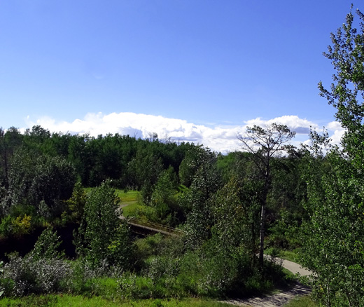
After walking Cody I rode my bike out and back on the bike path for
about eight miles through a linear park. Part of it is more urban, part
more remote:
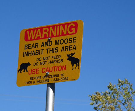
Nope, didn't
see any.
On a pretty Sunday afternoon there were a lot of people and dogs on the
path and so I had to be very careful.
I also stopped to take photos along the way of the park scenery, birds,
buildings that can be seen from the path, kids riding in the skate park,
and other things that caught my eye:
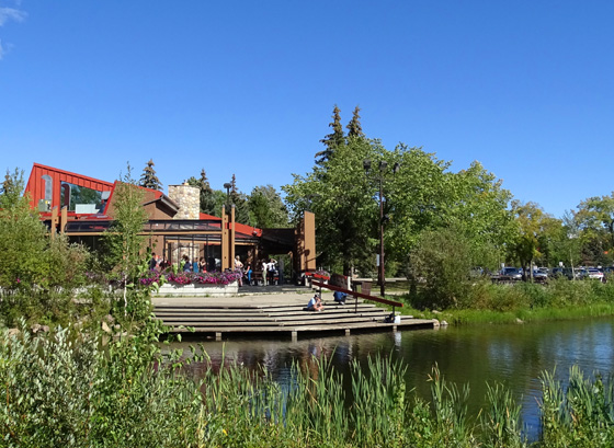
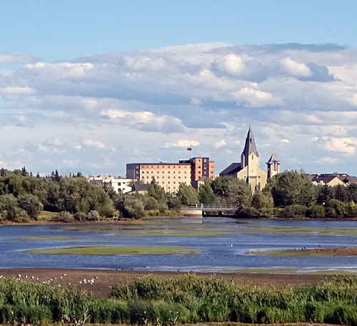
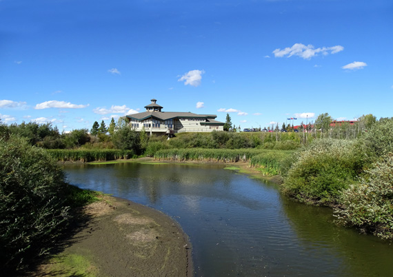
Above and below: view of a church and other
buildings across the lake
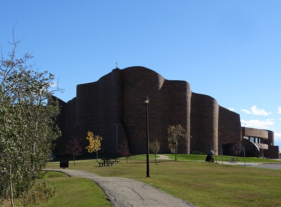
This is a college building with interesting
architecture.
Riding on the bike path was very relaxing for both of us (and Casey,
too). We really needed a break to get some exercise outdoors. The fact
that it was sunny made it perfect!
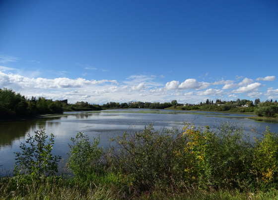
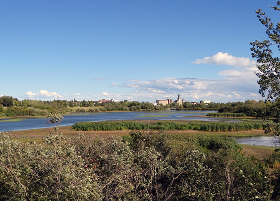
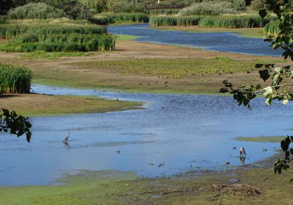
DROUGHT & WILDFIRES
The water in end of the lake between the campground and visitor center
appears low:
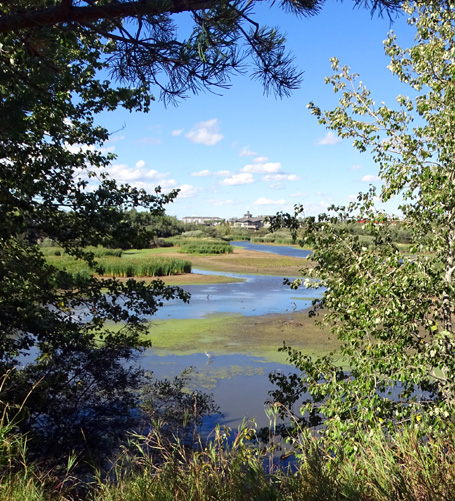
I think this area has seen some drought this summer, including the Peace
River Valley we drove through today:
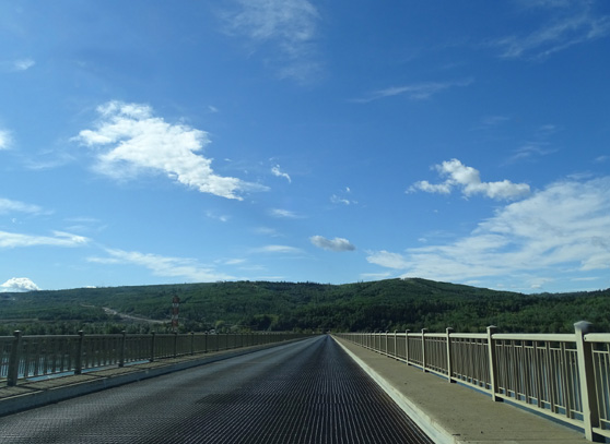
The long bridge over the Peace River doesn't
concern me as much as
the older (and longer) one over Nisutlin Bay in the
Yukon.
I read about the drought in a newspaper I read at Charlie Lake. I guess the
locals were probably happy with yesterday's rain, even if we
weren't.
There are still smoke warnings in Great Falls, Montana from the wildfires in
that state as well as in Idaho, Oregon, and Washington. The Pacific Northwest
definitely needs some rain.
If the weather prediction for Grande Prairie was better for tomorrow,
we'd stay here another day. Unfortunately, 40 MPH winds and rain are
expected by the afternoon so we'll head out in the morning and hope to
stay ahead of any weather that would make driving hazardous in an RV.
That's OK. For
several reasons, we're ready to get back to the States. It'll take at
least two more days for us to get to Great Falls.
Next entry: Mt. McKinley is finally officially renamed
"Denali"
Happy trails,
Sue
"Runtrails & Company" - Sue Norwood, Jim O'Neil,
Cody the ultra Lab, and Casey-pup
Previous
Next
© 2015 Sue Norwood and Jim O'Neil
