We can thank our friend Eric for another great recommendation for hiking
and cycling near our campground. His knowledge of the White Mountains
has been invaluable to us during our visits to this area in July and September.
This beautiful wildlife refuge is just eight miles north of Twin
Mountain, NH on Rt. 115. Both times I hiked there I parked at a
trailhead off Airport Rd. There is another trailhead on Rt. 115A.
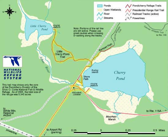
Here's a diagram of the wildlife refuge. You can see a larger one at
the link above.
I marked the trails I hiked with Casey on this date, a Sunday. We
walked a total of 5.5 miles. I raved about it enough to convince Jim to
see it, too. On Tuesday he and Cody came along for a 3.25-mile hike.
The main trail, shown below, is multi-use (hiking, cycling, horseback
riding, cross-country skiing, dog-sledding, and snowmobiling) but all we
did in the refuge this visit was hike.
There is a lot to like about this refuge:
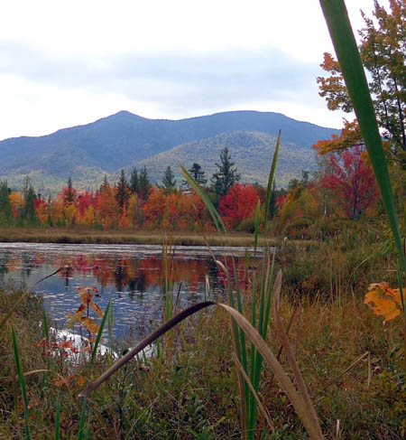
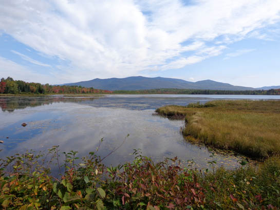
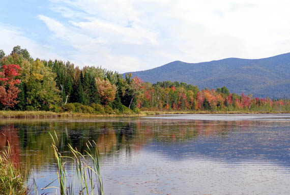
- The views of the mountains are fantastic from the west and north
sides of Cherry Pond.
- There is a variety of trails through the forests and wetlands,
from the wide main path to nice single-track.
- Lots of critters call the refuge home, so it's fairly easy to spot
birds and small animals.
- There's plenty of solitude. On Sunday, a warm, sunny weekend day,
I saw only three people and one dog in 2+ hours of hiking.
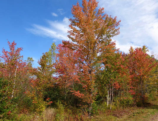
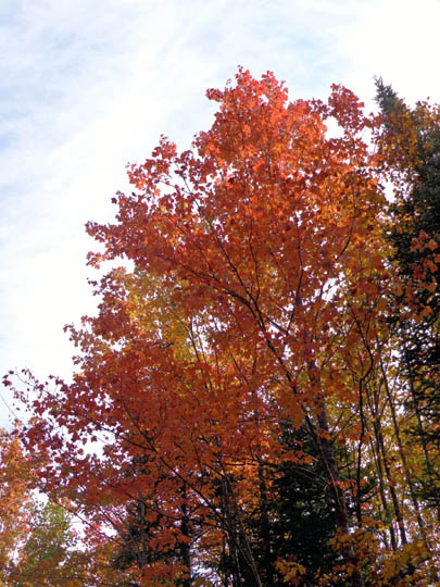
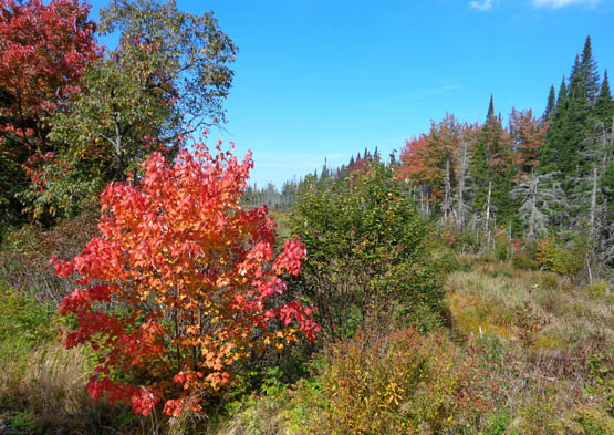
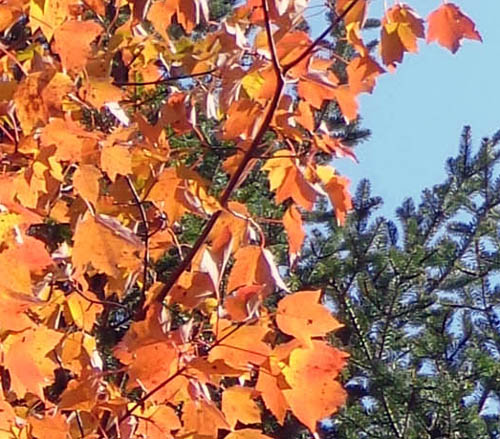
And the fall colors! Some of the leaves appear to have reached their
vibrant peak in the refuge this week. Although we left the area before
all the colors peaked we saw quite a bit the last few days we were
there.
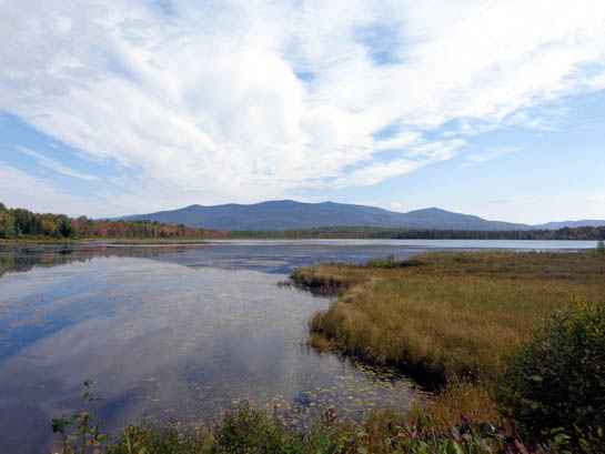
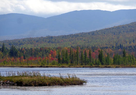
Colorful view across Cherry Pond
Most of the photos in this entry are from my longer hike with Casey
on Sunday. I'll organize them according to their location within the refuge.
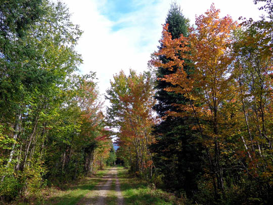
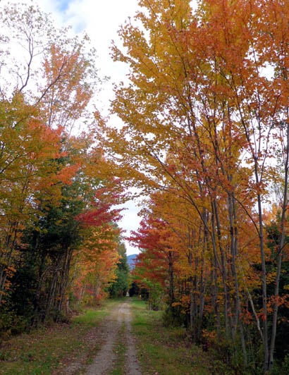
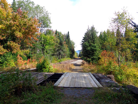
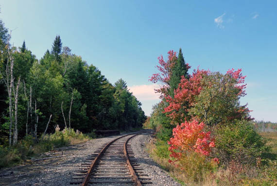
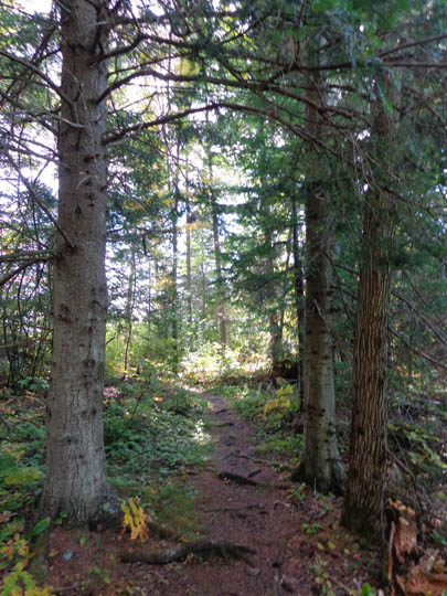
MAIN TRAIL FROM AIRPORT ROAD TO WAUMBEK JUNCTION
This mostly-straight, wide rail trail follows the old Maine Central
Railroad bed through mixed spruce-fir and deciduous forest for 1.5 miles from the
parking area on Airport Road to Waumbeck Junction, a former railroad
station where three rail lines converged.
You can see this junction at the lower left corner of Cherry Pond on
the map above. At this point visitors have choices of several trails to take.
This flat, tree-lined rail trail was full of color
both times we hiked it out and back:
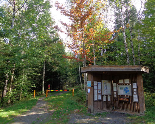
Trail head parking area on
Airport Rd.
There was a wet area in one place where Casey had fun splashing in
the water. This refuge is a good place for dogs, as long as they don't
chase wildlife.
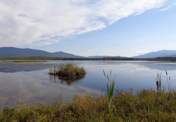
VIEWING PLATFORM
At Waumbek Junction the rail trail turns right (east) and continues
on to Rt. 115 A.
I followed it about a quarter mile to a wooden platform with
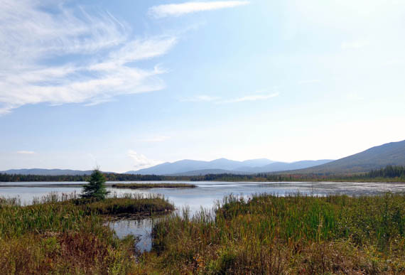
beautiful views of the western and northern shores of Cherry Pond:
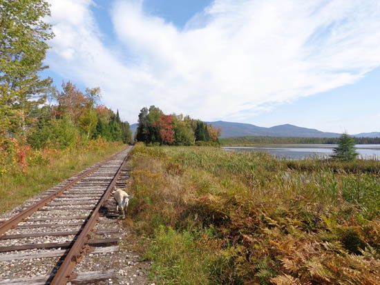
THE REMAINING RAILROAD TRACK
Then I followed the rail trail back to the junction and turned north
along the railroad tracks. You have to walk along these tracks to reach
the Shore Path, Rampart Path, and trail to Little Cherry Pond. In some
places the gravel on the side of the tracks is either too narrow or too
sloped to walk comfortably so Casey and I just walked down the middle of
the tracks.
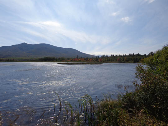
I found the tracks to be rather interesting because some of the best
views and most colorful trees and shrubs can be seen there:
Bridge over Cherry Pond outlet
Awesome view to northern Presies,
including Mt. Washington
Signs indicate that the tracks are still active. I doubt it. I could
see several trees in the distance that had fallen over the tracks and
hadn't been removed.
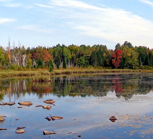
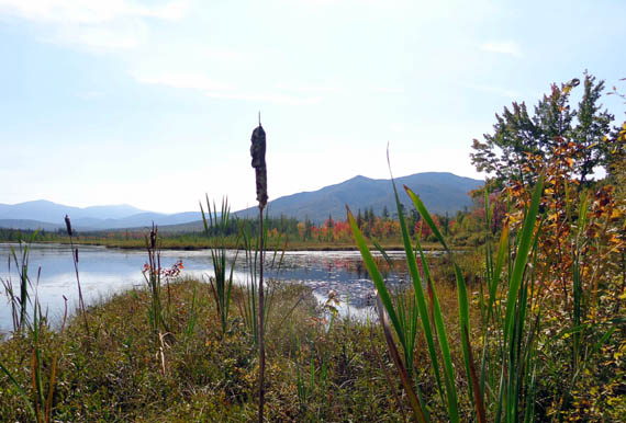
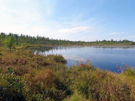
SHORE TRAIL
I reached the Shore Trail soon after walking along the tracks. It's a
somewhat rough, treed single-track path on the western shore of Cherry
Pond with excellent views across the water to the mountain ranges to the
east and south of the refuge, including the northern Presidentials:
After I walked the loop along the shore I continued north along
the railroad tracks for about a quarter mile to the beginning of the
Little Cherry Pond Trail.
LITTLE CHERRY POND
The rolling single track trail to this smaller lake passes
through interesting lowland spruce-fir forest with aspens, birch, red
maples, and other deciduous trees and shrubs.
Bog bridging crosses several wet areas full of ferns and other
plants typically found in northern boreal forests:.
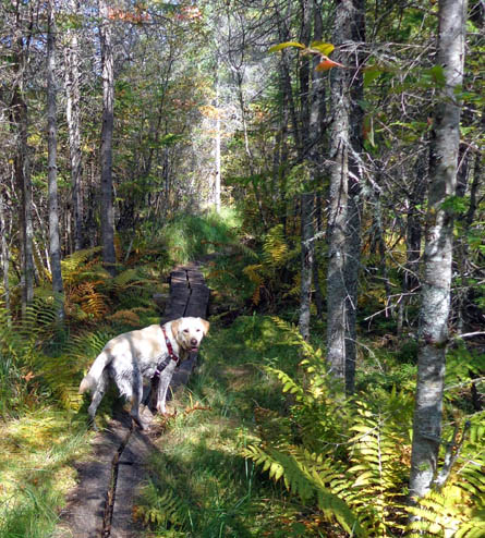
Casey waits patiently while I take her
picture.
We had this trail to ourselves so I let her
run loose.
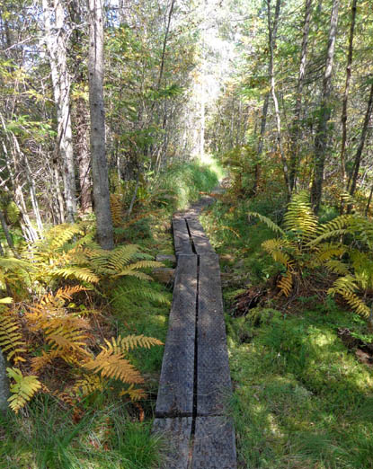
Some of the bog boards had wire mesh to
reduce slipping when they are wet.
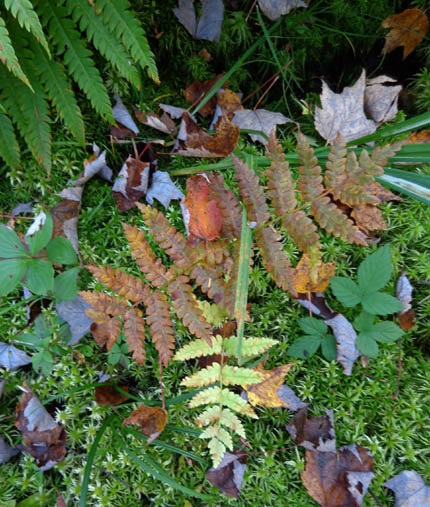
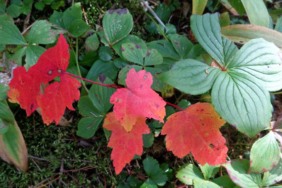
Nature's medley
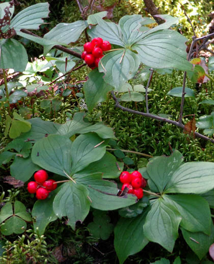
Bunchberries
This out-and-back trail has a loop in the middle. I followed one
part outbound and the other inbound. Note that this trail is for
pedestrians only (and dogs!).
The trail ends at a bench on the eastern side of Little Cherry Pond:
I didn't see a trail around the lake so I turned around and went
back to the railroad tracks.
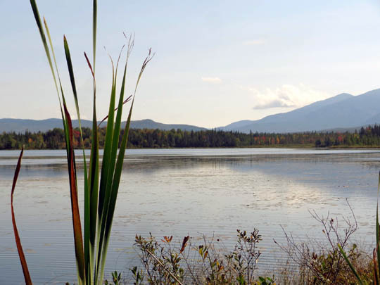
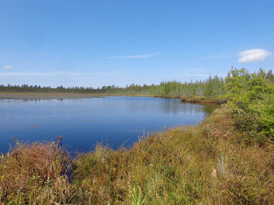
RAMPART PATH
I crossed the tracks and followed the Rampart Path farther north along
Cherry Pond (the larger lake) for about a quarter of a mile to
get some different views toward the mountains:
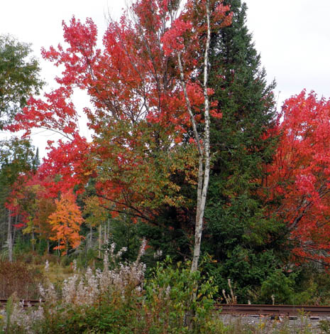
Here are a couple more leaf photos I took on the way back to the
parking area:
I swear the leaves were even more colorful when Jim went with
the dogs and me to the refuge two days later. It's so beautiful in the fall.
Go if you're in the area. It's free, easy to walk or cycle, and
a nature lover's paradise.
Next entry: gorgeous fall colors from Middle Sugarloaf Mountain
Happy trails,
Sue
"Runtrails & Company" - Sue Norwood, Jim O'Neil,
Cody the ultra Lab, and Casey-pup
Previous
Next
© 2014 Sue Norwood and Jim O'Neil
