Mount Madison wasn't my first choice
for a challenging hike this weekend.
I really wanted to hike a different route up Mt. Washington, also in
the Presies, than I did in July but lousy weather for most of the two
weeks we were here this time quashed any notions of that.
I'm talking about some combination of sub-freezing weather, rain,
sleet, snow, low clouds, and/or extreme winds up to 90 MPH at the summit
on any of the days I could have hiked up. I lucked out with better
weather in July.
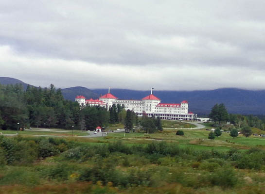
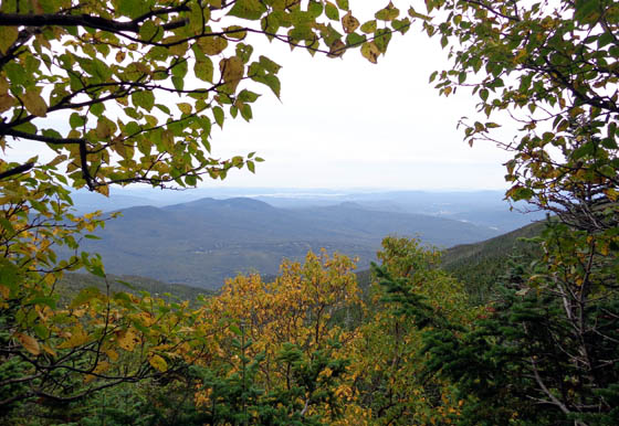
Common sight this month:
Mt. Washington and the northern
Presidential Range socked in by
clouds.
Even though I still have bad memories of my first attempt to summit
Mt. Madison during my Appalachian Trail Adventure Run nine years ago, I
knew there was an easier way up and down than the A.T. -- a trail
more suited to my current abilities and training.
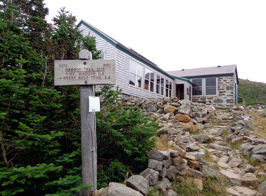
It's the Valley Way Trail from the Appalachia parking area on US 302
just a few miles from our campground in Twin Mountain. It's the route
folks take to the Madison Springs Hut. It's a much shorter and more
gentle way to reach the summit of Mt. Madison than from either direction
on the A.T. (I use "gentle" in relative terms compared to the
A.T. in this area.)
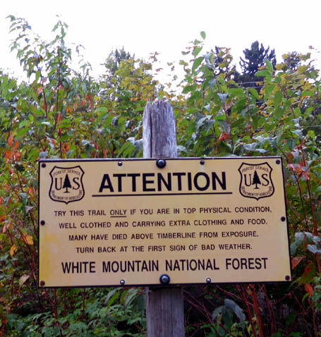
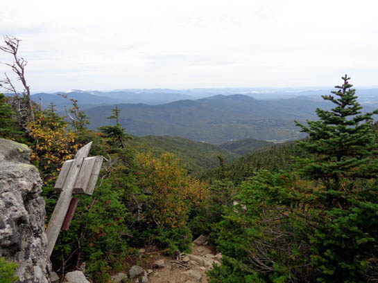
Even so, there are dire warnings on Valley Way at
the trailhead (above) and near tree line in the alpine zone (below):
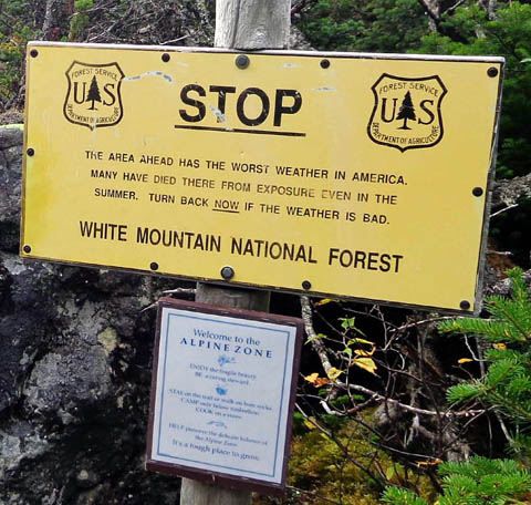
In case you can't read the fine print on the STOP sign above, it
warns, "The area ahead has the worst weather in America. Many have
died there from exposure, even in the summer. Turn back NOW if the
weather is bad."
I hiked this handy trail twice during my A.T. hike -- going
down the day I had to bail out near the summit of Madison because of sleet, ice,
and high winds (it would have been impossible for either Jim or me to
reach our rendezvous site on Mt. Washington that day), and going back up
to the summit on the next clear day so I could finish that section of
the A.T. from Mt. Madison to Mt. Washington.
This was my first time going up and back down the same day on
Valley Way Trail -- and it was tougher than I expected! My memory
of the trail has faded and I'm not 56 any more . . .
In fact, because of today's cold, overcast, windy weather I didn't
even go to the summit of either Mt. Madison or nearby Mt. Adams. I
turned around at the Madison Springs Hut a half mile below Madison's summit.
The hike was not a failure, though. Despite the lousy weather I got
back down to the valley before it began raining and I mostly enjoyed the
challenges of the trail. I just wish the weather had been better.
FLAGS ON THE 48
So why did I even do this hike today? I don't usually want to hike
on weekend days when the trails are more crowded, let alone in crummy
weather.
It's all Eric's fault!
Just joking. Eric is our avid hiking-cycling-running friend from
Maine. He knows the trails in NH and ME like the back of his hand. He
gave me a good reason to go to the summit of Madison and/or Adams today.
When we got back to the area he told us about a local tradition he
participates in called
"Flags On the 48." On the Saturday
closest to September 11 hikers climb the forty-eight New Hampshire peaks
over 4,000 feet elevation and place large U.S. flags on the summits
between noon and 2 PM in memory of all the people who died on 9-11-01.
Eric went up with a group of friends to help plant the flag on Mt.
Tecumseh in the southern Whites. He encouraged me to either join him
there or hike up a closer 4,000-footer closer to our campground.
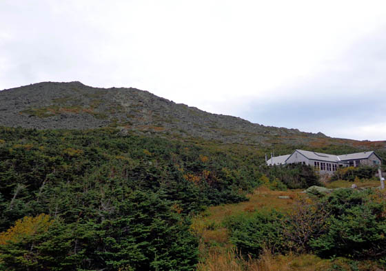
The summit of Mt. Madison (elev.
5,367 feet) is about 1/2 mile on foot above the hut.
The summit of Mt. Adams (elev.
5,774 feet) is about one mile on foot in the other direction.
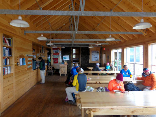
I reached the Madison Springs hut about 10:15 AM. It was so cold and
windy up there that I decided to descend the mountain when I saw the
flag bearers head out at 11 to go up to the summits of Mts. Madison and
nearby Adams.
If the weather had been nicer, or if I'd been with someone determined
to attend the ceremonies, I probably would have continued up to one of
the summits.
TRAIL DESCRIPTION
I know the Appalachia parking area fills up early, especially on the
weekend, because several popular trails begin there. When I reached the
parking area a little after 7 AM it was already full and I had to make my
own space.
It was much worse when I got back down at 2:30 PM; vehicles were
parked up and down the wide shoulder of US 302 by then.
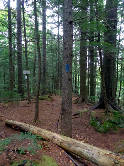
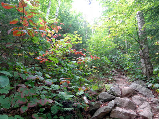
The trail is the most hiker-friendly
in the first mile.
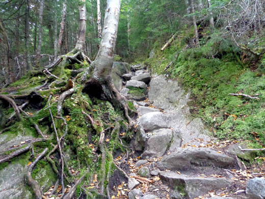
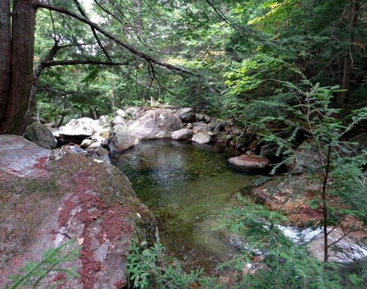
After approximately three-fourths of a mile the trail lies close to Snyder
Brook for a little while:
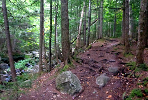
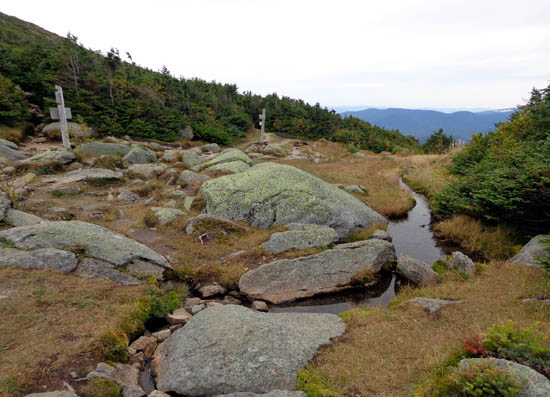
Valley Way winds high above the ravine formed by Snyder Brook all the
way up to the hut but hikers get the best views of the stream closer to
the beginning of the trail. The origin of the stream is a spring near the hut.
The temperature at the trailhead was only in the upper 30s F. when I
began the hike. It got
colder, cloudier, and windier as I ascended from 1,300 feet to 5,200
feet -- especially after I emerged from the trees just below the hut.
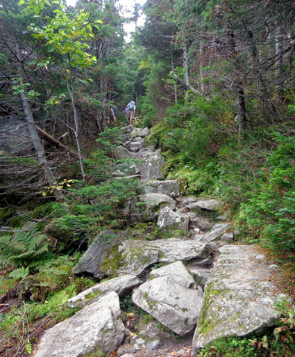
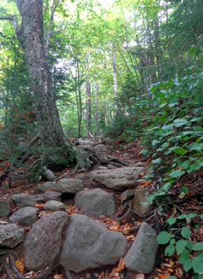
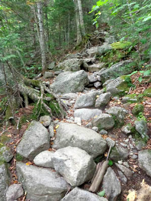
The trail was more gnarly than I remembered and it took me three
hours to hike up 3.8 miles. It took even longer on the slick rocks going
back down because I had to be so careful with my Granny Knees. Even so,
I fell twice going back down. I banged up my GPS as much as one of my knees.
Nope -- definitely not 56 any more! (My inside joke re:
not being in as good condition as when I did the A.T. run-hike nine years ago.)
My GPS recorded a total elevation gain and loss of 8,270 feet in 7.8
miles (I took a detour on the way down that added about 1/4 mile). That
would be difficult for most people if it was paved,
let alone rocky-rooty as all get out.
Considering the difficulty and the number of pictures I took, my time
isn't so bad.
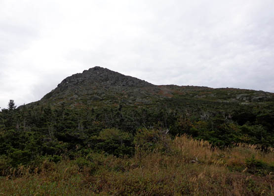
The trail isn't too steep the first two miles but the upper half is
much steeper and rock-strewn. From the hut to the summit, which I hiked
nine years ago but not today, the trail is a steep rock pile. At least
the rocks were mostly dry. One reason I began my descent at 11 AM was to
avoid the afternoon rain that would have made my descent even more
treacherous than it was.
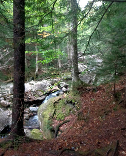
The trail finally offers some valley views about a quarter mile below
the hut:
There were a few more people on the trail today because of the flag
ceremony than there would have been otherwise.
I counted 17 people coming down the mountain in the morning from the
hut, including two "croo" members, as I ascended. I saw eight hikers
going up; five were in the Mt. Madison flag group. Before I left
the parking area the Mt. Adams group began its ascent but I didn't catch
up to them until the hut.
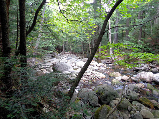
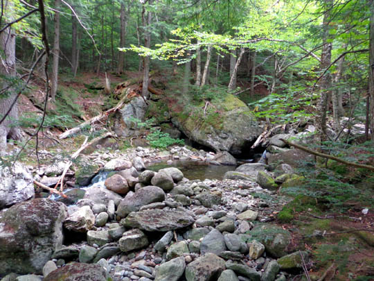
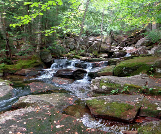
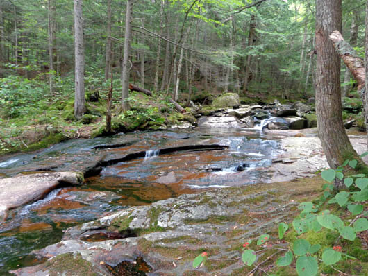
FALLS WAY & MAPLE WALK
On my descent I saw 38 people going up the mountain. The number would
have been higher if I'd stayed on Valley Way the whole time.
Instead, I followed
another USFS trail, Falls Way, along Snyder Brook the last half mile,
then Maple Walk to the parking area. I wanted to see the pretty falls,
cascades, and pools of water along the lower part of the creek:
Salroc Falls
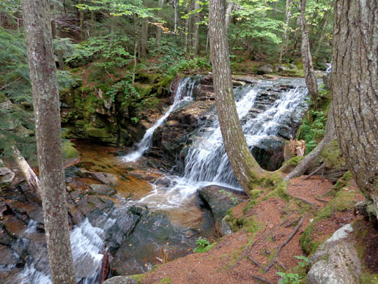
Tama Falls
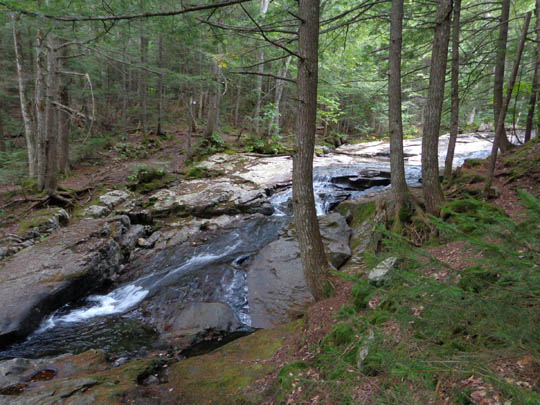
.
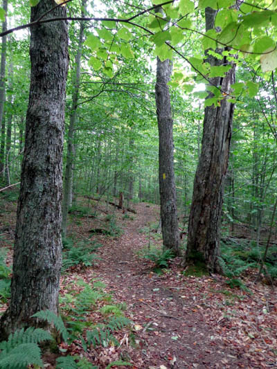
The maple leaves along Maple Walk
hadn't begun
to change color yet when I took
this picture.
The falls and pools of water in Snyder Brook are so pretty that I
took the dogs back two more times to play in the water. I'll show more
photos of the creek in another entry.
My arms and legs were pretty sore by the time I got back to the truck.
It's been a while since I've done that much elevation gain and loss. I
really leaned on the trekking poles on the descent and "had the brakes
on" the whole way down. I'm glad I did the hike, though.
Next entry: photos from a variety of popular trails, pools,
and lakes in the Whites -- Ammonoosuc Lake, Echo Lake, Ripley Falls,
Snyder Brook, The Basin, Artists' Bluff, and Prospect Mountain/Weeks
State Historic Site
Happy trails,
Sue
"Runtrails & Company" - Sue Norwood, Jim O'Neil,
Cody the ultra Lab, and Casey-pup
Previous
Next
© 2014 Sue Norwood and Jim O'Neil
