We did a good job following the fall leaf color through the Canadian
Maritimes and upper New England to western New York, but predictions of cold, wet
weather "drove" us to change some of our travel plans.
Instead of spending more time in New York and Pennsylvania, we
decided to drive straight through from Fort Drum to Andrews AFB in metro
Washington, DC on October 8. Despite road construction and more traffic than we've been used to in
recent months, we made it safely there.
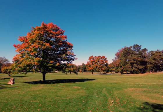
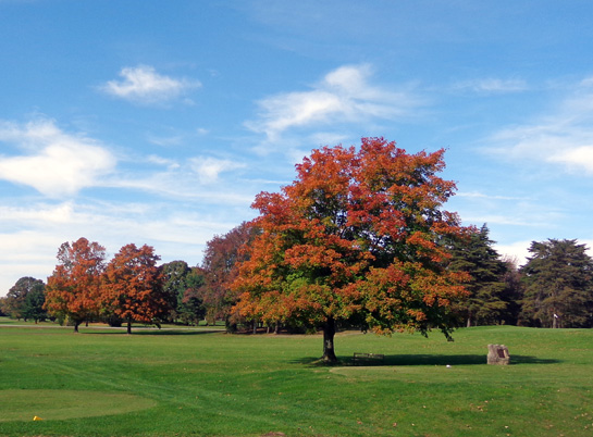
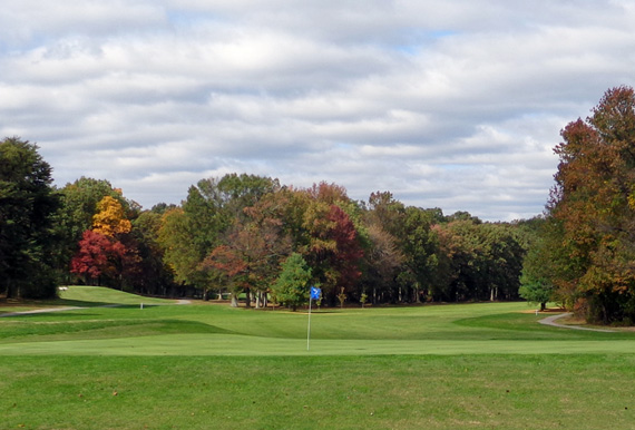
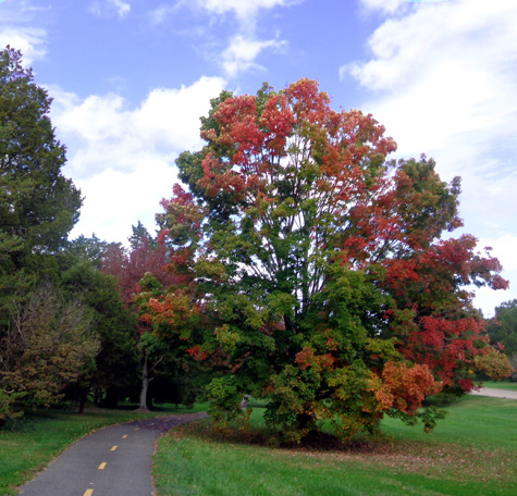
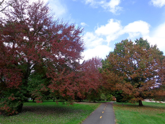
Above and below; pretty
leaf color on the golf course near our CG at Andrews AFB in mid-October
Our route was mostly on busy freeways --
I-81 through NY to Harrisburg, PA, using
I-476, a turnpike around Scranton, PA (two $2.60 tolls); I-83
from Harrisburg to Baltimore, MD; I-695 to I-95;
I-95/I-495 around NE side of metro Washington, DC to exit 11A and into
Andrews AFB at Pearl Harbor Gate.
The leaves were very pretty along I-81 through NY and down to the middle
of PA. They were most colorful when we were over 1,000 feet (1,500+ feet
on the turnpike around Scranton was probably our highest elevation).
From Harrisburg south we drove at lower elevations and most of the
leaves were still green. Some trees at Andrews AFB have turned color
by the third week in October.
BUT YOU GUYS DON'T LIKE THE METRO DC AREA, DO
YOU??
Yes and no. We hate the traffic, most urban areas, and anywhere
that's crowded but we thought of several reasons why Andrews AFB might
be a good place to spend 18 days in mid-October.
We needed to spend at least one night there anyway, to retrieve our
Honda Odyssey after storing it there for the summer. Since we're
spending several months in south Georgia and northern Florida this
winter we want to use it to get around.
It could be several years before we return to the East coast so there
wasn't any point in leaving the van in Maryland (Andrews AFB is in
Maryland, not Washington, DC).
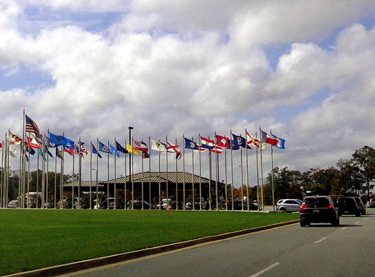
One of the entrances to Andrews AFB has lots of
colorful flags; this is only half of them.
We liked staying at Andrews AFB in late June/early July. The site we
had then was spacious, the $20/night cost for full hookups is excellent, and
there were a lot of miles where we could walk and bike on base.
We also wanted to spend more time at the National Mall and Smithsonian
museums in DC, cycle on the scenic Mt. Vernon multi-use path again, and spend
time with relatives who wanted to come visit us here.
Finally, the weather was a factor -- not too warm, not too
cold in DC in mid-October.
LIFE AT THE ANDREWS AFB FAM-CAMP
So how did all that work out?
Pretty well, except we don't
have quite as much room at our campsite this time. We got the only one
available the day we came in, then moved to a much quieter, more
spacious site a couple days later.
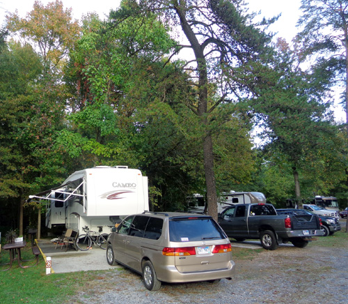
We're still closer than we like to the RV on our doorside (to the
left in the photo below) but the occupant, one of the CG hosts, is gone
all day. I can walk the dogs in the woods behind our site and we have room
to park both vehicles:
The campground is more crowded now because active duty troops are
permitted to live there from October to April; fewer sites are available
now for retirees and short-term active duty folks. We were actually
lucky to be able to reserve a site as long as we did. (Our reservation
was until Nov. 2 but we left Oct. 25, after 18 nights.)
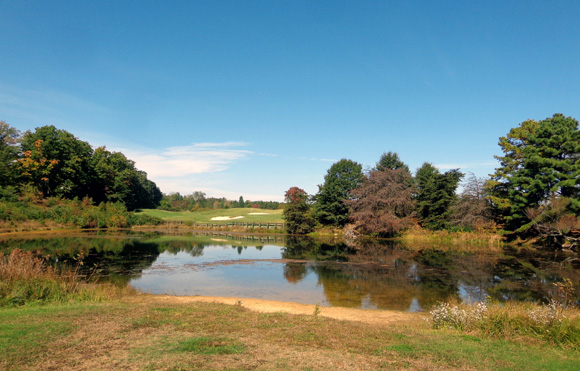
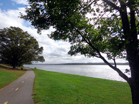
I got out every day to walk the dogs near the campground, by the golf
course, and over to nearby Freedom Park, which has a pretty lake:
When we were at Andrews AFB back in July I mentioned that sometimes
folks on base are inconvenienced when President Obama is playing golf there.
The President's air travel also affect folks at Andrews AFB.
Everything nearby simply stops when Air Force One is coming or going. (At least two planes
used by the president are stationed at Andrews.)
The day after we arrived I was walking Casey in Freedom Park and saw/heard several
helicopters flying in large circles overhead. I figured they were doing
some sort of training. Little did I know I was probably in their cross-hairs!
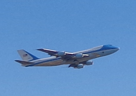
One of the planes dubbed Air
Force One
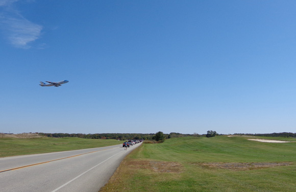
As I walked out of the park to the road leading back to the
campground, I saw that vehicles were backed up a quarter of a mile.
Then I figured it out. Since that's the end of one of the runways, I
realized it was probably because the President was either leaving town
or coming back from somewhere. One of the
stopped drivers confirmed my guess. I hung around long enough to take a
picture when the plane flew over the road.
Air Force One, or maybe Two??
Traffic was detained for several more minutes after the
plane disappeared from sight. The evening news confirmed that the President was flying
somewhere that day. I don't remember where or why.
Another day POTUS was meeting with
allies from 20+ countries in a building near the Presidential Inn to
come up with strategies to fight ISIL, a potent terrorist group in the
Middle East that's beheaded four Western journalists and aid workers and
is overrunning areas that we fought many years to
keep free (at the cost of thousands of American lives).
We
had no clue when we went to the Presidential Inn to reserve a room for
guests who stayed there during their visit with us. We didn't have
any traffic delays but did get stopped on our way to the Inn when we
tried to turn onto a street that security personnel had inconspicuously blocked.
In addition to my daily walks, I did some cycling on
base but not as much as Jim. He rode almost every day, saving his longest rides
for the weekend when traffic is minimal. We also both enjoyed another
ride on the Mt. Vernon multi-use trail.
MORE PHOTOS FROM THE MT. VERNON TRAIL
I showed some photos from this scenic paved path across
the Potomac River in Virginia in one of the July 10, 2014
entries. The path roughly parallels the George Washington
Parkway for eight miles from Alexandria to the Mt. Vernon estate.
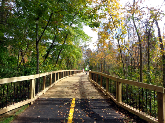
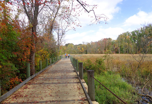
On a recent weekday we parked at one of the trailheads
off the parkway and rode out-and-back on the bike path for 16 miles total. Last
time we didn't see the entire trail. It has enough hills, curves, wooden
bridges, and scenic views of the river, wetlands, and woods to make it interesting.
Here are a few of the photos I took, with some of the
leaves now turning more colorful:
We really like this trail. So do a lot of other cyclists, runners,
walkers, and skateboarders, so we recommend you go on a weekday rather
than the weekend or a holiday.
MORE TOURING OF D.C.
We got mostly past the learning curve of using the metro train system
on our earlier visit to DC so we weren't as fearful of using it this
time when our visitors were here. We made two trips downtown on the
train this past Monday and Tuesday. If it had been the weekend, we could
have parked our own vehicle more easily downtown but we knew that would
be difficult on a weekday.
The first day we toured the inside of the U.S. Capitol again with an
intern named Andrina from South Dakota Rep. Kristi Noem's office, this
time with our guests. Members of Congress are on break this week so once
again . . . we didn't get to meet Kristi.
We had an impressive two-hour tour, though.
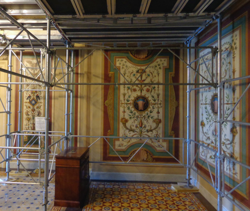
Andrina showed us some
rooms and features we didn't see with a different intern in July --
an area with elaborate tiled walls and floors that was being renovated,
the House floor, and the Senate balcony.
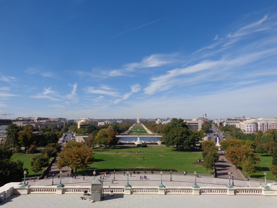
We took more photos of the National Mall from the balcony where
each new President gives his inaugural address. This time the lawn was clear
of all the tents, etc. that were set up there in early July for holiday
events:
Kristi's main office staffer, Andrew, came over while we were in the
House chamber and talked to our guests and us for 15-20 minutes about
procedures, historical anecdotes, etc. while we sat in Representative's
seats. That was educational and we really appreciated the extra effort.
(We wrote to tell Kristi he deserves a raise!)
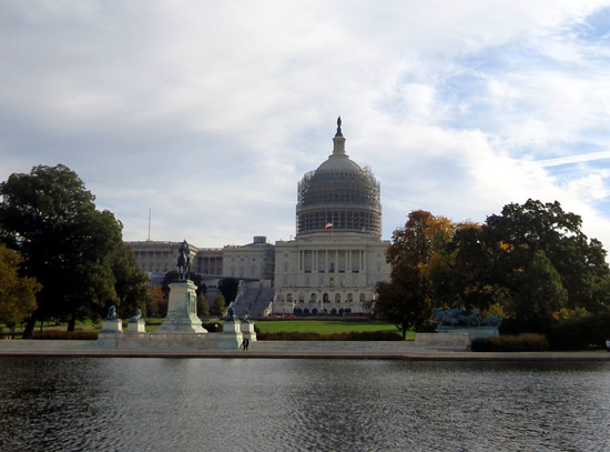
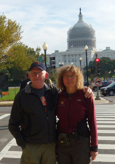
As we approached the imposing U.S. Capitol we noted that there is
scaffolding around the dome while extensive work is being done to
renovate it. You can see the scaffolding behind us in this picture and
the one at the beginning of this section:
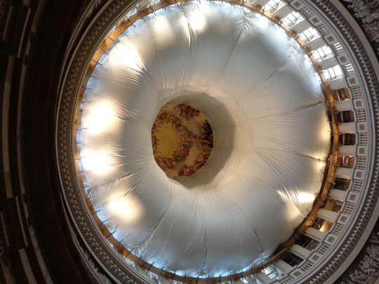
We could also see the protective sheeting on the interior of the dome
during our tour:
After our tour we were permitted to eat lunch in the basement of the
Longworth Building, where Capitol staff members eat. There was a good
variety of food, reasonably priced (for Washington, DC).
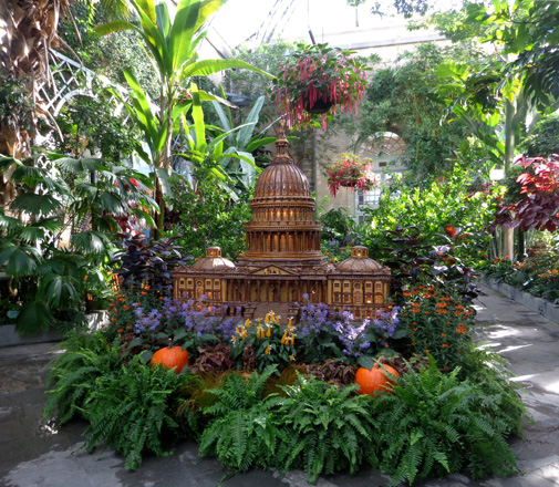
The same day we visited the nearby U.S. Botanical Garden and the U.S.
Air & Space Museum, both free to all visitors, domestic and
foreign:
Dressed for fall
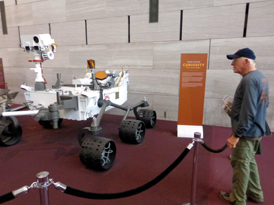
Jim observes the Mars Curiosity
rover at the Air & Space Museum,
one of the Smithsonian
Institute's many impressive museums.
The next day we did even more walking around the National Mall,
starting on the south side of the linear park and heading west for about
two miles to the Lincoln Memorial.
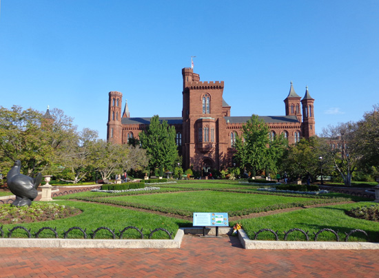
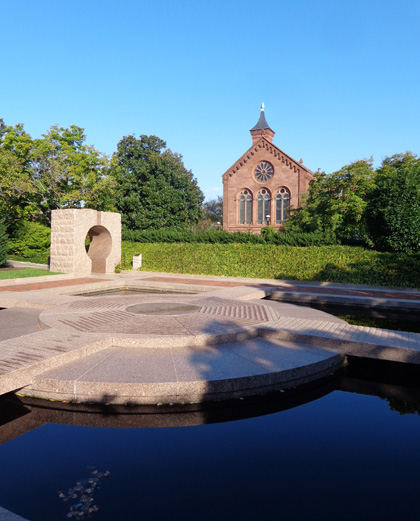
We went past the original Smithsonian building, called "The Castle,"
and its elaborate formal gardens,
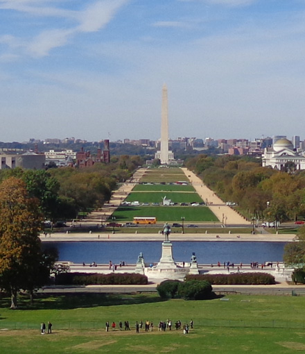
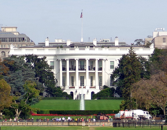
the Washington Monument, where I could zoom in on the White House
from a high spot,
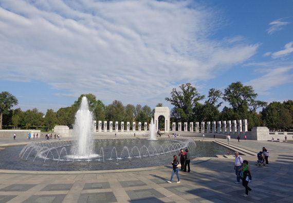
the WWII Memorial,
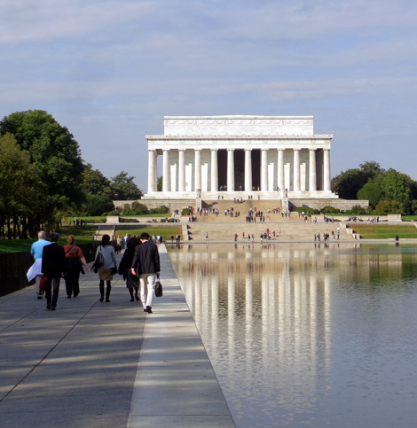
and over to the Lincoln Memorial:
We returned on the north side of the Mall past the Vietnam Wall,
where we could also see the Washington Monument:
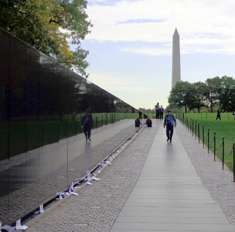
You can see that tall monument from just about anywhere downtown!
We finished that day with several hours of browsing in the Natural History
Museum, another of the magnificent, free Smithsonian Institute's buildings.
Jim and I have been there before so focused more on our favorite exhibits
this time and let our guests wander where they wanted.
I spent the most time in the geology-mineral-gem exhibits, which were less
crowded than they were in
July (why is everyone so
fascinated with the Hope Diamond??).
We enjoyed seeing meteorite fragments made of iron like the earth's core,
learning more about earthquake activity in the U.S. (a large computer screen
with colored circles showing current and recent earthquakes is fascinating
-- one of several good reasons not to live in California!), and oogling
all the very cool minerals and geodes.
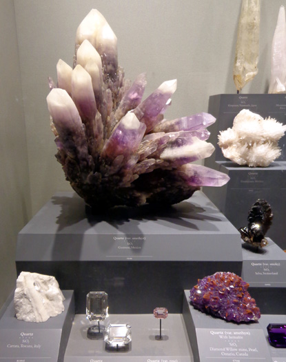
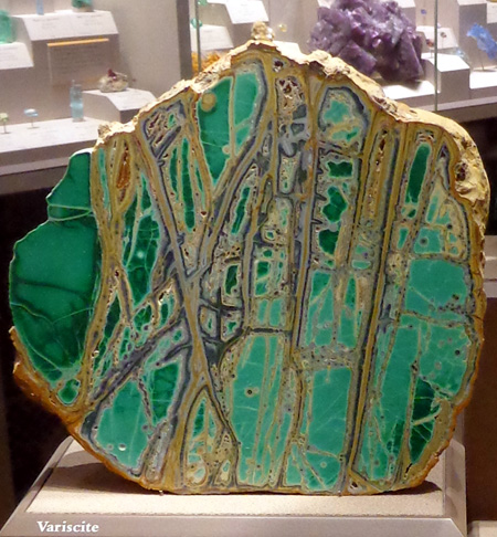
I took lots of photos. The museum has a spectacular variety of minerals, gems,
and geodes from all over the world. I was fascinated with all the interesting
shapes and colors. I don't care for jewelry or gems that are cut; I
liked the "raw" minerals (cleaned up for show) on exhibit.
This photo from the wilderness display in another area of the
museum makes my heart sing:
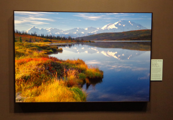
That's Denali AKA Mt. McKinley reflected in Wonder Lake in
Alaska's Denali National Park.
It's very rare to be able to get a photo like that because Denali is so often
under clouds by the time the shuttle buses get 80+ miles back into the park
and the lake is rarely that calm (it's a windy area). The guy who took this
picture won a grand prize for it from the Smithsonian Institute.
When we go to Alaska next summer I'll do my best to capture
Denali reflected in one of the ponds or lakes but it won't be easy. You pretty
much have to camp overnight at Wonder Lake or stay in one of the lodges at
Kantishna to get out early enough in the morning to get a shot like that.
Tomorrow we're heading to Salem, VA (Roanoke area) for routine
medical appointments like our knee injections and annual physicals. Bet we see
some pretty fall colors in the Blue Ridge Mountains!
Next entry: continuing the snowbird journey south
Happy trails,
Sue
"Runtrails & Company" - Sue Norwood, Jim O'Neil,
Cody the ultra Lab, and Casey-pup
Previous
Next
© 2014 Sue Norwood and Jim O'Neil
