When we're in a new location for a short time,
we have to make the best use of that time to see and do all the things
we'd like to see and do, regardless of weather conditions.
That's why
we took a scenic drive today down NB 114 to Hopewell Rocks
and Fundy National Park -- despite a forecast of 60% rain and
thuderstorms. It worked well for us this time. Although there were intermittent light
showers, it was warm and mostly dry today with lots of sun and pretty white
clouds intermingling with the dark gray ones.
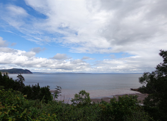
It was interesting to see distant showers over the Bay of Fundy from our
various observation points in the park and along the roadways:
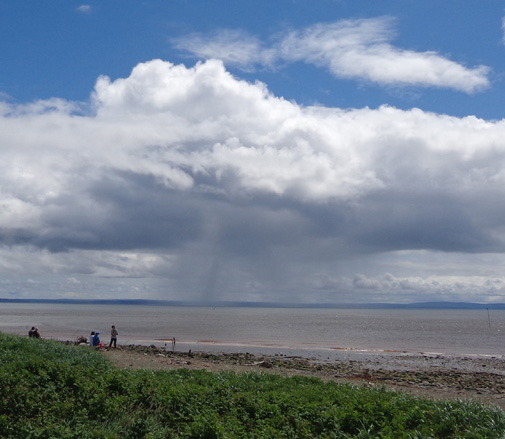
A storm in
the Bay, as viewed from the town of Alma
Our main goal today was to see
Hopewell Rocks. The
Bay of Fundy has the highest tides in the world -- up to 52 feet
from high to low, in just six hours -- and one of the most
intriguing places to see the effects of the variance in the tide is at
Hopewell Rocks.
Because of all the
photos I took, I'll talk about Hopewell Rocks in Part 2 of this series. We were also able to see some
effects of the huge tidal variance at the locations I'll discuss in this
entry -- the bayside town of Alma and Fundy National Park, which were
also on our agenda today.
Here's a AAA map section
showing our out-and-back route with a minor variation on the return:
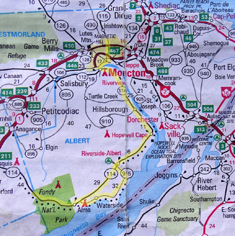
From the campground we drove through Moncton to NB 114,
crossing the Petitcodiac AKA Chocolate River, so nicknamed for its brown water at high
tide and brown mud at low tide.
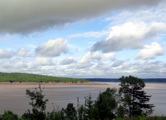
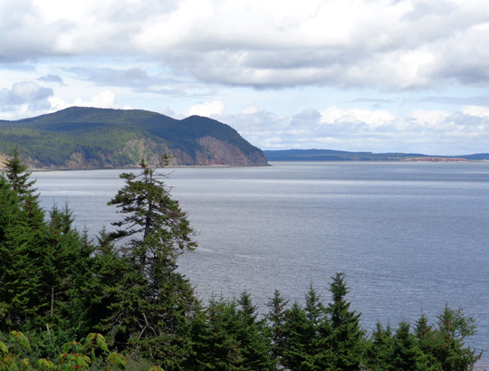
NB 114 gave us glimpses of the river, then Fundy Bay, as we traveled
southeast toward
the little town of Hopewell Cape (see map above). The next picture shows the river near its mouth with the
bay at rather low tide when we were coming back in the evening:
HOPEWELL CAPE
Jim spotted a farmer's market in Hopewell Cape this morning so we stopped while it
was open and wandered around looking at the food (not a lot) and old
buildings full of historical equipment (a lot):
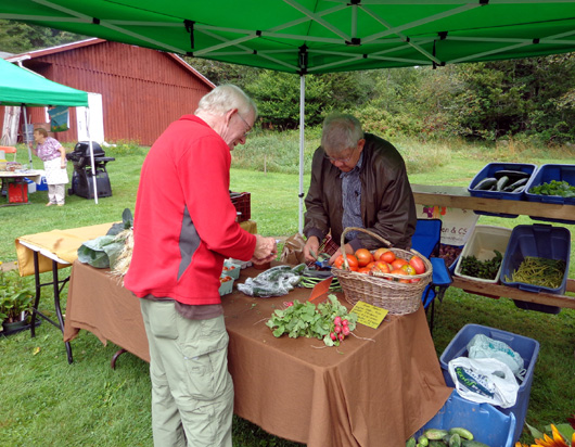

We bought some delicious pumpkin seed bread made with whole rye and
wheat, then headed to Hopewell Rocks so we could see them close to high
tide. Today the tide peaked about 11:20 AM.
We took a hike at Hopewell Rocks to see the "flowerpot" rocks at high
tide -- very cool. We knew it would be interesting to see the
same place this afternoon with the water much lower. But we had to wait
about six hours to see that phenomenon.
To kill time, we headed west to Alma and Fundy National Park.
BAYSIDE AT ALMA
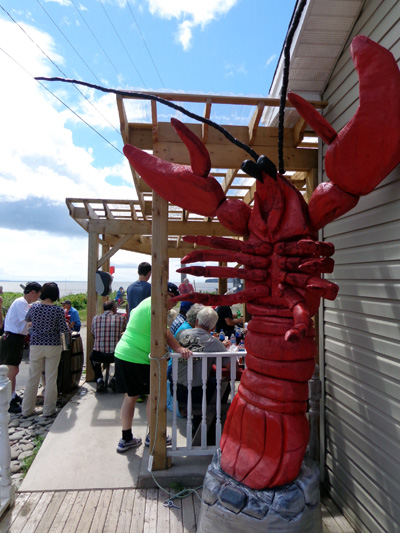
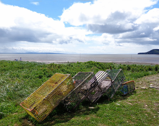
Alma is a small fishing town with several seafood shops.
We'd read good things about the Alma Lobster Shop in a brochure we got
at our campground so we stopped there. The shop sells
seafood and also serves meals.
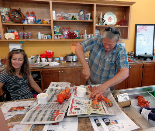
The restaurant was pretty busy at 12:45 PM. There was a group of
retirees in about a dozen antique cars. They were already eating when we
got there. We got served pretty quickly,
though, and found a seat on the covered patio overlooking the Bay.
Jim and I shared a bowl of lobster chowder (probably the best I've ever
had) and lobster roll (chock full of lobster). Yum! We didn't take the
cooler with us so we didn't buy any scallops, lobster, or other seafood.
It all sure looked good, though.
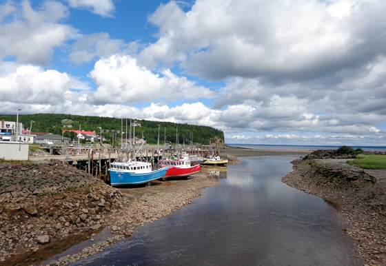
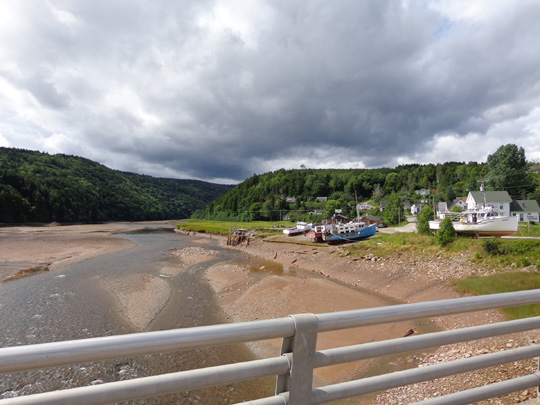
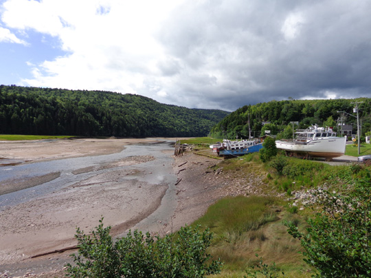
Fundy Bay and the nearby Salmon River were still fairly full of water
while we were in Alma at lunchtime.
They looked much different four hours later when the tide was much
lower.
By then all the boats
were high and dry.
I took these pictures on our way back to Hopewell Rocks after we
toured Fundy National Park:
FUN AT FUNDY
The entrance to Fundy National Park is just across the river from Alma.
We paid $13.60 CA (senior rate for two) to get in. The receipt is good
until noon tomorrow, if we decide to go back. We got a very nice 22-page
magazine about the park with our entry fee, much fancier than the brochures we
get at U.S. national parks -- but not really necessary.
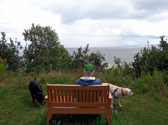
We took a left fork near the entrance, parked about a quarter mile down
the road, and walked with the dogs through a grassy
meadow to an overlook with a bench above the Bay of Fundy:
Then we walked across the road and about 1/2 mile around the "bottomless"
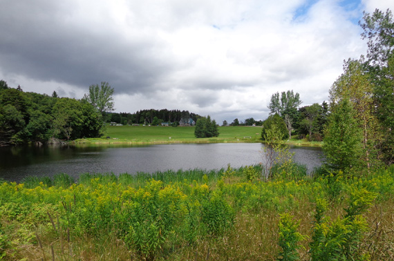
McClaren Pond.
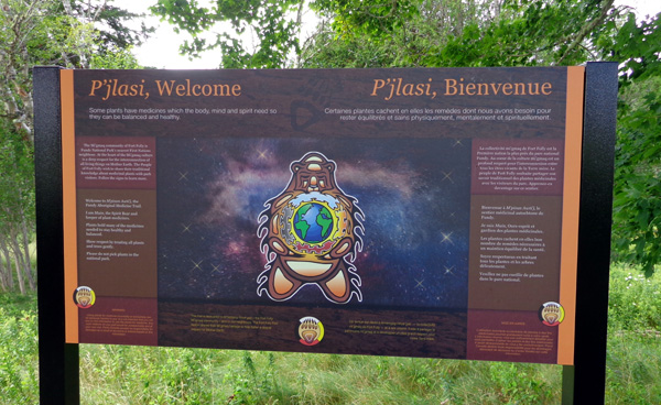
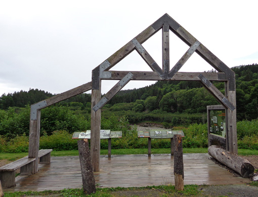
New Brunswick is officially bilingual, as this sign at the pond
illustrates. Road and other signs throughout the province have both the English and French
languages on them:
Part of the dirt trail around the pond was wooded, part open. The dogs enjoyed swimming in
the water and picking their own ripe red raspberries. They sniff them
out and are pretty good at avoiding the thorns!
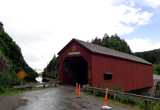
Next we drove to Point Wolfe, site of a former 1800s lumber mill and
town along Point Wolfe River:
We drove through a handsome red covered bridge that spans the river just before it empties
into the Bay of Fundy:
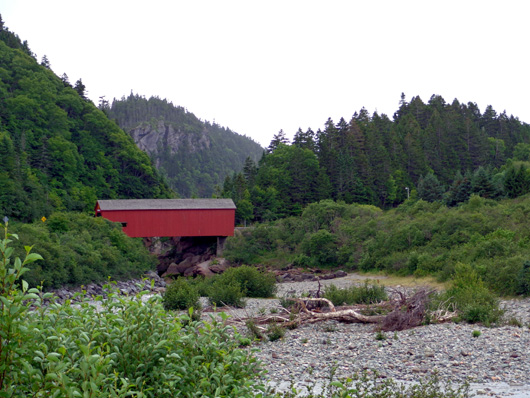
The road winds
through a scenic wet area and by a gorge just downstream of the covered
bridge.
On our way back toward the visitor center we took a little side road to Herring Cove
Beach and let the dogs out again for a short walk to an overlook.
Although the tide was starting to go out we didn't attempt to go down the
numerous wooden steps to the beach. (There's no beach when the tide is
high.)
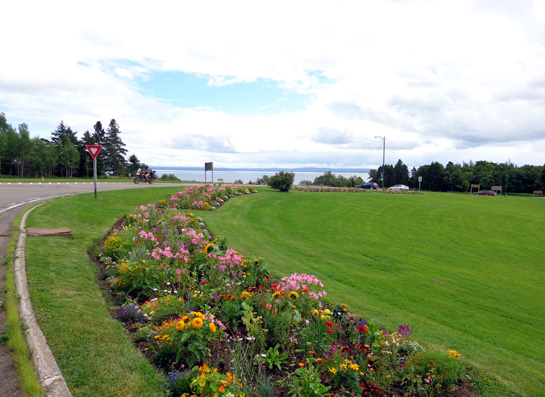
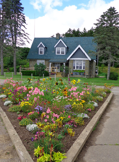
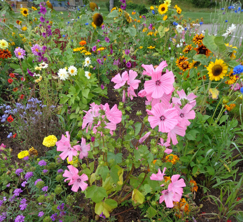
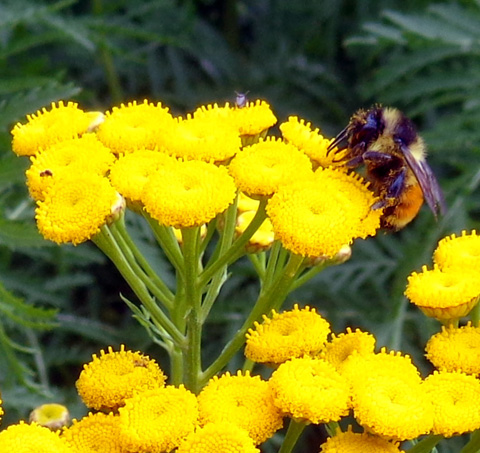
Next we stopped at the visitor center/gift shop near the entrance to
the park. I enjoyed seeing all the colorful flower beds in this area:
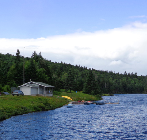
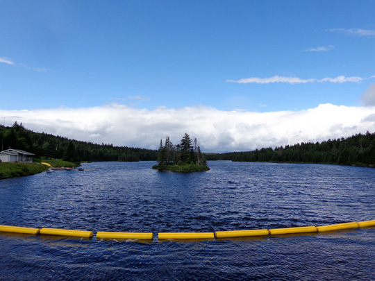
Then we took the right fork from the entrance and drove about eight miles west through the park on NB 114 to
beautiful blue Bennett Lake, where we turned around:
There are numerous hiking/cycling trails throughout the park but not
much of it is accessible by road. The park is hilly; we got up to 1,224'
above the bay on the road.
We drove back to Alma, where I got out to take photos of the riverbed
with the tide lower (those photos were shown earlier on this page). Then
we took a 32-mile loop on NB 915, a smaller, scenic road closer to the Bay
of Fundy. I was driving and didn't take any pictures. This road
rejoined NB 114 before Hopewell Rocks.
We parked at Hopewell Rocks again and walked down to the overlook and
steps to the beach.
Low tide was about 5:50 PM. We got there about 5:30 and wandered around
the beach where it had been under 40+ feet of water in the morning!
The
difference in the rocks and beach in just a six-hour span was amazing.
Next
entry: the "flowerpot" rocks at high and low tides
Happy trails,
Sue
"Runtrails & Company" - Sue Norwood, Jim O'Neil,
Cody the ultra Lab, and Casey-pup
Previous
Next
© 2014 Sue Norwood and Jim O'Neil
