Just reading about the popular section of this trail between Morell and
St. Peters was enough to put it on our list of Things to Do on PEI for
the same reason we wanted to ride Gulf Shore Way at PEI National Park:
it is about the only section of the Confederation Trail that runs next to water for
several miles.
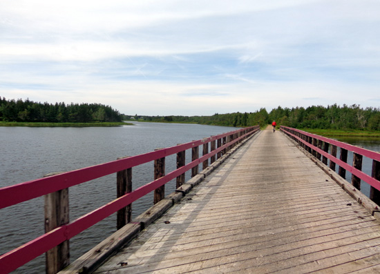
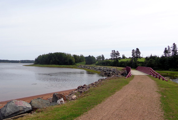
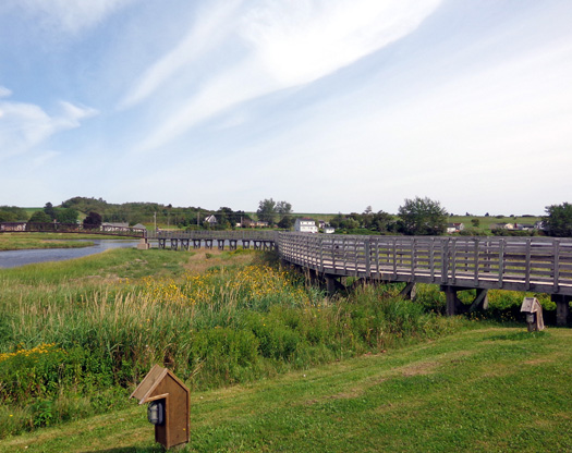
It also goes over the mouths of three rivers on
memorable fuchsia-colored bridges that have been spiffed up since they
were RR trestles. This is the longest bridge:
Today's weather was perfect for a bike ride -- partly to mostly sunny, 60s
to low 70s F., some breeze.
We left the dogs at home in the morning while we went to the
Charlottetown Farmers' Market, which I talked about in a previous entry.
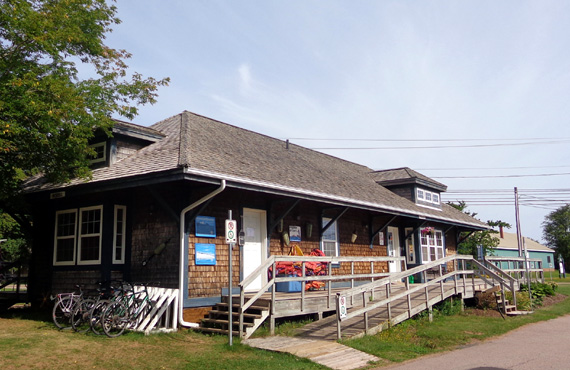
When done browsing and shopping, we drove east on Rt. 2 to the small
town of Morell and parked at the trailhead next to the visitor center,
which was a former PEI Railroad station:
We rode our bikes east on the Confederation Rail Trail, part of
the Trans-Canada Trail, to St. Peters and back.
Here's a map of PEI
from WorldAtlas.com with our approximate driving and cycling route
marked:
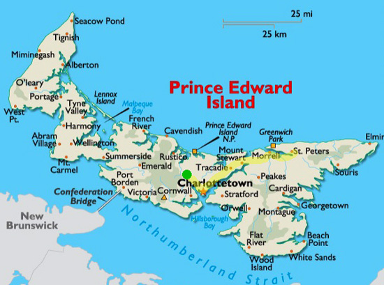
Our campground is marked with a green dot. Hopefully your screen is
large enough to show the towns of Morell (which is spelled on most maps
and in our PEI brochure with just one "L," not two as on this map) and
St. Peters to the upper right. St. Peters is as far east as we traveled
on the island while we were here.
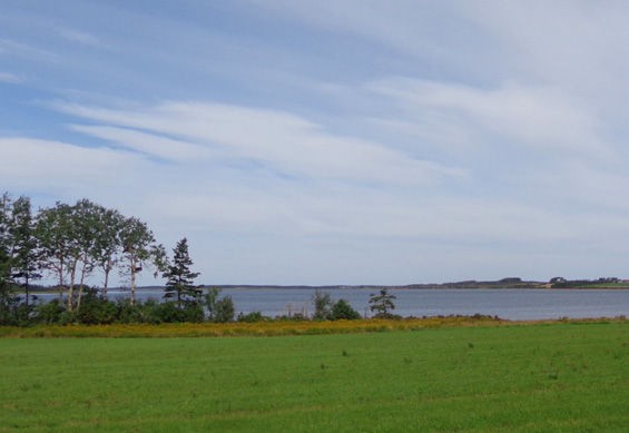
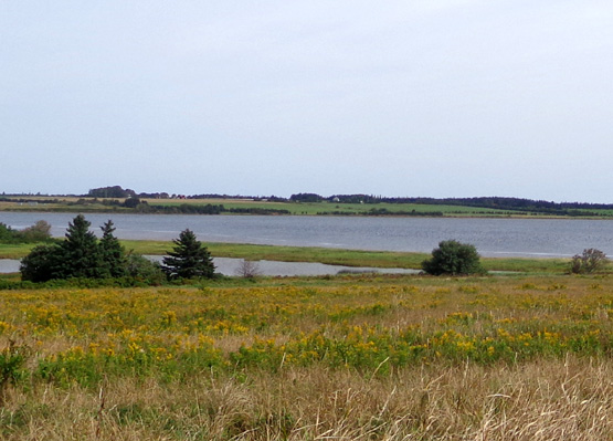
Most of this 12 km (7˝
-mile)
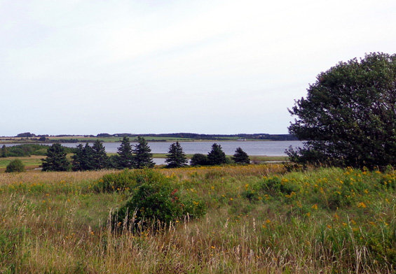
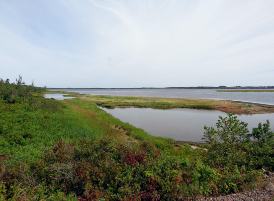
section of trail between Morell and St. Peters follows the south shore of
St. Peters Bay.
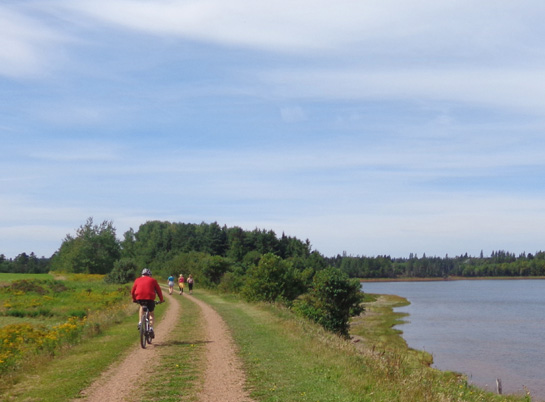
Sometimes we rode
very close to the bay and the rivers that enter it in this segment:
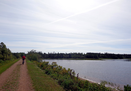
Jim rides close to the river (above) and the bay
(below)
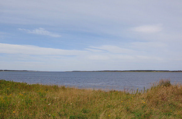
It's not a wide bay -- only
˝ to 1˝ miles
wide, so we could see land on the other side unless trees blocked our
view.
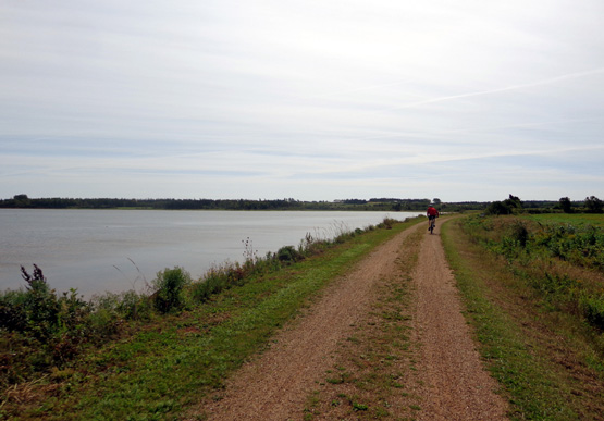
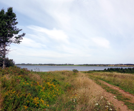
The trail is close enough
to see St. Peters Bay for over six miles. The bay itself is
a little longer than that; we didn't see where the water flows in from
the Gulf of St. Lawrence.
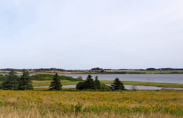
North shore
of bay is close here.
North shore of bay is farther away here but still
visible from the trail.
This is the most scenic -- and popular -- segment of the
274-kilometer Confederation Trail on the island. Another 170 km of
branch trails extend to other parts of the island. That's a total of
about 440 km or 273 miles of crushed stone trails in this system. It doesn't
include other trail networks on the island, such as those in PEI National
Park.
Although we saw a few other folks cycling and walking, I was expecting
more people on such a nice Saturday morning.
Jim approaches three hikers.
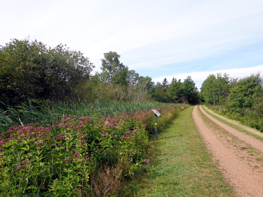
The trail surface in this segment is smooth double-track crushed rock,
sometimes
with grass in the center. Since it's a rail trail it's pretty flat.
We were grateful that it curved around the shore as much as it did
instead of being mostly a straight line.
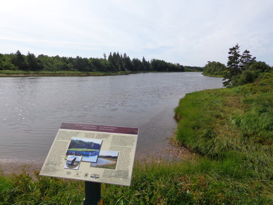
There are a dozen or
more interpretive panels along this segment describing the coastal
environment, wildlife, plant life, agricultural and fishing industries,
history of the trail, etc.:
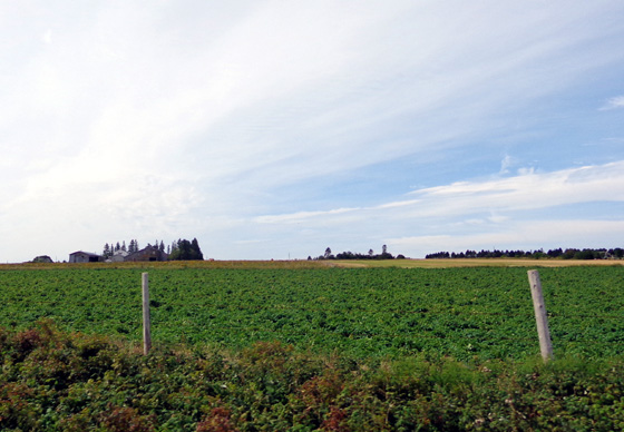
We passed potato and bean fields,
. . . lots of apple trees right
along the pathway, and numerous wildflowers -- yellow dandelions,
goldenrod, daisies:
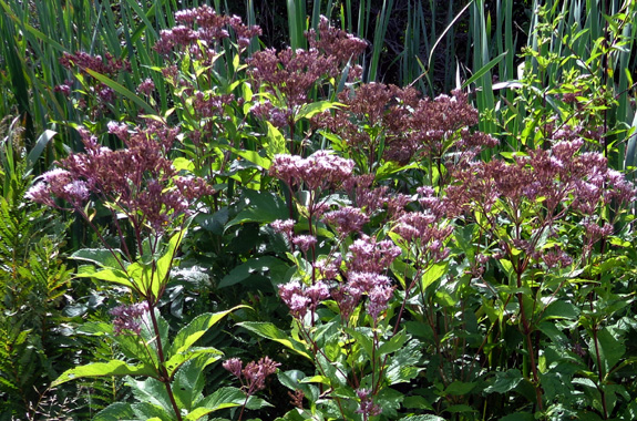
. . . white Queen Anne's lace and cow parsnip; fuchsia and purple
asters, fireweed, spotted Joe-Pye weed, and crown vetch:
Above and below: tall spotted Joe-Pye weed, a
member of the aster family;
it is named for a Native American healer who used
it in his medicine
I loved the three purple-painted bridges over rivers --
unexpected and cool! Here's one of the shorter ones:
The tide was down a little, exposing more of the red sand and dirt on
the shore. It contrasts nicely with the green grasses and blue sky and
water:
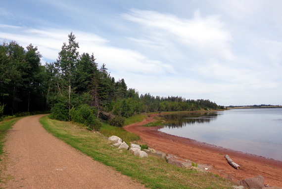
The sand on the south side of the island is reported to be even more red
than that.
As we neared St. Peters we could see a lot of small buoys out in the
bay. This is just one small spot I cropped from a wider angle:
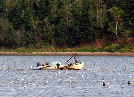
Interpretive panels indicate that they hold nets used to grow
cultured mussels started from "seeds." Each mussel farmer has a
different color of buoys so he knows where his aqua farm is located.
Cultured mussels grown in estuaries are a major part of the fishing
industry on the island. When mussel larvae seeded here become larger
they are transferred to other rivers to mature. It takes about two
years for the mussels to grow large enough to be harvested.
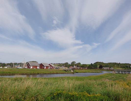
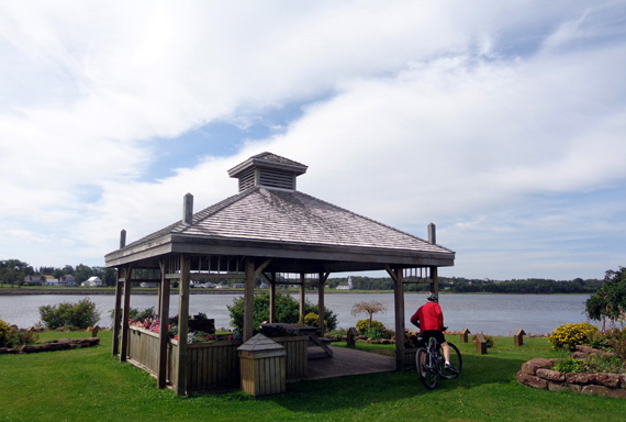
We rode around St. Peters a little bit, mostly in an effort to find
lunch. That wasn't successful. We found a nice restaurant but the wait was too long
so we enjoyed a very nice park where we stopped to eat the Clif
bars we brought with us:
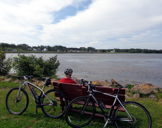
After eating our snack we rode our bikes back to Morell, for a total
of 15+ cycling miles.
We liked this section of trail, especially when we had water views.
Before we got here I offered to crew Jim so he could ride the whole
trail from one side of the island to the other, or just several long
segments, but he declined -- partly because of the time it would
take, and partly because the rest of the trail is inland and likely not
this scenic.
When we first got to the island we picked up two excellent guide
books and maps of the Confederation Trail at the visitor center at the
end of the Confederation Bridge. Both were free. The welcome center
where the ferry docks at Wood Island probably has the same information.
Next entry: cycling Gulf Shore Way in the Cavendish
unit of PEI National Park (more scenic water views)
Happy trails,
Sue
"Runtrails & Company" - Sue Norwood, Jim O'Neil,
Cody the ultra Lab, and Casey-pup
Previous
Next
© 2014 Sue Norwood and Jim O'Neil
