Nova Scotia conjured up visions of beautiful mountains and coastlines,
colorful fishing villages, and fascinating Scottish history well before
we arrived here. I've seen pictures of the lush scenery and heard
tales of the vibrant mix of cultures for several decades. It's been one
of my bucket-list destinations since my brother married his
Scottish-born wife, Margaret, in 1967.
Marge is one of several
people we know who have vacationed in Nova Scotia and raved about it. It
reminded her of the rolling green hills of her native Scotland.
Although Jim and I are interested in learning more about the history
and variety of cultures in this province, we are
interested even more in its scenic beauty and opportunities for outdoor adventure -- from
what we've read, it's full of gorgeous hiking trails and cycling paths.
There are many other outdoor activities available to visitors and
residents. Those are just our two current favorites.
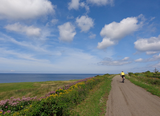
Riding along the Celtic Coastal
Trail on Cape Breton Island
The "five scenic trails" referenced in the quote above don't mean
hiking or cycling trails; they are scenic driving routes
to showcase the island. We'll do one or more of those, too, as we explore
as much of the island as we can on foot and with wheels in the three-plus days
we are here.
When choosing a base from which to go out on day trips on the
island, we picked Baddeck as being the most centrally located. There are at
least three nice campgrounds near Baddeck. I'll talk about the one we
chose in the next entry.
ROUTE FROM MONCTON TO BADDECK
Here's a AAA map section that shows today's route in yellow:
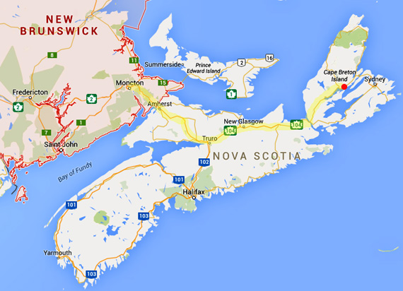
The town of Baddeck is in the upper right marked with a
red dot. That's where we're staying while we explore the island the next
four days.
We took CA 2 from Moncton to the Nova Scotia border, CA 104 to
Cape Breton, and CA 105 to Baddeck. All three are federal highways.
There is a section of toll road in
Nova Scotia between Amherst and Truro that goes over Cobequid Pass. Cost
for cars is $4 CA and $5.25 CA for vehicles with trailers. It appears
that NS 4 is an alternate route that avoids the toll road.
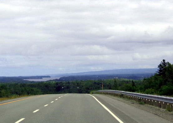
View of Cobequid Bay (an arm of the Bay of Fundy)
from Cobequid Pass
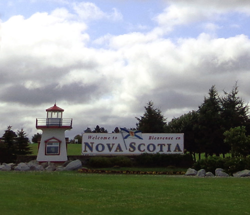
Signs in New Brunswick are in French and English because both are
official languages in that province. English is the only official
language in Nova Scotia so signs are just in English here.
Jim joked that therefore in Nova Scotia, distances should be in miles
instead of kilometers and speed limits in MPH, not KPH. <grin>
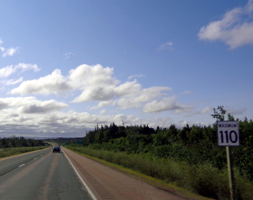
110 MPH??!! Not quite. That's kilometers = 68
MPH for those of us from the States.
Kilometers are fairly easy for us since we're former runners;
many races are measured in km's. Translating liters to gallons is
trickier for us, as is determining the "real" temperature (i.e.,
Fahrenheit) when we see/hear it in Celsius.
TRAFFIC, ROAD, &
WEATHER CONDITIONS
CA 2 east of Moncton was pretty rough hauling a large 5th-wheel trailer.
CA 104 and 105 in Nova Scotia
were much smoother. That could vary from year to year, of course.
CA 2 was all freeway. CA 104 was freeway to New Glasgow, then two-lane
the rest of the way to Cape Breton, with lots of passing lanes up hills
and freeway-type intersections at roads -- but people's driveways
open right onto the highway. (That seemed odd.) CA 105 was two-lane and
fairly smooth to Baddeck.
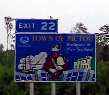
Nova Scotia has very colorful highway signs before
each town or city.
Traffic was moderate until highly-traveled NS 102 headed south toward Halifax. We saw
lots of RVs until that intersection; most of them were headed to/from
Halifax and not Cape Breton. Good!
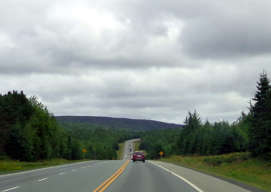
We left the campground in Moncton at 8:45 AM in sunshine. The weather
was totally schizoid as we headed east throughout the day, with about a
dozen brief rain showers followed each time by sunshine and billowing
clouds.
A little sun
. . .
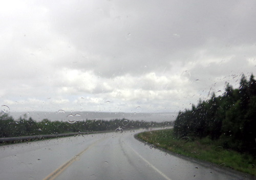
A little
rain . . .
It was mostly sunny in Baddeck this afternoon. We got to the campground about
2:45 PM. Temps were in the mid-70s F. and it was very humid. Average
low-high for Baddeck now is 55-73 F.
We stopped three times along the way:
1) A very nice welcome center as we entered Nova Scotia on CA 104 --
lots of flowers, a sunken garden with walkways and benches (next photo), nice views
to the valley and Bay of Fundy below us, lots of travel information, and
friendly staff:
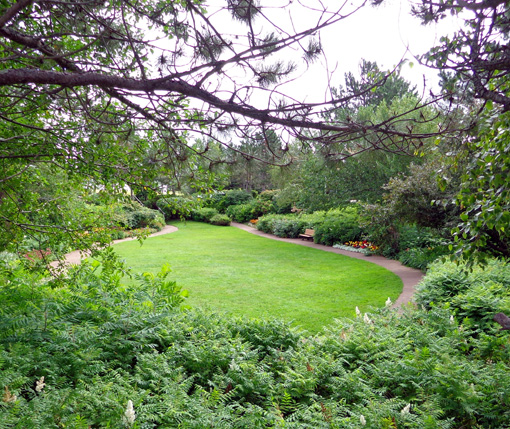
That place sets the
gold standard for welcome
centers. I got several maps and brochures and we were on our way
again.
2) What was called a rest area at Westville, before New Glasgow (exit 21
on C 104). This was nothing more than a muddy truck stop.
3) An Irving/Circle K station at Aulds Cove to fill the tank before we drove over
the causeway to Cape Breton Island (diesel @ $1.343 CA per liter).
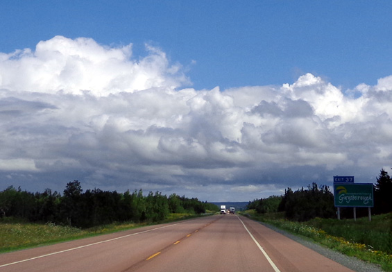
TERRAIN & SCENERY
I loved how hilly
this route was.
It was also very scenic with so many conifer-and-hardwood forests, wildflowers,
and bodies of water.
We could see a little bit of the Bay of Fundy at the New Brunswick-Nova
Scotia border, Cobequid Bay before Truro, Northumberland Strait near New Glasgow, St. George's Bay
and the Strait of Canso at Aulds Cove near the causeway to Cape Breton
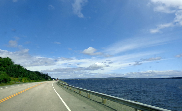
Island, and St. Patrick's Channel the last few miles to Baddeck.
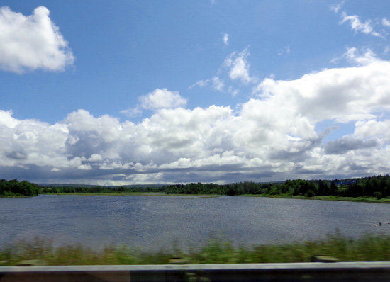
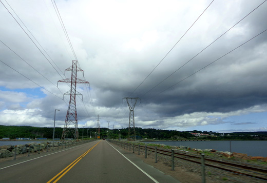
Causeway to Cape Breton Island
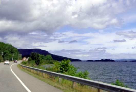
Above and below: St. Patrick's Channel along
CA 105 to Baddeck
Close to the campground we passed the intersection with the scenic Cabot
Trail, which makes a loop through the northern half of the island and
Cape Breton Highlands National Park. We plan to do a driving tour on
that route tomorrow.
Soon after that intersection we crossed the wide Baddeck River . . .
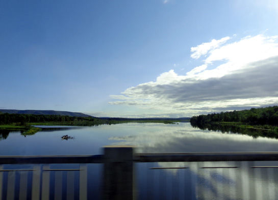
. . .
and turned left (N) to the little road
leading back to the Baddeck Cabot Trail Campground, our home for the
next four nights:
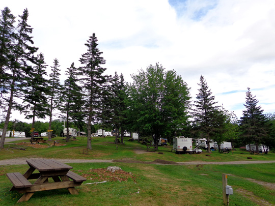
One part of the hilly campground; our site isn't
shown here.
Next entry: information and photos from the Baddeck
Cabot Trail Campground & the Baddeck River
Happy trails,
Sue
"Runtrails & Company" - Sue Norwood, Jim O'Neil,
Cody the ultra Lab, and Casey-pup
Previous
Next
© 2014 Sue Norwood and Jim O'Neil
