The Battle for Fort Pulaski during the Civil War marked a turning point
in military history and signaled the end of masonry fortifications. This
fort, named for a Polish war hero, has an interesting history.
I mentioned Count (later, General) Casimir Pulaski in a previous
entry about the old public squares in Savannah. In addition to
this fort, there is also an impressive statue of Pulaski in the
square named after him.
Pulaski lost his life in the successful defense
of Savannah during the American Revolution in 1779 and was honored
posthumously by grateful Georgians who appreciated all that he did for them.
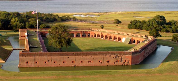
Aerial view of the irregular pentagon shape of the
fort;
the entrance is
over the moat to the left. (Photo from the NPS
website)
Fort Pulaski was part of the coastal fortification system adopted by the
U.S. government after the War of 1812. It succeeded two previous forts
built at the same location. Although construction of this new fort began
in 1829, its armament and garrisons were still not complete at the
beginning of the Civil War. Despite that, its admirers considered it
invincible and "as strong as the Rocky Mountains."
Not. As it turned out, before U.S. (Federal/Union) forces could occupy the fort, they
had to conquer it from the Confederates and that included doing some
serious damage to the structure.
Georgia seceded from the Union in January, 1861. Before the state militia and Confederate
States of America could occupy the fort, they had to overcome the
stranglehold the U.S. Navy had on all the southern ports. They managed
part of that OK but made soon made a serious tactical error.
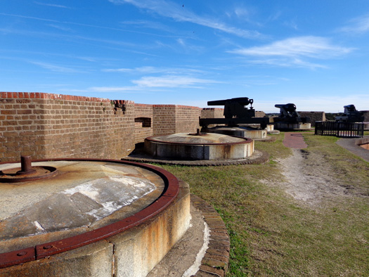
Gunmounts on the upper level of the southeast side of the fort
Too sure of the strength of the incomplete fort and unaware of the
strength of new Federal (Union) armament, the Confederates abandoned
nearby Tybee Island at the mouth of the Savannah River. That unknowingly
gave their enemy the only site from which Fort Pulaski could be taken rather easily.
The Federals acted quickly and moved troops to Tybee to prepare for a
siege on the fort in April, 1862.
The Confederate troops weren't particularly worried because Tybee Island was
a mile away over water and marshland. At the time there weren't any known cannons that could
breach the distance. What the Confederates didn't know was that the
Union armament included ten new experimental rifled cannons whose projectiles
could -- and did -- effectively shatter the walls of the fort.
Oops.
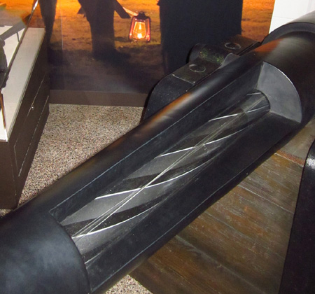
Cutaway of the new cannon used by the Union troops
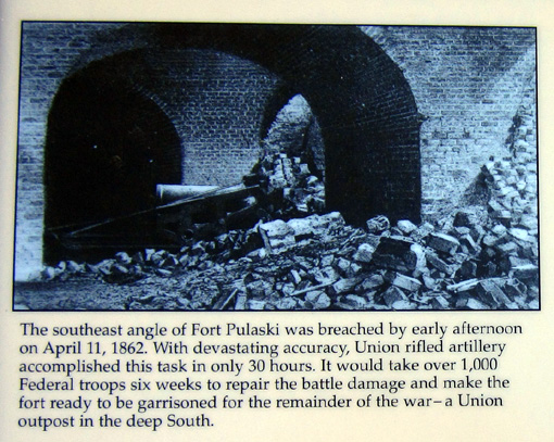
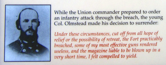
Impressed by the hopelessness of the situation and concerned about the
lives of his men, Commander Col. Charles Olmstead surrendered only 30
hours after the bombardment began.
Above and below: photos and text from an
interpretive panel at the fort
Federal troops garrisoned Fort Pulaski until the end of the war and used
it to house Confederate prisoners.
The fort was unoccupied from the end of the Civil War until it became a
national monument in 1924 and was subsequently restored by the Civilian
Conservation Corps during the 1930s.
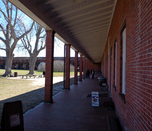
VISITING THE FORT
Last Friday
we drove to Fort Pulaski east of downtown Savannah, crossing several rivers to
reach McQueens and Cockspur Islands. Since the fort and surrounding property is
a national monument we got in free with our National Park Service senior passes.
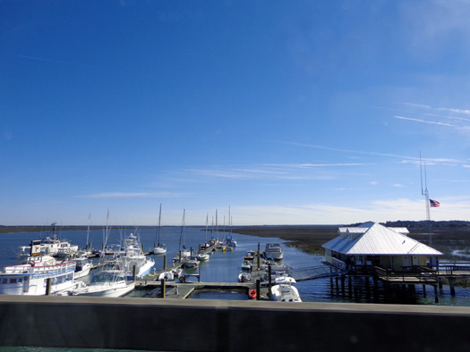
Marina along the drive to Cockspur Island
We listened to a video about the history of the fort in the visitor
center first, then toured the exterior and interior of the fort on our own.
THE
DEMILUNE
There's a new word for you! We've toured several forts but haven't run
into that term before.
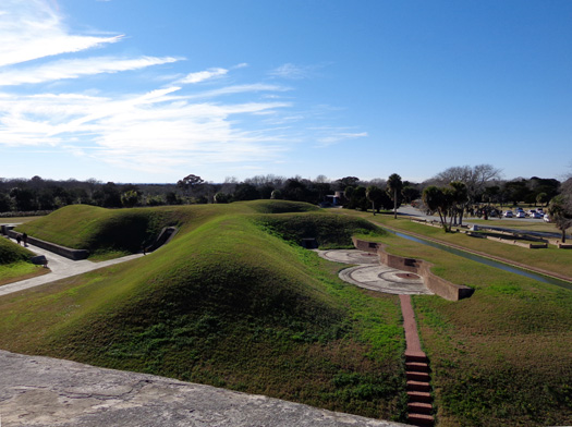
A paved path leads from the visitor center to the triangular patch of
land designed to protect the rear of the fort, which held the entrance,
from an invasion. Called the demilune, it was surrounded by a
seven-foot deep, 32-to 48-foot wide moat on all three sides:
During the Civil War the demilune was flat, with a
surrounding parapet. It held outbuildings and various storage sheds.
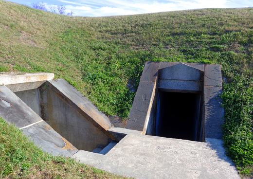
The large earthen mounds seen above and below were built after the war.
They cover four powder magazines and passageways to several gun
emplacements. It's literally and figuratively cool to walk through the
underground maze.
View looking down to the demilune from the upper
level of the fort
We crossed the moat on a small drawbridge to the demilune:
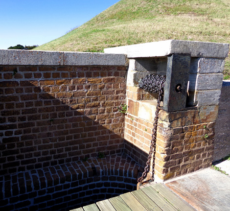
Chain that operates the small drawbridge
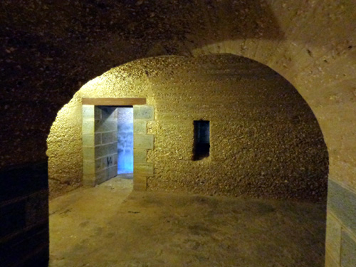
Above and below: under the mounds
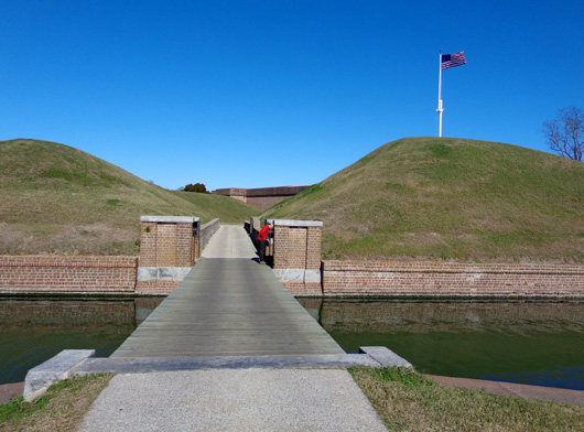
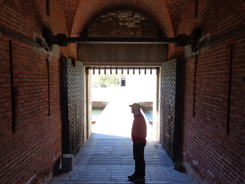
DRAWBRIDGE & GROUND LEVEL OF THE FORT
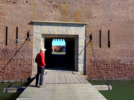
The main drawbridge entry, positioned on the west (rear) wall, was designed
to be part of the fort's defense.
As the drawbridge is raised, a strong wooden grill drops through the
granite lintel overhead. Bolt-studded doors are closed behind that. An
inclined granite walk leads between two rows of rifle slits, past
another set of doors, and into the fort.
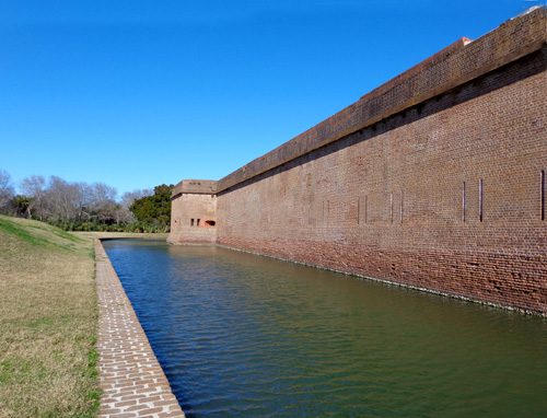
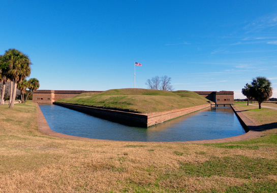
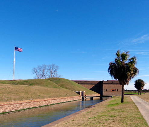
The wide moat also surrounds the five-sided fort.
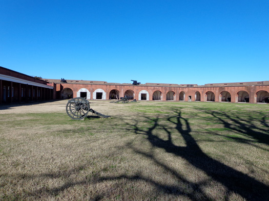
The large grassy area inside the five-sided fort is called the "parade:"
The long west wall at the rear of the fort is called the "gorge wall."
It contains the sally port (fort entrance shown above), officers' quarters, and
other rooms.
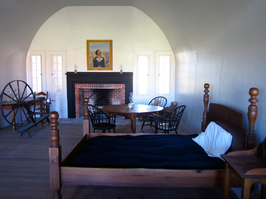
Some of the rooms have been furnished as they were during the Civil War,
such as the commanding officer's quarters:
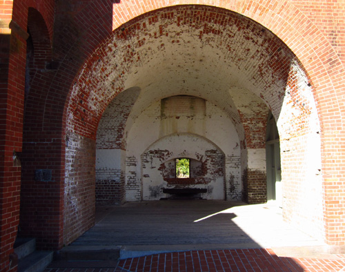
We made a clockwise circuit of the lower level, which is
characterized by thick walls and many structural arches:
While occupied by Confederate troops the northwest corner contained
40,000 pounds of gunpowder. The Union forces knew that and planned to
blow it up:
Even though the walls of this magazine were 12-15 feet thick, Col.
Olmstead knew that once the southwest wall was breached it would be
fairly easy for the Union army to blow up the magazine. To avoid carnage
to his men, he surrendered.
Continued on the next page . . .
Happy trails,
Sue
"Runtrails & Company" - Sue Norwood, Jim O'Neil,
Cody the ultra Lab, and Casey-pup
Previous
Next
© 2013 Sue Norwood and Jim O'Neil