Continued from the previous page.
THE RACE: SATURDAY, AUGUST
10, 2013
Ah, race day. At
least it didn't start at 0430 like the LT100 foot race we used to run.
It was cold, about
36 degrees. I had gloves with hand warmers, stretch pants over bike
shorts, long sleeved shirt, and a jacket.
Because of all the
volunteering I had done, the volunteer coordinator moved me up to the
"orange" corral. This was one corral up from all the first timers.
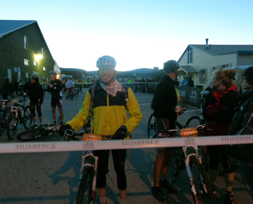
This was a little
intimidating for me but because I had been out there training on the
course all summer, I felt I would do okay. Since I was up one corral, I
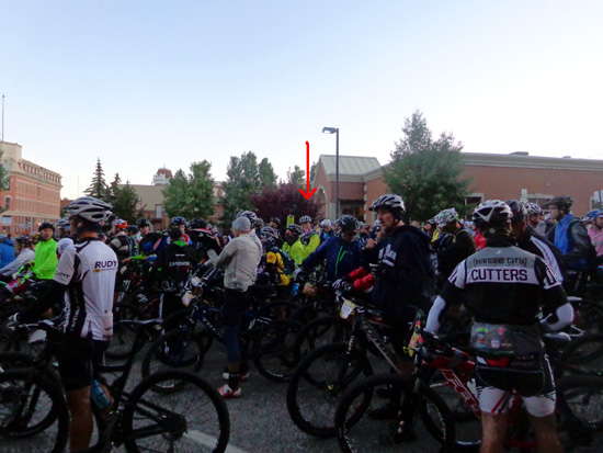
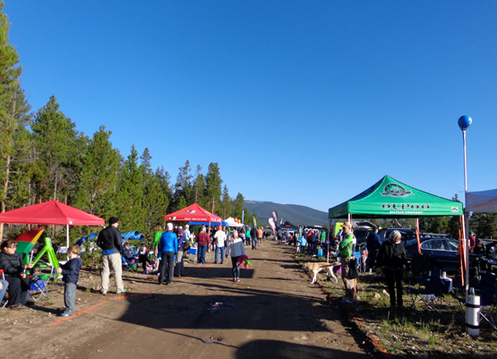
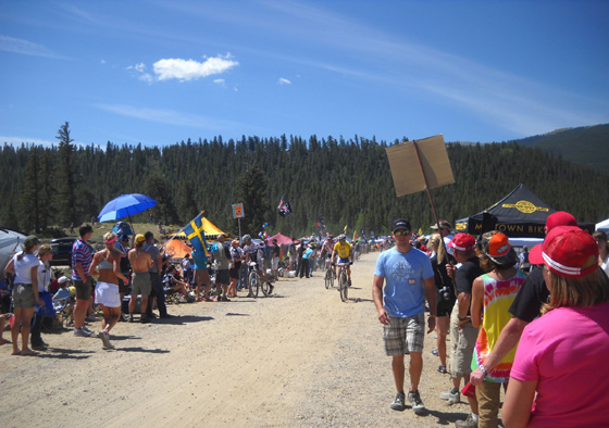
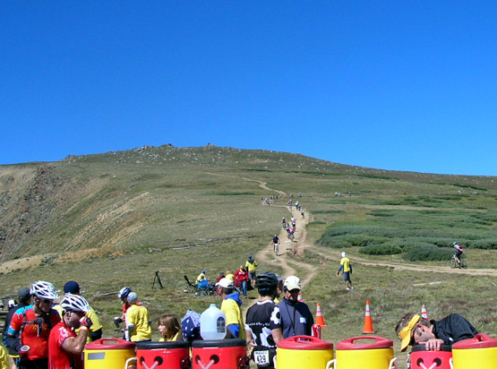
felt like I might have a shot at finishing. I got in line really early
so I'd be in the front of that group (photo above). My corral and the
one directly in front of me soon filled up:
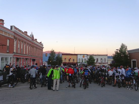
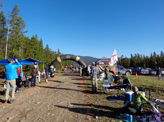
Looking toward
Harrison Ave.; the start line is about three blocks away on 6th St.
The sun is just starting to light up Mt. Massive in
the distance.
Sue took pictures and gave me encouragement while I waited for the starting
gun. At the last minute I gave her my long pants but kept the jacket on
until Twin Lakes, 40+ miles into the race.
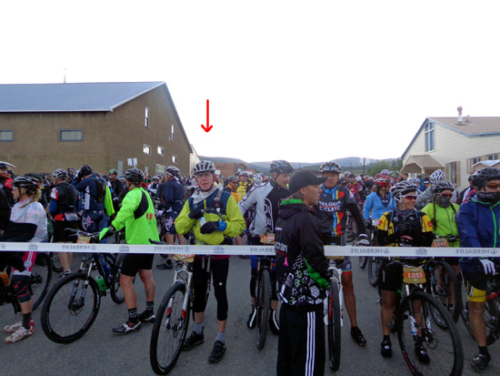
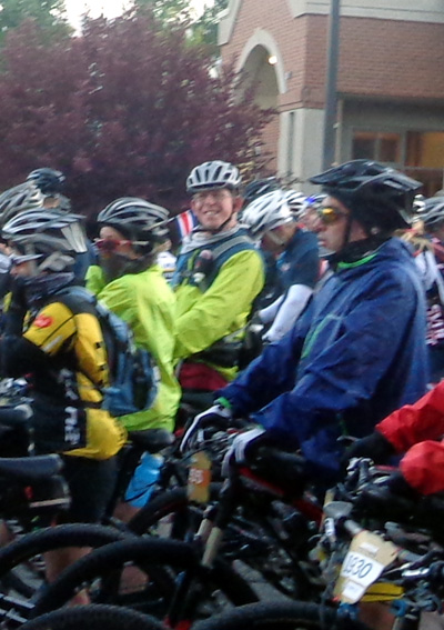
When the riders in my corral were allowed to slowly move up to the
last riders in the corral ahead of us, crews were ushered outside the
ropes. Sue gave me a big kiss and took a couple more photos
from the side. We were more crowded then:
Sue left a few minutes before the start so she
could drive back to our camper and walk to the nearby intersection of 6th St.
and McWethy Rd., where riders make their first big turn 6/10ths of a
mile into the race. She was able to see me better there than she could
have at the starting line.
I heard the shotgun
at 0630 and slowly inched toward the starting line at 6th and Harrison
with the other riders in my corral. That took over a minute.
As riders in front
slowed or were forced to stop they would shout a warning, "stopping"
or
"slowing." I'd never heard or been warned about that. It was very
crowded going up 6th Street towards our camper, only inches between
handle bars and the tires in front.
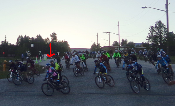
Me, rounding
the curve as carefully as possible (8-10-13)
I don't know how
many times I've stood at that corner and watched as the hoard of bikes
came roaring past. Now I was right in the middle of it. I feared I would
crash right there, but I didn't.
[Sue's note:
We've been in Leadville for the 100-mile run about a dozen times. The bike
race is one week earlier. Since our
RV was parked so close to this turn, we'd go out and watch the bikes
come whizzing by on race morning, then skedaddle to whatever aid station
we were working that year.]
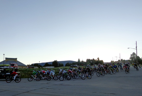
Front group of
this year's riders (8-10-13)
Since the course was
now downhill with a light breeze on CR 9, I was very cold. Because of the close
proximity of other riders, none of us could really generate any heat by
peddling. My eyes were watering, my hands and feet were numb, and I was
shivering.
Here's another version of the out-and-back race course, which
starts and ends in Leadville and turns around at Columbine Mine:
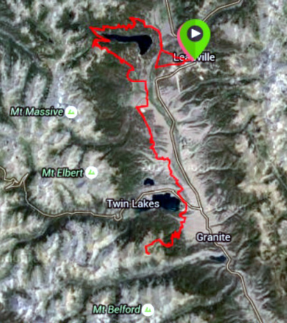
Courtesy of
Google Maps
We got to the dirt
road (CR 9A) and again "slowing." Finally the St. Kevin's climb.
Again "slowing" and "stopping."
I got the impression
that many of my fellow riders had
never been on this course before. It didn't seem fair that I was stuck
back there with all those new and inexperienced people. After all, I had
been training on this course for two months; some of them had
just arrived yesterday.
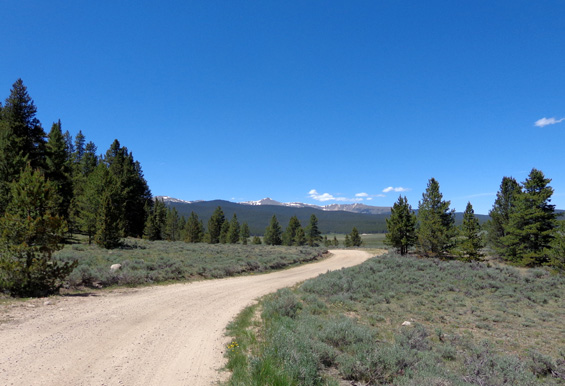
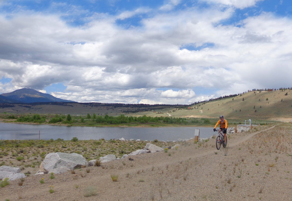
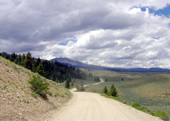
CR 9 looked
much different with dozens of other riders around me on race day.
(6-26-13)
When I finally made
it to the top it seemed to open up a lot. Merilee (former LT100 co-race
director) was at the famous Green Gate Corner directing us to SLOW DOWN
for the upcoming turn. It was a fast ride to the bottom and the Carter
Summit Aid Station and the paved road.
I zipped right
through, thinking I'll need this station when I get back but not at the
moment. Now all I had to do was ride for awhile.
I remember hearing
that I need to make good time on this paved section, to push hard and keep my
heart rate at 144 bpm. I was on pace here and got to Hagerman Road
without incident. The county had plowed this road
in the week before race day and we thought that was stupid. By race day it was okay,
though.
Hagerman Rd.,
nine years ago while I was training with Cody and Tater for the LT100
run. (Aug., 2004)
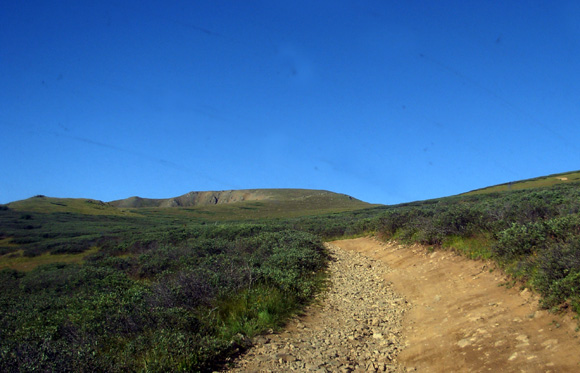
After making a left
turn onto the rough Jeep road about a mile later, I climbed to the top of Sugarloaf Mountain
non-stop with no issues.
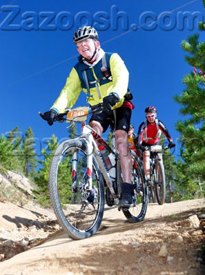
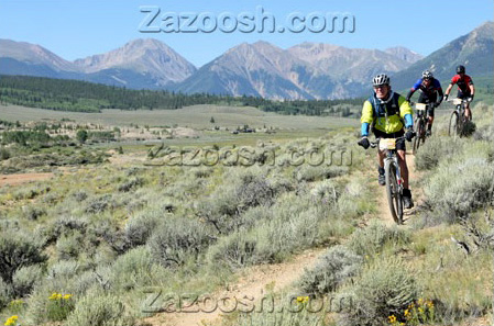
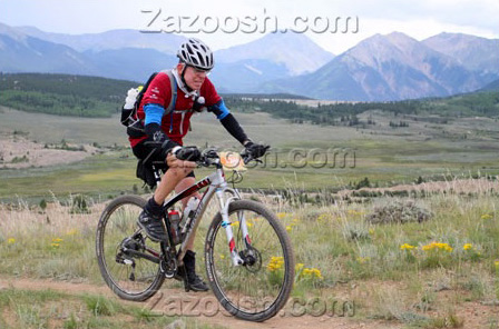
One of the official race photographers from Zazoosh took this photo of me on that
more narrow road:

I took a minor
fall in one of the ditches before starting the descent on Powerline, but
it wasn't a big deal.
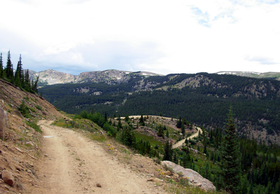
Jeep road
up Sugarloaf Mtn. (7-26-07)
Descent on Powerline (official race photo)
I took the Powerline
descent a little slower than on previous training rides. I probably rode
this part of the course ten times in training the last two months.
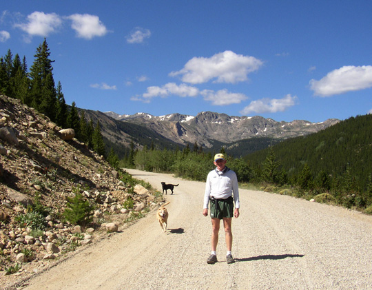
Reaching the creek
at the bottom . . .
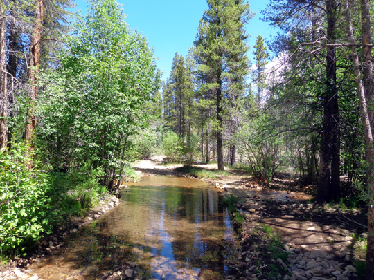
(photo taken during one of Jim's training rides in
July)
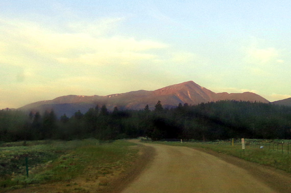
Half Moon Rd. before the turn to Pipeline AS; Mt.
Elbert glows pink in early morning sun. (7-11-13)
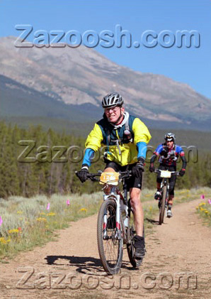
Dirt track before Pipeline AS (official race
photo)
I pushed hard
through Fish Hatchery and on to Pipeline. Sue was there with drinks and
food.
I didn't expect Sue
to be at any of the aid stations. She dreaded the crowds and hysteria at
Twin Lakes where she volunteered a couple years ago. The Pipeline Aid
Station was a little better organized, much less crowded, and it turned out to be a
manageable experience for her.
Above and
below: crew members getting set up before the first riders come
roaring through. (8-10-13)
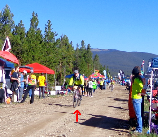
Here I come!
I've done about 26 miles so far. (8-10-13)
The Forest Service
had also plowed the Pipeline Road section of the road a couple of weeks before
the race but it was fine by race day.
We hadn't talked
much, but I was still close to Chris at this point. I really didn't talk
to anyone on the course. That's one of the differences in cycling and
running this race.
I made it down "Oh
Shit Hill" without crashing and took the single track slowly.
Single track
before Twin Lakes (official race photo)
On to Twin Lakes Aid
Station and the eventual climb to Columbine.
Crossing the
dam at Twin Lakes during one of my training rides (7-14-13)
Scene from Twin
Lakes AS in 2011; it's the most crowded aid station during the race.
We don't have
very many photos of the narrow Jeep track to Columbine. It's rougher and steeper than this
picture
illustrates. Sue took it in
2007 on our way up to volunteer at the aid station. There is a lot of
2-way bike traffic on
this "road" during the race since Columbine Mine is the turnaround
point.
The Columbine climb
was tough but I got to the top pretty much on schedule.
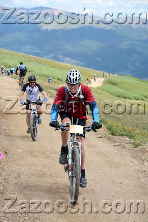
The official race
photos all show me riding up, not walking. You can see my determination
-- and riders going both up and down the mountain -- in
this shot:
I said "Hi" and
joked with the Aid Station captain at Columbine, grabbed something to drink, and left
quickly.
I've worked this aid
station many times. This time I was on the other side of the table.
Weird!
Volunteers' view
of riders coming down to Columbine Mine AS after their long
uphill climb;
racers turn
around here and have to ride back uphill before the long descent
(8-14-10)
I passed and said
"Hi" to another friend still on her way up. It took me an unnecessarily
long time to get to the bottom. I was really afraid of crashing on the
way down and I lost a lot of time there.
I pulled into Twin
Lakes Aid Station and ate a few watermelon chunks.
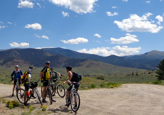
With several
folks in my training group after a ride that ended at
the location of
the Twin Lakes AS (I'm on the far L). (7-20-13)
A section of
dirt road after Twin Lakes on the return (7-14-13)
Back on the single track between Twin Lakes and
Pipeline (official race photo)
On to the Pipeline
Aid Station . . .
Continued on the
next page: my worst bike crash, an official finish, and post-race thoughts
Happy trails,
Sue
"Runtrails & Company" - Sue Norwood, Jim O'Neil,
Cody the ultra Lab, and Casey-pup
Previous
Next
© 2013 Sue Norwood and Jim O'Neil