This is a continuation of the
previous entry.
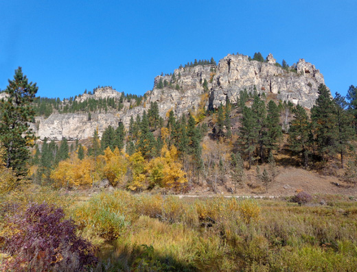
In summary, this morning we drove to Spearfish
so Jim could ride his bike out and back on the Spearfish Canyon Scenic
Byway, a winding road following Spearfish Creek upstream through
interesting limestone and sandstone cliffs for thirteen miles to the
town of Savoy.
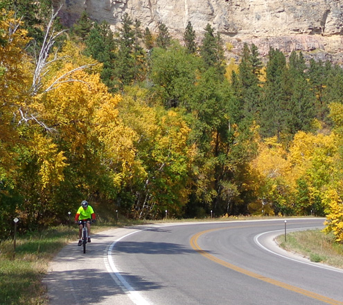
I crewed for him along the road in our truck in
case the traffic was too heavy or he decided he wasn't having any fun.
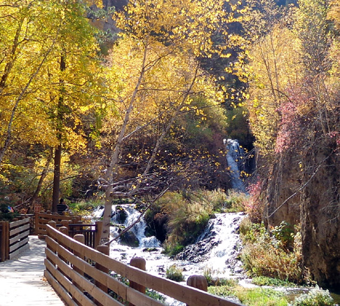
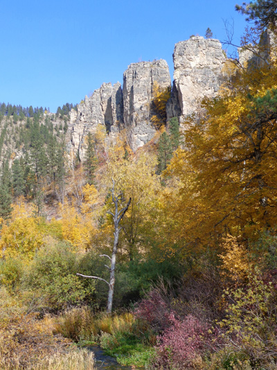
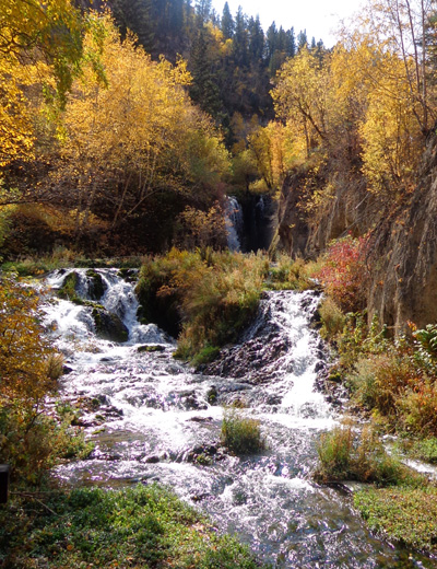
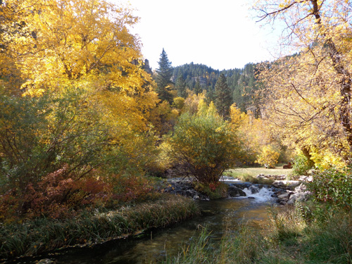
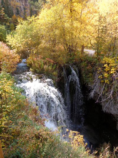
Jim did have fun and continued on another
mile past Savoy to Roughlock Falls, which I think are the most impressive
of three sets of falls along Spearfish and Little Spearfish Creeks. Then he
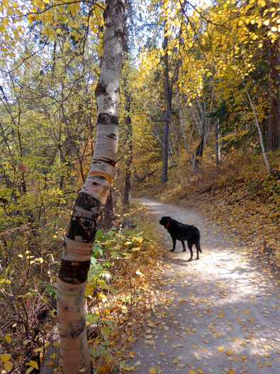
rode back to the town of Spearfish while I hiked to the falls with Cody.
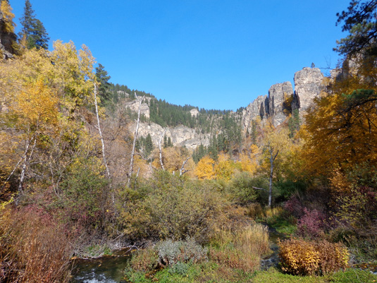
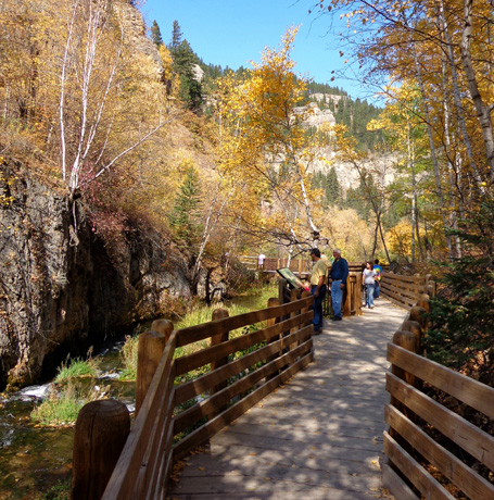
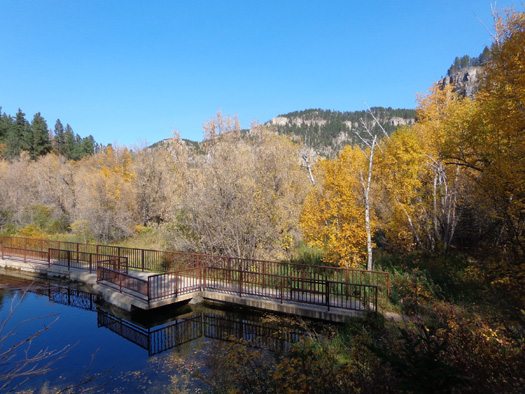
When I reached Savoy I parked the truck at the trailhead for Roughlock
Falls Trail. The trail leads through scenic forested hills above Little
Spearfish Creek to a two-tiered set of waterfalls with boardwalks at the
upper and lower levels and a moderately steep dirt trail connecting the two levels.
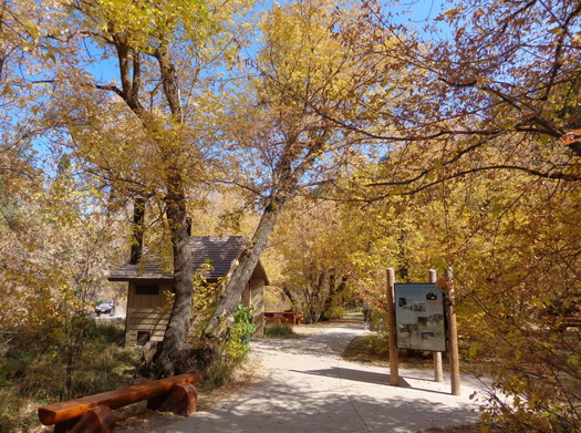
The Roughlock Falls
Nature Area is run by the South Dakota State Game, Fish, & Parks
Department. Entry is free to the
Roughlock Falls Nature Trail, the falls themselves, picnic areas,
restrooms, and the dam close to the parking area in Savoy.
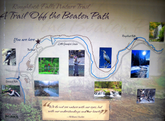
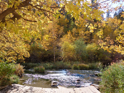
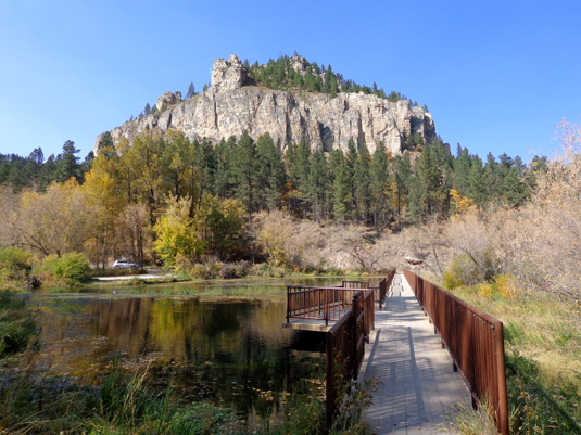
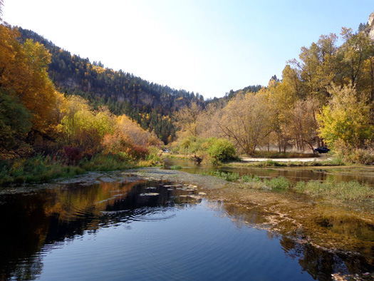
The trail follows
fairly close to the creek on one side. Narrow dirt Forest Service Road
#22 runs along the other side to -- and beyond -- the upper falls area.
Here's a diagram of the trail, creek, and dirt road from a sign at the
trailhead:
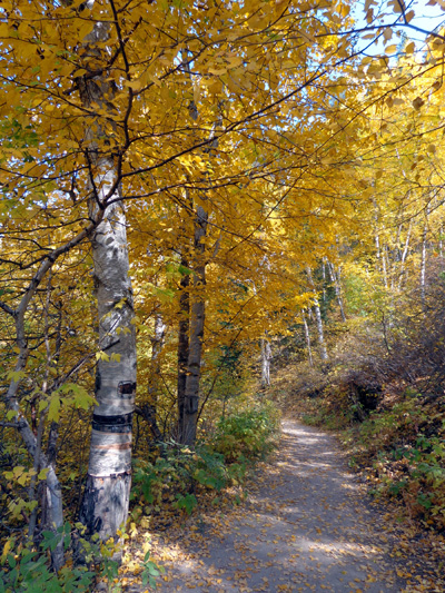
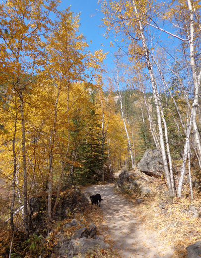
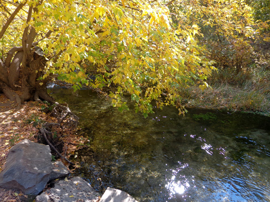
Last year I enjoyed the one-mile hike out and back to the falls on
undulating single-track dirt trail along the creek so Cody and I did it
again today.
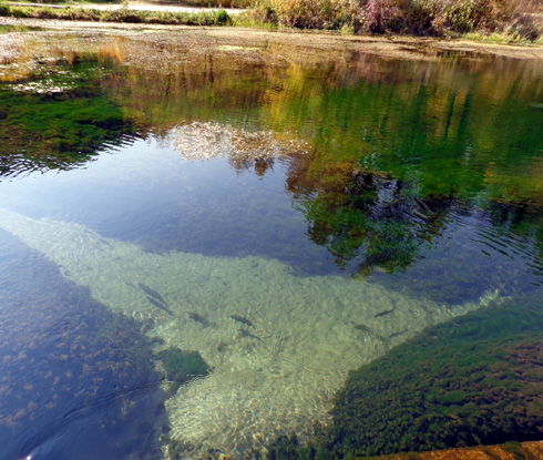
Even though the water is cold all year Cody thought it was perfect for
drinking and wading.
It was even prettier this time with all the yellow and gold leaf colors.
I think you'll agree if you compare the photos in this entry with the ones I took in June of
2011
when everything was green.
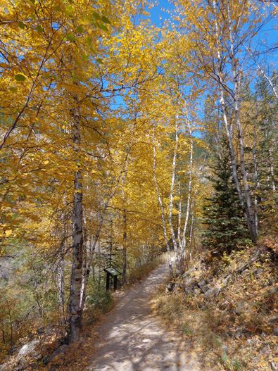
There are several
nature and geology interpretive signs along the trail.
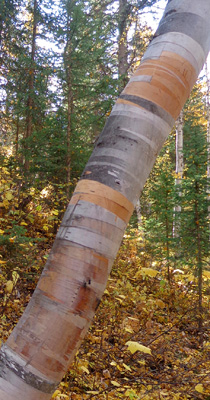
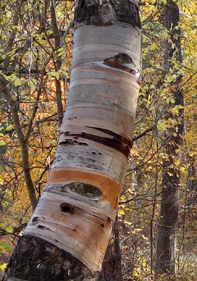
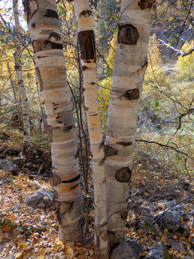
I love all the interesting paper bark birch tree trunks along the trail:
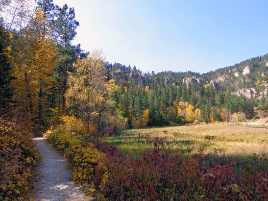
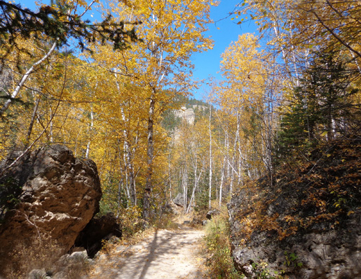
There are occasional glimpses of the canyon walls from the trail and
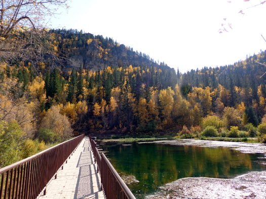
from the bridge across the creek near the bottom of the falls:
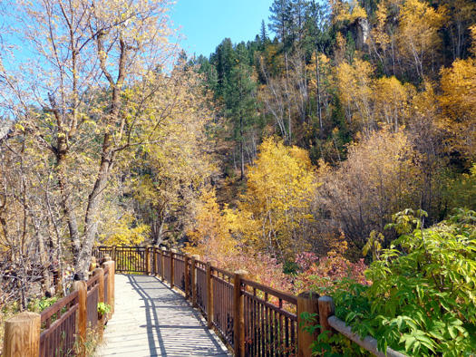
The trail morphs into a boardwalk next to the creek about 200 feet
from the base of the lower falls.
Visitors can follow the walkway shown below to get closer to the falls
and/or cross the creek and walk up a rather steep hill to the upper
falls:
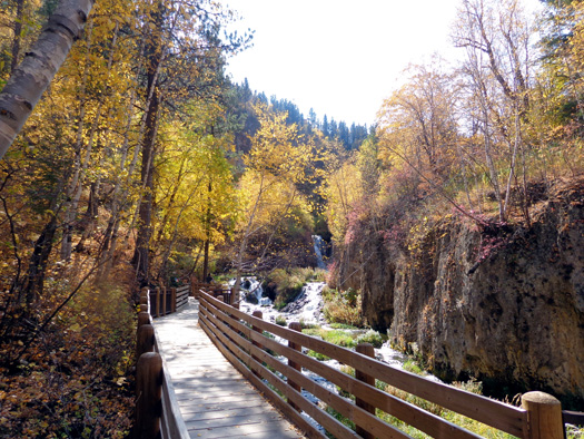
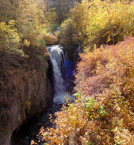
There is a closer view of the falls from this photo
near the top of this entry.
Last year I didn’t take the time to hike or drive to the upper part of
the falls.
This time I walked up there and explored the picnic area, upper creek,
and top of the upper falls. I'm glad I did because it's very scenic and
interesting:
There are two boardwalks in the trees with decks overlooking the upper
falls on either side of the creek:
The blue dots are from shooting into the sun.
I prefer the views from the boardwalk at the bottom of the falls but it
was good to have the upper perspective, too.
Just about anyone
can negotiate the Roughlock Falls Trail and the flat trails and boardwalks at the top of the falls. There
is a rather steep dirt trail and steps down to the lower level, rendering it
unsuitable for some folks to descend and/or ascend.
If
you're athletic enough I recommend hiking the Roughlock Falls Trail at least one
way and seeing both levels of the falls at the end of the trail.
I walked back down to
the bridge across the creek below the lower falls and hiked another mile back to the truck on
Roughlock Falls Trail. I took a short detour and crossed the small dam a
little ways from the trailhead parking area:
There were quite a few people at Roughlock Falls today, as well as on the
scenic byway.
I knew the Spearfish Canyon area would be crowded on the weekend; I wasn’t expecting so
many folks out there on a Monday. This is the annual buffalo roundup day at
Custer State Park farther south in the Black Hills.
Obviously everyone wasn’t down there -- although it felt like it
when I attended the roundup last fall.
Next entry: Jim's 40-mile bike ride in the Black Hills
(Mickelson Trail, Stockade Lake, road through Custer State Park)
Happy trails,
Sue
"Runtrails & Company" - Sue Norwood, Jim O'Neil,
and Cody the ultra Lab
Previous
Next
© 2012 Sue Norwood and Jim O'Neil
