Continued from the previous page.
I SPY
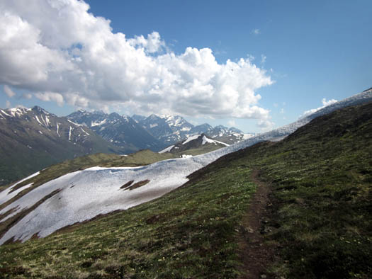
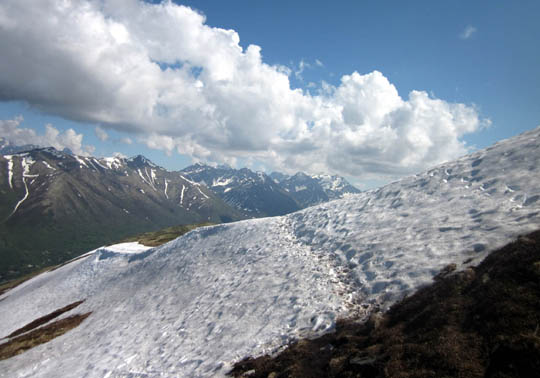
While on the summit
of Rendezvous Peak I noted some
buildings on the ridge to the northwest. With such expansive views, and
situated directly above Joint Base Elmendorf-Richardson (JBER), I
thought it might be an active military site.
I wasn't too far off. Another
hiker told me it's an old Nike missile site.
Subsequent research verified that this radar site was used for surveillance during the Cold
War with the USSR. I would think it could still be used for surveillance
and/or anti-missile purposes. It has great views of Cook Inlet but the
immediate vicinity is off-limits to hikers:
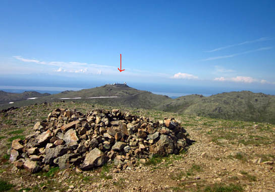
Above and below: Here's lookin' at ya, kid!
Mount Gordon Lyon is about a mile to the NE on the
same ridge.
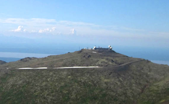
The views to the
north end of Cook Inlet, Knik Arm, and Eagle River are similar on that
ridge closer to Mount Gordon Lyon, which is open to hiking (i.e.,
to the right in those photos). I'd
like to go up there another time.
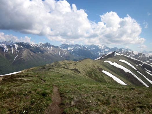
Cody and I took another short break at the summit of Rendezvous Peak before
descending to the second saddle.
I took these two
pictures going down:
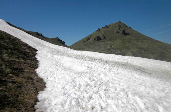
View south to Rendezvous Ridge
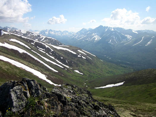
View more to the west, toward Little Teton
Peak; it's about 100 feet higher than Rendezvous.
I was facing Rendezvous Ridge to the
south as I came down, noting the trail that follows the ridge.
Hmmm . . . I sure would like to see the views on the other side of Little
Teton Peak! I could go up that peak or stay a little lower on the ridge.
Decisions, decisions. I chose the ridge.
RENDEZVOUS RIDGE
The ridge was very tempting but I was running out of time and water for
Cody and me so I wasn't able to hike that direction very far this afternoon.
Back down at the saddle I went south on the Rendezvous
Ridge Trail for about ˝ mile so I could see down into the valley on the
other side of Little Teton.
One group of hikers was coming back toward me. Another group was continuing
farther south ahead of me.
I had to cross a slick, rather dangerous section of snow on the east
side of Little Teton going out and coming back.
Fortunately, neither Cody nor I slid down the steep embankment on the
near side of the snow bank. It
wouldn’t have killed either of us but it could have been hazardous to slide
down it unexpectedly. It’s not a place I’d choose to butt-slide, either
-- just too steep and long to arrest a slide easily:
It doesn't look as precipitous in the pictures as
it did in person . . .
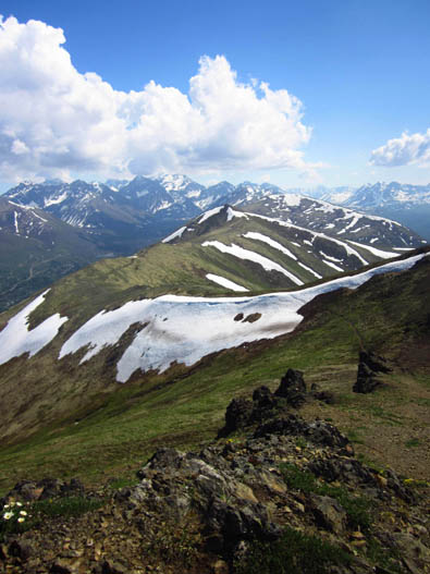
The ridge is
beautiful, with magnificent views all around -- the Chugach Range to the
east and south, the homes and roads down in the South Fork Valley,
several glacial-blue lakes in the watershed above the South Fork of the
Eagle River, the valley below me to the west, as well as the Anchorage
Bowl and Cook Inlet.
Trail going south along the ridge; South Fork of
Eagle River to left, Anchorage to right
My first view of the valley on the right
Gotta go farther on
that ridge next time! I hated to turn around.
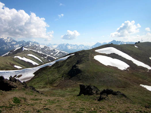
Heading back toward Rendezvous Peak (background);
this side of the snow bank
isn't as steep as it is closer to Rendezvous.
Little Teton Peak is on the left.
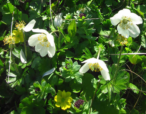
These pretty alpine flowers, and others, were growing near that snow
bank on the ridge:
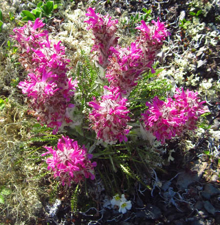
I think this is Whorled Lousewort but I wouldn't
put money on it.
As delicate as these plants look, they are exceptionally hardy to be able to
withstand the harsh winter weather at this latitude, this elevation, and so close to an
ocean. These hillsides reportedly get some vicious winds and deep snows.
A QUICKER DESCENT THAN ORIGINALLY PLANNED
After talking with the three female hikers my intent was to return the
long way to the parking area but take the more gradual alternate trail
to the first saddle instead of the steep pitch I used on the ascent.
However, I changed my
mind when I got back to the second saddle between Little Teton and Rendezvous.
I eye-balled the snowy descent to the southwest between the
shoulders of the two mountains and decided to go that way. I could see
our truck down in the parking lot (thin red arrow below) and figured it'd be a whole lot faster
making a straight shot down:
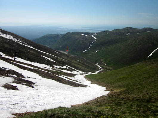
Rendezvous is on the right of this drainage area, Little Teton on the
left.
Never mind that steep descents are harder on my knees . . .
that trail is much
steeper than the main trail, dropping about 1,300 feet in only 2/3 of a
mile.
Did I say "trail?" When the snow is melted, there is a trail you
can follow.
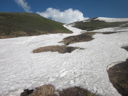
With all the current snow, however, the trail on the Little Teton slope ran in and out of
the snow all the way down to its intersection with the main trail. I
figured it'd be just as easy to stay on the snow as much as possible if it would support me.
It's a drainage and I didn't know if there was much water running underneath.
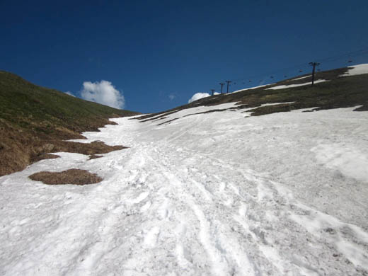
Looking back up the gully full of snow; a ski lift
is on the right on Little Teton.
The trail is between the ski lift and the drainage V, mostly
under snow today.
I didn't have any problems going down through the snow. It was firm and deep enough that I never fell through it
when walking and deliberately sliding standing up, or several times when I butt-slid
a couple hundred feet at a time. I didn’t want to slide sitting down the whole way for fear of losing
control.
The snow pack got thinner as I descended toward the main trail and I
could see water running down to Toklat Creek. At that point I had to
remain upright and walk through soft snow or marshy, brown grass:
Sliding down that slope was great
fun because it wasn’t so steep that I ever lost control. I could stop
when I wanted to stop. The only problem was using my one free hand
to help control the slide -- it was numb
from the snow when I reached the intersection with the main trail. The
day was so warm I didn't carry gloves with me.
I rejoined the
main trail where the trail on Little Teton ends and continued down about
half a mile to the parking area.
FINAL THOUGHTS
Cody had a great time today, too, with all the snow to play in.
He had fairly easy
access to water
in the larger creek along the main trail around Rendezvous for about 2/3
mile and near the bottom of the snow chute on Little Teton where we came
down. From about 3,000 feet and above there was snow but no water for him.
Keep that in mind if you're hiking with a dog (I saw a bunch today),
especially later in the summer or fall when it's drier. I was
carrying enough water in my Camelbak for both Cody and me for two hours
but couldn't go much longer.
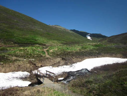
Cody got water from Toklat Creek near the beginning
of our hike. This side trail parallels
the main trail on the other side of the creek at
least half of the way up to the first saddle.
My total distance was about four miles.
Total time = about 2:20 hours. Total ascent/descent = 1,745
feet each.
When I downloaded the track and elevation profile Jim pointed to a
vertical line and asked me if I fell over a cliff. No -- I forgot to turn the GPS back on for a couple
minutes after one of my breaks!
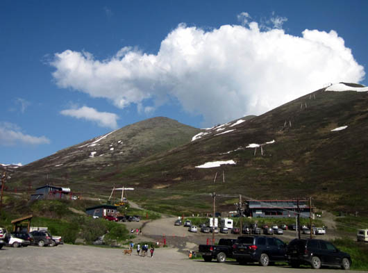
It was busier at the
trailhead when I got back, with some sort of private event in the lodge:
On the way back down Arctic Valley Road I pulled off at an overlook with
good views of the city, Cook Inlet, and the Chugach Range:
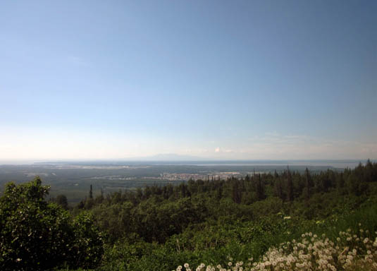
View down to JBER, the city, and Cook Inlet (those
are dandelion puffs in the foreground)
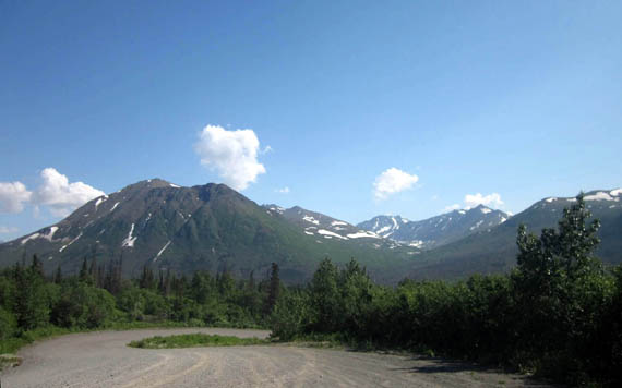
More Chugach Mountains from Arctic Valley Road
This would be a good road to cycle up and/or down on a day when there
isn't a lot of vehicle traffic on it (because of dust).
I enjoyed this hike and am more likely to do it again than Flattop if we
return here at the end of July. (We're already making plans to come back
after touring the Kenai Peninsula.) I like having all the various
options of where to go from the first and second saddles.
In addition, there are
fewer people on these trails and I think the views are even better than
those on Flattop. But don't tell anyone
else or it might get as crowded as Flattop! < wink >
There are more wildflowers, too:
A variety of pretty wildflowers along the steep
trail between the two saddles
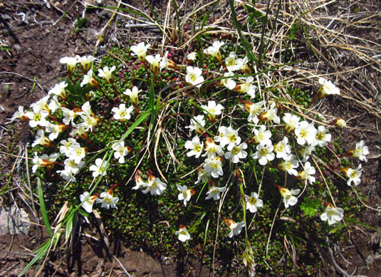
This pretty clump of flowers just below the first
saddle recently emerged after the snow melted.
Meanwhile, I’d like to find some other
trails in the Chugach Range if I go back out again for a longer hike
next week. So many trails, so little time . . .
Next entry: a summary of some other activities in
Anchorage the next few days
Happy trails,
Sue
"Runtrails & Company" - Sue Norwood, Jim O'Neil,
and Cody the ultra Lab
Previous
Next
© 2012 Sue Norwood and Jim O'Neil
