|
2012 HIKING, CYCLING, & RV TRAVEL ADVENTURES
| ||

|
Runtrails' Web Journal
WEDNESDAY, JUNE 13 TUESDAY
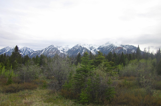
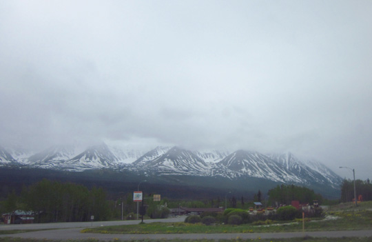
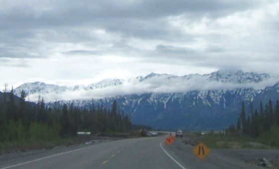
AFTERNOON: WHITEHORSE TO KLUANE LAKE We left Whitehorse at 1 PM and began one of the most scenic
sections of the Alaska Highway. Too bad we couldn't see all of it! By then the sky was more
cloudy, partially obscuring views to the top of the mighty Kluane
Icefield Range and the St. Elias Range,
home to Canada's highest peaks -- Mt. Logan (19,545 feet), Mt.
St. Elias (18,008 feet), Mt. Lucania (17,147 feet), King Peak (16,971
feet), Mt. Steele (16,664 feet), and other peaks above 15,000 feet.
Most of those peaks aren't visible from the Alaska Hwy. even on a
sunny day. The rugged snow-capped mountains we could see in this
section are in the 8,000-foot range and they were beautiful despite the
clouds yesterday. Hopefully we'll have sunnier weather when we come back this way in
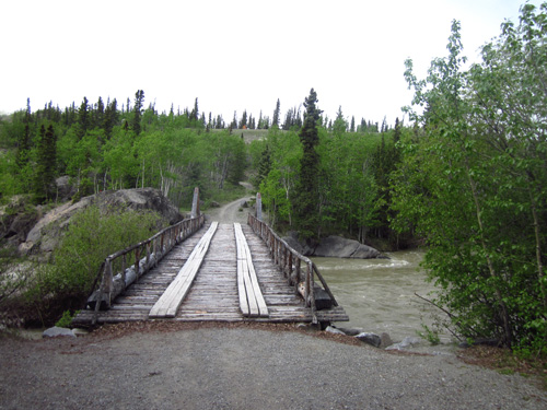
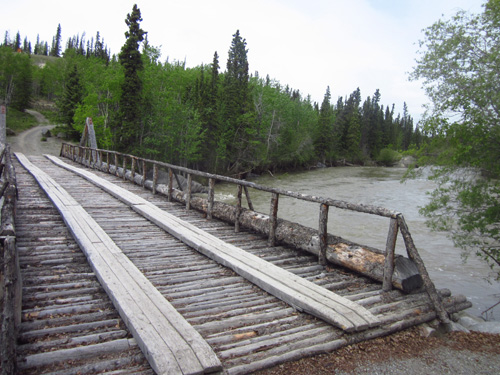
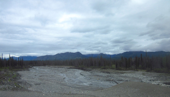
the fall. CANYON CREEK #2 At Km 1547 we came to another Canyon Creek and stopped at the rest
area on the east side of it to read about the historic bridge that was
built in 1904 during a nearby gold strike. One of the great things about The Milepost book is the heads-up it gives for things to see along the Alaska Hwy. We were ready for a
break when we got to this area near Kluane (kloo-WAH-nee) Lake and the book's
description of a large turnout lured us in.
Above and below: not safe
for heavy vehicles but fun to walk over
The original bridge has been rebuilt several times since it was
replaced by a sturdier bridge a few hundred feet downstream during
construction of the Alaska Hwy. Although it doesn't look much like the
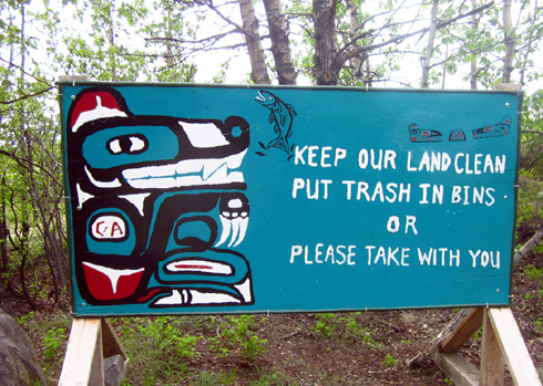
original it does look old and it offers scenic views of the creek. I liked this sign nearby:
One thing I've noticed about rural Canada is how clean most of it is
-- except in urban areas. A few miles past this creek we came to Haines Junction, a town of
about 900 people. We continued north and west on the Alaska Highway (YT
1) toward Kluane Lake. The Haines Hwy. (YT 3) goes south to Haines,
Alaska, which we might visit on the way back in the fall. Haines is
across a bay from Skagway, AK, which is also reached by road through the
Yukon and British Columbia. Haines Jct. is on the northeastern boundary of Kluane National Park.
Because of the chilly, damp weather we didn't stop at the park visitor
center in town. We'll save a visit to the park for our return trip.
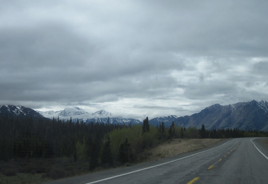
About fifteen miles west of Haines Jct. we hit the literal high spot
on the section of the Alaska Highway between Whitehorse, YT and
Fairbanks, AK -- Bear Creek Summit (elev. 3,294 feet). It still fascinates me that we are at such low elevations yet feel
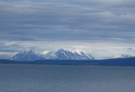
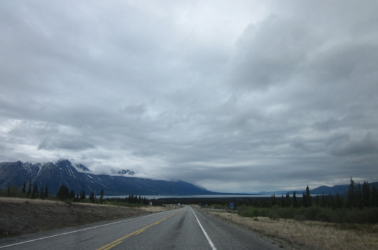
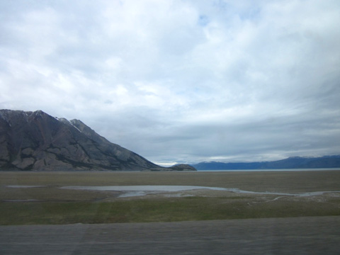
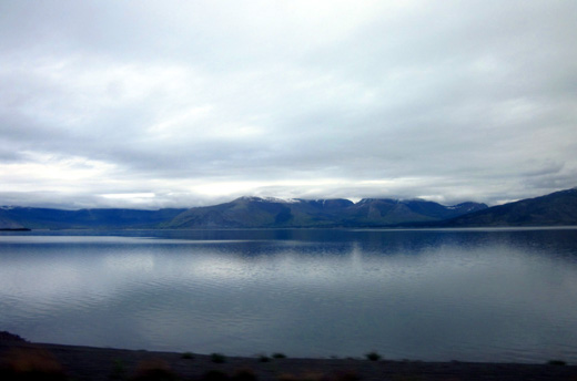
like we are high up in the Colorado Rockies. BEAUTIFUL KLUANE LAKE We've been looking forward to seeing Kluane Lake, the largest lake in
the Yukon -- and it has a bunch of lakes! This one is very
special.
It covers about 154 square miles and is fed by streams coming down
from the older Ruby Range to the north and younger Kluane Range to the
south. Because there are glaciers in those mountains the water in the
lake has a glacial blue tint. On an overcast day, however, it didn't
look nearly as deep turquoise-blue as British Columbia's Muncho Lake did on a
sunny day last week. At the south end of the lake we stopped at a viewpoint to read
several interpretive panels about the cultural and natural history of
the area.
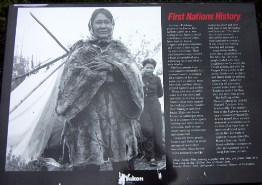
First Nations people have hunted, trapped, fished, and gathered plants
and berries in this area for thousands of years.
Their lives changed dramatically after two more recent events --
the gold rush in the early 1900s and the construction of the Alaska Hwy.
in 1942. Despite the changes, traditional activities continue to play an
important role in local Tutchone culture.
We also enjoyed reading about the role glaciers have played in the
formation of and changes to the lake though time.
One of the most interesting phenomena is the complete reversal of the
flow of water from the lake approximately 300-400 years ago.
Water used to flow from the south end of the lake to the Gulf of Alaska
and the Pacific Ocean. After one of the glaciers advanced across the
outlet and closed it, raising water levels by about 30 feet, the lake
began draining from the north end in a newly-carved channel. Since then
it has drained into the Yukon River System, which flows north into the
Bering Sea.
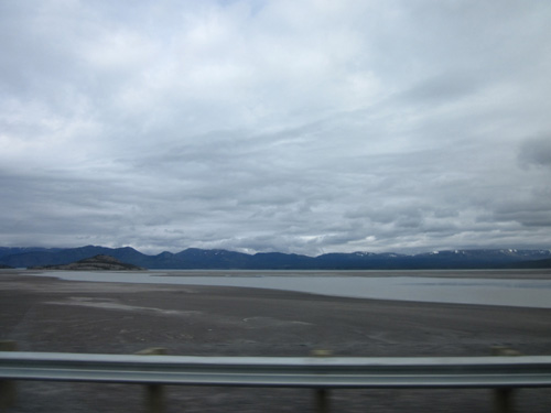
The lake has now receded by about 40 feet but the water continues to
flow out the north end. Looking across the lake you can still see where
the beaches used to be when the lake was higher.
Despite all the recent rain and snowmelt the south end of the lake looks
like it's at "low tide:"
The road winds around the south end
of the lake and hugs the northwestern shore between the Kluane Mountains
and the lake.
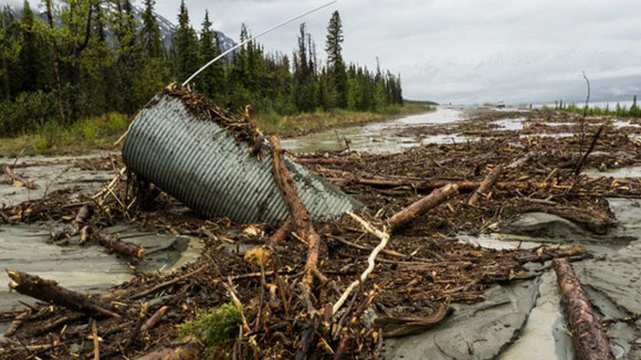
HIGHWAY REPAIRS AT KLUANE LAKE A couple miles after the wayside with that viewing point we came to the second-biggest problem that
occurred last week on the Alaska Highway -- mudslides and another
washout at the south end of Kluane Lake near Km 1639. This is the Kelly Wroot photo I showed in a previous entry from the CBC
article dated June 8:
Yesterday afternoon as we approached this damaged section of the
highway next to the lake, crews were still working on the road. No one
was coming the other way so we were waved on through.
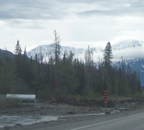
The culvert and debris were on
We could see bent parts of that metal culvert still lying in other debris off to the side of the road (not shown). A new, larger culvert
(above) appears
ready to be installed when permanent repairs are made. The temporary repair to this section between Haines Jct. and
Destruction Bay was reopened after just a couple of days. Only two
people were handling traffic when we passed through. I assume more will
be sent as soon as crews are available for a more permanent fix. Several miles later, after swinging around the south side of the
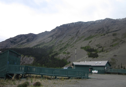
lake, we turned into the Tachal Dhal Visitor Centre at Km 1649. I had read the
information about the interpretive exhibits in Milepost but failed to
note that it closes at 4 PM. We arrived 15 minutes too late and found
the door locked:
Oh, well. We searched the rocky slopes on Tachal Dhal (formerly Sheep
Mountain, shown in the photo above) in the hopes of seeing some of the
female Dall sheep that live there in late spring with their lambs but we
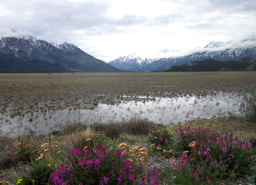
didn't see any. The view of Kluane peaks to the south is scenic, especially with a foreground of
bright dandelions, sweet vetch, and other wildflowers:
We looked for large turnouts along the lake where we might be able to
spend the night. We did see some that might have been suitable but decided to spend the night at the
government campground at Congdon Creek (Km 1666). It was an excellent choice for us. Continued in the next entry: the Congdon Creek Provincial Park
campground and photos from a hike along the lake shore
Happy trails,
Sue
© 2012 Sue Norwood and Jim O'Neil |
|||