TRAIL TO THE GLACIER'S EDGE, CONT.
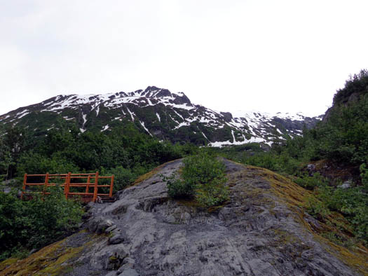
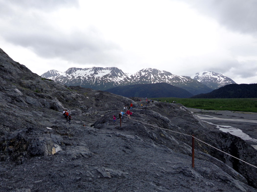
Soon the Edge trail got more rough as it passed through rocky terrain
that was more recently ground down by the advancing, then receding, glacier.
The trees, shrubs, and other plants here are not as mature as the forest
we'd been hiking through.
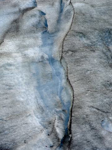
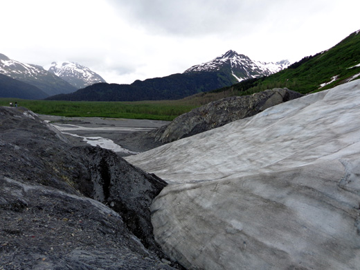
In the next two photos you can see marks gouged in the bedrock where
Exit Glacier scraped them years ago as it flowed slowly over the rocks:
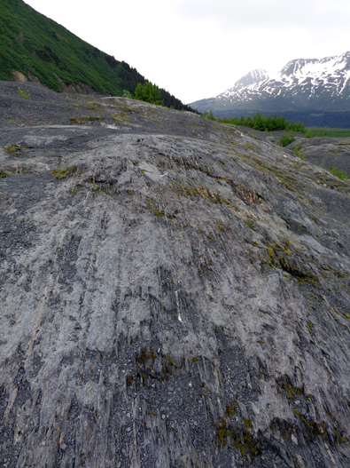
Glaciers don't just sit still. They are in constant motion for a variety
of reasons. You can hear the creaking and popping of the ice and the
dripping and flowing of water inside the cracks and under all the ice if
you're close enough.
As more snow accumulates at the top of the glacier and turns into ice, the added weight,
pressure, and tension increase on the layers of ice underneath and
farther downhill, forming deep crevasses on the surface and grinding
down the rocks beneath them. Gravity and melting contribute to the
movement downward. One sign states that Exit Glacier flows downhill
about one foot each day!
Tidewater glaciers -- those whose terminus is along a body of
water -- are even more obviously in motion than glaciers whose
terminus is on land, like Exit Glacier. You can see glaciers "calve"
along the coast of Alaska in many places. Calving is the breaking off of
large chunks of glacial ice into the water. We hope to see that phenomenon
when we take a day cruise to the fjords next week.
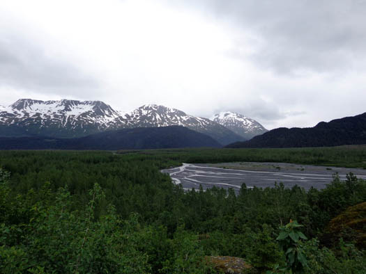
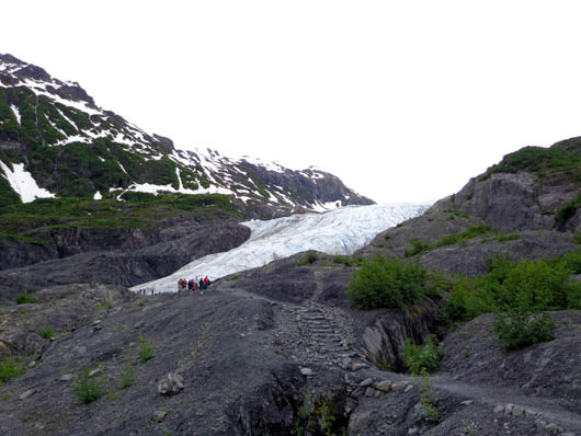
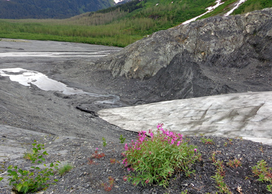
As we climbed higher on the Edge trail we could see more and more of the
outwash plain below the toe of Exit Glacier:
A sign at the overlook below indicated that the ice extended to this
point in 1998:
Note the new green growth in the rocks where the
glacier receded in recent years.
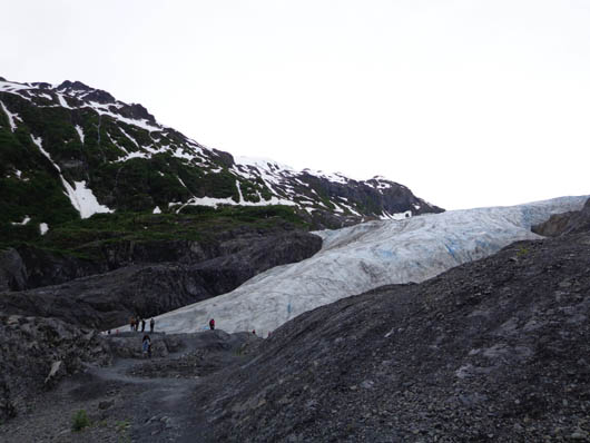
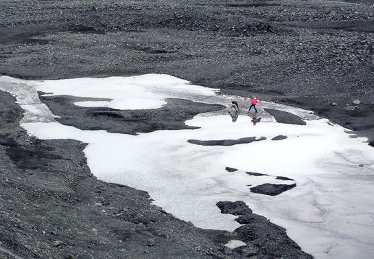
I zoomed in on the next photo and highlighted the people to show some
perspective:
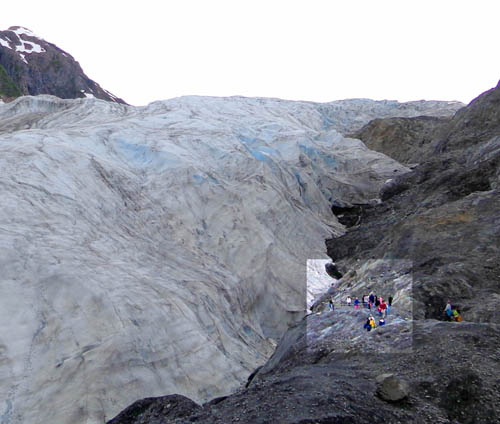
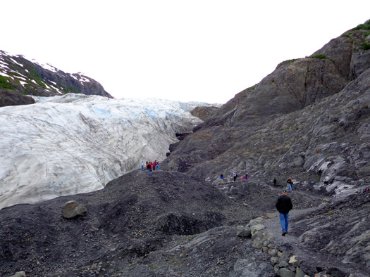
There are few to no plants this close to the
glacier. "Succession" takes some time.
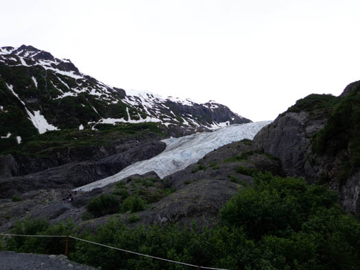
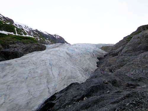
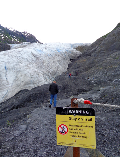
I was glad Jim was able to go with me on the hike so he could get up
close to the glacier. We couldn’t touch it because of the danger but we were
only
15-20 feet away:
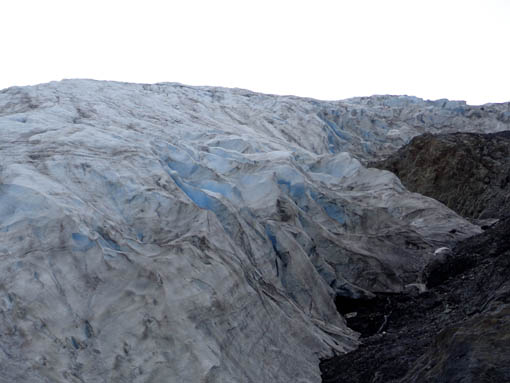
The surface of Exit Glacier was dirtier than Byron Glacier near Portage but we could
still see that iconic blue color in crevices and water spurting out from the edge.
A glacier is blue
because densely compacted glacial snow and ice absorb the light
spectrum's long wavelengths. Only the shorter bluish wavelengths are
reflected back for us to see.
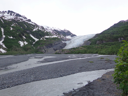
VIEWS OF THE TOE OF THE
GLACIER & THE OUTWASH PLAIN
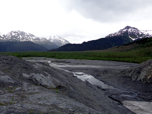
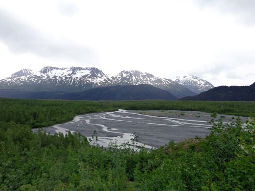
We also got good views of the “toe” (AKA terminus, or leading edge) of the glacier and
the "outwash plain" below it, where melt water drains into Exit Creek.
These photos are in order as we turned around and continued CCW around the trail loop
near the glacier:
It doesn't take long for new plants to begin
growing in the dirt and rocks where a glacier has receded.
Hikers cross the channels of water in the outwash
plain.
It’s amazing how much this glacier has receded since the end of the
Little Ice Age, which lasted from 1200 to 1900 AD. Glaciers advance when
the accumulation of snow and ice exceeds the rate of melting. They
shrink when melting exceeds the rate of snowfall. We have been in a warmer
interglacial period of time for over a century.
We saw signs along the road, trails, and on interpretive panels that
show where the glacier extended all the way back to 1815. Before that it
was even larger -- over many centuries it carved out this whole
valley!
The date signs are a
very effective way to show visitors how much it has receded,
particularly in the past century.
This
interpretive panel is also graphic:
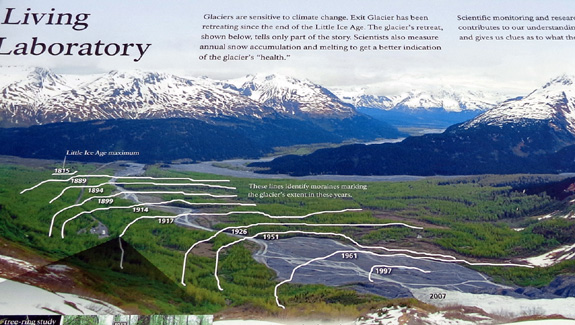
The glacier is still almost three miles long, however, extending up to the
massive Harding Icefield 2,700 feet above the valley.
The ice field covers over half of Kenai Fjords National Park’s
669,983 acres and a chunk of the adjacent Kenai National Wildlife
Refuge. The ice is up to 4,000 feet deep in some places, completely or
mostly covering the mountains below it.
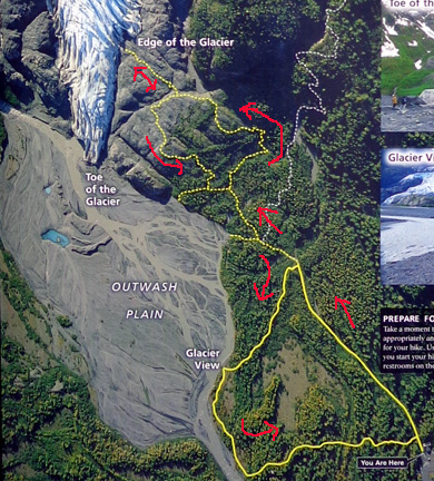
LOWER GLACIER VIEWPOINT
As mentioned, when we
got back to the Glacier View loop I went CCW to see the portion of the
trail we didn't hike on our way up to the glacier's edge.
Here's the trail map
again, with the route I took:
This is the
perspective of Exit Glacier and the outwash area from the Glacier View
overlook:
The ranger-led group was there when I
arrived. I already showed a picture of them on page one. This is the
beginning of Exit Creek.
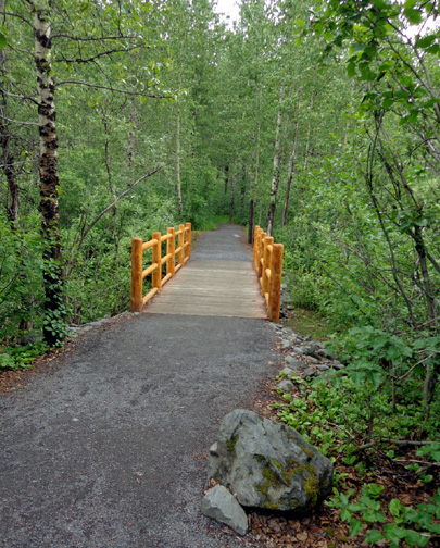
I took the next three
photos on the rest of the loop as I walked back to the nature center on
this flat, smooth, wheelchair-accessible trail. This part is not
paved but it's smooth.
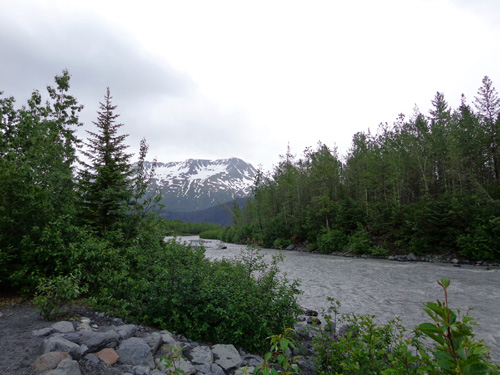
Exit Creek flows down
to the Resurrection River.
There were lots of folks on the trails today. I really enjoyed the hike
despite the small crowd.
We can highly recommend that other visitors see this glacier from one or
more of the trails. Just wear appropriate shoes if you go on any of the
trails besides the flat, smooth Glacier View trail. We wore our fairly
lightweight Merrill trail running/hiking shoes and they were fine over the
rough rocks on the Edge trail.
HARDING ICEFIELD TRAIL, HERE I COME!
During this hike
I got psyched up to go either on a ranger-led hike tomorrow at 9 AM up
to the ice field (4.1 miles one way) or to go by myself.
Unfortunately, dogs aren’t allowed
on the trails so I can't take Cody with me. That's typical of national parks.
I talked with two rangers re: trail conditions, etc. The ice
field trail is pretty steep but the footing isn’t too bad right now – a
lot of either mushy or
hard-packed snow remains on the upper half of the trail, mud and lots of rocks
on
the lower half, but apparently no ice or serious danger. The rangers just
marked the parts of the trail with flags yesterday that are still covered with snow.
Part of the Glacier View trail; I won't find
anything
this easy once I hit the Icefield trail!
There is a meadow halfway up the Icefield trail where I can turn around if
it gets too gnarly.
I’m more concerned about my knees hurting on the way down than
going up. I feel trained for the elevation gain/loss and distance.
CHOOSING A MARINE TOUR OF KENAI FJORDS NATIONAL
PARK
The best way for us to view other parts of Kenai Fjords National Park is
by boat on a day trip.
After supper this evening we bought tickets for our marine/glacier cruise. We chose
Monday because there’s a chance of some sun (finally!) that day and
hopefully our catamaran won’t be as crowded then as on the weekend.
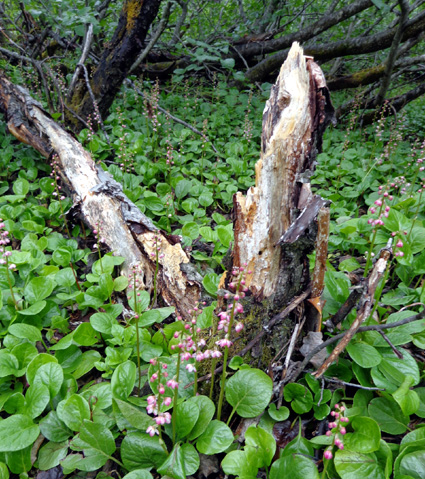
Liverleaf wintergreen flowers in bloom along the Glacier View trail at
Exit Glacier
We
talked/researched a lot before getting our tickets re: which
company to use and which specific cruise to take.
There are a lot of choices. All we knew was that we wanted a six-hour
cruise. Eight hours or more just sounded too long and tours under six
hours apparently don't leave Resurrection Bay. We wanted to see the
fjords and some tidewater glaciers farther out in Prince William Sound.
Although it cost more, we initially picked Major Marine because it 1)
didn’t waste time going to Fox Island for a meal, 2) offered a nice
prime rib and grilled salmon dinner on board, and 3) has a National Park
Service ranger on every cruise for interpretation.
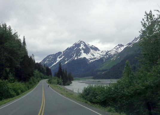
Along the Resurrection River,
heading back to Seward from Exit Glacier; note the cyclist ahead of us.
However, after we talked with one of the fellas at the resort office
about the differences between the two company’s six-hour cruises, we
chose Kenai Fjords Tour Co. He told us the six-hour Major Marine tour
does not go to the best glacier, Aialik, but only goes to Holgate
Glacier, “an ice cube compared to Aialik.” We definitely want to see
Aialik.
Our particular cruise won't stop at Fox Island, which is owned by Kenai Fjords Tour
Co. That's fine with us. We’ve
heard mixed reviews about stopping there. Some folks like it, others
think it’s just less time to see marine critters and glaciers. We’ll get
just a sandwich for lunch on our cruise, which makes it less expensive.
We can always get a nice salmon dinner at a restaurant in town.
We believe we got a good discount through the Seward Military Resort – a
total of $266 for the two of us compared to $325 directly from the
cruise company.
Next entry: Ever wonder what an ice field looks
like?? It's awesome! Follow along on my hike along and above Exit
Glacier to the Harding Icefield.
Happy trails,
Sue
"Runtrails & Company" - Sue Norwood, Jim O'Neil,
and Cody the ultra Lab
Previous
Next
© 2012 Sue Norwood and Jim O'Neil
