We've been looking forward to visiting the Kenai Peninsula south of
Anchorage because 90% of the land mass is protected wilderness full of
mountains, glaciers, ice fields, lakes, rivers, creeks, waterfalls,
marshes, coastlines, trails, and bountiful wildlife.It sounds like
paradise to outdoor lovers like us!
In addition to state and national parks, a huge national wildlife
refuge, and millions of acres of national forests, the peninsula is also
full of history and culture and has several coastal towns that are
very popular tourist destinations. The area appeals to people with all
sorts of interests, not just active outdoors men and women.
We have a long list of things we plan to see and do on the Peninsula.
How long we stay in this area depends on the weather -- and
whether we can get camping sites where we want them. July is normally
prime time for both Alaska residents and tourists to fish for several
kinds of salmon on the Peninsula.
The only campground reservations we have are for the next three
nights at the Russian River National Forest Service campground near
Cooper Landing and six days at the Seward Military Resort in Seward.
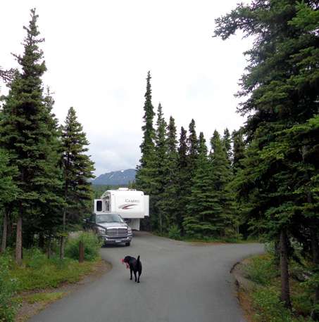
Our new home for a few days --
Russian River NFS campground near Cooper Landing
Beyond that, we'll play it by ear.
We like the flexibility of staying longer in areas we really like
(especially if the weather is great) and being able to leave "early" if
we aren't happy there for some reason. The only other reservations we
have this summer are at Denali National Park in early August, so we can
spend most of July on the Kenai Peninsula if we want.
OUR ROUTE
This entry describes today's drive from Anchorage to Cooper Landing,
which is on the Sterling Highway in the north central part of the
peninsula. Most of the information here is relevant for anyone who
drives this route, not just folks traveling in RVs.
Here's a section of the AAA map of Alaska that shows our route
highlighted in yellow:
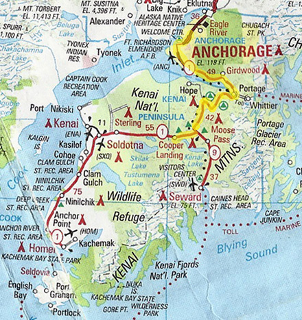
We followed the Seward Hwy. from MM 127 in Anchorage to MM 37 at Tern
Lake Junction, then headed west on the Sterling Hwy. to our campground
a few miles past the town of Cooper Landing.
Since we didn't have many miles to drive today we ran some errands on the
way through Joint Base Elmendorf-Richardson (JBER) and Anchorage.
We left Sam's Club on Dimond Ave. in the south part of town at
11:15 AM and arrived at the Russian River CG at 1:45 PM after several
short stops to take pictures and make lunch.
ANCHORAGE TO PORTAGE
We've already driven this section in our truck, without the 5th-wheel. The three
entries dated
June 27 describe the Seward Highway
along the north side of Turnagain Arm from Anchorage to Portage.
That didn't stop me from taking more photos today, however! Even with
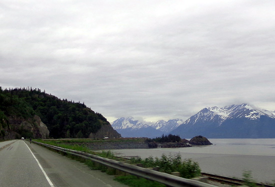
overcast skies the mountains and water are very scenic:
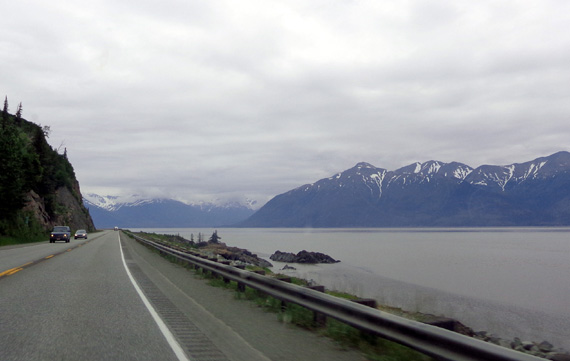
The tide was fairly high at the
western end of Turnagain Arm near Anchorage.
Approaching Beluga Point, where you can often see
Dall sheep on the cliffs and maybe
some whales in the water when the tide is high (we
haven't seen whales here yet)
Traffic was moderate to Portage at MM 79 and beyond. Once south of
Anchorage there are some passing lanes but the road is mostly two-lane
and curvy as it follows the rather narrow shoreline between the water and
mountain cliffs.
Jim was able to drive at or above the speed limit with the Cameo and
keep up with traffic. Sometimes those in a hurry get backed up behind
slower tourists and campers and take risks to pass them. The whole
Seward Hwy. is accident-prone so be careful when driving there.
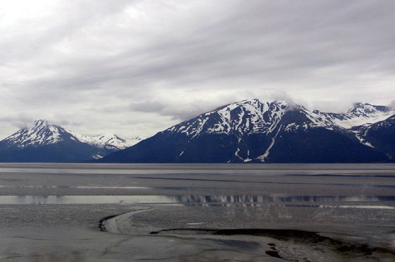
The tide was fairly low at the
eastern end of Turnagain Arm, which is several hours "behind" the
western end.
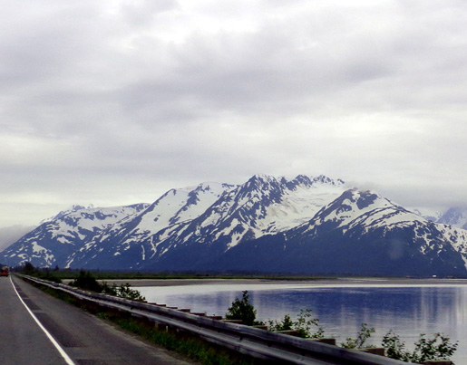
Glaciers near Portage at the eastern end of
Turnagain Arm
The only thing different in this section today was being able to see the Dall sheep
at Beluga Point more clearly than we saw them last week:
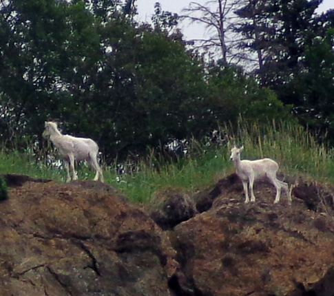
And with my new Sony camera with 16 megapixels and 16x zoom they actually look like
sheep this time and not little white dots!
PORTAGE TO TERN LAKE
We continued across the isthmus near the former town of Portage at the eastern end of Turnagain Arm
onto the Kenai Peninsula. The Seward Hwy. curves around the arm, heads
west for a little while, and then goes mostly south to Seward.
I've mentioned the devastating 1964 earthquake that destroyed or
seriously damaged several
towns in this area of Alaska, including Valdez, Portage, Whittier, and Girdwood.
The land was lowered by several feet and new standing water killed most
of the trees in this area.
The landscape is a bit eerie at this end of the Arm, with dead trees
still standing in the wetlands:
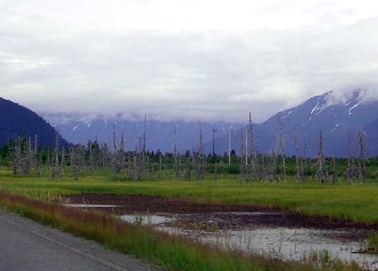
New, smaller trees have grown up behind them in the intervening
years.
The Seward Hwy. continues south to MM 0 in the picturesque town of Seward
on the eastern coast of the Kenai Peninsula. Today we followed it to MM 37
at Tern Lake.
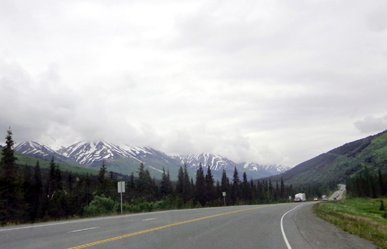
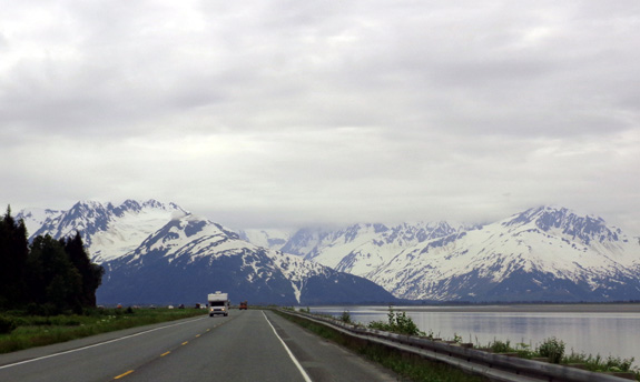
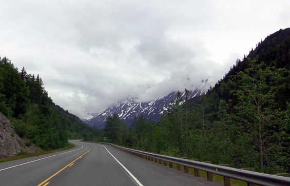
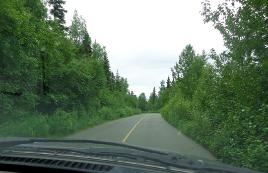
This section of the Seward Highway is also very scenic as it courses
through lush green valleys in the Chugach Mountains. There are no long grades that
are difficult to drive with an RV. Most of the streams and lakes are a
gorgeous turquoise blue from glacial silt. We continued to see glaciers
as we drove south:
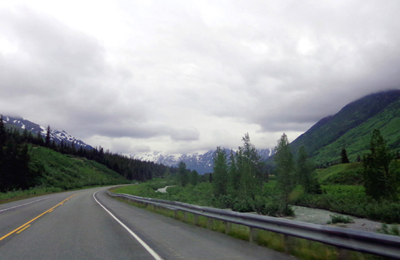
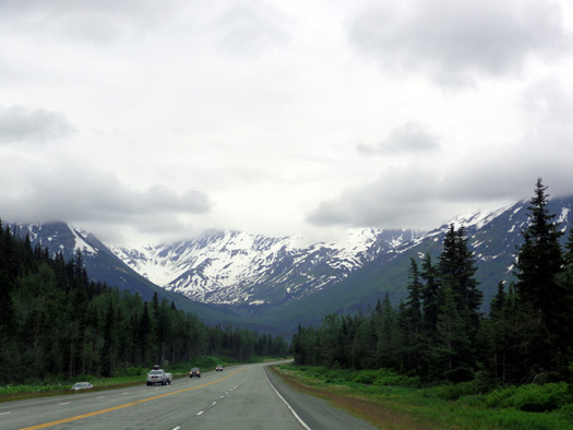
Because of the low clouds we couldn't always see the tops of the
peaks. Hopefully it'll be more sunny when we come back this way in a few
weeks.
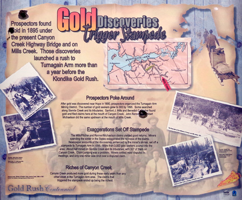
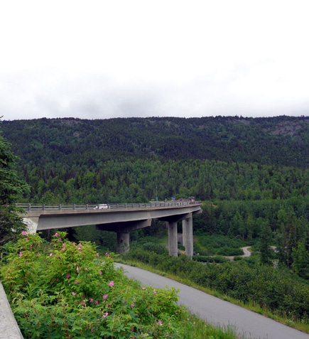
We stopped for lunch at the large, attractive Canyon Creek rest area at MM
56, which is located just north of the intersection with Hope Hwy.
The
parking area overlooks the scenic confluence of Canyon and Sixmile
Creeks. Both streams are a pretty glacial blue. There are interpretive signs about the
nearby Gold Rush in the mid-1890s and a
view to the high, curving bridge over Canyon Creek:

We noticed a paved hiking/cycling trail along the highway in this
area. There are several places to access the Sixmile bike trail and
walking path, which is eight miles long, but named after Sixmile
Creek.
There are also trailheads in this section of the Seward Hwy. to
access the popular 23-mile-long Johnson Pass Trail and the 10-mile-long
Devils Creek Trail. The Johnson Pass Trail follows some of the original
Iditarod Trail.
Just over the Canyon Creek bridge we came to the intersection with
the road to the historic town of Hope on the south side of Turnagain
Arm. This picturesque community at the mouth of Resurrection Creek was
established in 1896 during the local gold rush frenzy and still has
about 150 residents. We didn't drive back the 18-mile paved road to Hope
today but might on the way back to Anchorage in a few weeks.
We stopped briefly at MM 47 to take pictures of Lower Summit
Lake. Per The Milepost this turnout is known for its lush summer flowers but the only
things I saw blooming today are cow parsnip and dandelions (not
shown here):
This section of the Seward Hwy. is fairly smooth this summer. Although the terrain is mountainous there is generally more room here than next to Turnagain
Arm to build passing lanes, so traffic tends to go faster.
There are some more narrow spots
like this, too.
TERN LAKE JUNCTION TO COOPER LANDING & OUR
CAMPGROUND
At MM 37 we turned west on the Sterling Highway at Tern Lake to reach
our campground. The Seward Highway continues south to the town of Seward. We were happy
to see that most of the traffic continued that way.
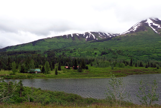
Tern Lake is a National Forest Service Wildlife Viewing Area.
Although we didn't stop today at one of the viewing areas I'm including
a picture of the lake that I took on July 3:

Tern Lake is reported to be a great place to see nesting trumpeter
swans and other migratory birds, spawning salmon, moose, bears, mountain
goats, and Dall sheep. All we saw driving by today were large birds. We'll go back in a few
days and spend more time there.
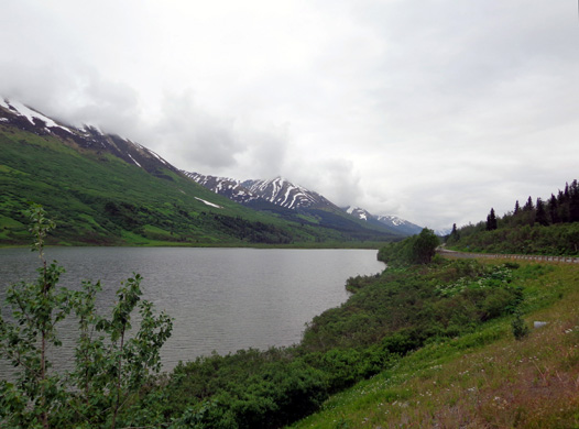
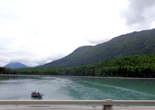
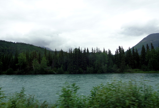
We followed long, thin Kenai Lake for several miles on the Sterling
Hwy. after Tern
Junction. It's a beautiful glacial blue color that is very popular with
anglers. The highway crosses the water when it turns into the Kenai
River and continues following the stream for about 20 miles:
We drove through the Cooper Landing business area (lodges,
restaurants, fishing services, outfitters/guides, etc.) around MM 48.
The town is named after the miner who discovered gold
there in 1894. About 350 people live in the community today. The fella
occupying this RV is a summer entrepreneur who sells food from the
red trailer and chainsaw (!) carvings from the little wooden building:
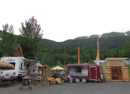
I like the "moose" on the bench:
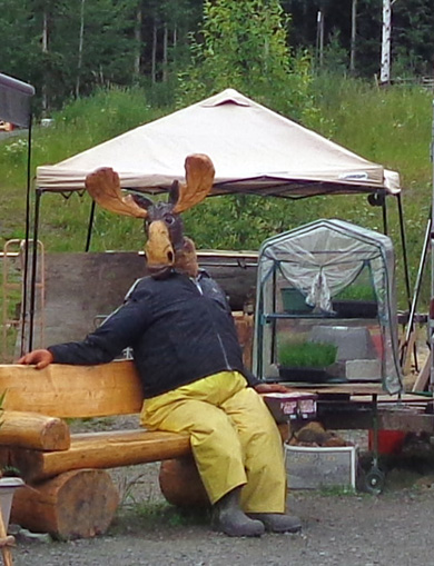
I imagine it's a popular place for tourists to have their pictures
taken.
We've already seen several such examples of summer tourist businesses
and Alaskan humor in our journey through the state.
We continued to MM 52 to the Russian River National Forest Service
campground sign. A narrow paved road goes two miles back to the
campground loops.
Campground road.
We passed two trailhead parking areas before reaching our campground
loop, one of five loops in the campground. There are several trails
going to the river, lakes, and waterfalls.
I'll talk about the campground and the fascinating "fish walk" along
the Russian River in the next two entries.
Happy trails,
Sue
"Runtrails & Company" - Sue Norwood, Jim O'Neil,
and Cody the ultra Lab
Previous
Next
© 2012 Sue Norwood and Jim O'Neil
