This entry describes the route from our campground near Kasilof to our
next destination in Portage Valley, a relatively short distance of 124
"camper miles" that were mostly through beautiful mountain valleys
on the Kenai Peninsula.
As usual, my trip notes are presented from the perspective of an RVer but
much of the information is relevant to travel in passenger vehicles or
even tour buses.
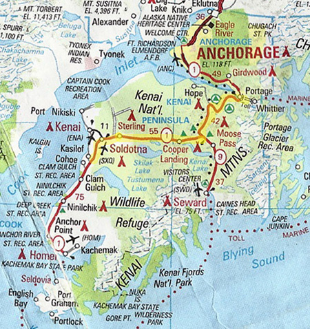
I'll use that same AAA map again to show today's route north on
the Sterling Highway to Soldotna, east to Tern Lake Junction, north on the
Seward Highway to Portage, then east four miles on the Portage
Valley Highway to the Williwaw USFS Campground:
When we crossed the Placer River just south of Portage we officially left
the Kenai Peninsula behind us. Now we are at the far end of Turnagain
Arm and back in familiar territory.
We were here on June 27 but, my, it seems like so much longer ago! Some
days we do so many things that they seem like two or three days each.
WEATHER CONDITIONS
We left the Kasilof campground at 10 AM. Intermittent rain -- the
reason we decided to leave the Peninsula a few days early and return to
Anchorage -- was our constant companion today and only got worse
in the Portage Valley after we arrived about 12:45 PM.
We tried to enjoy the
scenery anyway. This is a beautiful drive even on a rainy summer day and
would be spectacular on a sunny summer day. Maybe the next time
we visit the Peninsula it'll be more sunny.
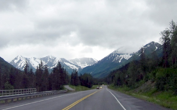
Heading east on the Sterling Hwy.
The only stop we made en route to the Portage Valley was to get fuel at a
Holiday service station in Soldotna ($4.39/gallon, the going rate there for
diesel).
The nearby Fred Meyer parking area was packed with RVs, which
are allowed to stay free for up to three days in a certain area. We talked
with a couple, Nancy and Wes, at Williwaw Campground who were there last night.
They said the Fred Meyer store is similar to a super Walmart inside.
I barely consulted The Milepost book or maps on the way to
Portage Valley since we’ve covered this route before, mostly going the
other direction. Unfortunately, it was raining most of the time then,
too!
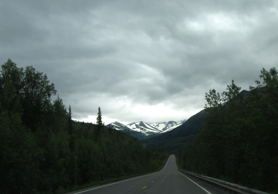
Peaks in the Chugach National Forest between Tern
Lake and Portage
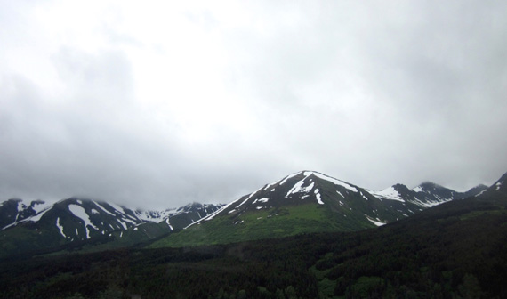
Because of the rain I didn’t take very many photos and most of those
were poor from inside the truck as we were moving. I didn't even try to
PhotoShop the gloom away! WYSIWYG. Most of the time we could see the tops of the
peaks; it could have been worse.
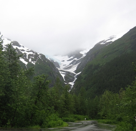
When we got into the Portage Valley we could see the lower part of several of the
"hanging" glaciers.
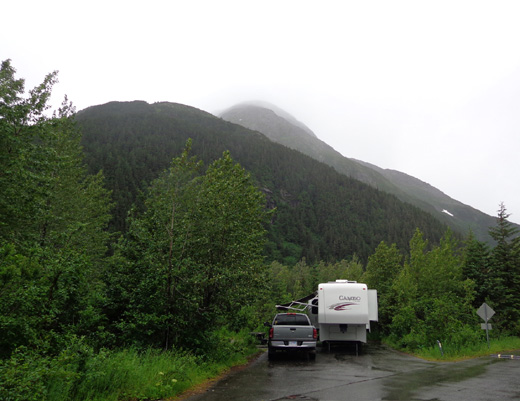
Middle Glacier is just above our campground. We could see
the blue ice near what looks to us like the top of the glacier. It probably extends
higher into the clouds than we can see:
That's one of several hanging glaciers along the road through Portage
Valley. Folks who hike and bike the Trail of Blue Ice bike path can see
them better than they can be seen from the road.
TRAFFIC & ROAD CONDITIONS
Traffic was moderately heavy this morning going in our direction on the Sterling Hwy. from Kasilof to Tern
Junction. It's even busier that direction on Sunday afternoons and evenings because many Anchorage residents
are returning home after the weekend or a week of fishing down on the
Peninsula.
Remember all those dip net salmon fishermen I talked about in
an earlier entry? The majority are reportedly from the Anchorage area,
where over half of the people in Alaska live.
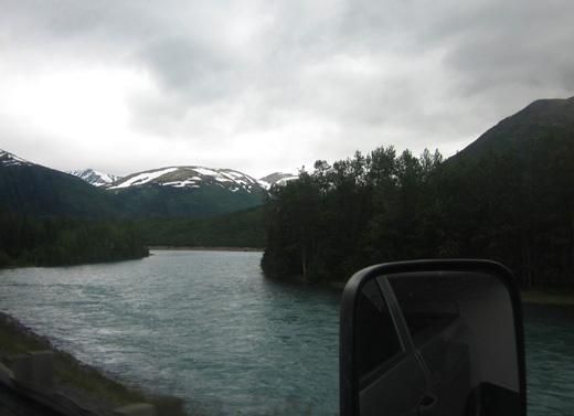
Kenai River along the Sterling Hwy.
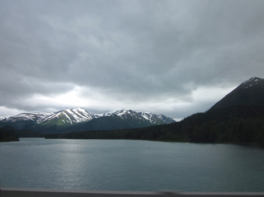
Kenai Lake
Traffic was predictably heavier going northbound on the Seward Highway
from Tern Junction to Portage Valley but there are more passing lanes on
that road so faster vehicles didn't get piled up behind slower ones for
long.
The surface was good and for most of this section the speed limit
is 65 MPH.
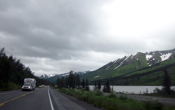
What surprised me
were how
many vehicles were going southbound on a Sunday into the
Peninsula instead of toward Anchorage:
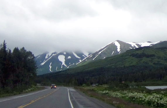
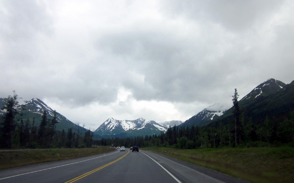
Seward Hwy. near Summit Lake
There were also short periods of time on the Seward Highway with few or
no vehicles visible in either direction:
The mountains and valleys were very pretty the entire way.
There were more Indian paintbrush and fireweed blooms than two weeks ago
when we went south on that section to Russian River but I didn't get any
good pictures of them.
NEARING PORTAGE
The next photos are from the section of the Seward Hwy. between the
intersection with Hope Hwy. and Portage in the northernmost part of the
Kenai Peninsula. The Seward Hwy. turns east and roughly parallels the
southern side of Turnagain Arm:
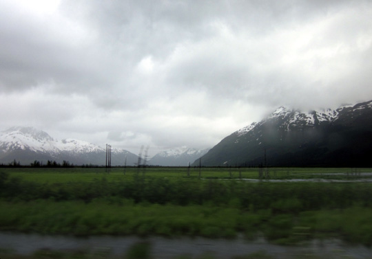
Dead
trees in the area near Portage that was badly flooded during the 1964
earthquake
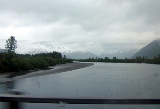
The rain got a little heavier as we approached Portage Valley, just
after crossing the Placer River (above). We turned east on the
highway that goes through the valley to the coastal town of Whittier and drove about four miles to
the Williwaw USFS Campground.
We arrived at the
campground
about 12:45 PM and found a very nice, wide site recommended by the
young campground host:
We’ll probably be here just one night since it’s predicted to continue raining
tomorrow. We had hoped to visit the old gold mining town of Hope and see
the Crow Creek Mine at Girdwood on day trips while camped here.
If it stops raining we might stay another night or two. If not, we'll
leave tomorrow for Anchorage.
I love everything
about this campground! In the next entry
I'll describe it and the fun we had nearby this
afternoon and evening -- despite the rain.
Happy trails,
Sue
"Runtrails & Company" - Sue Norwood, Jim O'Neil,
and Cody the ultra Lab
Previous
Next
© 2012 Sue Norwood and Jim O'Neil
