We both slept pretty soundly until 8 AM – that’s late for me but I
needed the rest. When I took my earplugs out I could hear that it was
raining . . . again. <sigh>
If we hadn’t been leaving for Kasilof today I probably would have
remained in bed a while! I’m so glad we had some sun the last two days
because it brightened our moods and our impression of Seward is better
than if it had rained there the entire time.
LET'S GO!
We left Seward about 10:15 AM and arrived at our new campground about
1:15 PM with one stop for photos, two stops for construction, and a
30-minute stop in Soldotna for Jim to get lunch at McDonalds. The
distance was 110 miles.
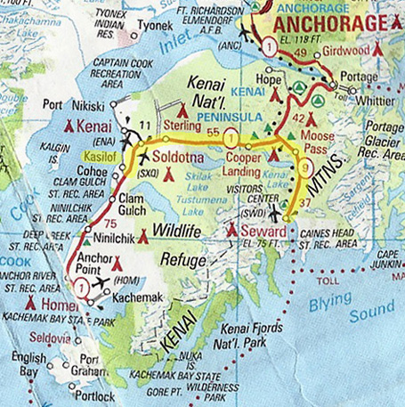
Our route is
highlighted in yellow on the AAA map section below. As you can see, it's
much shorter "as the crow flies" but there aren't any roads over the
Harding Icefield or Kenai Mountain Range.
It was in the low 50s all day with light rain in Seward and for about 20
miles north toward Tern Lake, where we turned west on the Sterling Hwy.
The farther inland we got, the fewer clouds there were.
We never did see any blue sky while driving. Since it was overcast when
we drove south on the Seward Hwy. to Seward last week I was hoping to
get some better mountain photos on the trip back north. Didn't happen.
I can assure you from what I was able to see, however, that this
would be a beautiful section of highway on a sunnier day. (As if there
are any unattractive areas in Alaska!)
ROAD & TRAFFIC CONDITIONS
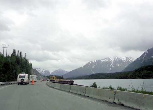
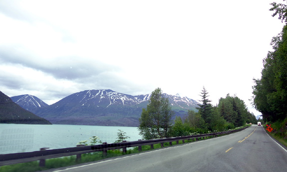
Traffic was pretty heavy for 37 miles on the Seward Hwy. It seemed like
at least a third of the vehicles were RVs. You can see two of them ahead of
us in the picture above.
There was less traffic on the Sterling Hwy. to Soldotna and Kasilof,
which is about 15 miles south of the Soldotna-Kenai urban area.
We had good, smooth pavement with turnouts and passing lanes on the
Seward Hwy. from MP 2 (our campground) to MP 17. From there to
MP 22 was a section of road work:
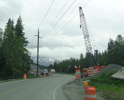
There are two major bridges being built in this section and traffic is
one-lane when crews are working. They were working in the rain today.
The longer of the two waits for pilot cars was about 8 minutes.
The road was better from MP 26 to 37, where we turned onto Sterling Hwy.
Of course, all the
road work
varies from year to year. Since the season is so short for repairs,
summer visitors to Alaska need to be prepared for unpaved roads and
construction work to delay their journey anywhere in the state -- and
Canada.
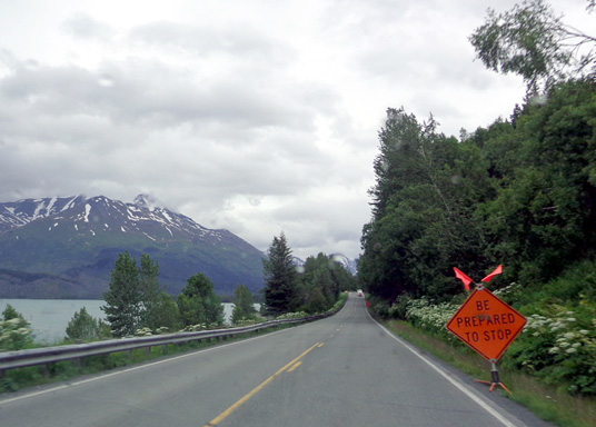
Sign of the times
Note that this is a fairly heavily-traveled section of roadway because
it is the only way in and out of the western side of the peninsula to
the "mainland."
SCENERY & TERRAIN
The Seward Hwy. runs through lush green valleys with mountains, lakes,
and rivers all around. It's a wildlife haven and nature-lover's
paradise.
Even on a rainy day you can see huge Kenai Lake
from both the Seward and Sterling highways.
I was able to get a couple pictures at MM 12.3 that I missed going
southbound last Thursday but they would have been better then with more
light in the sky. It was still raining when I took those pictures today.
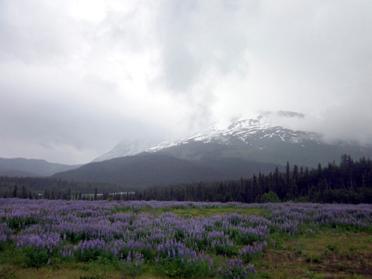
This
field of lupines in front of a lake and mountains was just gorgeous even
in the mist:
I wasn’t able to get any photos of Trail Lake in either direction;
there are just too many trees near the road and no good places for a large RV to pull
over.
I showed photos last
week along the Sterling Hwy. from Tern Lake Jct. to the Russian River
Campground. This is another picture of the Kenai River along this
section:
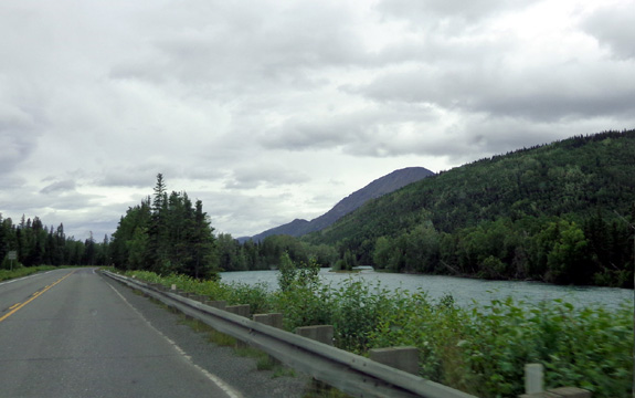
The Sterling Hwy. follows the broad Kenai River for
several miles.
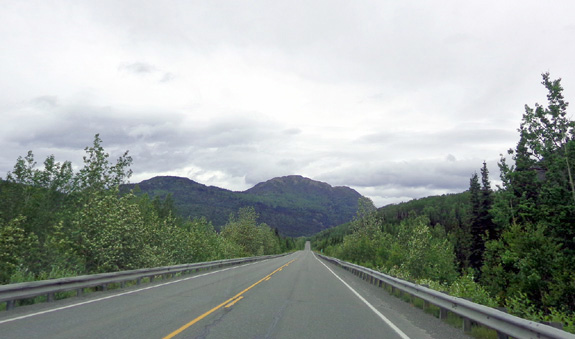
Heading west on the Sterling Hwy. on the northern
end of the Kenai Peninsula
The terrain changed from mountains to rather flat valleys west of
Russian River. Despite warnings about moose along this route we didn’t
see any today.
SETTLING INTO OUR NEW "HOME"
Jim paid $4.64/gallon for diesel in Seward yesterday. It’s $4.39 in Soldotna,
a more populated urban area. Although the prices are better as we go
west on the peninsula, they are still considerably higher than in metro
Anchorage.
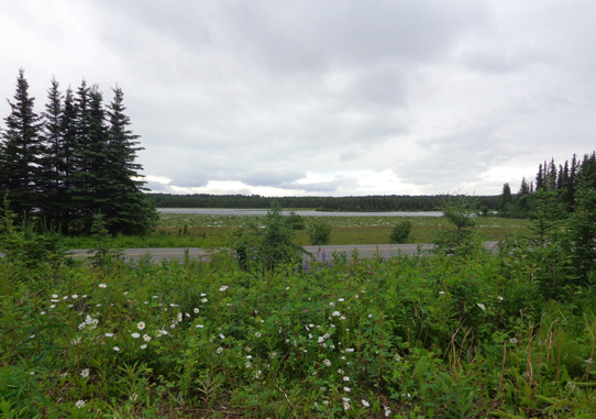
Johnson Lake is right across the road from our
nice, quiet campground.
The directions in the Churchs' camping book to the Kasilof RV Park were
good. We also confirmed them when making our reservation. There were
several turns off the Sterling Hwy. on small paved roads but we are no
more than a mile from it and the roads are good for RV travel.
It’s quiet here. We can really appreciate that after all the
distractions in Seward.
Next entry: camping at the Kasilof RV Park
Happy trails,
Sue
"Runtrails & Company" - Sue Norwood, Jim O'Neil,
and Cody the ultra Lab
Previous
Next
© 2012 Sue Norwood and Jim O'Neil
