Fortunately, there are less treacherous trails on the northeast face of
the mountains. As the signs warn, however, there are no
safe trails on Mt. Marathon.
Although I'm no longer able to run a race like this one I still like to
challenge myself on mountains that are new to me and, yes, to take some
risks. I've been itching all week for the opportunity to climb somewhere
on the mountain. I just had to wait for the trails to be re-opened after
this year's race tragedy had them closed for several days.
More about that shortly.
DON'T WANNA LEAVE YET . . .
Yesterday we decided we wanted to spend
one more day in Seward so we could go to the Alaska SeaLife Center, hike up Mt.
Marathon (Cody and me), do another bike ride (Jim), do a bunch of
laundry, and plan where to go next.
Last-minute decisions are part of our MO for maximizing the flexibility we have in each
location in Alaska that we decide to visit. That gives us the freedom to stay longer in
some places if the weather is good and we have more things we want to
do or to explore interesting places we learn about as we travel, e.g.,
or to leave earlier than we originally planned because of poor
weather conditions or other reasons.
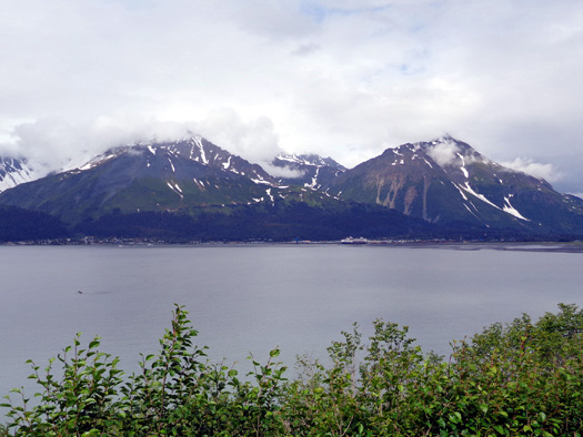
View of Resurrection Bay from the Bench Trail on
Mt. Marathon
On our first trip to Alaska we simply don't want to be locked into a
rigid schedule.
This is more my idea than Jim's but he's a good sport. I know he'd be
more comfortable with campground reservations made earlier than we're
making them.
A few days before heading to Seward we called to reserve a campsite at the Seward Military
Resort campground for three days. While checking in we were able to
extend it to five days.
Yesterday we wanted to extend another day because the weather improved
and there were more
things we'd like to do before we leave the area.
"Winging it" without campground reservations weeks or months in advance
has its pitfalls, however, and requires both flexibility and resourcefulness. The modifications we made for today and the
rest of this week (described at the end of this entry) describe how we
handled two current challenges we encountered with full campsites.
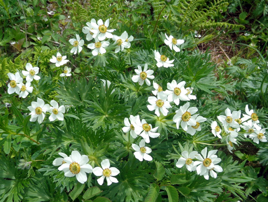
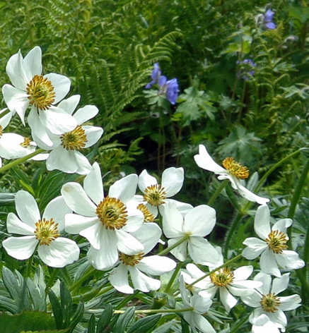
Above and below: pretty narcissus-flowered
anemones along the Bench Trail on Mt. Marathon
I noticed yesterday that the Seward Military Resort campground was filling up pretty fast all
of a sudden and encouraged Jim to go to the office to add on
another day.
Oops -- too late. We had to leave by noon today because
all the sites are reserved tonight.
We walked across the street to the Air Force campground, which isn’t as
nice as the resort but it’s our next best choice in this area.
Fortunately, they had several suitable sites left.
We got a back-in site, shown below,
for tonight at $18 ($7 less than at the resort). We have 30-amp electricity and a
threaded water pump behind us. There is a dump station and restrooms with showers. We can
still do laundry at the resort next door.
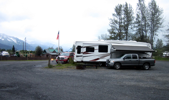
Advantages of this site are having more room and being
able to see the harbor from inside our camper. We didn't have a view
like that at the resort.
We moved to our new site after we went to the Alaska SeaLife Center this
morning, got settled in, and continued enjoying Seward for a few more
hours this afternoon and evening before it began raining again.
<sigh>
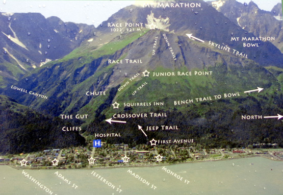
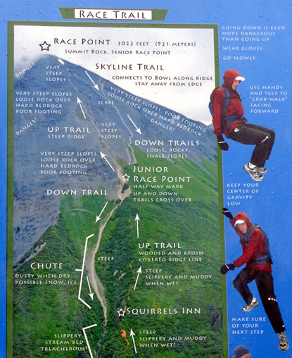
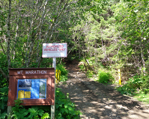
HIKING ON MT. MARATHON
After lunch I took Cody for a 3+ mile hike on
the hikers' trail on Mt. Marathon.
My goal was to reach the cirque between the peak
where the Mt. Marathon race runners turn around and the real summit of the
mountain. You can see those features in the next picture, also from a
sign at one of the trailheads.
I had no illusions of hiking on either the uphill or downhill
trails the racers use; those trails are too gnarly for me with
Granny Knees. They are also a muddy, icy, snowy mess right now
after hundreds of runners and search crews have been over them
repeatedly in the last six days.
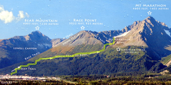
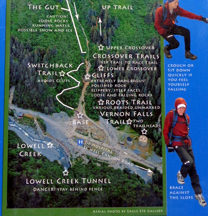
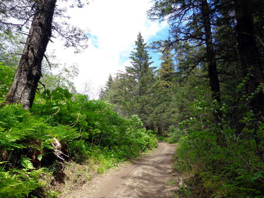
The route I took, highlighted in yellow on the
photo above, begins with what the locals call the Jeep Trail. It is a
longer route to the cirque and race point but much less treacherous than
the trails used in the race.
Above tree line the Jeep Trail connects to the
Bench Trail, which leads to the bowl (cirque).
I took Cody with me because dogs are permitted
on this route; they are not advised on the gnarly race
trails because of the danger of going over steep cliffs that are slick with ice,
water, and loose rocks.
View of Mt.
Marathon from across Resurrection Bay
We checked the hiker trailhead at First and
Monroe this morning (next photo) to be
sure it was open.
It is, even though Michael LeMaitre, the runner who
disappeared during the July 4 race, hasn’t been found yet.
The search continues for him. I'll talk
more about that situation at the end of this entry.
When Jim dropped me off at the trailhead after
lunch about ten search volunteers were just coming down the mountain in
a Jeep and another ATV-type vehicle:
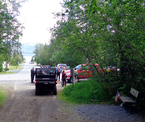
I met another half dozen searchers about half a
mile up the trail; they chose to hike down.
The various search teams have used different
colored plastic tape to mark the quadrants where they’ve hunted for LeMaitre in the
past week. There are dozens of blue, yellow, and orange ribbons up there
to indicate the areas already searched so efforts aren't duplicated as
rescuers continue to look for LeMaitre or his remains. It's a huge mountain to search.
This is one of the markers along the Bench Trail:
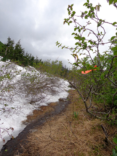
Even though this area isn't on the race course
volunteers have expanded their search to the entire mountain in case
LeMaitre got disoriented and lost during the bad weather on his way down the mountain.
The first mile of the trail I was on today is a
moderately steep jeep track with
tall spruce, hemlock, pine, and cedar trees and thick, lower growths of ferns, alders, devil's club, and
other understory plants on either side of the road.
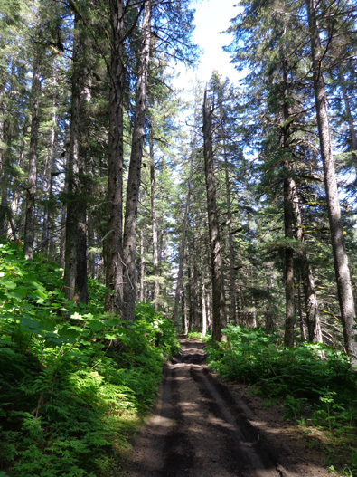
I gained about 800 feet elevation in that
one-mile section, which was easier on my knees going up than coming back down.
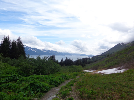
I started getting great views of Resurrection Bay when I got
to a clearing at the end of the jeep road and looked back down the
mountain:
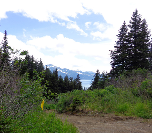
The higher I got above that point, the fewer
trees and the more I could see of the bay.
Continued on the next page . . .
Happy trails,
Sue
"Runtrails & Company" - Sue Norwood, Jim O'Neil,
and Cody the ultra Lab
Previous
Next
© 2012 Sue Norwood and Jim O'Neil