(Continued from the previous entry about the Eielson Visitor Center.)
The sign indicates that moose also browse aquatic plants at the far
shallow end of Wonder Lake and four species of fish live in separate
temperature zones of the water.
We didn't do any fishing and our bus turned around today at the
near end of the lake so we
didn't see any fish or moose. I bet people who camp at Wonder Lake
or hike in the vicinity see some wildlife, though.
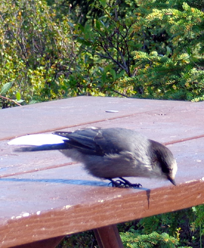
The only critters we saw in the half hour while we were at the lake
were rodents and birds. This gray jay -- I think that's what it
is -- mooched for food at one of the
picnic tables:
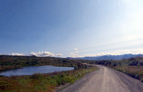
The park road closely parallels the McKinley River valley all the way
from the Eielson Visitor Center at Mile 66 to the near end of Wonder
Lake at Mile 85. The road continues past the lake another seven miles to
Kantishna but we chose not to go that far today.
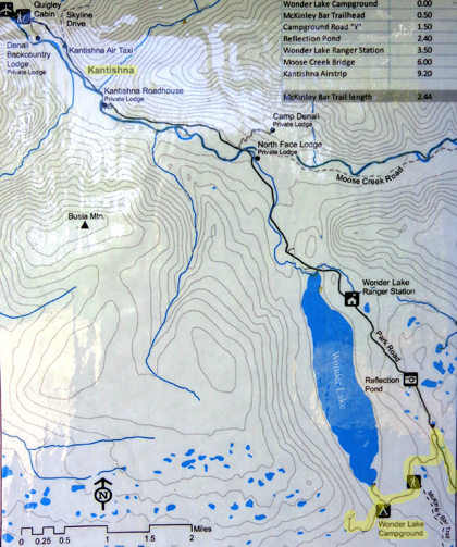
Here's the road map again so you can see the 19-mile portion of the
road from Eielson to Wonder Lake (lower left):
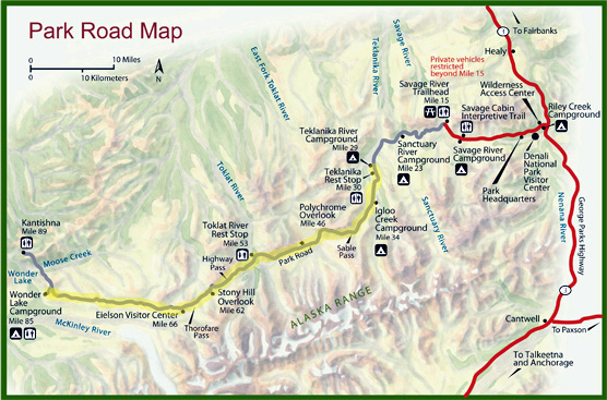
Although you can't see it, Mt. McKinley AKA Denali is just below the
bottom left part of that map, almost due south of this section of the road.
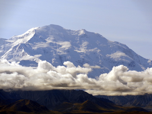
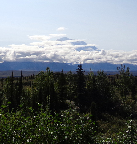
On a clear day the views of the mountain along this stretch of road
would be as superlative as those from the Eielson Visitor Center and
would show visitors more of its north and northwest sides. On this early
afternoon, however, we were allowed to see only decreasing amounts of
the summit of "The High One" as clouds quickly consumed more and more of
its base, and eventualy the summit, too.
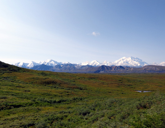
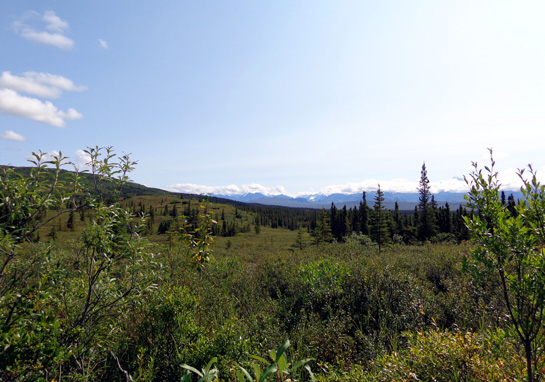
That doesn't mean the rest of our bus trip was ruined. Far from it. We still enjoyed the
scenery along this wide-open stretch of road with the Kantishna Hills to
the north and the snow-capped Alaska Range to the south. There's much
more to Denali National Park than just its namesake mountain.
MOVING RIGHT ALONG
Let's continue our virtual tour of the park road from Eielson to Wonder Lake:
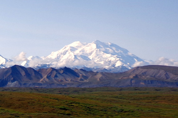
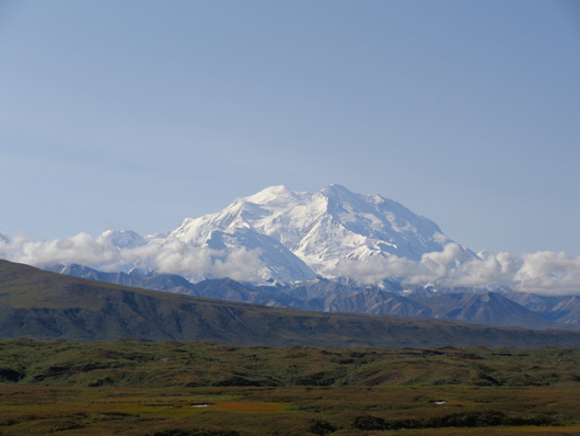
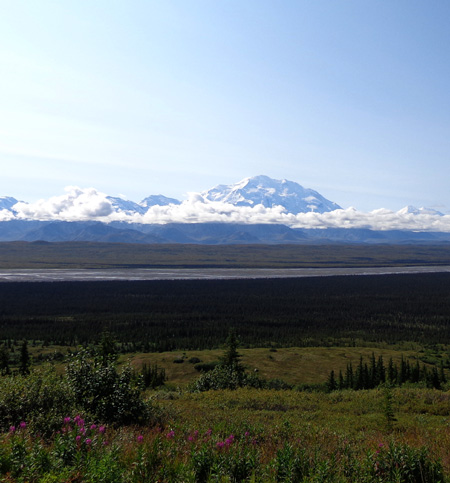
Above and below: After we
left Eielson we could still Denali pretty clearly
but low clouds were beginning to
form near its base.
Above and below: two more
views of Denali a little farther down the road
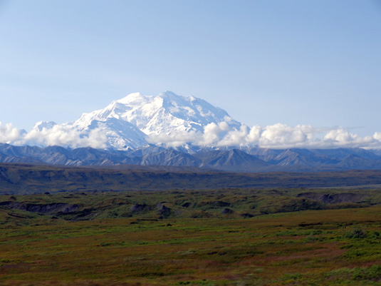
The McKinley River is more visible here.
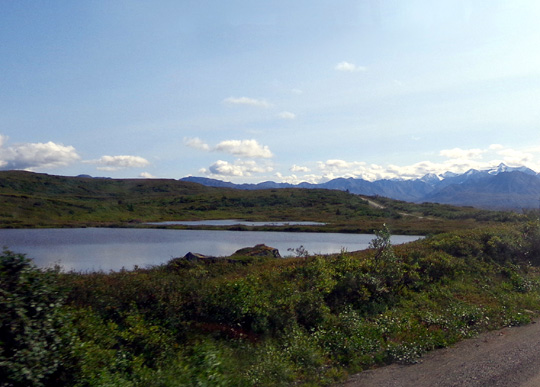
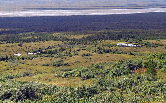
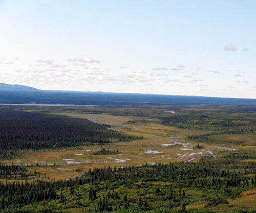
This section of the park road has numerous little ponds on
either side. It's a great place to look for wildlife in the
early morning or late afternoon, if you're here at those times.
We weren't -- we passed through, out and back, between
about noon and 2 PM.
The ponds were still scenic anyway! There were some loons
floating on one of the ponds but it was on the other side of the
bus and I didn't get a picture of them.
Because of the water features, chance of seeing wildlife,
proximity to Denali, roadway that is more flat above the river valley
than in some other areas,
and fewer and fewer buses as you get farther out the park road,
I think this section would be great to ride on a bicycle.
The next two photos show excellent moose, bear, and caribou terrain! I think it
would be very rewarding to hike through this valley full
of little streams and ponds:
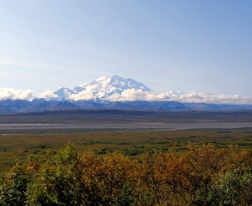
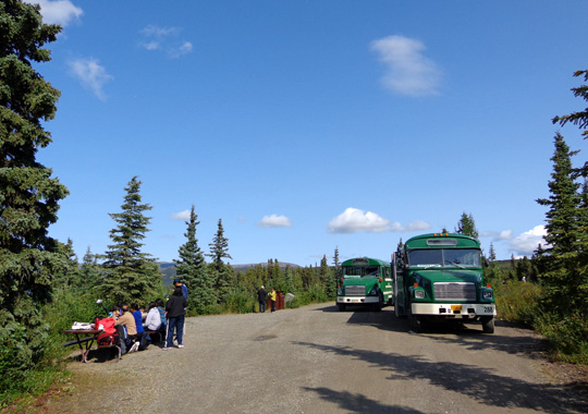
Our bus driver stopped for a few minutes at an overlook just
before we reached the near (southeast) end of Wonder Lake.
By then, approximately 1 PM, we were losing more and more
visibility of the north side of Denali, although we were still as close as ever to
it:
The sun was more of a factor by then, too, as it arc'd around to
the south -- the direction I was facing with my camera.
The remaining photos of the mountain on this page are more hazy because of that.
ARRIVING AT WONDER LAKE
I photographed this map section of the Wonder Lake and Kantishna
areas from an interpretive panel at the lake. We came in at the
near end of the lake in the lower right.
It's about a mile to the parking area where the picnic tables
are located at the tip of the lake:
That's where our driver parked first so we could walk down to the
lake, get some lunch, and/or pick blueberries on the nearby hillsides:
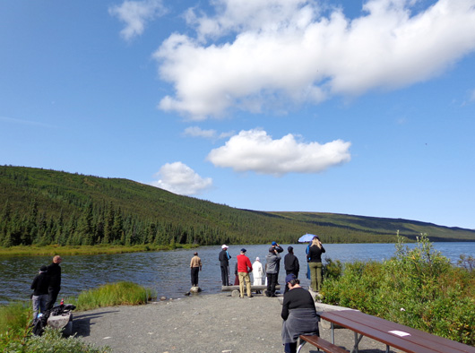
We had already eaten our sandwiches on the bus in transit so we
didn't "waste" the half hour we'd have to explore the lake area.
Jim had considered stopping at Eielson and catching another bus
back from there -- until he heard about all the
blueberries at Wonder Lake this time of year! Luckily we had a grocery bag
so we could collect the ones we didn't eat as we picked them:
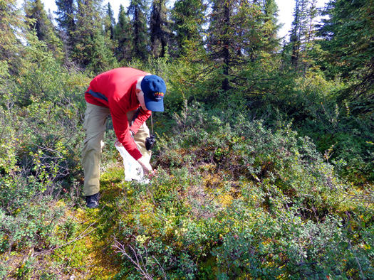
Those berries were yummy and we didn't have to go far off the
beaten path to find them. Only a few other folks on our bus took
the same opportunity.
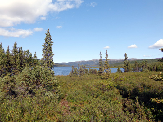
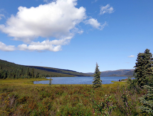
Here's another picture of this petty alpine lake that I took
from the hillside where we picked blueberries:
The Wonder Lake Campground (tents only), restrooms, and a second
bus stop are located about half a mile up the hill from the
picnic area. Our bus driver said we could either walk or ride up there
before beginning the long trip back to the entrance of the park.
I chose to walk up the little dirt road before the bus
got there so I'd have more time to explore the campground area. There are
more picnic tables and interpretive signs on a hill
overlooking Denali to the southeast.
By then more clouds had formed, further blocking the views of
the mountain and surrounding peaks:
There would be an impressive panorama of the Alaska Range and
McKinley River valley from this hill on a clear day. From the
lowland tundra Denali rises an impressive 18,000 feet from its
base to its summit -- possibly the greatest vertical
relief of any mountain on earth, according to an interpretive
panel near this overlook.
Folks who camp at this location also have the possibility of
seeing spectacular sunrises and sunsets over the mountain early and late
in the tourist season when the sun actually does rise and set.
We're late enough in the summer now that it isn't totally sunny
when we get up and go to bed. Today's sunrise at nearby Eielson Visitor
Center was 5:40 AM and sunset will be 10:37 PM. Each day is losing six
minutes of sunlight this week at this latitude.
Denali's the other direction from this end
of the lake.
I was hoping to see an impressive view of Denali over Wonder
Lake but we'd have to go further out the park road to get that
angle.
Since we purchased a Kantishna ticket originally with our Tek
Pass, we still have the chance to go out farther tomorrow or Saturday.
Next entry: scenes along the road on our way back
from Wonder Lake to the Toklat River (Miles 85 to 53);
includes our first-ever sighting of a caribou in the wild, plus
two playful wolves
Happy trails,
Sue
"Runtrails & Company" - Sue Norwood, Jim O'Neil,
and Cody the ultra Lab
Previous
Next
© 2012 Sue Norwood and Jim O'Neil
