The Black Hills National Forest covers 1.2 million acres of land,
mostly in southwestern South Dakota. It also extends into eastern
Wyoming a little bit.
In addition, there are thousands more acres comprising Custer State
Park, Wind Cave National Park, Jewel Cave National Monument, Mount
Rushmore National Monument, and the small towns of Lead, Deadwood,
Silver City, Custer, Keystone, and others.
This big green area on maps is full of scenic byways with hairpin
turns and narrow tunnels, historic towns and architecture, legendary
outlaws and other characters, a variety of museums, arts centers, and
shops, a replica of a 12th century Norwegian chapel, a mammoth site, old
mines and gold panning, Mount Rushmore and Crazy Horse memorials, hot
springs, unusual natural rock formations, rugged canyons, unique caves and caverns, a
petrified forest, the highest peak east of the Rockies, rushing streams
and waterfalls, extensive trails, lots of wildlife from prairie dogs to
mountain lions, bighorn sheep, mountain goats, elk, bears, and bison, a huge buffalo
roundup, and numerous recreational opportunities . . .
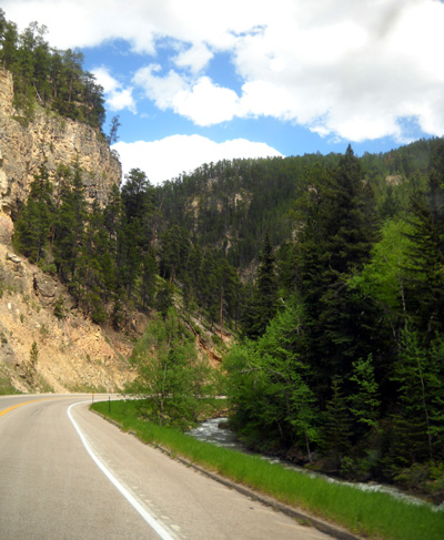
Spearfish Canyon
That's just a start of what you can see and do in the Black Hills
area.
I haven't mentioned all the gambling establishments, the large
motorcycle rally in Sturgis (we're talking hundreds of thousands
of motorcyclists in the area in early August), and many tourist
attractions.
There's something in the Black Hills area to keep just about anyone
busy for at least a few days.
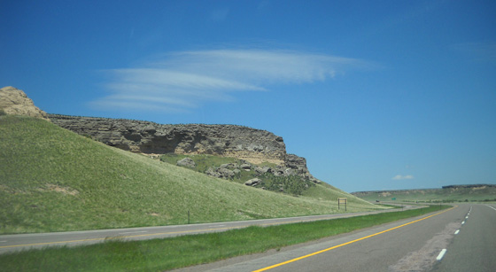
"Black hills" along US 18 in
South Dakota
We are most interested in the scenery and trails. The Black Hills are
literally and figuratively a cool place and that's why we'll be here for
about a week. That, and some business we need to do in Rapid City, the
location of our mailing service.
Here's our plan and how we got here.
PLAN A
This morning we left the USAF Academy bound for South Dakota. It was
just a one-day trip for us.
Plan A
was to camp for two nights at Wind Cave National Park in the
southeastern part of the Black Hills. We couldn't make reservations
there, however, so if there wasn't a suitable spot for us when we
arrived this afternoon Plan B was to continue on to Ellsworth AFB east
of Rapid City, another 90 minutes north.
We had a Plan C, also, because we couldn't make reservations at
Ellsworth either! Our mailing service now has a new building and some
campsites for customers since most of its clients are full-time RVers.
Along I-25 in southeastern
Wyoming
We lucked out and got the last spot at Wind Cave NP that was large
enough for our camper. The next two or three entries will be reports
from our adventures in the park.
This entry focuses on the drive from the Academy to Wind
Cave from the perspective of hauling or driving an RV but much of the
information is relevant to drivers of other vehicles, too.
If you aren't interested in routes, road conditions, rest areas, etc.
just scroll down through the photos (including bison) and hit "next" at
the bottom for more information about the national park.
THE ROUTE
We exited the USAF Academy at the north gate, which is at exit 156 on
I-25 north of Colorado Springs. Although there is major bridge
construction on Academy Drive between the campground and the north gate
there was adequate room to get our camper through. The construction will
probably take all summer. It
caused us more grief when we were cycling through it than when we left
in the RV.
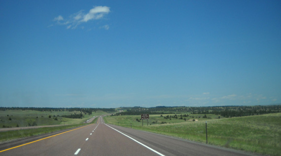
We drove:
- north on I-25 right through Denver to exit 126 in Wyoming
- east on US 18/20 to Lusk, WY
- north on US 18/85 to Mule Creek Jct., WY
- east on US 18 to Hot Springs, SD
- and north on US 385 to Wind Cave NP
Along I-25 in Wyoming; this area
is very green even for springtime (in the summer, it's brown).
There are several turns in Hot Springs to go to Wind Cave, so pay
attention through town if you're driving or hauling a large RV.
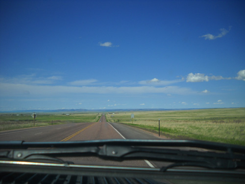
TRAFFIC & ROAD CONDITIONS
These highways are all fine for RVs. The two-lane roads in WY and SD
were hilly but good, with fairly easy passing even when there weren't
passing lanes.
We left the Academy late enough this morning (9:15) to avoid rush
hour traffic through both Colorado Springs and Denver. Traffic was heavy
in both directions between the two cities but it moved well except for
about two miles through southern Denver where a combination of road
construction, a vehicle wreck, and merging traffic fouled up traffic for
a little while.
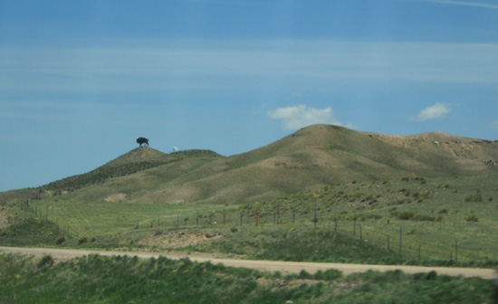
Look -- there's a bison on the
hill! Oops, just a metal one to get the kids all excited!
Traffic remained heavy through the urbanized Front Range area north of
Denver on I-25 until we were past Fort Collins, almost to the Wyoming
border. We were able to drive 60-62 MPH most of the way through this
area, however.
Traffic was noticeably lighter between Fort Collins, CO and Cheyenne,
WY -- and significantly lighter from Cheyenne to the Black
Hills. Where did everybody go?? (We loved it.)
We saw lots of southbound RVs along the entire route. Others were
headed north to the Black Hills or Badlands but since we were also going in
that direction, we didn't see as many NOBO camping rigs.
TERRAIN, FUEL MILEAGE, GAS STATIONS
This route is hillier than you might think since we were east of the
Rocky Mountains all day.
Going north we had a
net decrease in elevation. We started at about 6,700 feet at the
Academy, went up to 7,352 feet at Monument (just north of Colorado
Springs), were about 5,200 feet in Denver, and ended up at about 4,600 feet
at the campground in Wind Cave NP.
Our fuel mileage hauling the Cameo ranged from 16+ MPG on more
downhill segments to an average of 12+ MPG through hillier sections when
we were roller-coastering up and down.
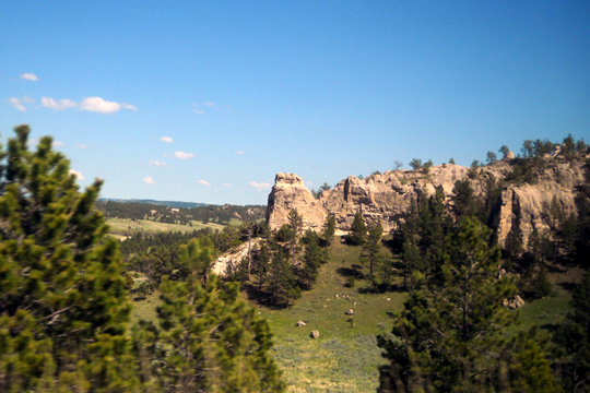
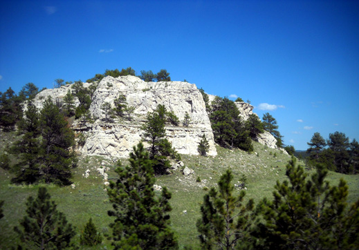
Rock formations along US 18 in South Dakota
We've stopped at exit 7 in Cheyenne many times for fuel on previous
trips on I-25 or I-80, usually at Flying J. Since we no longer have a FJ
card and they aren't as RV-friendly as they were before merging with
Pilot, we sought out a different truck station this time. There are
several choices at this exit.
Shamrock had diesel for less than FJ or Loves so we fueled up there.
Ingress/egress is easier than at FJ, too. The secret when you're in a
large RV is to go in the second entrance, not the first, so you're aimed
right for the angled pump lines in the rear of the store. We learned
that the hard way the last time we were here . . .
Cost of diesel was $3.85/gallon today. The Shamrock station also has
a Subway, so Jim was able to get lunch there.
The only downside to the Shamrock station is having to go inside with
your credit card, then retrieving it and your receipt afterwards. At
least it didn't have a $75 or $100 limit like we sometimes encounter
when we do the entire credit card transaction at the pump. It seems like
there's always some inconvenience when we get fuel with the camper.
REST AREAS, OTHER PLACES TO STOP
I don't think any of the rest areas in Colorado or Wyoming on this route were closed
today.
We stopped at two nice rest areas on I-25 in Wyoming to change
drivers, go to the bathroom, let Cody out, etc.: MM 54 and MM 126, which is where we got off the
freeway and onto US 18/20.
The rest area at MM 54 has a free dump
station for RVers. That's always a convenient touch.
More rocks and "black" trees
along US 18
I didn't pay much attention to the location of Walmart stores today because
we weren't planning to stop overnight along the way, but I did notice a
big, new Walmart on the east side of I-25 at Harmony Road in the Ft.
Collins, CO vicinity. I believe it's exit 265. There is a sign for
Walmart going
northbound on the freeway, which is very unusual.
The parking area looked large enough to accommodate several RVs. I don't
know if RV parking is allowed there, however. There is a Walmart on the
west side of the freeway in Ft. Collins or Loveland that did NOT allow
RV parking when we wanted to stay there several years ago -- not
the store's fault, but a local ordinance no doubt perpetrated by private
campgrounds that were losing money. I don't know if that ordinance still
exists, and I don't know if RVs can park overnight at the new store near
Ft. Collins.
In recent years when we've wanted to stay in that area for
one night we've parked at the Sam's Club or Walmart in Longmont, several
miles south of Ft. Collins and Loveland. The stores are 3-4 miles west
of the freeway at exit 234.
You're welcome!
SCENERY ALONG THE WAY
We have traveled this route before and always enjoy the mountains and
other scenery.
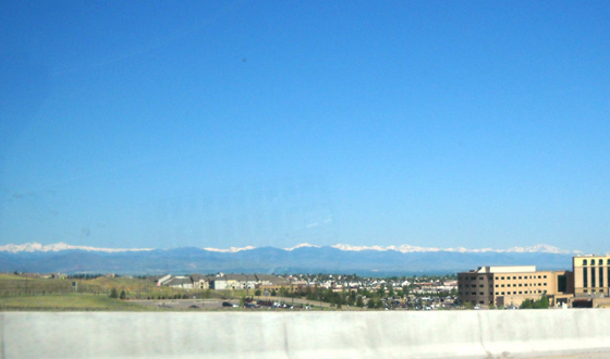
View of the Continental Divide
from Denver; look at all that snow at the end of May!
We could see a lot of snow on the Front Range peaks for many miles in
Colorado -- the Mt. Evans Wilderness Area, Rocky Mountain National Park,
and points in between.
These ridges form part of the Continental Divide
and they are high enough to still retain a bunch of the excess snow that
fell this season. I think Rocky Mountain NP is still closed; it usually
opens by Memorial Day but there's still a ton of snow in the park.
I got a decent picture of Long's Peak past Jim and out his window (he was
driving) as we passed 25-30 miles east of the 14,255-foot mountain on
the freeway:
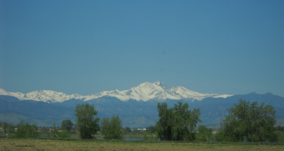
Long's Peak in Rocky Mountain NP
Wouldn't that be a nice view to have from your back yard?
Last May when we drove up to the summit of Pike's Peak the
Continental Divide looked very cool with all the snow-covered peaks to
the west. If we'd done that this year, the mountains would have looked
even better with the higher snow pack.
Too late now. When we return in July most of the snow will probably
be gone. The last day of May, however, and there's still all this snow . . .
From what we've read, it's even deeper and at lower elevations
farther north in Wyoming and Montana. That's why we headed to South
Dakota this week instead of the Bighorn Mountains.
Blue, red, and green on US 18 in
Wyoming
In Wyoming this afternoon we drove farther from the mountains but were treated to some
of the greenest rangeland we've ever seen there. That's because of all the
rain this spring. In dry years the range is already turning gold and brown
by now.
With the bright blue sky, some red
roads, and the green grass . . . Wyoming is even more colorful
than more-dry Colorful Colorado right now.
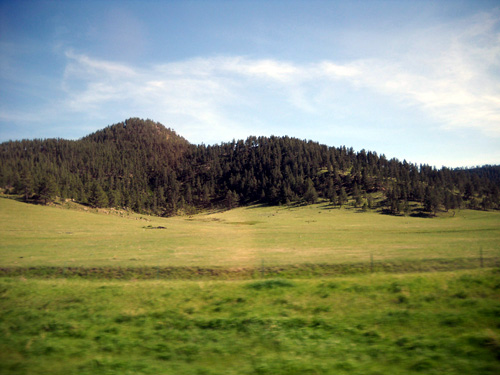
THE BLACK HILLS
Soon we came to the Black Hills, which offer a different kind of
beauty.
This was only our second time in Hot Springs and the first we've
headed north from there to Wind Cave. As mentioned earlier, we had
several turns to make but we managed to get through this popular tourist
area without having to turn around or backtrack on any narrow streets.
Bison graze along US 385 in Wind
Cave NP
Wind Cave NP is just a few miles north of Hot Springs. The terrain is hilly and
scenic.
US 385 bisects the park from southeast to northwest. There is no
entry fee to drive through the park or use the trails, which is
nice.
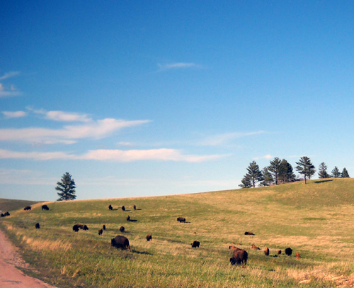
Although there aren't as many bison in Wind Cave NP as there are in
Custer SP, we saw some buffalo grazing right along the road just about as soon
as we entered Wind Cave.
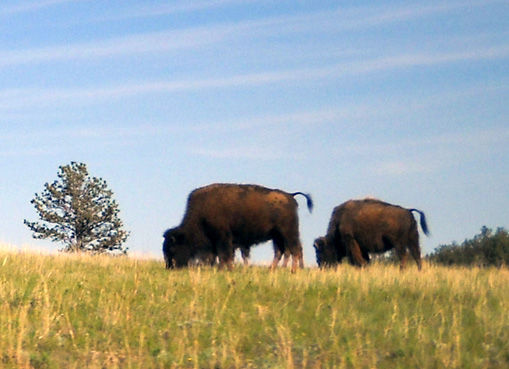
Three more bison at Wind Cave
(one is hidden behind the big guy on the left)
Cool!
These are pretty much "free-ranging" bison, although there are fences here and there
to keep them contained within the park and not in the campgrounds, near
the cave entrance, etc.
To our delight, we did manage to snag the last campsite large enough for our rig at
Wind Cave:
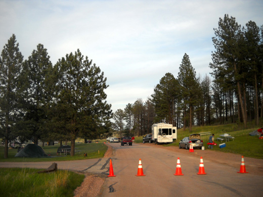
We have a nice view from our door side up the hill, where we spotted
three deer feeding in the woods about 50 feet away this evening.
I'll talk more about the campground and park in the next entry.
We plan to stay here for two nights, then move to Ellsworth AFB east
of Rapid City before the weekend crowd arrives there.
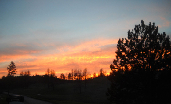
This evening's sunset out our back window
Next entry: Wind Cave NP -- camping and
other things to do
Happy trails,
Sue
"Runtrails & Company" - Sue Norwood, Jim O'Neil,
and Cody the Ultra Lab
Previous
Next
© 2011 Sue Norwood and Jim O'Neil
