We never did explore this interesting multi-use trail while we were
in Colorado Springs last summer, even though part of it winds through
the USAF Academy grounds. It was one of several new things on my
list to do the next time we were back in the area.
Although I got out on the trail twice this weekend, and talked Jim
into going with me the second time, I've still not been all the way up
to Palmer Lake. I got within about three miles of it before turning
around.
That just gives me something else to do when we return in July!
Two cyclists come up the hill
toward me.
This is a popular trail with locals any day of the week but it's even
more heavily used on weekends and holidays.
I didn't see any equestrians on the path either time I rode, but
there were some hoof prints indicating they'd been there. I saw more
bike riders than hikers or runners. It's a great trail for any of the
allowed activities.
Fifteen miles of trail may not sound like much to an ultra-distance
runner or cyclist, but the New Santa Fe Trail is just a small part of
the Colorado Front Range trail system extending from the New Mexico
border to the Wyoming border:
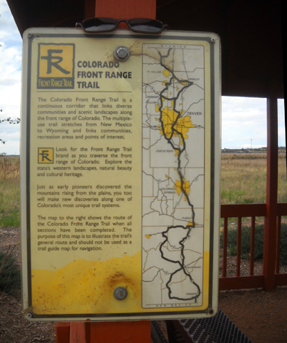
In the Colorado Springs area it connects
just south of the USAF Academy with the Pikes Peak Greenway, which
extends to Fountain Hills in the southern metro area, for a total of 26
miles one-way.
Go out and back from either end and you've got 52 miles of
multi-surfaced trail -- definitely an ultra.
In addition, both the New Santa Fe Trail and the Pike's Peak Greenway intersect with
numerous other shorter trails in the metro area. You could spend days
exploring all the paths.
What a concept!
If only Roanoke would connect all of its short greenway sections, it
would have a similar network of continuous trail. When we go back in the
spring and fall to make sure our house is still standing (!), the most
we can go on any one section currently is 11+ miles out and back on a
5+-mile section.
El Paso Country (which includes Colorado Springs) has a great system
of "open space"
parks, with over 7,000 acres of
parkland and 85 miles of trails for residents and visitors to enjoy.
I've written previously about some of the free parks we've visited
(Garden of the Gods, Red Rock Canyon, etc.). The New Santa Fe Trail is
just one part of the county's recreational opportunities.
If this is representative of other Colorado communities, it's no
wonder Colorado has been designated as the state with the fewest
overweight people in the country. Lots of sunshine, numerous farmer's
markets in the summer with fresh local produce, and great outdoor
recreational opportunities encourage people to live a more healthy
lifestyle.
Even so, I also read that 50% of Colorado adults are overweight.
What does that say about the rest of the country??
LET'S EXPLORE THE NEW SANTA FE TRAIL
All the photos in this entry are from my first ride on the trail this
weekend (yesterday). I covered half of the same territory today with Jim
but
didn't take any more pictures.
Yesterday Jim drove me to the North Gate trailhead, which is just outside the
Academy's north entrance gate. There is a large parking lot that will
accommodate about 30 vehicles -- and even on a weekday it was fairly full
by the time he dropped me off.
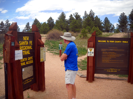
My goal was to bike north on the greenway, out of the Academy's
property for several miles, turn around, ride back through the Academy
to the Ice Lake trailhead, and return by road to our campground. My
total distance was 16 miles.
I enjoyed it so much, I talked Jim into a shorter ride today.
The description at the top of this entry has a good summary of the
scenery along the trail. There are continual views of the
mountains to the west, which helps take your mind off traffic where the
trail parallels 1-25 too closely in the northern part of the
Academy property.
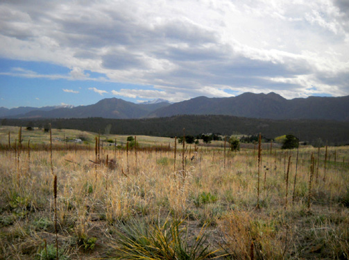
The other four miles of the trail through the Academy are far enough
from the freeway that you can't see or hear it.
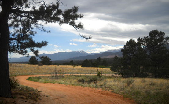
The trail descends to the south, with lots of hills and curves to
test your cycling skills.
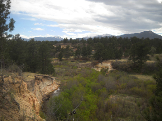
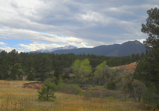
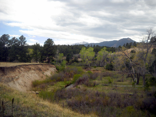
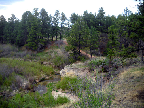
There are some cliffs near the trail above Monument Creek, which
winds through the eastern part of the
Academy property, affording nice views of the ravine through which
the creek flows.
There are several places where you can walk over to the
edge of the cliffs to see down into the creek bed:
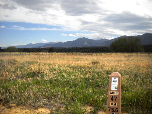
There are mile/kilometer markers along the trail but I'm not sure
where Mile 0 is located. The numbers do not coincide with a detailed
greenway map we got at REI, which goes from 0 at the Tejon Street
trailhead downtown to 26 at Palmer Lake.
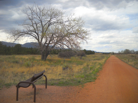
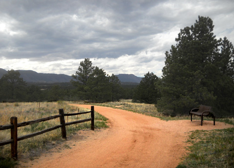
Nice features along the New Santa Fe Trail include benches at scenic
spots, several shelters and bathrooms, and interpretive signs re: the
history of the area, plants, and animal life. On my first ride I stopped
to read most of those.
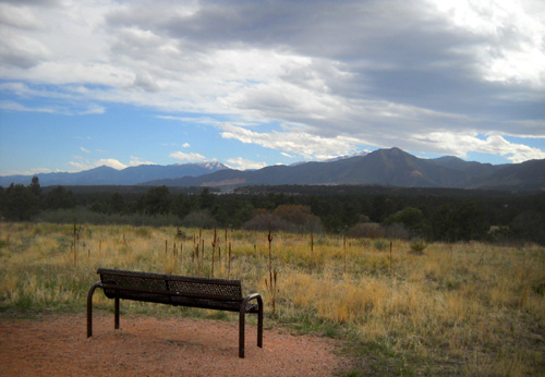
Bench with a view
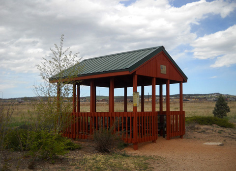
One of the shelters along the trail
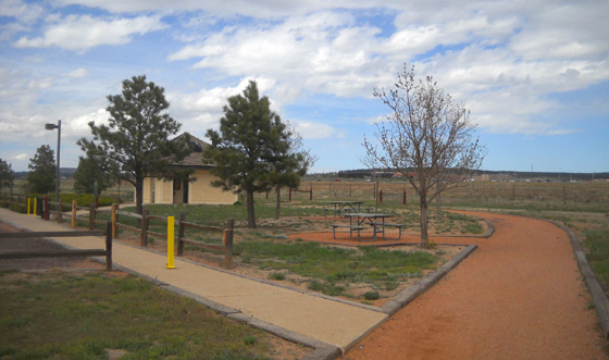
Nice picnic area and bathroom facilities at the Baptist
Road trail head
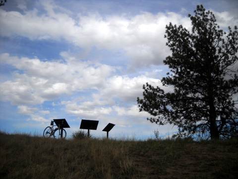
Silhouetted bike and interpretive
signs
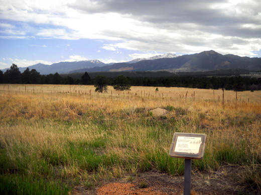
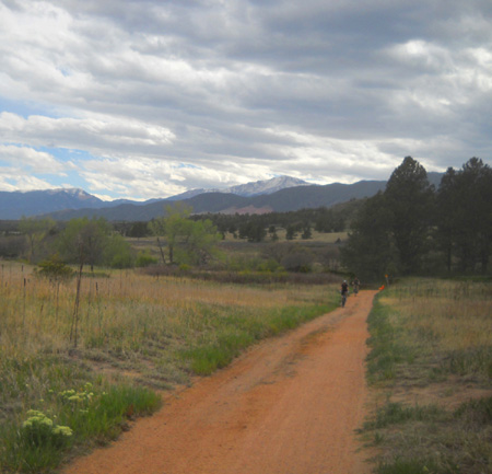
Pike's Peak is in the center
background with snow on top.
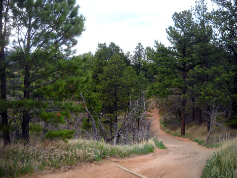
The terrain on the nine miles of the New Santa Fe Trail that I've
seen so far is quite varied -- from flat and straight to winding
and curving.
I was surprised how hilly it was from the north gate trailhead to the
Baptist Rd. trailhead, a distance of three miles, and four of the six miles through the Academy. I love the
way it winds up and down and around. It's fun to ride.
There was one hill that was entirely too steep for me to ride up,
especially with the wooden "steps" used for erosion control. The tires
that came on my TriCross bike just don't have enough grip on steep hills
with loose dirt or rocks. On pavement or with knobbier tires I could use
my granny gears and probably get up a hill like that.
Of course, it doesn't look so
steep from this perspective!
After I walked my bike up that hill I turned around to see if any of
the young studs could ride up it. One did, but very slowly.
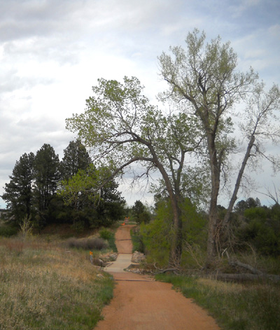
There is one relatively flat, straight section of trail for about two
miles south of the North Gate trailhead:
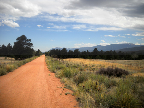
I assume that was part of the old railroad bed mentioned in the
description above.
In some places the trail is within sight of the current major rail
line that runs through the valley between I-25 and the Front Range:
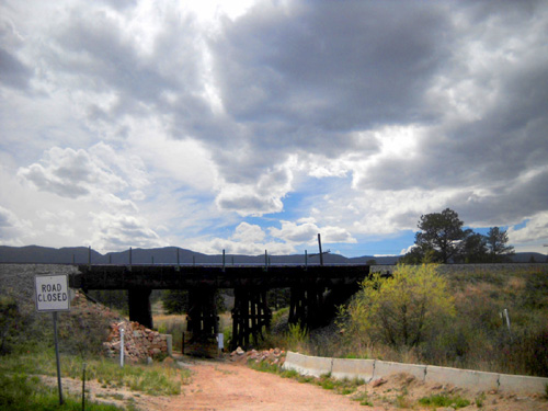
Railroad trestle near the Old
Santa Fe Trail north of the Academy
Fortunately, the trail wasn't close to the tracks for most of the nine miles I've
ridden so far nor did I see any trains on these two rides. Most of the
pathway is either far enough away from the tracks or below them enough to muffle the sound and block the
view of any passing trains.
Even when trains pass by, they'd be
interesting to see; I'm always
curious where they're going and what they're hauling.
All of the trail I've been on so far is rather smooth, hard-packed
crushed rock and dirt. There are a few places that are rutted or have
deeper sand to ride through.
The path is about eight feet wide, allowing plenty of room for
two-way traffic as long as folks don't walk or ride side by side.
Everyone I met was very courteous, which is also very different from
some of the clueless folks using the greenway in Roanoke.
Continued on next page . . .
Happy trails,
Sue
"Runtrails & Company" - Sue Norwood, Jim O'Neil,
and Cody the Ultra Lab
Previous
Next
© 2011 Sue Norwood and Jim O'Neil
