There are some very graphic photos of the deep snow on US 14A as it is
being plowed by WYDOT crews recently at the link above and at this one
from
RivertonRadio.com. Click on any of the
three photos at those links for enlargements.
Here's one of the pictures from the Lovell Chronicle site;
just look at all the snow!!
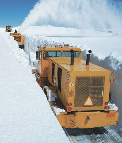
Below is another US 14A photo I found on the internet. It was taken by WYDOT;
here's the
link to the story dated May 26 about a landslide
that further delayed opening this road.
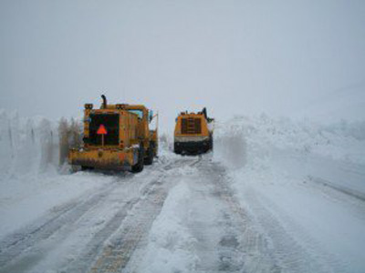
That picture shows a little more progress as crews widen one area
they've cleared. It looks like they were in white-out conditions that
day.
The remaining photos are ones Jim and I took today when we drove up US 14
from Dayton, WY to Burgess Junction (26 miles) and beyond on US 14A. We just had to
see what it looks like now, just two days before the Bighorn events
begin on Friday.
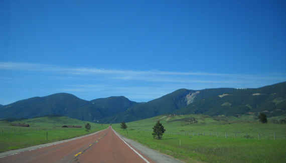
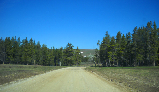
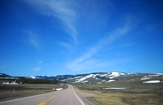
That's what it looks like (above) as we headed west on US 14 from Dayton
toward the Bighorn foothills.
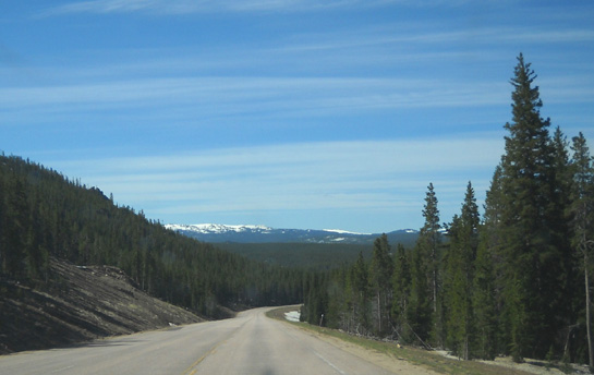
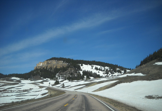
As we wound 5,000+ feet up the mountains toward the high plateau we could
see increasing amounts of snow along the roadside and in the distance
where the peaks reach heights of 11,000-13,000+ feet:
One of the prettiest scenes along this
section of highway is Sibley Lake, which is still partly frozen:
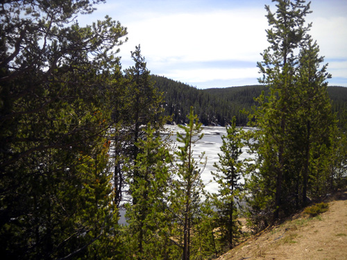
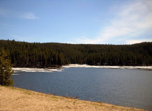
The campgrounds here and in other places this high are not open yet.
There was more snow a little higher up at the Burgess Junction Visitor
Center, located about half a mile from the actual junction:
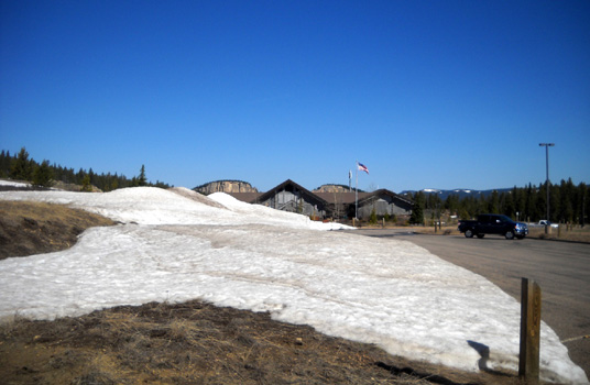
We were able to get inside far enough to use the restrooms but the rest
of the center was closed for an employee training day. We were hoping to
get some verbal information about driving conditions on the forest
service roads.
Not today. We'd just have to explore on our own.
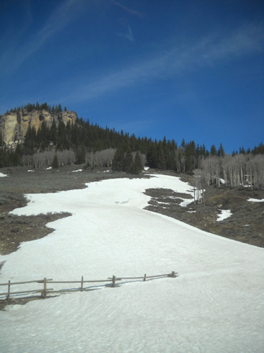
Before leaving the parking area Jim and Cody climbed up on a snow bank to give some
perspective on its depth:
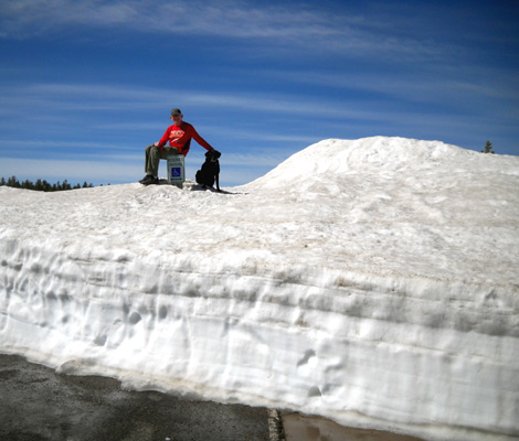
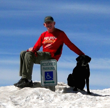
Jim found a "short" sign to sit on.
The elevation at Burgess Junction is about 8,100 feet. We expected to
see more snow on the ground here, but we soon found worse conditions
than we could safely drive through.
CONDITION OF FSR 15
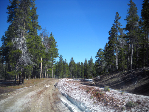
Just past the juncture of US 14 and US 14A we turned north on Forest Service Road 15
toward Dry Fork. The pavement turns to dirt and gravel in less than a
quarter mile.
This is the road buses take to deliver Bighorn runners to the start of
the 30K and 50K races at Dry Fork. It's also the road volunteers and
crews must negotiate to access that major aid station used by the 50K,
50-mile, and 100-mile runners. Folks drive several miles on FSR 15, then
turn right on FSR 168 for several more miles to reach Dry Fork.
Right now it is still in doubt if anyone can get back there by Friday.
We went in only half a mile before determining our chances of getting
stuck were too high to continue any farther.
We don't have 4WD, we didn't have a Verizon signal to call for
assistance if we got stuck, and we know it gets worse farther back where
sections of the road are in the shade for much of the day. It took Karen
Powers and her trail maintenance/marking crew six hours to clear a path wide enough for their 4WD
vehicles to access Dry Fork two or three days ago; the Forest
Service doesn't have the resources to plow it.
Whether the road will be accessible for the race depends on how much snow melts this week. If vehicles still can't
get all the way to Dry Fork by Friday, there is an alternative that
hasn't been used before: Twin Buttes.
You can see the buttes in
this picture I took from US 14 today:
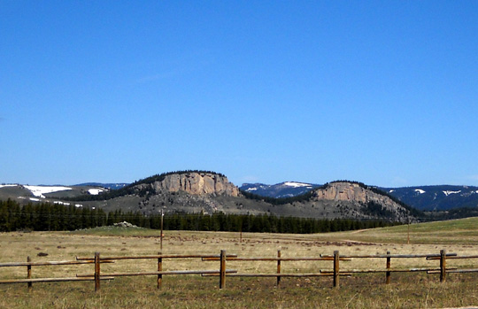
View of Twin Buttes from Burgess Jct. area
Race officials have already decided there will be a new aid station near
the buttes for the 50K, 50-mile, and 100-mile runners on their new
super-snow courses. Access is only a few miles back FSR 15 (farther than
we went today, but not nearly as far as to Dry Fork). The 30K may also
start there.
Dry Fork is still on the course for runners, who will just have to go
through some snow and mud to reach it.
This is the Bighorn Mountain Wild & Scenic Trail Run event, after
all! It wouldn't be as much fun if they took all the "wild" out of it.
SNOW CONDITIONS HIGHER UP ALONG US 14A
After we turned around we drove back to Burgess Junction and turned west
on US 14A, which leads to forest service roads that access other aid
stations on the traditional Bighorn courses. I love this drive! The
scenery is so beautiful, and it's even more beautiful when there is some
snow on the ground.
The shots in this section are in chronological order as we drove farther
west over what I call the high plateau through the Bighorn Mountains.
These are windshield shots I took while Jim was driving.
We knew the highway was finally opened last week but we wondered just
how high the snow is on FSR 13 to the Porcupine Ranger Station (normally
used as an aid station for the 50-mile and 100-mile runners) and FSR 14,
which accesses Porcupine and the Elk Camp aid stations. The two roads
are fairly close together. The elevation at their juncture with the
highway is at least 1,000 feet higher than Burgess Junction.
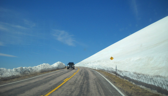
We drove for 20+ miles on US 14A over the gently rising plateau. All of
the streams that we could see were running fast and overflowing from
melting snow. The road was clear and dry.
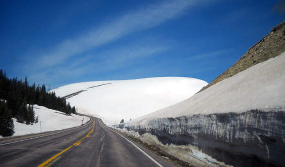
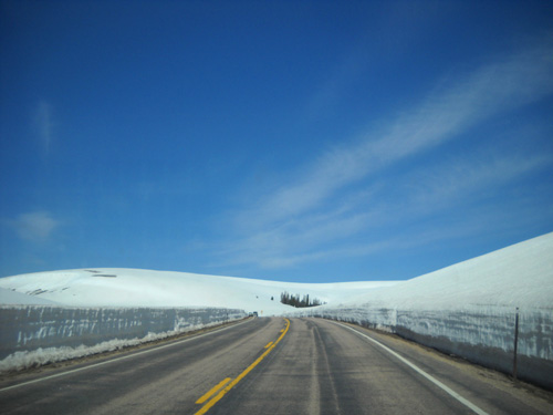
Snow levels increased as we got higher and higher, until the hillsides
were completely covered in snow. Only a few posts and pine trees peeked out
from the pristine white blanket:
Our high point today was at
the overlook at 9,340 feet about a mile before FSR 14:
More photos and narrative on the
next page.
Happy trails,
Sue
"Runtrails & Company" - Sue Norwood, Jim O'Neil,
and Cody the Ultra Lab
Previous
Next
© 2011 Sue Norwood and Jim O'Neil
