After reading that Bastrop is one of the more popular parks in the Texas
state park system, I was curious to find out why folks like it so much.
Both Bastrop and Buescher (pronounced Bisher) are fairly close to
McKinney Falls so it made sense to check them out while we were in the
Austin area this time.
Our primary goals on our first visit were 1) to determine whether we
wanted to camp at Bastrop for three days before heading to Huntsville
SP, 2) to see what the park trails were like, and 3) to see if that
12-mile road linking the parks was suitable for me to cycle. Although we decided not
to move to the campground at Bastrop we drove back another day to
run/hike some of the trails in the park.
THE LOST PINES: AN ISLAND OF DIVERSITY
Both Bastrop and Buescher state parks are located in an isolated
timbered region of loblolly pines and hardwoods that is called the "Lost
Pines." It is separated from the main body of East Texas pines by a
hundred miles of post oak forests and covers 75,000 acres (70 square
miles) in five counties on the Texas coastal plain.
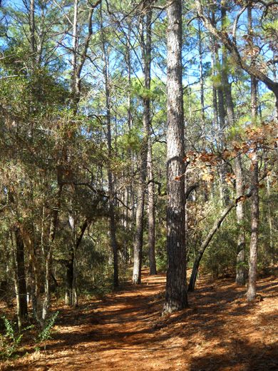
Typical soft, pine needle-covered Lost
Pines trail
Almost one-tenth of this unique pine forest is located in Bastrop and
Buescher state parks, which are dedicated to preserving this ecosystem
and protecting it from farming, logging, and urbanization.
The "lost pines" have persisted in this area of sandy, gravelly soil
for about 18,000 years. They represent the westernmost stand of loblolly
pine trees in the U.S. The ecological region in which they grow is known
as Post Oak Savannah. It is a mosaic of pines, oaks, shrubs,
grasslands, and mixed flowering plants. This diverse environment
supports many species of wildlife like white-tailed deer, bobcats, rabbits,
squirrels, opossums, armadillos, the endangered Houston toad, and about
250 kinds of birds.
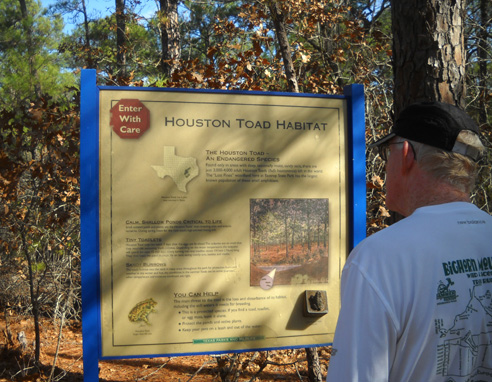
Jim reads an interpretive sign about endangered Houston
toads.
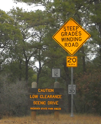
The park websites both mention that portions of the trails and Park
Road 1C may be closed between October and January for prescribed burns
and/or road paving. That prompted a phone call.
We learned that the road and all the
trails would be open while we were in Austin. The last burn was about a month ago and
the paving probably won't start until the end of 2011.
Prescribed burns are necessary in many
state and national parks to reduce undergrowth that can fuel large
wildfires and to improve the overall health and viability of the
forests. We could see evidence of recent controlled burns but were glad none
were going on while we were there.
ROOSEVELT'S FOREST ARMY
That's the subtitle of one section in an interpretive guide we picked up about these
two parks. You can download the guide at either park website:
Bastrop or
Buescher.
In the early 1930s the National Park Service (NPS), the Civilian
Conservation Corps (CCC), and what is now called Texas Parks & Wildlife
Dept. (TPWD) teamed up to design and construct buildings, roads, dams,
bridges, fences, and other facilities in many Texas parks.
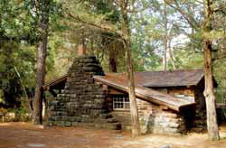
A stone CCC cabin at Bastrop SP
(photo from park
website)
Two CCC companies arrived at Bastrop and Buescher state parks in 1933
to transform almost 7,000 acres of over-cut and tangled forest into two
beautiful public recreational areas. Structures like the fences and
stone cabins at Bastrop were designed in harmony with the environment so
they appear to be part of the natural landscape.
The park's CCC showpiece is the refectory, a handsome dining hall built from cedar,
oak, walnut, and pine indigenous to the park and red sandstone quarried
nearby. The structure features carved mantels, roof beams, and
furniture.
Because of this legacy of CCC fine craftsmanship, Bastrop was
awarded National Historic Landmark status. It is one of only five CCC
parks in the entire country with this recognition. Unfortunately, we didn't know that until after our two visits
to the park and we didn't see the refectory or cabins. Rats. Guess we'll have to go back
another time, eh?
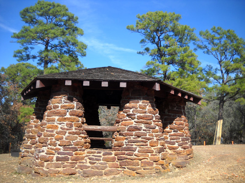
The Scenic Overlook pavilion was
built by the CCC in the 1930s.
You can see photos of some of the CCC buildings at Bastrop on the official
park
website and at the link to a video of
the park. Buescher doesn't have a separate video.
PARK ACTIVITIES & FACILITIES
At 5,926 acres, Bastrop is by far the larger of these two parks and
offers more trails and other amenities. Buescher comprises 1,016 acres
of hilly, wooded land.
Popular activities at both parks include picnicking, camping,
hiking/running, cycling, fishing, non-motorized boating (both parks have
rather small lakes), nature photography, wildlife viewing, interpretive
programs, and the scenic drive between the parks. Bastrop also offers
golfing on an 18-hole course and swimming in a large oval pool in season.
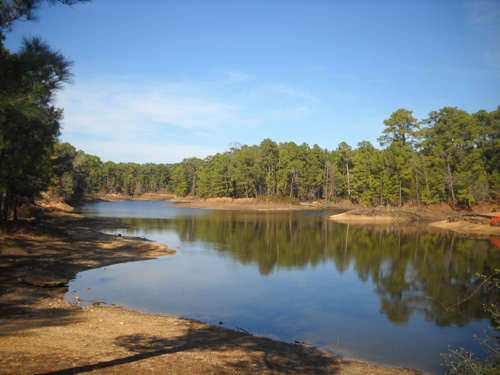
The lake at Bastrop SP is very
low right now.
Bastrop has eleven trails, several of them spurs, ranging in length
from 1/10th of a mile to 8.5 miles. Most are less than a mile
long. Total trail distance is about twelve miles. I'll talk more about
the trails we ran later in this entry.
Buescher has one 7.7-mile loop trail we didn't see. Both parks have lots
of paved miles for road runners.
I'm not sure how many of these trails can be used for mountain
biking. Bikes are not allowed on the Lost Pines Trail. Both parks' websites encourage the use of winding, hilly,
narrow, paved Park Road 1C for cyclists, although the Buescher home page
indicates it is for "experienced" cyclists. After we drove it in our
truck, we decided neither of us is trained for hills like those right
now!
Note to folks with RVs: unless you have a very small motorhome
or camper, you don't want to drive it on Park Road 1C between the two
parks. In addition to the steep grades and narrow width of the road, there are
also some tight
curves and low-hanging branches. Enjoy the
road in your tow vehicle, toad, bike, or on foot.
Speaking of RVs . . .
Both parks have RV and tent camping sites with or without water and
electricity. Bastrop has weekly and monthly rates during the winter
months. The sites are a little larger at Bastrop than they are at
Buescher -- but not nearly as generous for medium to large RVs as
some other Texas state parks we've visited. We decided we were better
off extending our stay at McKinney Falls SP instead of moving over to Bastrop for
three days.
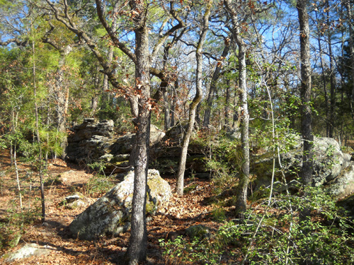
Boulders along the Lost Pines
Trail
Bastrop also offers youth group camping, eleven rustic stone cabins,
lodges, group barracks, and two
large dining halls. Buescher has several limited-use cabins, screened
shelters, a group picnic pavilion for day use, and a recreational hall
for day/night use. Both parks have picnic areas for day use.
Check the two park links above for further information about camping,
facilities, and fees.
OUR DRIVING TOUR THROUGH THE PARKS
Our first visit to the parks was on a chilly, damp, overcast day when we
weren't real motivated to get out of the truck! We ran and walked at
McKinney Falls that morning before driving over to Bastrop and Buescher.
The closest park, Bastrop, is about 30 miles from McKinney Falls,
Buescher about 40 miles (we returned via four-lane US 71, not Park Road
1C).
All we did on our first visit was drive through the parks and on the
scenic road that connects them.
Beginning of the scenic drive at the Bastrop SP end
of the road
The entrance road at Bastrop bisects the
golf course, an attractive introduction to the park. Our state park pass
allowed us free entry; visitors without a pass must pay $4 per person
over age 13 per day. We picked up a park map and a
separate trail map that shows details of the hiking trails, including
the Lost Pines Trail.
Check the Bastrop
website to see a map of the park.
We drove through the Piney Hill RV campground first, then followed
Park Road 1A counter-clockwise in a convoluted loop on the south and
east sides of the hilly, heavily-forested park. We turned in to look at
the Copperas Creek camping area. It's an appealing place to camp but the
sites are too small for our rig.
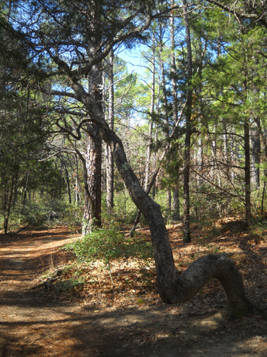
Interesting tree along the trail
at Bastrop SP
We passed several trailheads on our way to the juncture with Park
Road 1C. All the single-track trails looked inviting from the road.
We turned right on 1C, missing the last quarter of the loop around
Bastrop. We made sure we saw that when we returned a few days later to
run/hike the Lost Pines Trail. We passed the lake but didn't drive up
the road (1B) to the area with the CCC cabins.
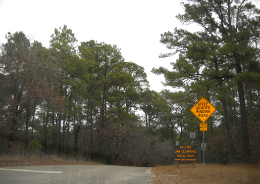
Park Road 1C is indeed hilly, narrow, and winding. The speed limit is
only 20-30 MPH so it took a while to drive the twelve miles to Buescher SP.
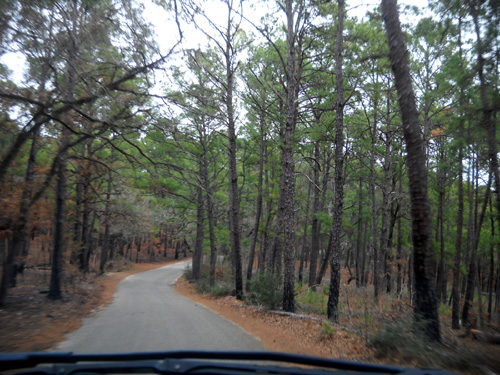
Park Road 1C on a gray day
The first part of the road is through quiet, forested, undeveloped
park terrain. Several miles of the road at the southeastern end near
Buescher are on private property. Although we saw one business and some
driveways to cabins in the developed section, we saw very few vehicles
on the road the weekday afternoon when we were there.
We entered Buescher from the north, the "back door" on the opposite
side of the paved park loop from the entrance station. We didn't see a
self-pay station . We knew our parks
pass was good, so we didn't worry about having a permit on our
windshield from Bastrop and not Buescher. I guess they figure anyone
entering Buescher from that side has already been through the gate at
Bastrop.
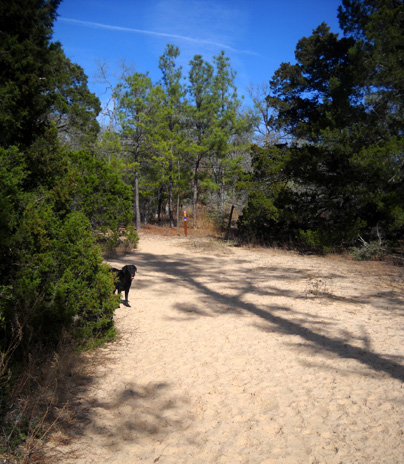
Sandy section of the Roosevelt
Cutoff Trail at Bastrop SP
We weren't in Buescher State Park very long, just long enough to drive
through two of
the campground loops (Lakeview and Oak Haven) and determine the sites
weren't big enough for our rig. They are pleasant sites, however, for
small to medium RVs.
We followed Park Road 1C around the western half of the park. We
didn't drive on the park road (1E) that passes the trailhead for the
7.7-mile hiking trail loop but assume it's similar to the trails at
Bastrop -- heavily forested and hilly.
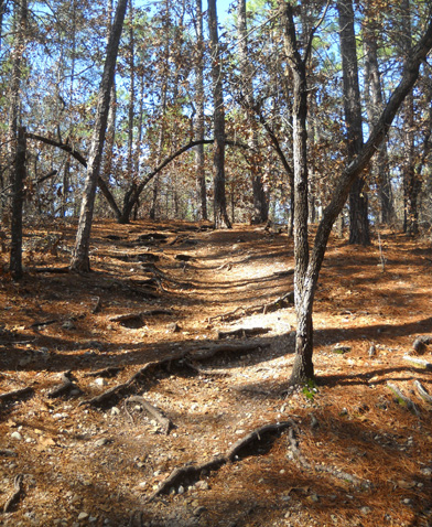
Roots on an uphill section of the
Lost Pines Trail
I don't have any photos of Buescher SP. If it had been a sunny day, I
would have been more likely to take pictures!
We stopped at the park headquarters on the way out of the park to get
a park map and ask some questions. Visitors who enter the park from FM
153 off US 71 either enter free with their state parks pass or pay $4
per person (age 13 and up) per day.
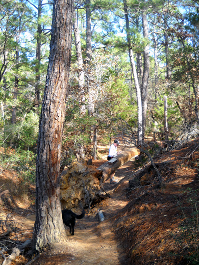
LOST PINES HIKING TRAIL AT BASTROP STATE PARK
Today, our last full day in the Austin area, we finally made it back
over to Bastrop for a long run. It
was a beautiful sunny day this time, pretty warm for us in the upper 60s
F.
We aren't acclimated to upper 60s but we didn't complain! We are
soooo tired of winter weather.
We parked at the main trailhead for the Lost Pines Trail. It is
located where I drew the arrow on the map below, in the northern part of
the park at the Lost Pines Overlook pavilion:
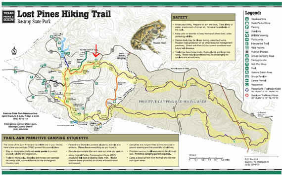
I know that map is too small to read but I wanted to
show you the general layout of the trails at Bastrop. To see a
full-scale map, go to the trails
link on the Bastrop SP website.
Jim ran the entire route I marked in yellow, a distance of about
twelve miles. It included the Lost Pines Trail (which is mostly
in the shaded area on the right side of the map), Scenic Overlook Trail,
and some road mileage. Cody and I hiked (and ran a little bit) for nine
miles on the Lost Pines, Roosevelt's Cutoff, and Scenic Overlook trails.
It took all of us about three hours going clockwise on our respective
loops from the red arrow and back.
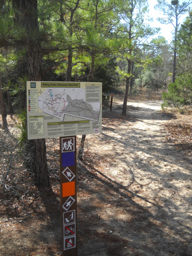
The trails we saw in the park were very well marked with maps
and arrows at
intersections (photo above). Each trail is color-coded. In the
example above, I knew I wanted to bear left on the purple Lost
Pines Trail. I never had any doubt where I was or where I was
going.
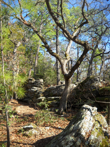
Jim and I were both pleased with the single track trail surfaces
and general terrain, which is hillier than what we've been doing
lately. It's also hillier than the trails at Huntsville State Park,
where we're headed next.
We were in and out of some ravines but didn't see any
running water in any of the creeks.
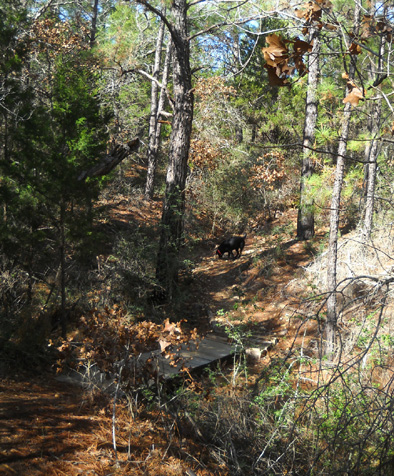
Bridge across a little dry creek on the
Lost Pines Trail
There were no clean ponds for Cody to cool off or drink until we
were almost back to the truck, just a
couple mucky waterholes. Since it was warmer than Cody and I are
used to, we could have both used more water.
Otherwise, I loved the hilly, curvy Lost Pines Trail and
Roosevelt's Cutoff. There were very few long, straight sections
yet the trails are "fast."
The dirt trail surfaces have some sand in them; they
probably dry out pretty quickly after it rains. There are some
roots and rocks but most of the Lost Pines Trail and Roosevelt's
Cutoff are pretty
smooth.
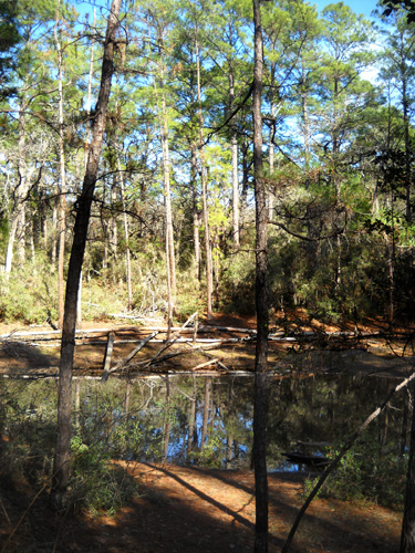
Small pond on Roosevelt's Cutoff Trail
Most of the trails at Bastrop are shaded with the tall loblolly
pines that give the trail its name. There are also some
deciduous trees and shrubs in the mostly-open forest. I didn't
see any flowers in bloom where I hiked.
Cody and I got back to the truck before Jim was done running.
We drank some water and started down the Lost Pines
Overlook Trail until we met Jim coming the other way. We walked
back up to the truck, sharing trail stories:
ATHLETIC NIRVANA?
I doubt we'll ever camp at Bastrop or Buescher but if we stay in
the Austin area again, we'll probably drive back over to one or
both of these parks to run/hike on the trails. Running friends
John and Marcy Beard have also told us about other nice trails
in the area of Bastrop Lake, which is larger than the lake in
the state park.
The roads and trails through the Lost Pines area are popular
venues for foot and cycling races, too. John is participating in an adventure
race soon in the Bastrop Lake-Bastrop State Park area. If Marcy
wasn't working in New York right now she'd be on his team. I
bet there are some trail running races in the Lost Pines area, too.
Part of the course for the popular
MS 150 bike race from Houston
to Austin uses the roller-coaster road through and between Bastrop and Buescher state parks. According to the race website, this is the
largest event of its kind to raise money for the National
Multiple Sclerosis Society. Last year 12,000 cyclists in this
two-day, 180-mile (not 150) event raised $16 million for MS.
This year's race will be held in mid-April.
I'm enjoying our new Specialized TriCross cyclocross bike enough
to consider someday doing a cycling "century" ride
on it or my Terry Isis road bike,
but 180 miles sounds painful! Maybe I can work up to something
like that some day . . .
Next entry: back "home" at Huntsville State Park
Happy trails,
Sue
"Runtrails & Company" - Sue Norwood, Jim O'Neil,
and Cody the Ultra Lab
Previous
Next
© 2011 Sue Norwood and Jim O'Neil
