I can't believe another natural disaster has occurred in a place we
recently visited!
Now you know why I wanted to use so many photos in my series of
entries about the Falls Trail at Bandelier: it may never be the
same again.
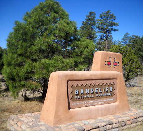
Handsome entrance sign to Bandelier National
Monument (May, 2011)
The three trails above, plus Juniper Campground, were reopened on
July 15 after the threat of fire was over in those areas. (Ironically,
one of the trails is named "Burnt Mesa!") The
Los Conchas Fire, New Mexico's largest fire ever, was finally
100% contained about a month after it began. It burned a whopping
156,593 acres in the northwestern part of the state. Parts of the fire
are still smoldering within the containment zone.
Areas affected in addition to Bandelier National Monument are the
Santa Fe National Forest in Sandoval, Los Alamos, and Rio Arriba
Counties; Santa Clara Reservation; Jemez Reservation;
Cochiti Reservation, Santo Domingo Reservation; Valles
Caldera National Preserve; and state and private in-holdings like
the Pajarito Mountain Ski Area.
THE POTENTIAL DANGER TO FRIJOLES CANYON
If you look at a map of Bandelier, you'll note that the only places
open in the park at the current time are on the mesa above Frijoles
Canyon to the east. The canyon and everything west of it is closed
either because of fire damage or the danger of flash flooding.
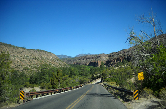
This entrance road down into
Frijoles Canyon is closed to the public now. (May, 2011)
Everything in Frijoles Canyon, where the main sites within the park
are located -- the visitor center, administrative offices, the
fabulous cliff dwellings, Tyuonyi Village, Alcove House, the Falls Trail
down to the Rio Grande -- all those are closed indefinitely to
the public, as are all the backcountry trails in the park.
As many artifacts and exhibits as possible from the visitor center have
been removed in case of flooding so they are not damaged.
This
page from the National Park Visitor
website has a good explanation of what's going on at Bandelier A/O
mid-July.
The park
website will be updated periodically as
more sites and trails are opened up.
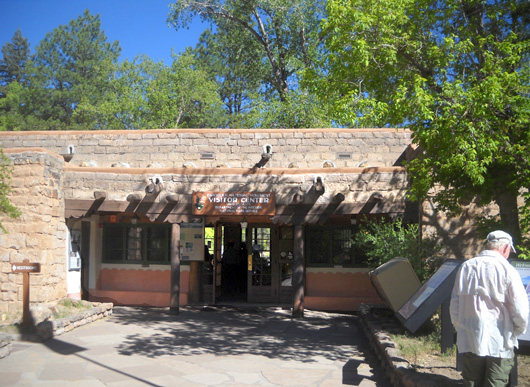
Jim reads interpretive signs
outside the entrance to the CCC-built visitor center at Bandelier (May,
2011)
Apparently part of Frijole Canyon was involved in the 20,800 acres
of Bandelier's total 33,750 acres that were burned. In addition, flash flooding
is a big concern this summer. In bold red letters on the park's home
page
(A/O today) is written:
"As northern New Mexico's season of afternoon thunderstorms could
begin at any time, the possibility of flash flooding in the park, and
especially Frijoles Canyon, will keep much of the park closed for the
near future. More sections of Bandelier will open as soon as conditions
allow for safe visitor access."
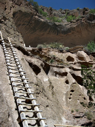
The trail to the
culturally-historic Alcove House is
currently closed. (May, 2009)
Mid- to late summer is referred to as "monsoon" season in parts of
the West including New Mexico and Colorado.
We spend a lot of time in the Rockies (especially Colorado) during
the summer. After the monsoon season starts we can count on literal
gully-washers most afternoons as storm clouds gather over the mountains
and dump prodigious amounts of rain in short periods of time. The storms
are often very localized but they can cause serious erosion, landslides,
and flash flooding.
We are careful about camping or hiking in canyons because of this
danger.
The final steps up to the Alcove
House (there are many more!) (May, 2009)
That's a big concern after fires like this one. This explanation on
the New Mexico Fire Info
site dated July 14, 2011 further
explains the problem:
"The severity of the fire resulted in a loss of vegetation that
provides soil stabilization and caused a water-repellent condition in
the soil. With the monsoon season beginning these conditions could lead
to devastating floods in Frijoles Canyon where the park’s visitor
center, administrative offices, and a large number of cultural and
historic sites are located. Diversion dikes, waterproof barriers, and
sandbags have been installed in this area to mitigate the potential
damage from flooding."
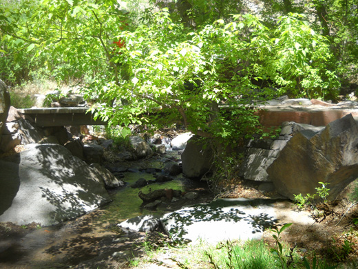
As low as Frijoles Creek was when
I took this picture of a bridge across it on
the Falls Trail on May 25,
2011, it's hard to visualize it being flooded.
Well before the Las Conchas Fire was contained, Burned Area Emergency
Response (BAER) team members were busy identifying what areas needed
treatment "to stabilize soil; control water, sediment, and debris
movement; prevent impairment of ecosystems; and mitigate
significant threats to health, safety, life, and downstream values at
risk." (same
site, July 24 update)
Of special
concern at Bandelier are the irreplaceable Ancestral Pueblo
archaeological sites, such as the one below:
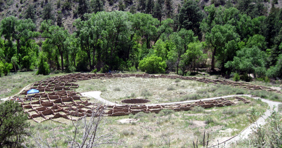
Tyuonyi Village lies in the upper
canyon along Frijoles Creek (May, 2009)
Treatments in the national forest and at Bandelier will include
aerial seeding and mulching, extensive trail and road work, and other
rehabilitative "mop up."
This
site also has extensive information
about the fire and a map showing its boundaries; today's
update is the last, it says, so this link may not work forever.
HISTORY OF FIRES IN THE AREA
This isn't the first large fire at Bandelier in modern history.
According to the park
brochure, "Fires in 1977 and 1996 together burned almost 40 percent
of the park. In 2000 a fire that began in Bandelier traveled northeast
along the mountain slopes and through neighborhoods in Los Alamos."

Santa Fe National Forest on
outskirts of Los Alamos (May, 2010)
That was the awful Cerro Grande Fire that burned more than 43,000
acres and destroyed a couple hundred homes and businesses in Los Alamos.
You can still see the obvious scars on the trails through the Santa Fe
National Forest west of town.
The Jemez Mountain Trail Runs go through several miles of that burned area.
You can see photos I took in 2009 and 2010 of Guadje Ridge during
training runs/hikes (entries dated May 15 and 17, 2009 and May 21,
2010).
Although I didn't hike up there this year (because it's still
ugly!), Jim confirms that it looks the same. Here's an example:
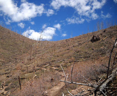
This part of Guadje Ridge was burned ten years
before I took this picture!
It used to be covered with beautiful ponderosa
pines and other plants. (May, 2010)
Oddly, partly because of the Cerro Grande Fire in 2000, Los Alamos
was spared from this one.
How? Because so much of the vegetation was already burned. Not only
was there less to burn, it was easier to contain the Las Conchas fire
line near the city this time.
We first heard about the fire from our ultra running friends Deb and
Steve Pero, who live southwest of Los Alamos a mere mile or two from the
start of the Las Conchas Fire. Fortunately for them, the fire burned to
the north and not in their direction. They were certainly on pins and
needles for several days or weeks, however, and ready to evacuate at a
moment's notice if the winds changed and the fire headed their way. That caused a lot of stress for them right before the Hardrock 100
race.
NM 501 southwest of Los Alamos
was closed for several weeks. LANL property is to the left. (May,
2009)
The lives of many people were disrupted before the fire was
contained. Residents of Los Alamos were evacuated for several days and
roads in the area were closed. People who lived in nearby White Rock
were on notice that they might have to evacuate if the winds shifted.
Many other folks who lived in the area also had to leave their homes.
Los Alamos National Laboratory (LANL), which employs something like
12,000 people, was shut down for several days, as were numerous smaller
businesses.
Fortunately, the fire did not destroy either town or LANL property
this time.
HOW DID THE FIRE START?
I've read the fire cause as both "human" and "natural." Per a July 3
update on the NM Fire Info
site:
"An interagency investigative team led by New Mexico State
Forestry has been determined that the Las Conchas Fire was caused by a
fallen tree that caught fire after coming into contact with nearby power
lines, according to New Mexico State Forester Tony Delfin.
Investigators from New Mexico State Forestry, the USDA Forest
Service, New Mexico State Police and Sandoval County conducted the
investigation and were on scene shortly after the fire started on
Sunday, June 26 . . . Investigators believe the fire started after an
aspen tree was blown down onto nearby power lines during a period of
strong winds. The contact resulted in the line arcing, which then caused
the tree to catch fire. Heat and flame caused the line to snap, which
then allowed the burning tree to fall onto the ground where the fire
spread into nearby vegetation."
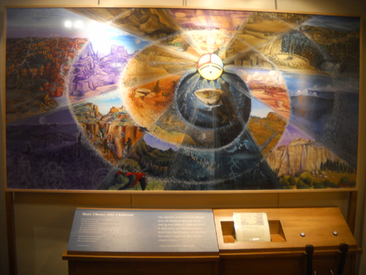
Interesting Native American art
re: circles of life (displayed in the visitor center at Bandelier, May,
2011)
Considering the cost and destruction involved, I hope the fire was
caused in this way and not by a careless (or callous) human.
OTHER QUESTIONS
As far as I can tell from the above websites, no lives were lost in
this fire. Fifteen people were injured (probably firefighters).
Sixty-three residences and some outbuildings were destroyed; many
more were threatened. And over 156,000 acres of land were burned.
We are very glad that none of our friends in the area or their homes
were harmed. We are saddened by all the property losses, however.
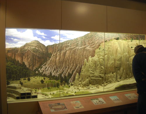
Scale model of the Ancestral
Pueblo cliff dwellings and village
in Frijoles Canyon on display in
the visitor center (May, 2009)
I know there are distinct ecological advantages to wildfires, but
. . .
- I wonder what Bandelier looks like now, and if all the national
treasures to be found in Frijoles Canyon -- both geological and
cultural -- will be spared from damaging flash floods
caused by the fire. Will the backcountry trails reopen?
- Will Valles Caldera National Preserve reopen to visitors?
- The Santa Fe National Forest? (trails, campgrounds, etc.)
- What about the Pajarito Mountain Ski Area?
- And what about all the wildlife that has been displaced?
2012 JEMEZ MOUNTAIN TRAIL RUNS - ??
Then there's the question of whether the Jemez Mountain Trail Runs
will be held next year -- and if they are, can they ever be the same
quality experience?
When we talked with the co-RDs at Hardrock in early July, the fire
was nowhere near contained and Los Alamos residents had only recently
been able to return to their homes after being evacuated. At that time
Bill and Kris did not have much information about the destruction along
the Jemez race course because the public wasn't allowed in those areas.
The race goes through a lot of national forest land near Los Alamos, the
Valles Caldera, and the Pajarito Mountain Ski Area.
I still don't know how much of the course was burned. It could be
years before dangerous snags are removed or fall naturally, and trails
are repaired and reopened.
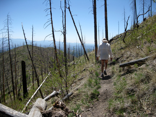
Jim runs by snags on the trail on Guadje Ridge. The snags had been
there for nine years when I took this picture in
May, 2009.
We hope the race will be run next year, as it brings a lot of
visitors to Los Alamos and has a significant impact on the local
economy. A reroute would be better than no race at all.
I realize there are other more important ramifications of this fire
than the ones I've mentioned, but I wanted to talk about recreation and
travel issues relevant to this journal -- in particular,
Bandelier, the surrounding area that we enjoy so much, and the Jemez
race.
ADDENDUM AUGUST 10:
The Peros sent me these links to photos on or near the Jemez course
that were taken recently by
Bill Geist and
Blake Wood. Bill's got at least four
Picasa albums devoted to the fire damage.
Wow. Just wow.
ADDENDUM AUGUST 18:
Co-RD Bill Geist wrote to let us know the Jemez Mountain Trail Runs
website has been updated with
information about the 2012 race. Because most of the 50K and 50-mile
courses are in the burn zone which will be closed to the public for many
years, the courses will be have to be substantially re-routed. The date
of next year's race is tentatively scheduled for May 19, pending
approval of the forest service.
We hope the race will live on and people will continue to support it.
The local running community knows how to provide races that are fun and
a good value for the money.
Now back to our regular programming from May: five days
at the USAF Academy campground in Colorado Springs
Happy trails,
Sue
"Runtrails & Company" - Sue Norwood, Jim O'Neil,
and Cody the Ultra Lab
Previous
Next
© 2011 Sue Norwood and Jim O'Neil
