Ditto for a woman!
There are some peaks that hold so much allure
for me that I am essentially fixated on them when we're camping nearby.
When we're visiting Colorado Springs, for
example, my eyes search for a glimpse of Pike's Peak whenever I'm
outside. Ditto for Mts. Elbert and Massive when we are in Leadville.
All three peaks so dominate their respective landscapes that they are hard to miss.
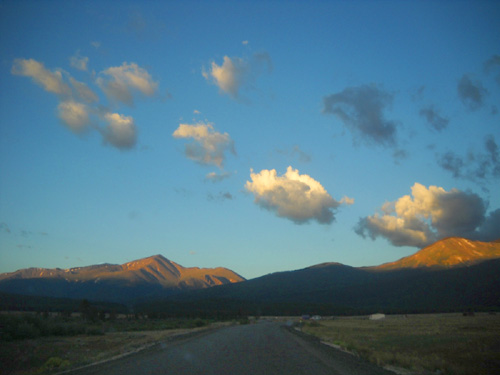
Sunrise
brightens the summit of Mt. Elbert (L) and the left side of Mt. Massive
(R).
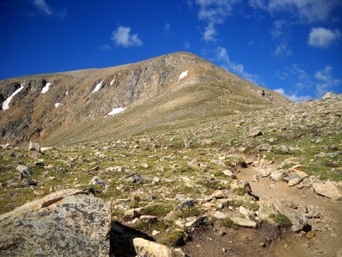
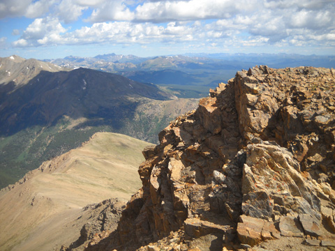
The
prominent ridge facing this direction on Elbert is where I ascended
today.
I'm eager each year to get back out to climb to
their summits. Before I get the opportunity I think, "I've been all
the way up there before -- I wonder if I can do it again?" At
my age and with bum knees, I don't take it for granted that I'll be able
to climb 14ers forever.
After
I've climbed them once more I stare at them from far below and think, "Wow -- did it again! I was all
the way up there on that point yesterday!!"
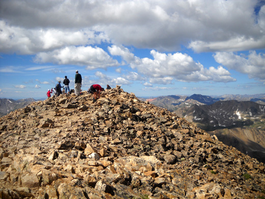
Mt. Elbert summit this morning: chalk up another
ascent!
From the valley
the summits always look impossibly far away even though I've been up to
each of them several times. What's especially gratifying is to look out in the distance
to Pike's, Elbert, Massive, and other 14ers I've climbed (and lower
peaks, too) and realize I got up there under my own power.
I had that same experience on my two journey
runs (Appalachian Trail and Colorado Trail) when I'd look behind me and
see a string of ridges I'd already hiked. It's an awesome feeling.
MY TRAIL TRIANGLE
I've climbed Mt. Elbert more times than Mt. Massive. I
prefer the trails on Elbert so I chose to hike it today. If I have time
and the weather cooperates, I may also climb Massive again before we
leave the area.
Elbert has the allure of being the highest peak
in Colorado (14,433 feet) and the second-highest peak in the Lower 48
states. Massive, which lies just to the northwest of Elbert, has five
summits over 14,000 feet. Its highest point (14,421 feet) is the
second-highest peak in Colorado.
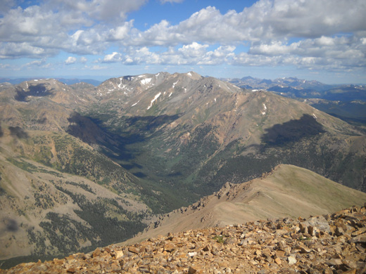
View from Mt. Elbert's summit north to Mt. Massive;
"massive" is right!
There are five major trails on Mt. Elbert. The two
easiest and most popular are on the east side of the mountain facing the
valley with US 24.
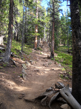
My favorite way to ascend Elbert is on the
NE face via access off the Colorado Trail from Halfmoon Road. It's a relentless climb with some steep grades and lots of rocks
but it is rated as a Class I (easy) route. Keep in mind that any route
up this mountain will involve an ascent of about 4,000 feet in four or
five miles -- at high altitude -- so it's no piece of cake
unless you're already acclimated and trained for rather rough mountainous terrain.
You don't need any climbing equipment, however.
I like this trail for several reasons. One is that I
can't see the summit until I'm very close to it. Popping over the last
ridge and suddenly seeing the very top is always a nice
reward for the effort to get there. This route is the
only way I've ever climbed to Elbert's summit.
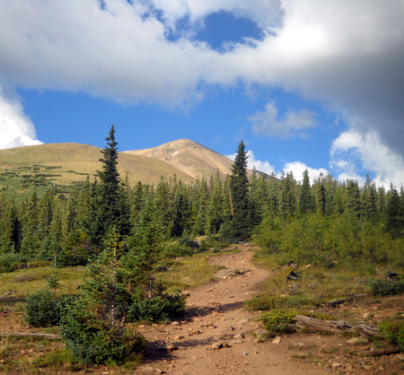
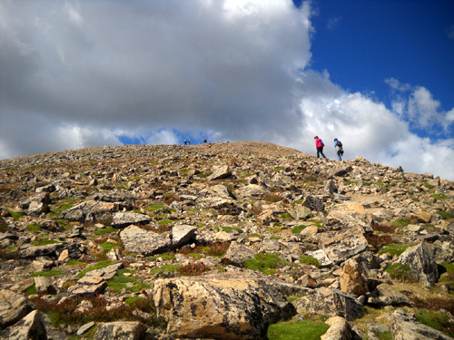
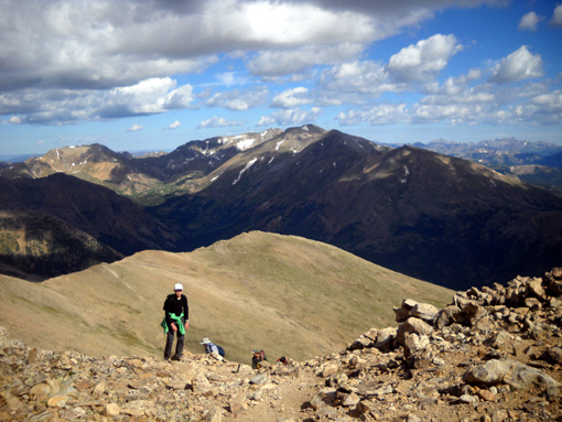
One of
Elbert's false summits, as seen near the treeline (~12,000 feet elevation)
Because of my knees, however, descending that
steeper, rockier route with loose scree is harder for me now.
I knew from topo maps and visual observation
from the NE ascent -- you can see parts of each trail from the
other -- that the grade was
a little easier on the East Trail from Twin Lakes but I didn't try it until
my knees really deteriorated a few years ago.
Going up the
NE slope; note the large cirque (bowl) to the left.
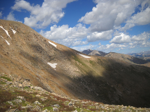
This is a view of the same cirque that I took from
the other side (the east slope) as I descended.
On my ascent I could see some remaining
snowmelt at the bottom of the cirque.
The ridge on the other side of the cirque is the
one that goes SE toward Twin Lakes.
What works well for me now is to
hike up the NE side, down the east side, then return to the trailhead on Halfmoon
Road via the Colorado Trail. I've highlighted those trails on the map below.
This map is from Gerry Roach's classic Colorado's Fourteeners book, 2nd edition,
p. 92:
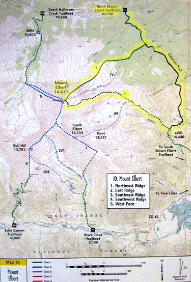
Gerry identifies the NE route as "Northeast Ridge II" and it is marked with #1
above. He calls the eastern route "East Ridge II;" it is marked #2 above.
The
National Forest Service calls these two
popular routes North Mt. Elbert Trail and South Mt. Elbert Trail.
Since there are other trails on the south side of the mountain I'll use
Gerry's NE and East designations.
Note that the Colorado Trail is to the right, running predominantly
north-south. I started/ended at the top of the map at the north Mt.
Elbert trailhead.
Here's a closer view of the map and the direction I went today:
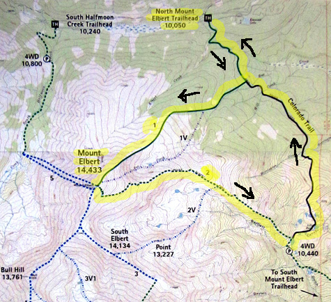
I call this the "Elbert Triangle" hike.
Maybe I should call it a loop?
The total
distance is about 14 miles, which I can still manage in a day hike even
though I can no longer run any of it. Correction -- shouldn't run any of
it. I still do a little bit of running here and there.
UP 'N AT 'EM
Jim and I got up at 5:30 AM so I could get an early start on my hike. It
was 46 F. on our thermometer in Leadville, elevation 10,200 feet. I'd be
going up to 14,433 feet, where it's colder.
Despite a 30% chance of rain in Leadville it didn’t rain in the valley or on
the mountain. Highs were mid-70s in Leadville (50s or 60s on the summit) and it was mostly sunny all day with low humidity. There were lots of
billowy white clouds and some breeze all day – great weather for a hike on Elbert
or any other nearby mountain!
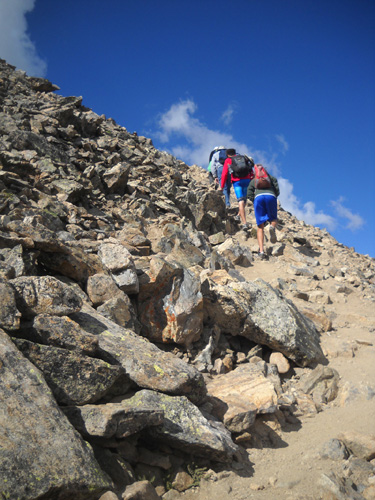
Several hikers are silhouetted against the sky and
clouds as we all ascend Elbert's NE face.
Jim and I drove out Halfmoon Road (FR 110) to the North Elbert Trailhead. That road is
awful with all the bumpy “corduroy,” the worst I've ever seen it.
Since the military helicopter crash on the side of Mt. Massive that
killed some troops a couple years ago Halfmoon Road is no longer used in
the LT100 foot race; runners have been rerouted to the “pipeline” and
are now on the Colorado Trail fewer miles, too.
We got out to the trailhead about 6:45 AM and left the truck there. The
parking area was already mostly full -- that early on a Wednesday
morning! I doubt everyone was hiking or running up to the Elbert summit; some
were probably hiking, running, or cycling only on the Colorado Trail (CT), which runs
contiguously in this area with the Continental Divide Trail (CDT).
Jim took his mountain bike in the truck with us and left soon after I did. He
rode his bike back to the camper, a distance of 13
miles, on dirt and paved Forest Service and county roads.
When I got done hiking I drove the truck home.
SORRY, CODY-BEAR, YOU CAN'T GO
If memory serves,
Cody's been up there with me every previous time I've climbed Elbert in
the last eight years (i.e., since we got him).
I didn’t take him this time. He can do the distance but there just
aren't enough natural sources of water on this route for him to get
enough to drink for as long as I knew we'd be out there.
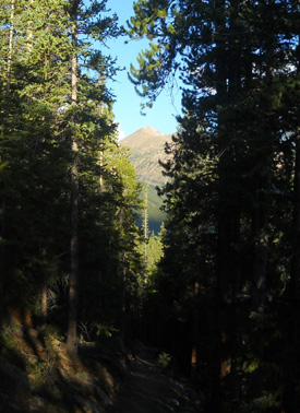
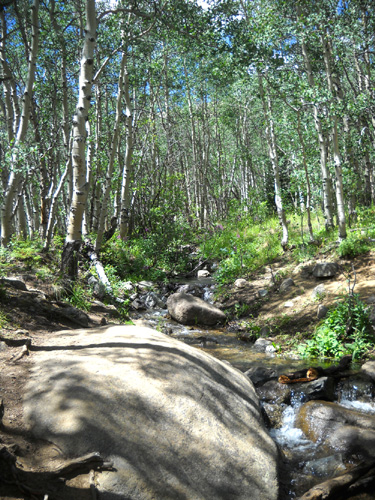
(L) View of Mt. Elbert from the Colorado Trail; (R)
still in the forest on the NE route
Last year Cody and I ran out of water on this same hike even though he was carrying two liters in his pack
and I gave him some of mine;
I didn't want that to happen again. I figured it would take me even
longer this year since I'm getting slower as I get older.
It didn't take me any
longer this time, but the lack of water would still have been a big
problem.
The only available water going CCW on the triangle is 1) on the Colorado Trail
1/3 mile from the beginning of
the hike and 2) then not until about five miles from the end, coming down
toward Twin Lakes on the East Elbert Trail a little before the junction with the CT:
The last five miles on the CT there are several streams. It was the nine miles
with no streams I was concerned about.
I knew Cody would have to go about six hours between creeks. He requires about
twice the amount of water I do -- especially on a sunny day at
high altitude -- and between the two of us, we can’t carry
enough for that long. In addition, he hasn’t been wearing his pack much
this summer and I didn’t want to weigh him down with more than two
liters of water (that amount would last him only 2-3 hours).
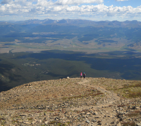
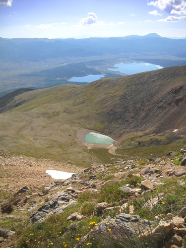
Over the edge? Looking back down the NE ridge from
about 13,000 feet as I'm ascending Mt. Elbert
Now I'm higher during my ascent.
If you take a dog up Mt. Elbert or any other mountain consider the
distance you'll be going, the location of streams, and the time you
think it will take you. Then take more water with you (for yourself
and your dog) than you think you'll need for the space between water
sources.
MY HIGHEST CLIMB THIS YEAR
This was another consideration regarding Cody: neither of us has
been
over 12,600 feet elevation yet this summer.
This
hike is almost 2,000 feet higher than that. We had a lot more mountain
training last year before this triangle hike, including two 14ers before Elbert
and more high-altitude training in the Bighorns and San Juans in June
and July.
I realized the latter fact about one mile before I finished today! I
might not have done as well if I knew that going uphill. <grin>
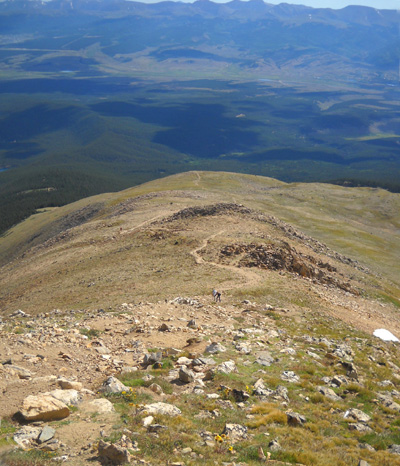
Above and below: views toward the NE from
just before the summit;
Turquoise Lake and Leadville are in the distance.
Even so, it took me about the same amount of time this year as last --
8:15 hours. When you find out how many pictures I took you'll wonder how
I got back down before dark!
It would have taken me a little longer with Cody (getting him water,
mostly, and moving him off the trail when others went by). I got to the
summit about 10 minutes faster this year than last, spent the same
amount of time up there (35 minutes), and took a little longer on the
descent and Colorado Trail.
Even though I wasn’t trying to “compete” with anyone, I managed to pass
fifteen people on the way up, most of them younger than me and most in
the last mile. And that's with taking a gazillion pictures along the
way!!
Only two young men passed me on the way up (none down).
That's gotta make a
62-year-old woman feel good, eh?
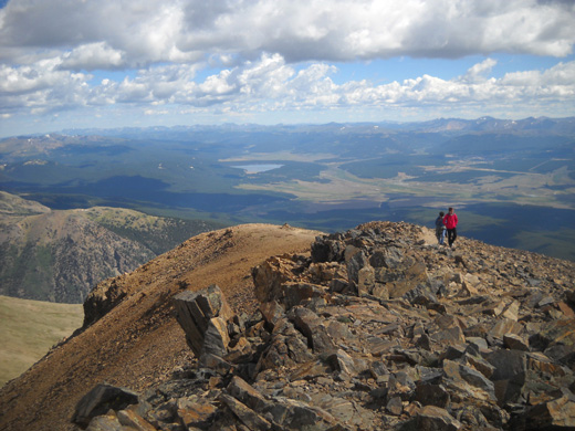
Coming up on a group of five young folks that I
passed about 1/2 mile from the summit
Looking back down on the group I just passed; Mt.
Massive's multiple peaks are in the background.
Keep going -- photos and narrative continued on the
next page so the pictures load faster . . .
Happy trails,
Sue
"Runtrails & Company" - Sue Norwood, Jim O'Neil,
and Cody the Ultra Lab
Previous
Next
© 2011 Sue Norwood and Jim O'Neil
