There are so many national forests in Colorado that it's hard for me to
tell on my AAA map where one ends and the next one begins. I do know that the
large loop (lollipop) we drove today included a good portion of the Pike
National Forest, however. We covered 210 miles, including some extra distance
to check out forest service dispersed (free) camping options.We saw some very beautiful
territory along the way, including great views of Pike's Peak, Mt.
Evans, the Continental Divide, and the Lost Creek Wilderness Area. We saw snow above 11,000 feet but remained
toasty warm at 6,000-10,000+ feet in the bright sunshine. We traveled on
some roads that were new to us and held some surprises, and we hiked a
familiar section of the Colorado Trail from Kenosha Pass.
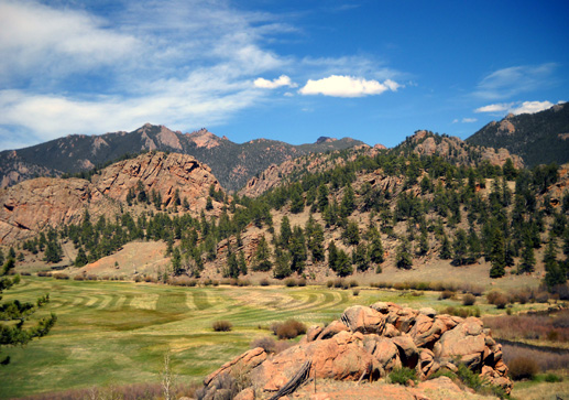
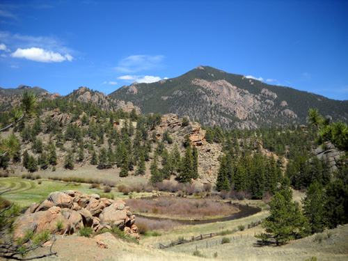
Lost Creek Wilderness Area
We had fun! So did Cody -- we found him some snow banks and
creeks to play in.
I'll describe various parts of our journey and include lots of
photos. Most of the roads were in great shape, suitable for any vehicle
(including RVs).
This route makes an interesting day trip or can easily be extended if
you camp or find other lodging. There are many other things to do in the
national forest and towns along the way than what I'll mention
here; we barely scratched
the surface.
I hope you enjoy the tour!
DECISIONS, DECISIONS
The main purpose of this trip was to help Jim decide if he wants to run
the North Fork 50K or 50-mile trail run in late July. It starts and ends near
the little town of Pine, Colorado. (On the AAA map it says Pine Grove, but
other references call it just "Pine.")
One of the deciding factors in whether he enters the race is how close
we can find a suitable camping spot. The only one we know of for sure is at
Kenosha Pass, a 45-minute drive on race morning. We wanted to look for
closer spots along a forest service road (Buffalo Creek) we searched when I was doing the
Colorado Trail in 2006. We know there are dispersed camping spots there but we
don't remember how big they are or how rough the dirt road is.
Here is a section of the Colorado AAA map that shows the
location of our route in relation to both Denver and Colorado
Springs. I highlighted the roads we took in yellow:
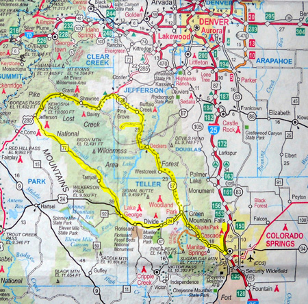
We began and ended our little excursion at the USAF Academy in northwest Colorado Springs,
took I-25 and US 24 through Manitou Springs to reach the loop,
and drove the
loop part of the route in the counter-clockwise direction.
The dotted lines on the map indicate what AAA designates as
"scenic roads." I can tell you that just about every
road in Colorado west of I-25 is scenic! That's certainly the
case with this route. The roads without dots were just as
beautiful as the dotted ones.
COLORADO SPRINGS TO PINE
The first segment was easy to figure out: the most direct
route from Colorado Springs to the race venue, without driving
4WD dirt roads over the Front Range, was to take four-lane Hwy. 24
through the Pike's Peak/Manitou Springs area to Woodland Park,
then head north on CO 67 to Deckers and CO 126 to Buffalo Creek
and Pine Grove. The forest service road we searched, CR550, is the little
segment I marked in yellow that goes west off CO 126 below Buffalo Creek.
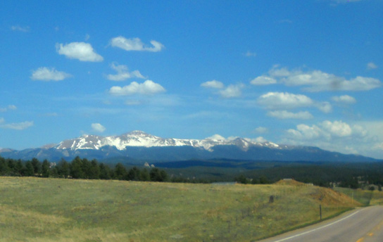
Now you'd think our route this morning past Pike's Peak would be
spectacular. Guess what? You really can't see that much of the
mountain from the Manitou Springs area:
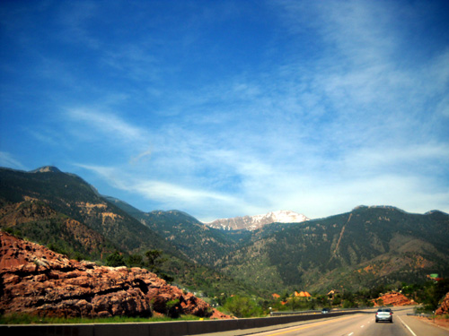
The views are much better a little farther away in any direction
than they are that close to the base of the mountain. We had
fine views of Pike's Peak along I-25 through Colorado Springs
and looking east along US 24 from Divide and Woodland Park as we returned
home today:
Four-lane
Hwy. 24 is scenic as it winds its way west from Manitou Springs
higher and higher through rocky, hilly terrain. After the
turn-off to Pike's Peak, the road is straighter and faster to
Woodland Park, where we turned right on CO 67.
We were pleasantly surprised by how good a road CO 67 is.
Because it's marked "scenic," we thought it might be narrow and
slow through the national forest. It wasn't. It's a good road
for RVs as long as you watch for a couple of bumpy places.
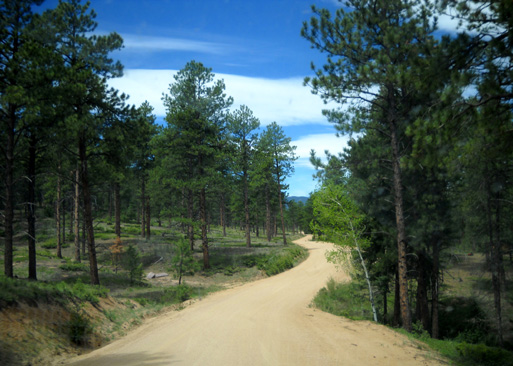
CO 67 starts off through a scenic valley north of Woodland Park:
We noticed a nice paved bike trail along this road for about
eight miles. I think it's called Manitou Park.
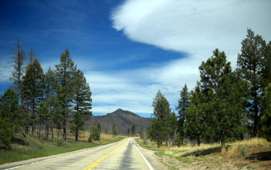
The northern half of CO 67 has hillier terrain:
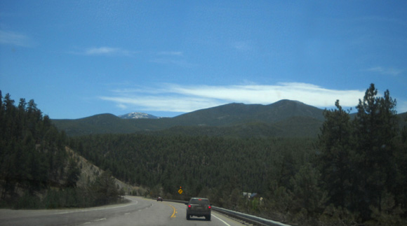
We passed through a couple of less-than-scenic areas that have been burned in
forest fires. The advantage was that we had better views of
distant Mt. Evans, a 14er, that way:
Near the little town of Deckers we crossed the N. Platte River
and turned west, then north, on CO 126. This is also a good
paved road that continues winding through the mountains.
In a few miles we recognized the turn-off for CR 550, a dirt
road that leads to the Little Scraggy trailhead between Segments 2 and
3 of the Colorado Trail. We drove through the day-use area to see
the trailhead for nostalgia's sake, then headed west on CR 550
for three or four miles to check out the dispersed camping options
along the roadway.
With the Memorial Day weekend approaching, quite a few folks
were already occupying the dispersed campsites.
We quickly decided we'd never take the Cameo back this road,
however. Although it looks nice and smooth in the next photo, it
soon deteriorates into bumps and ruts.
Four years ago we decided not to take the HitchHiker back there,
either, but we couldn't remember exactly why. Now we know.
There are lots of
nice, free camping spots along this road if you have a tent or a small
camper, particularly a truck camper, pop-up, or
little Class B or C recreational vehicle, but we'd never drive a
nice Class A or tow a
new or medium-to-large travel trailer or fiver back
there. Besides the bumpy road, the sites are mostly too small.
Ditto with the paid Buffalo Creek forest service campground
about three miles back this road. It was still closed today but
opens tomorrow.
We parked outside the locked gate and walked around the loop.
The bathroom was open and the campground host's 5th-wheel camper
was parked in there but none of the sites are large enough for
anything over about twenty feet long. The campground road is also
badly rutted -- really badly eroded.
Nice view from a campsite at the Buffalo
Creek CG
Well, darn. Camping along that road would be very handy for the
North Fork race but it's not an option for us. We did enjoy the scenery, however, and crossing
the Colorado Trail a couple times on CR 550 and once near the
firehouse on CO 126 farther up the road toward Buffalo Creek.
We also found the start/finish for the North Fork race in Pine.
It's a pretty area and should be nice for the 50K and 50-mile
races, although part of the course goes through a burn area. Jim
wants to wait until after his next two 50Ks to decide whether to
run North Fork or not.
PINE TO KENOSHA PASS
Our plan today was to see whether any of the campsites near
Buffalo Creek were
appropriate for us and to find the nearby race start/finish. If
we found suitable sites, we'd just retrace our route back to
Colorado Springs.
If not, we'd continue on to Kenosha Pass, hike part of the CT,
and either retrace our route from there or check out a road
that's totally unfamiliar to us, CO 77, which would take us back
to US 24. As you can see from the map above, that's the route we
took.
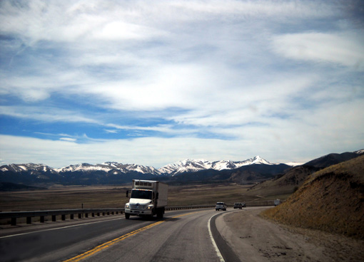
US 285 is a great road southwest from Denver to Buena Vista and
on south to the New Mexico border. The part we drove today from
Pine to Jefferson, about 25 miles, is marked scenic for good
reason. There are great views of mountains and valleys the whole
way, with the Mt. Evans Wilderness Area to the north and the
Lost Creek Wilderness Area to the south -- both in the
Pike National Forest.
The highway is wide, smooth two-lane with passing lanes and
other opportunities to pass slower vehicles like RVs. That's
good, because we gained about three thousand feet climbing from
Pine to Kenosha Pass, which is at 10,000 feet elevation.
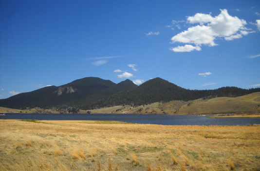
We have camped at Kenosha Pass in a national forest service
campground on the south side of US 285 two or three times
previously so we knew it was an option, albeit a distant one,
for the North Fork race.
View south toward the campground we've used
previously
No one was camped there today but it was open and several
vehicles were parked there to access the Colorado Trail. Out of
about a dozen sites, only a couple are large enough for our rig.
It's first-come, first-served, so we'll have to trust our luck
getting a site there if Jim enters the North Fork race.
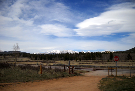
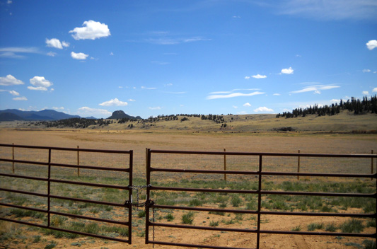
There is another forest service campground on the north side of
the road. It was gated (below) but we could access the entrance
road to reach the Colorado Trail on that side of the road.
We've walked around that campground before and know it's not
suitable for our rig. The loop is too tight, the trees are too
close to the road, and the sites are too small.
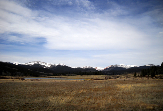
The Kenosha Pass-South Park area is a beautiful place with lots
of history that I talked about in an
entry in the 2006 journal.
The views are expansive from the parking areas along both sides
of the road
and from the dirt road leading to the campground on the south
side:
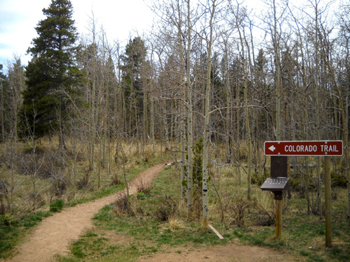
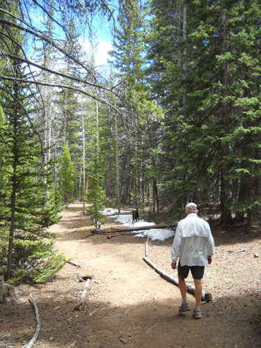
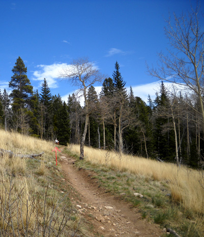
A SHORT HIKE ON THE COLORADO TRAIL
After checking out the campground we parked in the trailhead
parking area on the north side of 285 and headed west on CT
Segment 6 for about a mile. The trail winds up a couple hundred
feet in elevation through aspens and pines to a bench with a view.
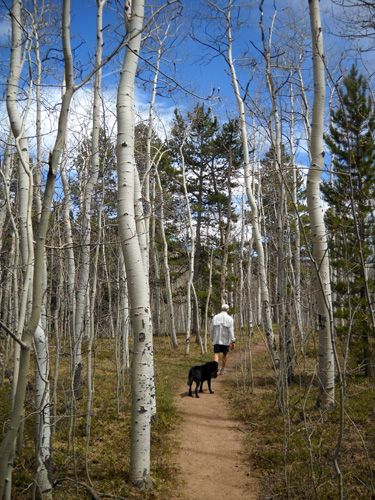
There aren't any leaves out yet on the aspen trees. The only
flowers we saw blooming were dandelions (yep, we're in another
Dandelion Time Warp again this year!).
Here's one of those oddities you're more likely to notice when
you're walking than running:
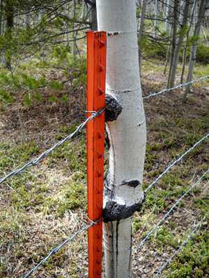
In case it's not obvious, the aspen tree has grown around all of
the fence wires.
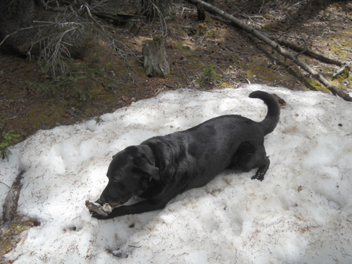
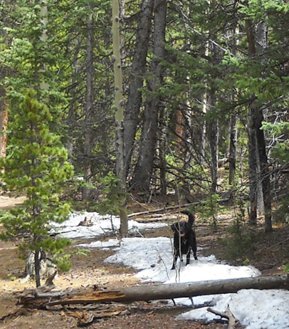
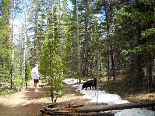
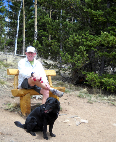
Most of the snow was melted here at just over 10,000 feet. Cody
ran through or rolled around every snowdrift we passed. Here he
is in double doggie paradise -- soft snow to lie in
and a stick to chew!
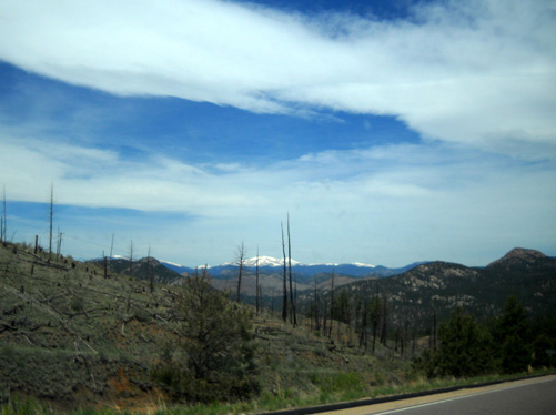
This is one of my favorite segments of the Colorado Trail,
crossing the Continental Divide at Georgia Pass about twelve
miles west of Kenosha Pass. Since I'm no longer able to run,
I'll probably never do the entire 33-mile-long segment
again
(certainly not point-to-point) but someday I'd like to do an
out-and-back hike from Kenosha to Georgia Pass. The views from
Georgia Pass are magnificent.
The views from the South Park-Continental Divide overlook on the
CT that we reached today aren't shabby, either. They were more
scenic in August, 2006 when the aspen leaves were out but still nice
today with bare branches:
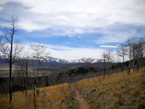
Looking west toward the Continental Divide
from the CT
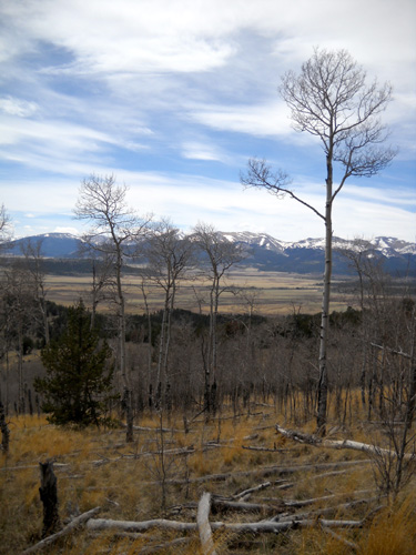
Southwest toward South Park, where we'd
soon be driving
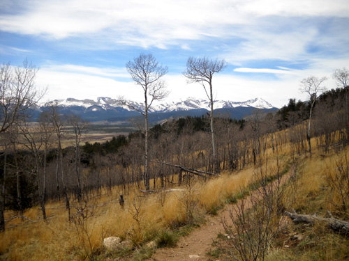
A little farther down the trail, looking
toward Georgia Pass
While I went down the trail to take those pictures, Jim (above
red arrow in photo below) enjoyed a strategically-placed bench at the edge of
the woods:
When we got back to the truck we continued on our journey west
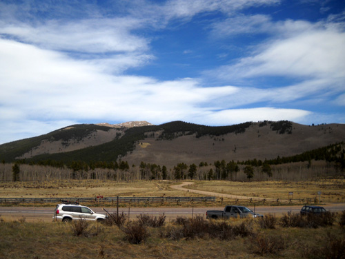
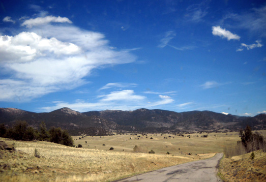
on US 285, with excellent views toward the Continental Divide:
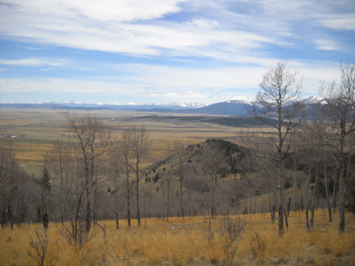
The road descends into historic South Park, a huge fertile
valley west of the Lost Creek Wilderness Area. Here's
another view of it from Seg. 6 of the Colorado Trail:
An interesting side trip in this area is to take Lost Park Road
(FSR 56) south from US 285 to the trailhead between CT Segments
5 and 6 at Long Gulch. It's a fairly primitive road but 4WD
isn't required as long as it's dry. We used that trailhead twice
when we ran the CT but didn't go down that road today.
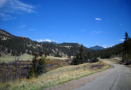
Instead, we drove a few miles farther west on 285 to the little town of Jefferson
and headed south on CO 77 for forty-two miles to the slightly
larger town of Lake George.
JEFFERSON TO LAKE GEORGE
I love to explore new roads and trails. This was our first time
on CO 77 -- and perhaps our last!
The road is pretty good for three or four miles at either end
but a mess in between, with a lot of potholes and broken
pavement. We had to drive carefully and slowly. We were real
glad we weren't towing the camper. However, we met several
smaller and/or older campers heading north toward us from the
Lake George area to camp at Tarryall Reservoir:
Despite the lousy road maintenance, this is a very scenic road
and I'm glad we took it. I'd recommend it if you're in a
vehicle with good suspension and not in a hurry to get
from Point A to Point B.
All but the first few miles at the north end of CO 77 are
through the Pike National Forest.
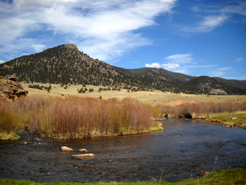
The road follows Tarryall Creek much of the way through a
beautiful valley, close to the hills/mountains east in the Lost
Creek Wilderness and with views of the Continental Divide to the
west.
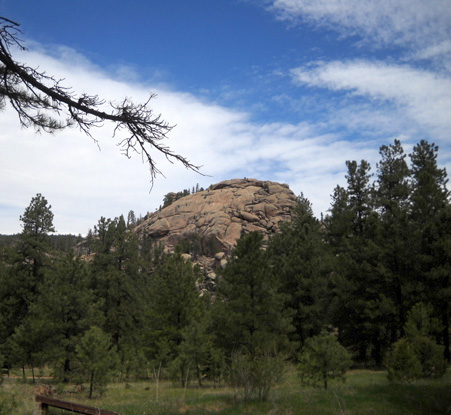
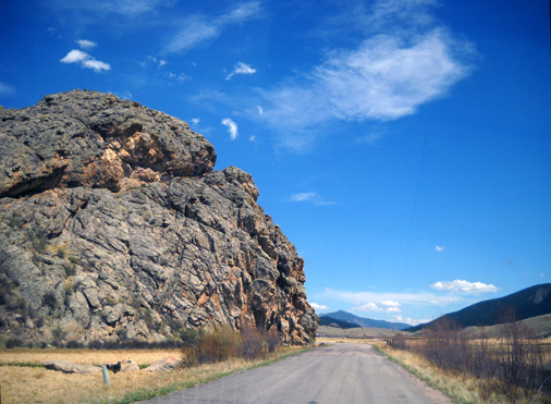
We passed several interesting rock formations right next to the
road, such as this one
shortly before the reservoir,
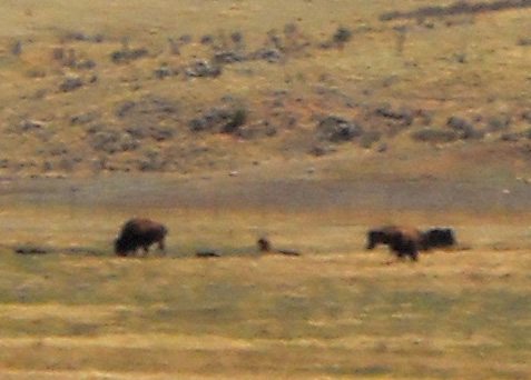
and many ranches, including one that raises bison:
They're fuzzy, but "clearly" bison!
Farther along CO 77 we could see lots of campers parked around
Tarryall Reservoir, which is popular with anglers. When I
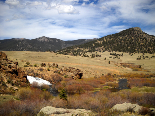
noticed a large rock formation and waterfall at the south end of
the lake I asked Jim to turn on a dirt road leading to a parking
area so I could get out and explore a little bit:
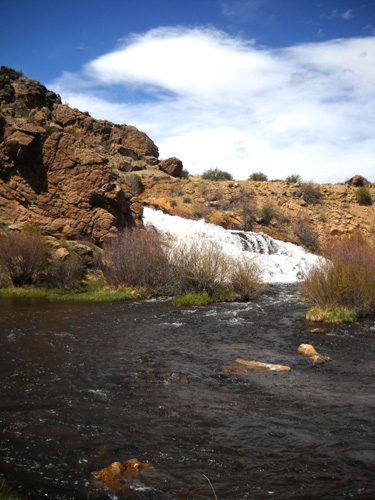
The shallow water was a good place for Cody to get a drink and
swim around without bothering two anglers who were fishing a
little farther downstream.
The dam that forms the lake is left of the waterfall:
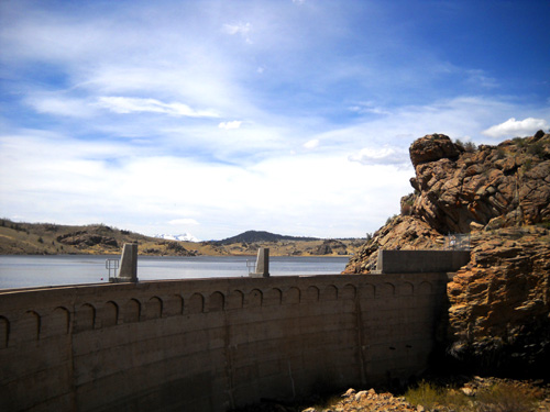
I climbed part way up a trail in the rocks to the left of the
dam to get better views of the waterfall, surrounding valley,
and mountains to the east:
This looks like a nice place to chill out, do some fishing and
hiking, and get away from the rat race. I don't know if there is
a fee for camping.
The next photo is a "windshield shot" along the same road
as we headed south from the reservoir to the town (and lake!) of
Lake George:
I think the prettiest spot along CO 77 is the site of the former
Williams Ranch:
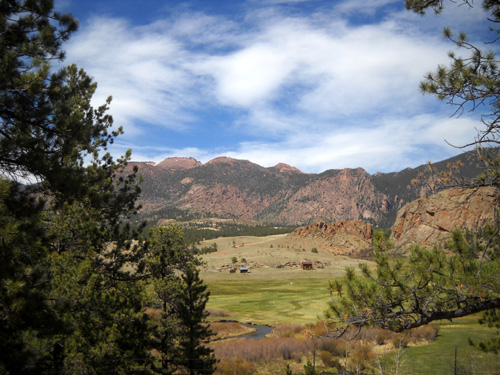
Signs at an overlook above this scenic, fertile valley describe
life here in the last 150 years.
The mountains in the background, part of the Lost Creek
Wilderness area, are one of eleven designated Natural National
Landmarks in Colorado. One of the signs describes this scenic
area as "a vast expanse of granite spires, pinnacles, narrow
ridges, and deep gorges."
There are at least two trails through the Lost Creek Wilderness
Area: part of Segment 5 of the Colorado Trail and the
McCurdy Trail, which has a trailhead on CO 77. We saw several
other trailheads along the road but I don't remember the names
of all the trails.
LAKE GEORGE TO COLORADO SPRINGS
The last leg of our circuit took us past several interesting
places where we didn't stop today; there simply wasn't
time.
At Lake George we turned east on US 24, which is two lanes but
fast to Woodland Park. We passed through the little town of
Florissant and the road leading to the Florissant Fossil Beds
National Monument. Next was the town of Divide and roads to
nearby Mueller State Park and the Colorado
Wolf & Wildlife Center. I'd like to go back to some
of those when we're in the area again.
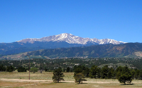
We enjoyed the views of Pike's Peak heading east on US 24:
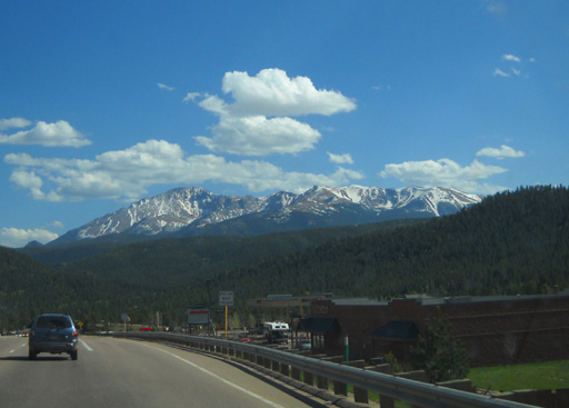
Either hiking to the top of Pike's Peak on the Barr Trail or
driving up in our truck is on my list of things to do while we're here this
time. I love that mountain.
We arrived back at the USAF Academy about suppertime. After all
the beautiful scenery and fairly remote roads we'd just driven,
rush hour traffic on I-25 was a bit of a shock! It just made us
appreciate where we'd been in the Pike National Forest all that
much more.
Next entry: touring the U.S. Olympic Training
Center in Colorado Springs
Happy trails,
Sue
"Runtrails & Company" - Sue Norwood, Jim O'Neil,
and Cody the Ultra Lab
Previous
Next
© 2010 Sue Norwood and Jim O'Neil
