What self-respecting
ultra runner (or recently retired ultra runner) wants to catch a ride to the top
of the mountain to run down it???
Not us. Even with bad knees, I can still climb up mountains. It's coming
down that hurts. That's where I need a ride!
I can go UP on my own. How about a ride back DOWN??
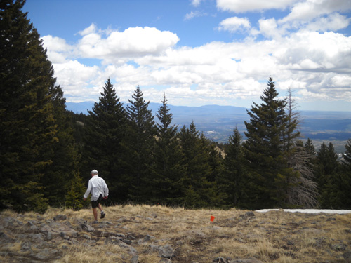
Since neither of us is acclimated to 10,400+
feet yet, going up was a bit slow but at a steady pace with some breathers to
check out the views and take pictures, we made it from the ski lodge up the
service road and a trail to the top of the mountain and back down via road,
trails, and the ski slopes (!) in a pretty fair time earlier this week.
Now why would we want to do that?
So Jim could get some acclimation for the Jemez Mountain 50K
tomorrow and I could see the great views from the mountain while
I'm still able to climb it. I'm not one to turn down an
opportunity to climb a mountain with decent footing. The grade
of the dirt road was gentle to moderate, with wide swooping switchbacks,
unlike the insane vertical of most of the ski runs we crossed at
least twice.
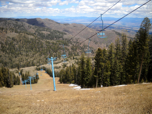
Of course, these photos don't begin to illustrate the steepness.
You have to stand there to get the true perspective.
Looking up and looking down at some of those slopes just about made us
dizzy, not the altitude. I'll never understand how folks can
remain upright on skinny skis hurtling down snowy mountains like
that!! The few times I tried cross-county skiing on barely
undulating terrain a decade ago I couldn't stay upright on the
slightest little downhill slope.
Even then, I did better going uphill than down.
WHY NOT, INDEED?
We were amused by the names of some of the dozen-plus ski
runs we crossed on the service road on the right half of the
mountain: Wildcat, Big Mother, 'Nuther Mother,
Sidewinder, Breathless, Precious (those last four are marked
"experts only"), One More Time, I Don't Care, Why Not
. . .
Why not, indeed? Seems like we chose to hike up the service road
on the side of the mountain with the toughest runs, the steepest
of which has a 37% grade. Yikes!
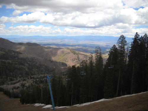
See the faint trail coming down the Aspen
ski run / chairlift?
That's part of the 50-mile Jemez Mountain
race course.
The upper trails and roads and a steep descent down one of the ski
slopes (above) isn't even on the 50K course, but Jim wanted to find
where he went wrong last year going up the mountain and coming
into the ski lodge aid station during the 50-mile race. He got
lost on the south side of the mountain after coming out of the Valles Caldera
portion of the race and missed the AS cut-off. He wanted to make sure he could find the
correct section of the 50K course leading to the aid station
this year.
We don't think we found it but we had a heck of a good time
climbing and descending other parts of the mountain!
There are no leaves yet on the aspens above
9,000 feet.
The Los Alamos Ski Club owns 750 acres of Pajarito Mountain,
pronounced something like "Pa-REET-o" by locals. It is open to
the public for skiing in the winter and mountain biking and
hiking in the summer. There is no charge to just go in, park,
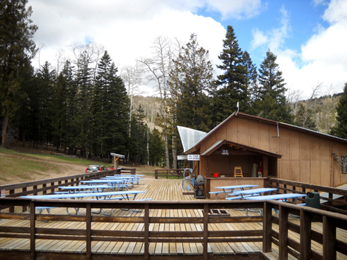
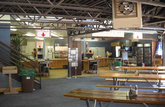
and run/hike as much as you want. The ski lodge is open in the
summer for meals. There is no overnight lodging at any
time, however.
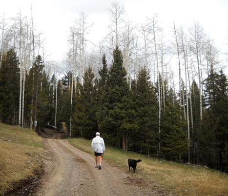
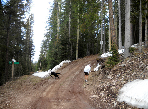
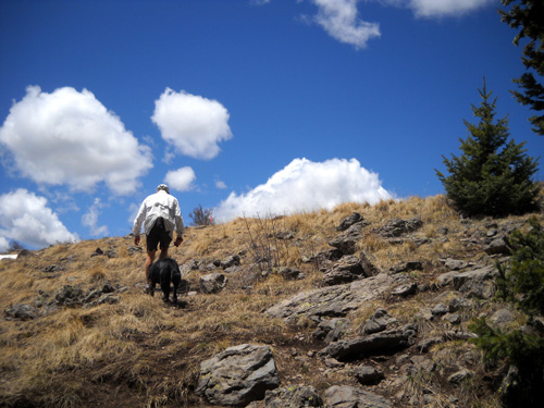
We parked below the lodge, scouted around for trails, and began
walking up the service road to the right. It was about two miles
to the point near the top where we turned around, just past the
big blue bench that overlooks the caldera.
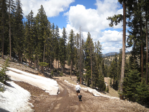
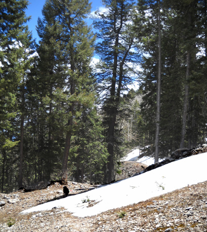
We soon found snowdrifts in shady spots along the road and in
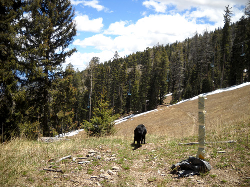
the woods as we ascended from 9,200 feet.
Cody was ecstatic! S-N-O-W is not the four-letter word to him
that it is to Jim. Cody often spots a good patch of snow before
we do. He just races toward it, hurling his body into the soft
center and rolling around on his back Too funny!
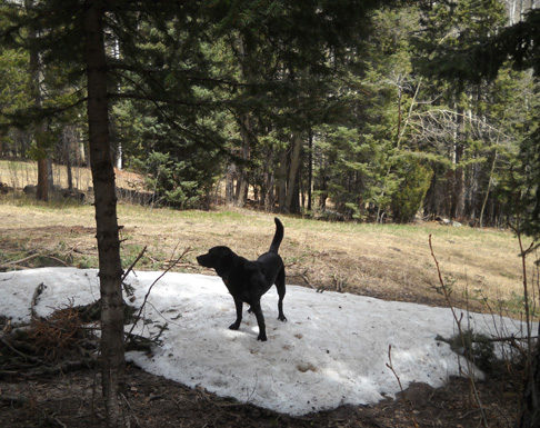
Look what I found!!
Stopping several times on the way up the mountain to throw
sticks and snowballs to Cody was a good way to catch our breath
and entertain the little rascal at the same time:
Cody retrieves one stick while Jim hunts
for another one. You just can't have enough sticks!
On the way up the road we saw several trails used in the summer
by hikers and cyclists. I made a note of those for my descent.
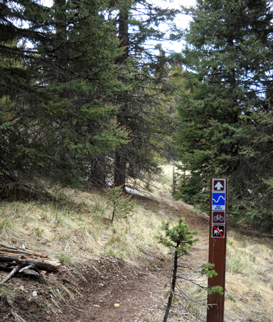
Jim's plan was to find the trail below the Aspen chairlift
that is used in the 50-mile course and drop down it
on the way back to the lodge. We could see the faint trail
through the ski run when we crossed it on our ascent (photo farther up in this
entry).
As we climbed higher the road became muddier, there was more
remaining snow, and we began to get better views of the
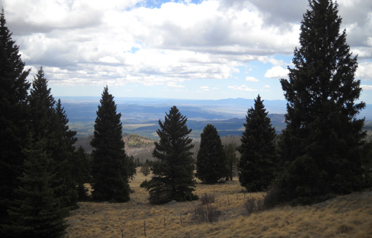
mountains and valleys to the north and east:
A couple work vehicles passed us near the end of the service road. We soon
found out what they were up to -- trying to find and repair
a leak in the liner of the retaining pond that is used to make artificial
snow in the winter, if necessary:
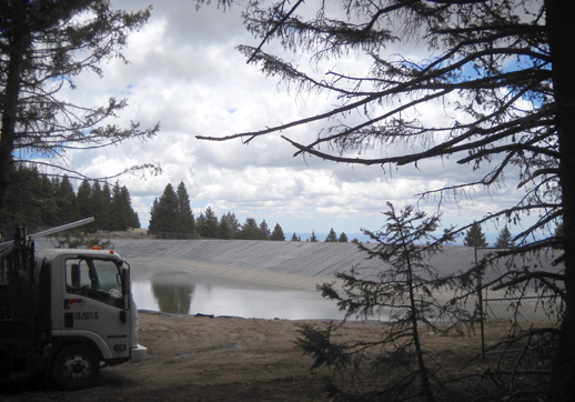
Considering all the snow we still saw in mid-May, it was hard to
believe they needed to make any more during the winter. Jim
stopped to talk to the guys for a few minutes while Cody and I
investigated further up the road.
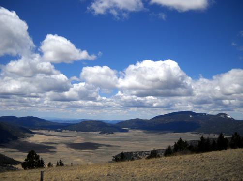
Just beyond the retaining pond we found a nice deck overlooking
the mountains and valley to the southeast:
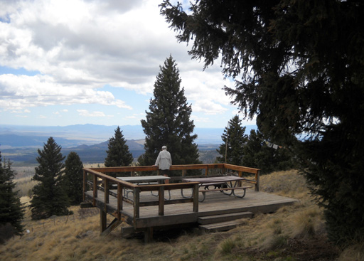
My favorite fellas do some male bonding on
the deck.
Nearby we saw a trail that was marked with orange flagging. Jim
recognized it as part of the 50-mile course.
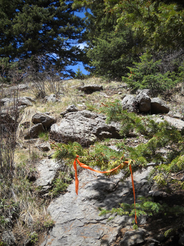
We followed the trail up a short, rocky section and viola!
There was the
iconic blue bench Jim had told me about seeing twice last year
when he got off-course in the 50-miler (he was supposed to go by
it only once). Very cool:
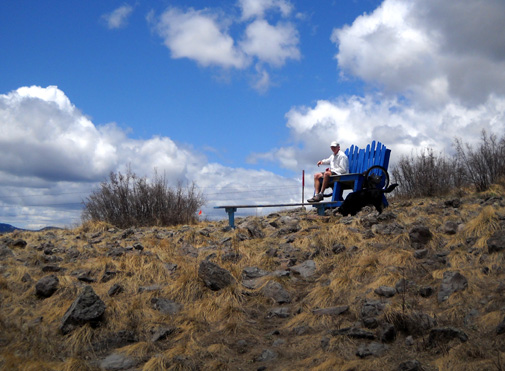
The bench is so big it dwarfs its
occupants!
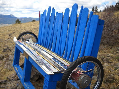
Skis and bike tires: how appropriate! The
oars, less so.
He won't be going past the bench this year in the 50K but it's a great
overlook and I'm glad I went far enough to see it.
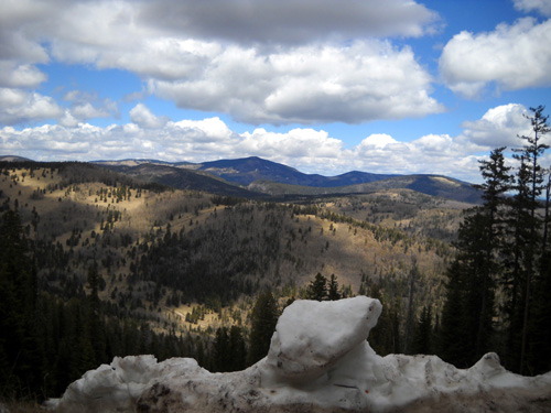
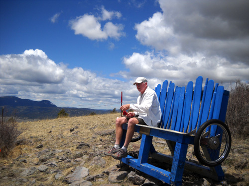
While Jim relaxed on the bench, breathing in the thinner air at
10,400 feet, I went up the trail a little farther. We weren't at
the very tip-top of the peak, but very close. This is the trail
the 50-milers run as they descend to the blue bench:
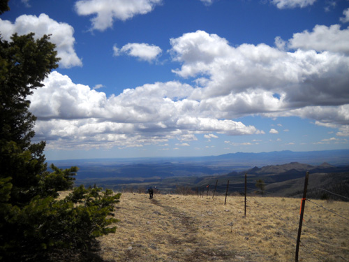
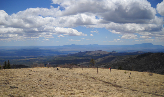
The views of the Valles Caldera National Preserve and
11,254-foot Redondo Peak to the south were fabulous:
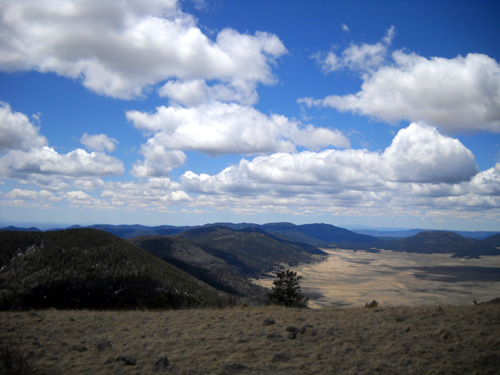
Runners in the 50-miler do a loop down in the 89,000-acre caldera,
an ancient volcanic crater, before
climbing Cerro Grande and Pajarito mountains. Last year we drove
on NM Hwy. 4 past the Caldera and I got some
photos of it from the road and
a mountainous trail on the south side of it.
MOUNTAIN MADNESS
After about fifteen minutes absorbing the views we reluctantly
turned around for the descent.
Jim follows race flagging back down to the
service road.
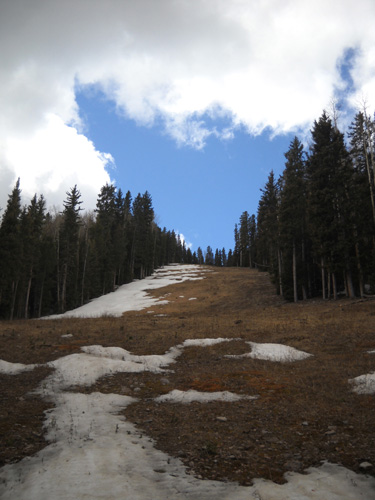
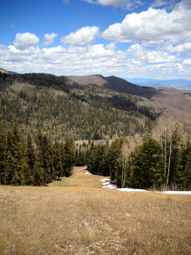
Soon we reached the Aspen chair lift and ski run. Jim began his
quick descent to the lodge, cutting off over a mile of the
distance we'd hiked up on the service road. Again, the slope is
steeper than this perspective shows:
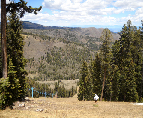
Above and below: Jim quickly descended the
ski slope, following the 50-mile race trail.
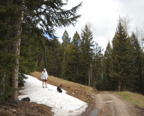
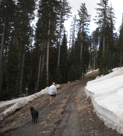
My plan was to either descend on the road or find one of the
trails with an easier grade than those crazy ski runs. I kept
going on the road another quarter mile, then just couldn't
resist the urge to switchback down on another ski slope to a trail I
could see halfway down.
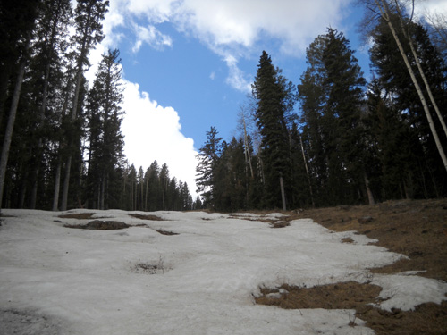
Pretty soon it looked like there was a lot of snow on the trail
ahead:
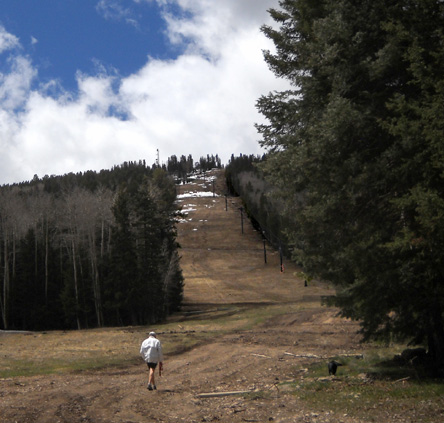
I wasn't sure it it ever descended to the lodge anyway, so I
ended up dropping down the bottom portion of the Wildcat Trail
(below) to the service road.
To mitigate the pounding of a straight descent on my knees, I
zig-zagged back and forth across the grassy, rock-strewn slope.
Cody was puzzled at first, wondering why I didn't just go
straight down (I wasn't on any path, just going cross-country).
It was funny to watch his reaction every time I zigged and he
zagged. What is that crazy woman doing?? It
didn't take him long to figure out that he could descend in a
straighter line and I'd always come back toward him. Smart dog.
In retrospect, I should have just switch-backed
down the Aspen slope behind Jim.
Jim saw me coming along the service road from the lodge. He'd already eaten most of his
lunch by the time Cody and I got down there. I ordered a spicy
bean and cheese burrito at the cafe and ate it while we talked
happily about all the fun we'd had on our little trek! It was
short but memorable.
Both of us noticed that it was harder to breathe as we climbed
up the mountain but we did pretty well otherwise with the
significant altitude. Neither of us was dizzy, nauseous, or had
a headache. Of course, we weren't pushing hard like during a
race. Although Jim won't be going to the top of Pajarito
Mountain during the 50K, he'll be getting higher (10,480 feet)
on Caballo Peak.
Mountains sure make me happy, especially ones with a great view
on top. I rue the day when I absolutely cannot
climb them any more.
Next entry: the Jemez Mountain Trail Runs
Happy trails,
Sue
"Runtrails & Company" - Sue Norwood, Jim O'Neil,
and Cody the Ultra Lab
Previous
Next
© 2010 Sue Norwood and Jim O'Neil
