The Tongue River Canyon changes a little bit each day from season to season and
year to year, but I bet if I looked back at ten years of photos I've taken
along this trail, probably not much has changed to the "big picture" that is
visible through the camera lens.What has changed is the way I view
it. Although my thoughts and dreams haven't radically changed in the last
decade, I know I'm not exactly the same person I was then. Probably the biggest
change is in my physical inability to run these trails now;
fortunately, I can still hike them.
A WILD RIDE
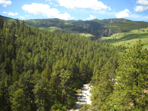
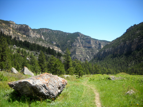
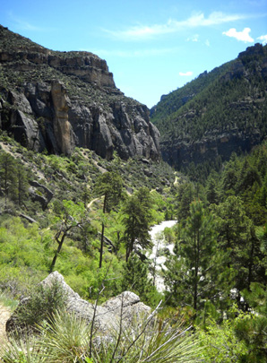
Several miles farther upstream from the Foothills Campground, where the drop in
elevation is more pronounced through a long and scenic canyon, the Tongue River
is high, wild, and noisy as it crashes against large boulders and inundated
tree trunks along its banks.
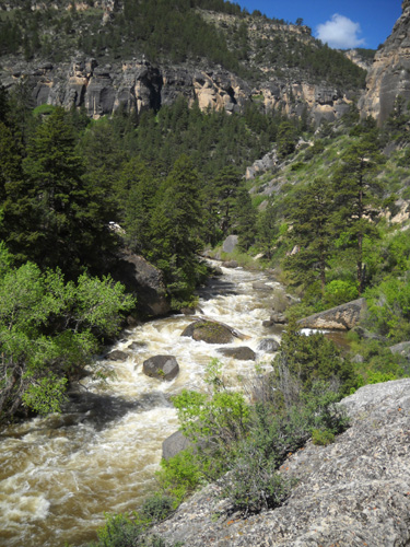
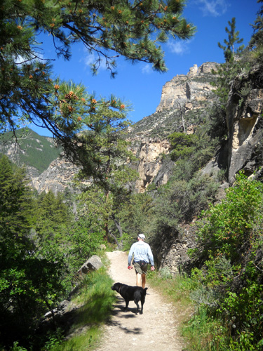
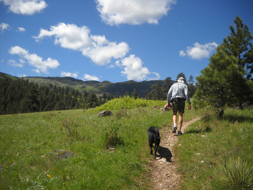
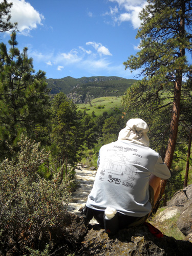
I was mesmerized this morning by the sight and sound of the white water as
Jim, Cody, and I made our way about two and a half miles up through the canyon
from the trailhead to the location of the Lower Sheep Creek aid station during
the race. My thoughts wandered to the raw power of nature as we climbed the
trail between the steep canyon walls . . .
I probably wasn't paying as much attention as I should have for rattlers,
but I'm pretty sure
Jim was! Fortunately, there were no
rattlesnake incidents today.
The section we ran/hiked out and back through the canyon this morning is
approximately the second to fourth mile outbound in the Bighorn 100-mile race.
All four race distances (100-mile, 52-mile, 50K, and 30K) traverse this canyon
inbound, then have five final miles on the Tongue River Canyon Road before
ending at Scott Park in Dayton.
The elevation in this section ranges from ~ 4,375 feet at the trailhead to ~
5,025 feet at the aid station. Elevations in all four races get up to at least
8,000 feet elevation, and about 9,200 feet in the two longest races.
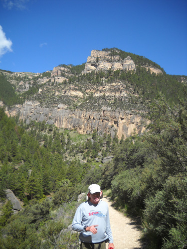
The first mile up through the canyon from the trailhead is mostly exposed to
the sun, with the rock walls both reflecting and absorbing heat. It felt pretty
hot at 10:30 AM.
Jim was already thinking about how glad he is that he's running the 50K this
year instead of the 100-miler, which starts at 11 AM. Each time he's started
the 100-miler it's seemed brutally hot climbing through the canyon. I can vouch
that it's even hotter in the 52-miler and 50K if you hit that section in the
middle or late afternoon after running about 90% of the race distance! At least
on the return the runners are going downhill and not up.
This section seemed rockier today than I remembered from previous jaunts
through the canyon. <sigh> Although my knees felt fine a few days ago on
steeper sections of trail in Golden Gate Canyon State Park, they must still be
recovering; they were a little sore today on the downhill return to the
trailhead.
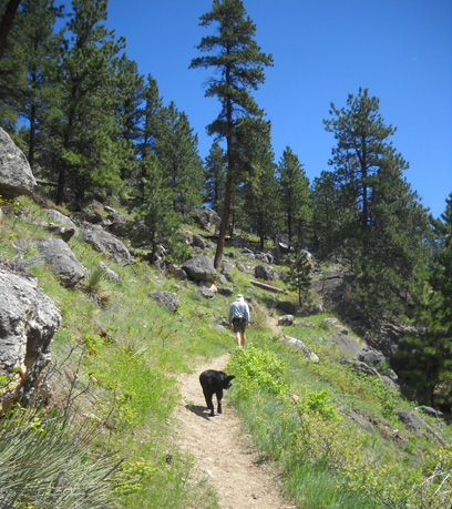
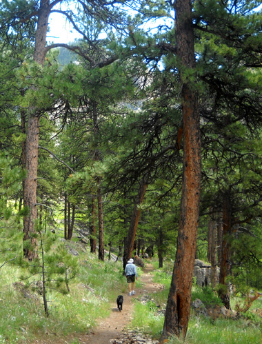
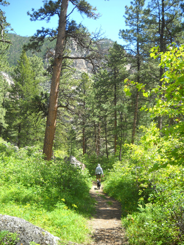
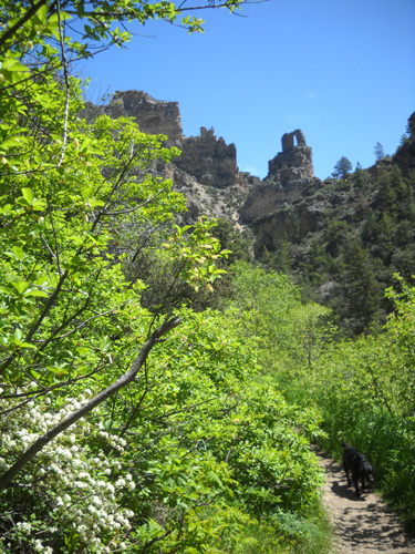
The trail has more shade in the second mile outbound from the trailhead,
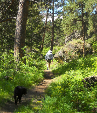
then opens up to a meadow full of blue lupines and other flowers, where Jim "hid"
from Cody and me while he waited for us to catch up
-- see arrow below:
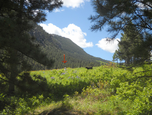
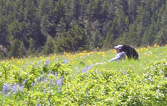
Cody found him, of course! He's a good little tracker.
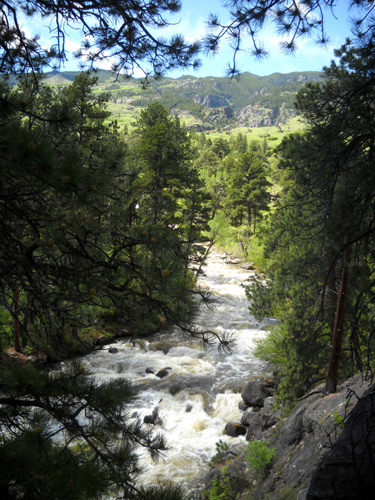
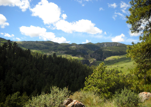
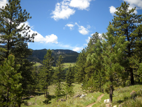
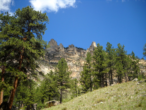
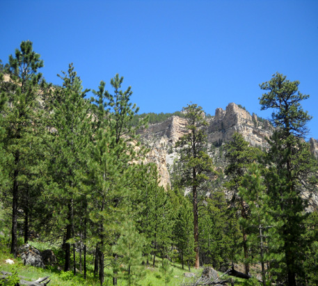
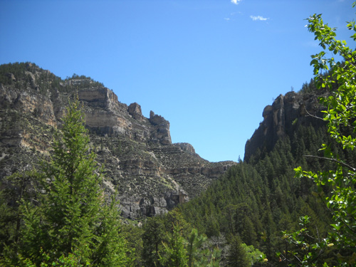
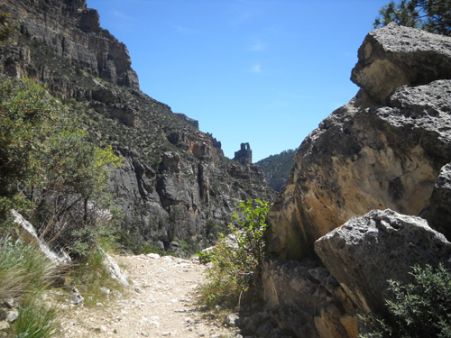
I love this area of the course because there are great views toward Horse
Creek Ridge . . .
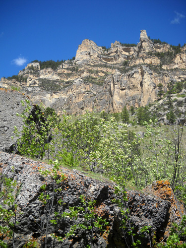
. . . and toward the interesting cliffs to the right of the trail:
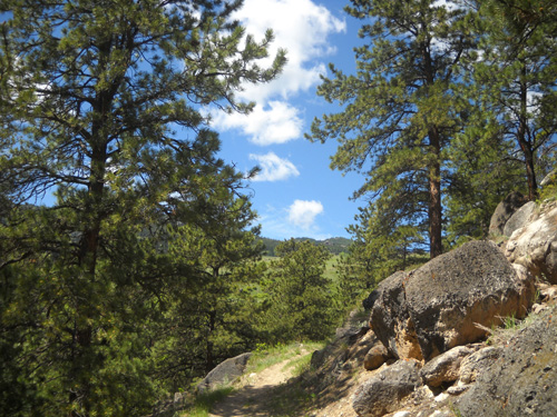
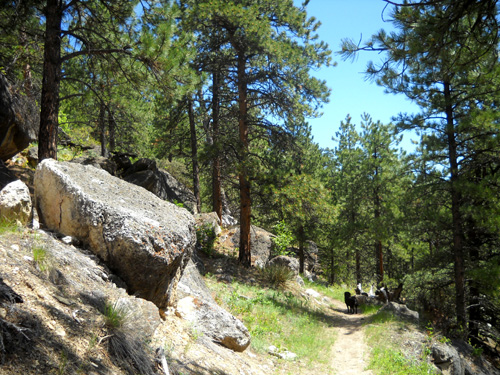
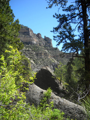
Then the trail ducks in and out of more trees and passes a scenic overlook
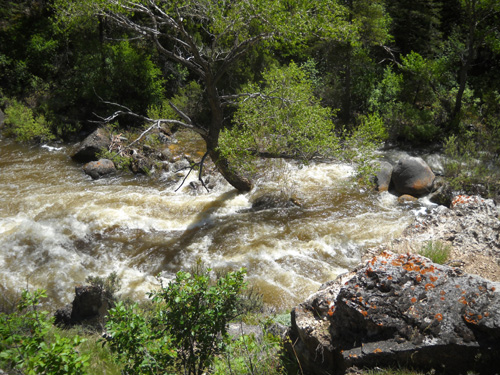
before descending to the Lower Sheep Creek crossing:
Cody had fun playing in the creek near the Lower Sheep Creek aid station
location. That was the first stream we came to that was safe for him to enter.
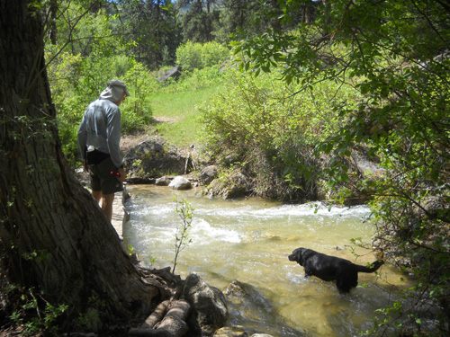
We wouldn't let him near the fast-flowing river for fear he'd slam into a
boulder or get carried too far downstream. He's "not 35 anymore" either! At 7+
dog years, he's almost as old as we are now.
Unlike last year, we couldn't see any snow on the distant
mountainsides ahead of us on the way to Horse Creek Ridge. We
made tentative plans to run and hike that area next.
It's always fun to anticipate our next adventure!
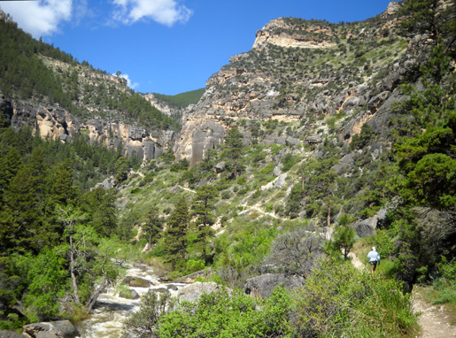
We turned around at the creek and headed back up the hill to the
overlook:
From there it's almost all downhill to the trail head.
I took these shots on the way back to the truck. This is
the direction all the runners will face as they near the end of
their races next weekend.
Jim startled me with his comment that he hasn't seen this part
of the trail in this
direction during the race since we ran the 52-miler
together ten years ago! Same thing with the finish in Scott
Park. That's because he's only entered the 100-miler since then
-- and he's never gotten this far into the return. I'm
glad he'll have the satisfaction this time of seeing the course during the
race from Dry Fork all the way to the finish.
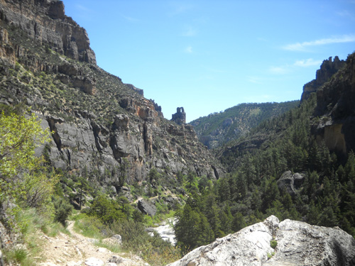
Note the distinctive "key hole" rock
formation (AKA The Needle's Eye) that is a very welcome sign that you're nearing the trailhead aid
station:
Soon we were back at the trailhead, glad that this time we
didn't have to also run/walk the last five miles of the race
course on the road to Dayton. Jim will be grateful to have that
opportunity in the 50K next weekend, however.
AN UNEXPECTED TREAT
We enjoyed a serendipitous visit with two old friends on the way
back to the campground. Mariann Foster was pushing her daughter
Maria in a jogging stroller as she ran along the Tongue River
Canyon Road:
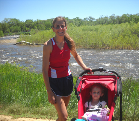
She often runs with Maria through Dayton, Scott Park, and on
local roads when they come to town to do business. Mariann and
her husband Jeff own a small
ranch north of here, where they
raise alpacas and make beautiful
items
from alpaca fibers. A much fast runner than either of us,
Mariann will be working the finish area of
the race this year instead of running one of the races.
Next entry: photos and journaling from Dry Fork to the
finish
Happy trails,
Sue
"Runtrails & Company" - Sue Norwood, Jim O'Neil,
and Cody the Ultra Lab
Previous
Next
© 2010 Sue Norwood and Jim O'Neil
