Until Jim began researching the Golden Gate Dirty Thirty 50K,
we'd never heard of this beautiful state park. It's a gem
(that's part pun, since it's in gold country). We haven't
visited very many of Colorado's state parks over the years, but
we might start adding more of them to our list of warm-weather
destinations after seeing how nice this one is.
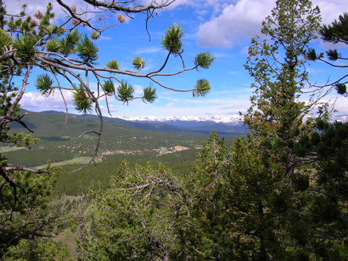
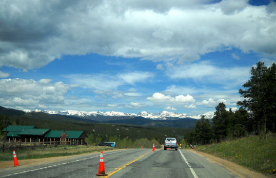
View of the Continental Divide from one of
many vista points in the Dirty Thirty race (photo by Jim)
This relatively new event, which includes 7- and 12-mile races in
addition to the 50K distance, is run on mostly single-track
trails within the park. Although Golden Gate Canyon SP has one
campground that accommodates RVs, it is located significantly
farther from the race start/finish than a private campground Jim
found on the internet: Dory Hill CG.
In this entry I'll talk about the park, the campground
where we stayed, and some of the mining and other history of the
area that lies in sort of a triangle between Golden, Idaho
Springs, and Nederland. I'll write
a separate entry about the race and show course photos that Jim
and I took.
GETTING THERE
Gold seekers had a tougher time than we did to
get from the foothills of Colorado Springs and over the mountains to
Black Hawk and Central City back in the 1860s. It's a hilly trek but at
least we had nice paved roads to follow! We determined that our easiest route
from the USAF Academy would be I-25 north to I-470
around the southwestern part of metro Denver, then west on I-70 to US 6
just past Golden, CO.
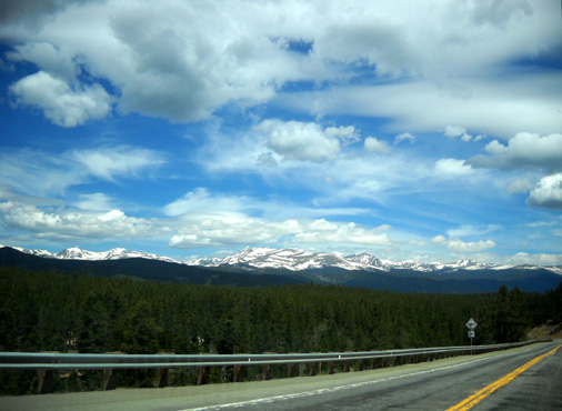
After climbing out of the Denver 'burbs
we could see Mt. Evans to the south and the beautiful snow-covered peaks
that form the Continental Divide in front of us:
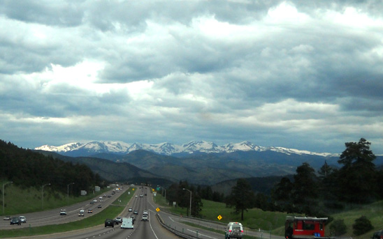
Although we wouldn't be crossing the Divide yet, those peaks would form a
backdrop to our activities the next few days.
We exited the freeway at US 6, a winding canyon road that quickly led
us to the intersection with CO 119, AKA the "Peak to Peak Scenic
Highway." We quickly climbed through a cool, shaded gulch with high rock
walls and wildlife warnings (below)
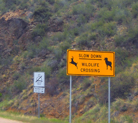
to the little town of Black Hawk, which seems to be primarily modern
casinos. We'd come back the next day to explore Black Hawk and adjacent Central
City a little more.
Our destination that day was the Dory Hill Campground, located five miles
farther northeast on CO 46.
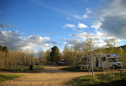
DORY HILL CAMPGROUND
Dory Hill is a privately-owned
campground half a mile off CO 119 and
about seven miles from the entrance to Golden Gate Canyon State Park. It
sits at a lofty 9,227 feet elevation. In addition to about thirty RV and
tent sites with water and/or 30-amp electric hookups, there are also
a dozen cabins with electricity that visitors can rent.
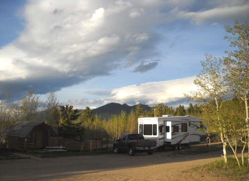
We were able to get one of the few pull-through RV sites but had to back
up to get out of it. That wasn't a problem; it would have been if
someone had been parked behind us that was using a nearby cabin (that's
us in the next photo, with two cabins to the left of the truck).
There were a few other sites large enough for our rig. The one we
liked best was taken when we got there. You can make reservations if you
know ahead of time which particular site you want. Since this was our
first time there and we didn't know which site would be best, we made
reservations but the campground owners chose the site we'd use.
Our site was $28/night, which is more than we like to pay but less
than many private campgrounds nowadays, especially ones in popular
tourist areas like this. Tent sites with water but no
electricity are $26/night (yikes!). Cabins with electricity are
$45/night and guests must supply their own sleeping bags and
pillows. All these are base rates for two people and one vehicle per
site or cabin; additional people and/or vehicles cost more.
The campground has an office with basic supplies, a game room, and
books/magazines to borrow, a laundry, bathroom, beer store, and fuel pumps we didn't
use, and a dump station we did use on the way out. Although we didn't
have a Verizon cell phone signal for calls or broadband internet access,
we could get WiFi on Jim's laptop and a few stations on the TV.
This evening I was seated at my computer and facing in a different
direction when Jim told me to go outside and look. It "looked" like the nearby
mountain was on fire!
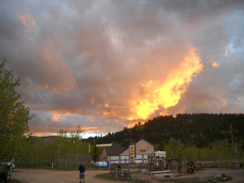
Ironically, there is a fire station right across the road from the campground
but no fire trucks were needed tonight. The intense colors were only the
setting sun reflecting off the clouds.
Notice another person out there taking pictures in the photo above?
I'm not the only one . . .
.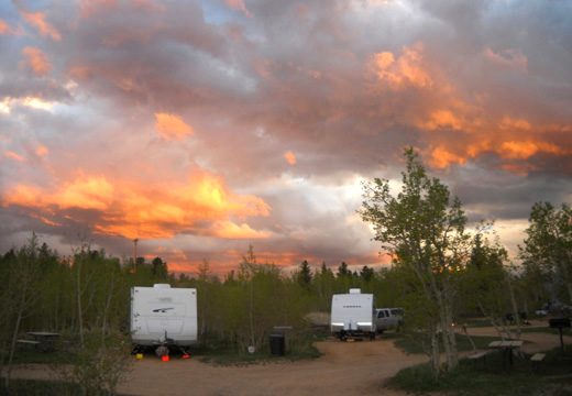
I took a series of half a dozen pictures of the dramatic sunset as it
morphed from primarily fiery yellows to equally intense oranges
across half the sky.
GOLDEN GATE CANYON STATE PARK
Curious about the area, we took a little driving tour today in three
different directions from the campground to find
the race start, see part of the Peak to Peak Scenic Highway, and try to
find Jim a hamburger in Black Hawk or Central City.
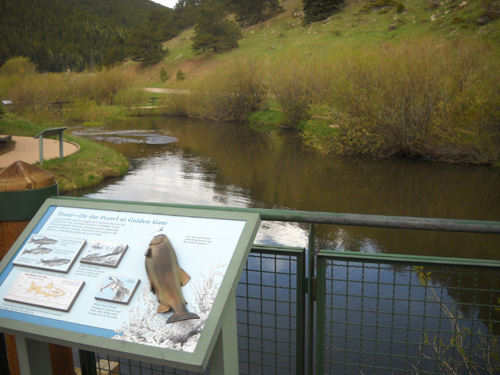
We reached one edge of Golden Gate Canyon State park on CO 46 less than four miles from
Dory Hill. The visitor center and Crawford Gulch Road, which leads to
the start/finish of the Dirty Thirty race, is a few miles farther east
past Kriley and Slough ponds. Both ponds appear to be popular with
anglers.
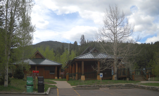
Our first stop in the park was the very nice visitor center, above.
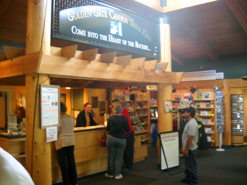
Adjacent to the entrance deck is a trout pond where visitors can enjoy
some solitude on a short trail, but not fish. With a Colorado fishing
license you can fish in all the other
ponds, lakes, and creeks in the park, however.
Inside the visitor center are numerous exhibits about the
history of the area, the plants and wildlife found here, and
recreational opportunities in the park. We spent about twenty minutes
reading interpretive materials and looking at old photographs.
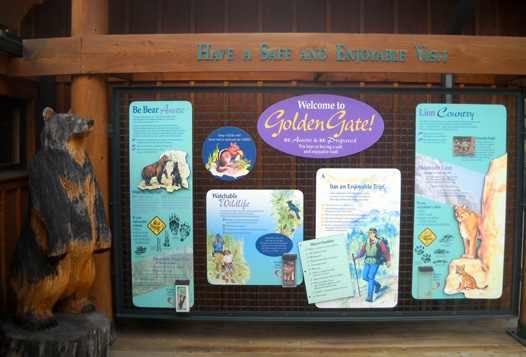
WILDLIFE AND RECREATION
Golden Gate Canyon State Park is "rich" in wildlife, so rich that
controlled public hunts are permitted during certain seasons. You can
find information about hunting elk (below) and other critters at the
park office or on the web site.
Besides hunting and fishing, other popular recreational activities in
the park include hiking, running, biking, horseback riding, picnicking,
and camping.
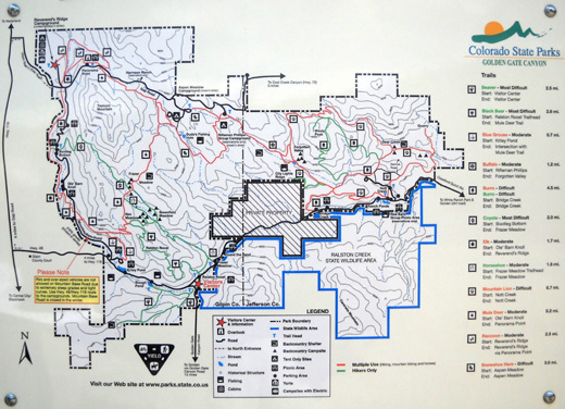
The park has thirty-five miles of trails ranging from less than one mile
long
to almost seven miles long. They vary in difficulty from moderate to "most
difficult" and can be combined in many ways for longer distances, as
they are in the Dirty Thirty race. Some trails are for foot travel only.
Others are for hikers, runners, cyclists, and equestrians.
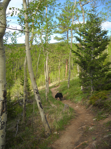
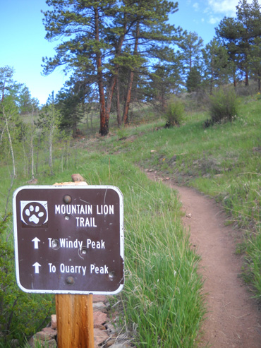
Along the Mountain Lion Trail
The twelve trails are each named for an animal native to the area and
are cleverly marked on trail signs and maps with the animal's
footprint:
All twelve species except buffalo (bison) -- and maybe burros?
-- still live in the park:
in alphabetical order they are beaver, black bear, blue grouse,
buffalo, burro, coyote, elk, horseshoe hare, mountain lion, mule deer,
raccoon, and snowshoe hare.
You can get a good trail map at the visitor center or online. This one
is too small to read but gives you an idea of the layout of the park.
Trails are in red and green. The hash-marked portion in the middle of
the map is private property the state hasn't been able to purchase for
public use.
The park has a number of event facilities, including the Red Barn Group
Picnic Area that will be used in the Dirty Thirty race. It also has 125 individual
picnic sites, two campgrounds, several backcountry campsites and
shelters, several cabins and
yurts, and a ranch guest house.
The race course passes several of the remote backpacking campsites, at
least one shelter (below),
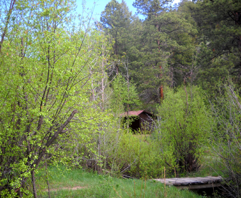
Shelter #4 on the Mountain Lion Trail
and
the guest house. The campgrounds and cabins are accessed off a different
road and we haven't seen them.
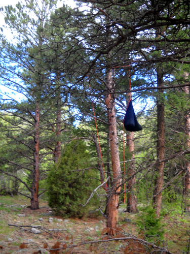
Since bears are present in the park, all backcountry campers are
supposed to hang their food up high like this in "bear bags"
so the critters don't hang around the campsites and pose safety
concerns:
After we left the visitor center we drove several miles farther on
Crawford Gulch Road through park and private property and back on park
property again until we came to the Red Barn Group Picnic Area on the
eastern side of the park.
The race will start on the road near the Red Barn. Runners will go
uphill through this large parking area and proceed up the Mountain Lion
Trail, which starts just to the right of the blue truck below:
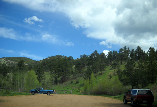
During the race, that parking area will be packed with runners'
vehicles.
At the end of their races runners will descend from Windy
Peak to a different trail head closer to the finish line, follow the dirt
access road past this rock formation (below), and finish where they started
on Crawford Gulch Road:
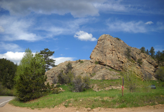
They will get to enjoy lots of beautiful mountain and valley views along
the way!
HISTORICAL PERSPECTIVE
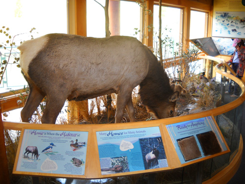
Local natural resources have attracted humans to the Front Range and
Golden Gate area for at least 12,000 years. The earliest known
inhabitants were big-game hunters at the end of the last glacial period;
they hunted bison and mammoths from about 12,000 to 7,500 years ago.
When the climate warmed, the indigenous people had to change their
lifestyle to one of hunting and gathering different sources of food.
They relied on bison, elk, deer, rabbits, other small mammals, and
plant-based foods for their subsistence (about 7,500 to 900 years ago).
Most of those plants and all of the animals except bison are still found
in the area today.
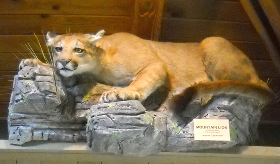
Well, maybe not that one. He's preserved in the visitor center
but his siblings continue to roam the rocks and mountains in the park.
A succession of Indian tribal groups began inhabiting or using the area at
least 400 years ago. The Utes have the longest history here. Other
tribes, including the Apache, Comanche, Kiowa, Cheyenne, and Arapaho,
primarily lived in the Plains but also made use of various resources in
the foothills and mountains.
As the settlement and development of Colorado by non-Native Americans
progressed, tribes were removed. By the 1880s the last of the
free-roaming tribes were placed on reservations.
THE RICHEST SQUARE MILE?
Apparently it was for a little while.
Back in 1859 John Gregory discovered gold about five miles from
Golden Gate Canyon State park in what soon became known
as Gregory Gulch. Hordes of prospectors swarmed the area, building
little mining camps along the precipitous canyon walls. Per the 2010 AAA
Colorado-Utah TourBook (p. 48), "Although later eclipsed by the
lodes at Cripple Creek, the gold dug from Gregory Gulch amounted to more
than $67 million."
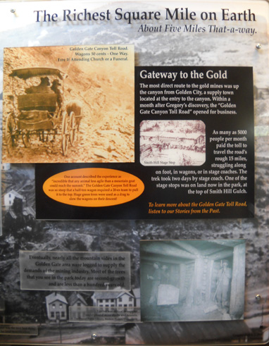
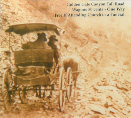
The most direct route to the gold mines, according to the exhibit
(above) in the park visitor center, was up the canyon from Golden City, a supply town located at the
entry to the canyon. Within a month after Gregory's discovery, the
"Golden Gate Canyon Toll Road" opened for business.
Ha! It didn't take long for someone to figure out how to make some bucks
without having to dig for gold. Just charge everyone else who wanted to
do it! As many as 5,000 people per month paid the toll to struggle over
the rugged fifteen miles of "road" by foot or in wagons or stage coaches. One
of the stage stops was on land now in Golden Gate Canyon State Park at
the top of Smith Hill Gulch.
How rough was that road? One account described the experience as
"incredible that any animal less agile than a mountain goat could reach
the summit." The road was so steep that a half-ton wagon required a
20-ox team to pull it to the top. Huge green trees were used as a drag
to slow the wagons on their descent.
Sounds to me like it'd easier to hike or ride a horse up and down that
bumpy road than ride in a
wagon or stage coach. Ouch!
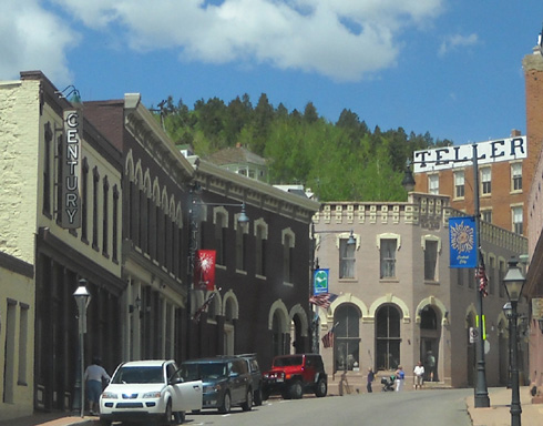
MINING CAMP LEGACY
Central City and Black Hawk are apparently the only two mining camps in this
area that have survived to this day. Each now has a population
of about 500 and 100 people, respectively.
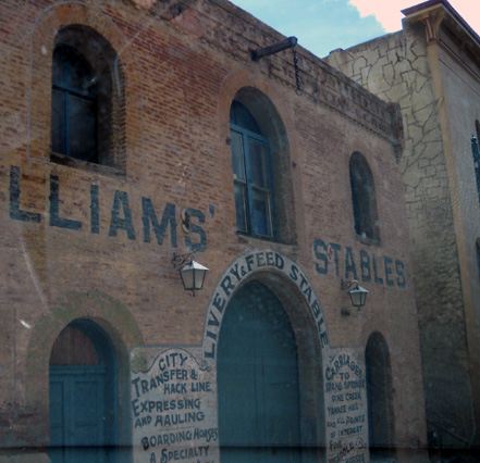
Black Hawk, located right on Hwy. 119,
is essentially a place to lose your money in a bunch of casinos!
When I looked up the town in the AAA TourBook to quickly
learn more about its history (since I had no internet connection
to do a web search), all I found was a list of ten
gambling establishments!
We don't play lotteries or gamble, so no thanks (well, unless
you count staying invested in the stock market during these
turbulent economic times!).
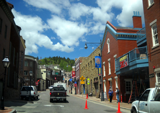
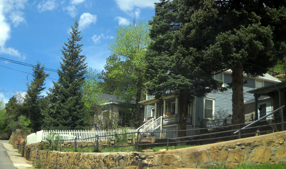
Central City (above and below) is more interesting to us. It has
a National
Historic District with a preserved 1870s main street and
Victorian homes dotting the hillsides.
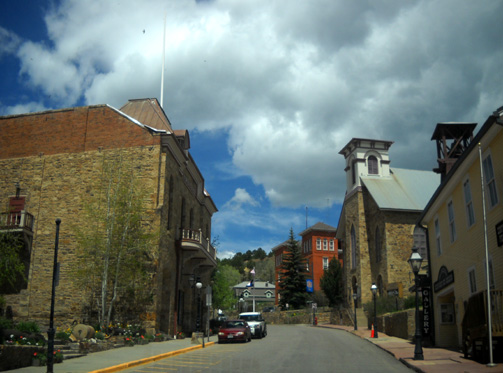
Central City has several other redeeming features like museums and an opera house.
The summer Opera Festival has attracted patrons from around the
state for about eighty years. Visitors can take guided tours of
the opera house, Gilpin History Museum, Thomas Historical House,
and probably some other buildings not listed in the AAA tour
guide.
I took all these "windshield" shots in Central City either while Jim was driving
or while I was driving (!) after I let him
out to get a Subway sandwich. We couldn't find either a
fast-food hamburger joint or a free parking
space so I just circled around the historic area while Jim
waited for his turkey sandwich. I made mental
notes of which streets I'd like to walk if we're ever in the
vicinity again. I'd like to see more of the architectural
details.
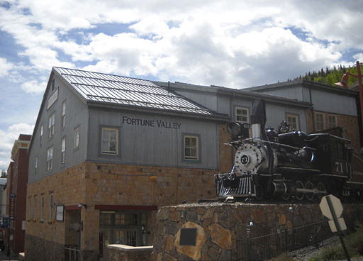
Oh, yes. Central City has its fair share of casinos, too, like
Fortune Valley (above) but they are mostly in vintage buildings
and not as gaudy as those in Black Hawk.
THE DIVIDE
During this three-pronged drive we also went north a few miles
to see whether the "Peak to Peak Scenic Highway" would be
suitable for hauling our camper from the area this weekend (next
destination: the Bighorn Mountains of northern Wyoming).
Despite some road construction it looks like CO 119 will be a
good route for us to follow to Nederland and beyond. I loved tracking
east of the Continental Divide:
This is a very scenic area to visit, with plenty of recreational
activities and more sedentary ones, too, in a large circle
including Golden, Idaho Springs, Mt. Evans, Nederland, and
Boulder. Dory Hill CG advertises that it's also convenient to
Breckenridge, Copper Mountain, and Rocky Mountain National
Parks. It's not. You can find plenty of places to stay
that are closer to those points of interest.
Next entry: the Golden Gate Dirty Thirty race
Happy trails,
Sue
"Runtrails & Company" - Sue Norwood, Jim O'Neil,
and Cody the Ultra Lab
Previous
Next
© 2010 Sue Norwood and Jim O'Neil
