(Continued from
Page 1)On this page I'll talk about
the next two distinct segments of the Barr Trail, each 3+/- miles.
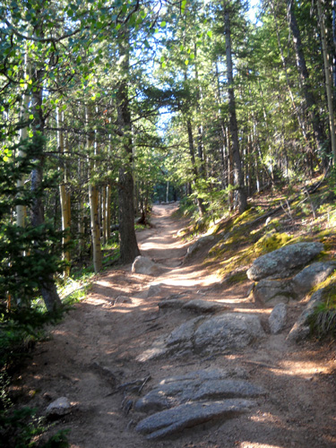
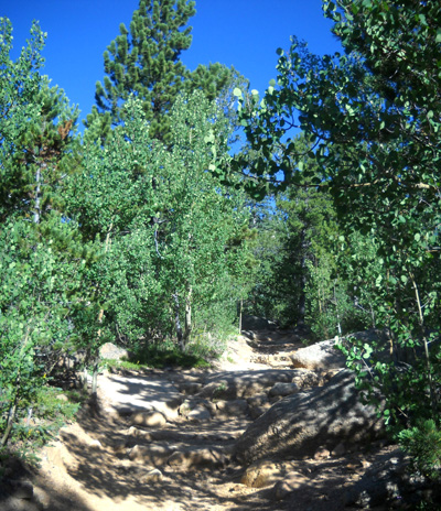
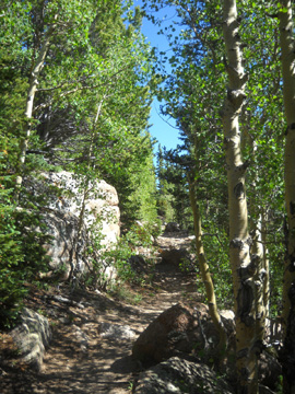
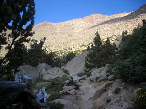
LIKE A FREEWAY IN COMPARISON
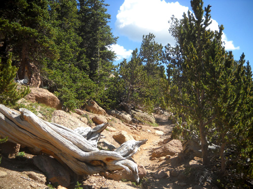
I loved the next 3˝-mile section of
mostly smooth, rolling terrain from the incline
intersection to Barr Camp. With an elevation gain of only about 1,200
feet over 3-4 miles, I
made better time than expected. I was even able to do some running
when the trail was flat or a gradual uphill slope. (Running down even gentle
hills puts too much stress on my knees.)
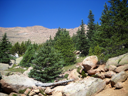
Just look at how great the trail
looks in these photos:
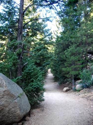
Downhill -- what a surprise!
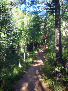
The elevation through this
section is approximately 9,000 to 10,000 feet, an altitude for which I
am well-trained. I didn't struggle with the elevation until I got above
13,000 feet, the highest I got in the San Juan Range earlier this month.
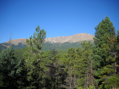
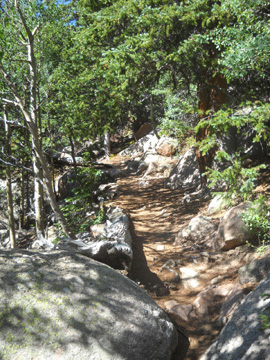
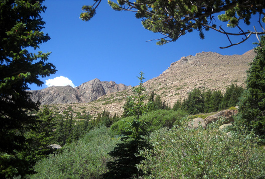
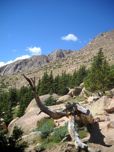
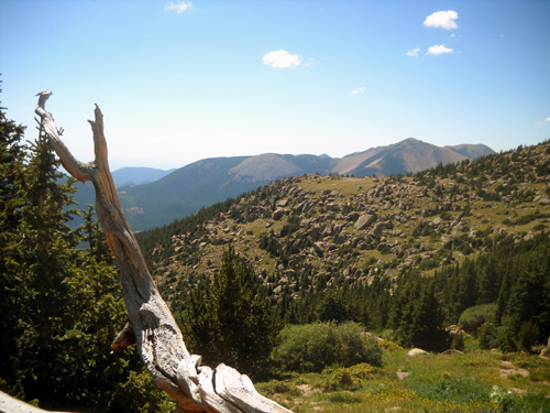
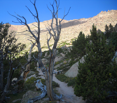
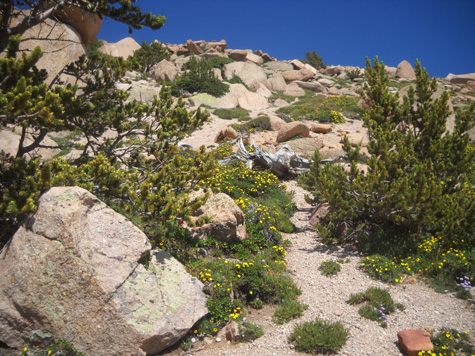
This segment is mostly forested yet it
offers several excellent views of Pike's Peak:
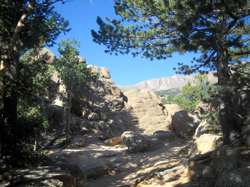
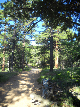
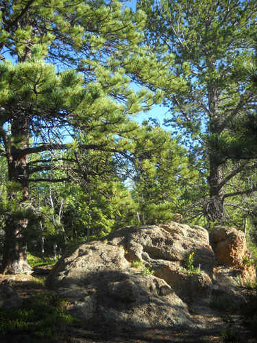
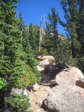
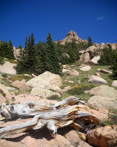
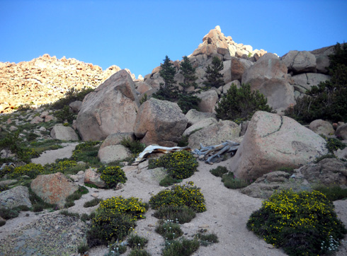
Although there are fewer rocks in this section of trail,
there are still some rocks to negotiate:
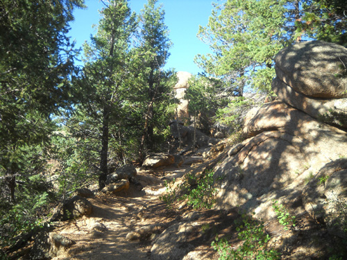
Most of the rocks are interesting formations
along the side of the trail, however:
This time of year the few creeks along
the Barr Trail are fairly dry. The first little stream I saw was Noname Creek
at 2.9 miles. There were other small creeks at 5.3, 5.9, 6.2 (Barr
Camp), and 6.7 miles. The Barr Camp website says there is also water at the Timberline Shelter at about 9 miles but I
can't vouch for that; I've never walked down to the shelter.
That's it for water on the Barr Trail, in case you need to
supplement your own supply or have a dog with you. It's the main reason I
didn't take Cody with me today. It was all I could do to carry 100 oz.
for me; he couldn't have carried all the water he would have
needed.
If you think you'll need water along the
way, take a filter with you. Even at Barr Camp you have to filter your
own water. The supply in my Camelbak lasted all the way to the top so I didn't need to
get any from streams.
YIKES! BIKES!
Remember what I said the other day about not having to
worry about bikes on the Barr Trail? Well, that's one of the things I
forgot about . . .
Bikes are allowed on the Barr Trail. I saw tire
tracks about as soon as I stepped on the trail in Manitou Springs. I
couldn't believe my eyes. Silly me, thinking I could get away from
mountain bikes for a day.
I didn't encounter the first cyclist until a little
before Barr Camp:
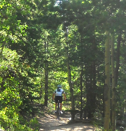
Actually, there were three guys riding together, going uphill. That
fact, plus their politeness, made me respect them instead of be
irritated by them. They'd already ridden almost six miles (uphill!) of this
challenging trail and had at least six more to go, whether they were
going all the way to the summit or hanging a right on the Elk Park
Trail to reach its trailhead on the Pike's Peak Highway.
I'd sure rather walk or run up this thing than try to pedal it!!
I didn't see any more cyclists until one passed me going
downhill near the summit. I'll show photos of him in the next part as he's
doing the hike-a-bike routine over the rocks and tight switchbacks Shows he's got some
sense, considering the potential drop-offs at that elevation. I can't imagine that
even the most skilled of mountain bikers could ride over some of
those rocks. Or do they?
And people think ultra runners are nuts??
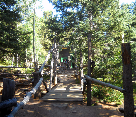
WELCOME TO BARR CAMP
I was quite pleased, considering all my lolly-gagging, to hike 6Ľ
miles to Barr Camp (elev. 10,200 feet) in about three hours. I'd gained
about 3,800 feet in elevation -- not half the total elevation
gain yet, but a little over half the distance to the summit.
Barr Camp
is one of the places along the trail that I remember the best. I've been
there several times on previous Pike's Peaks hikes and runs. It's a
popular waypoint for both day users and overnight
visitors.
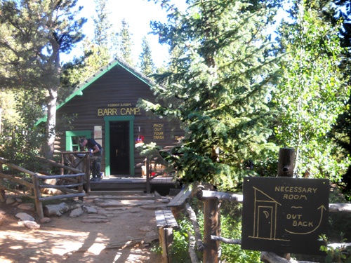
The camp was built by Fred Barr, the trail's designer-builder, in the
early 1920s to provide respite for trail users. Now under permit of the
Forest Service, it has been operated by full-time, year-round caretakers
since 1979.
Neal and Teresa Taylor have been the caretakers the last five years. It's
an interesting life, believe me! The only way to get down to the city
is to hike six miles on the Barr or Elk Park trail, or catch a ride on
the cog train at its Mountain View stop 1˝
miles away -- also by trail. That's how they keep the place stocked with food and
supplies for themselves and their frequent visitors.
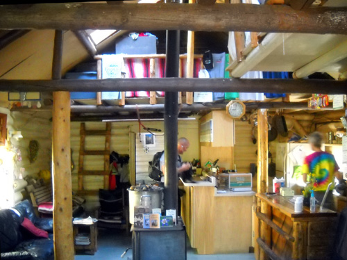
There are clean pit toilets, a stream to filter your own water,
snacks, dehydrated food, drinks, and other items to purchase, and a
place to camp in a tent camp, lean-to shelter, cabin, or bunkhouse. The
website indicates that reservations are needed even in the
winter because accommodations can fill up year-round.
Just think -- camping at 10,200 feet elevation in the winter . . .
There is no fee for day use of the restrooms, picnic tables, water
supply (BYOF -- bring your own filter), or camaraderie with the
proprietors and other trail users.
I spent an enjoyable time at Barr Camp on my way up to the
summit today. I saw Teresa right away, coming out of one of the
bathrooms after she checked on its condition (as clean as it could be).
I introduced myself and asked if Neal was there, too.
He was. Jim and I
have met him before (he's an ultra runner who recently finished the Hardrock Hundred) but this was my first time to meet Teresa.
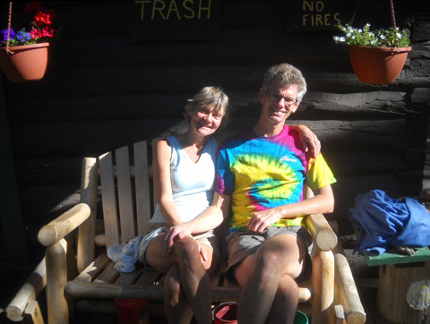
The couple took a few minutes out of their busy morning to chat with me on
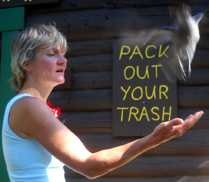
the porch of the main cabin, where Teresa demonstrated the fine art of
feeding the resident winged gray jays out of her hand. The birds were too
fast for my camera, but you get the idea (photo below).
It was a
pleasure to talk with the Taylors and learn about their unique lifestyle
at the camp. You can find the answers to most questions about Barr Camp at this
FAQ
link.
One of the things I did at Barr Camp was to try to give Jim a head's
up about my progress. Our cell phone connection was poor but he got the
gist of it and was glad to hear I was doing well. We had a little better reception above
tree line when we talked a couple hours later.
As much as I wanted to hang around Barr Camp and talk to Teresa and
Neal for a while longer, I knew I'd better get going. Not only did I
want to reach the summit before a storm rolled in, I also didn't want to
keep Jim waiting too long for me.
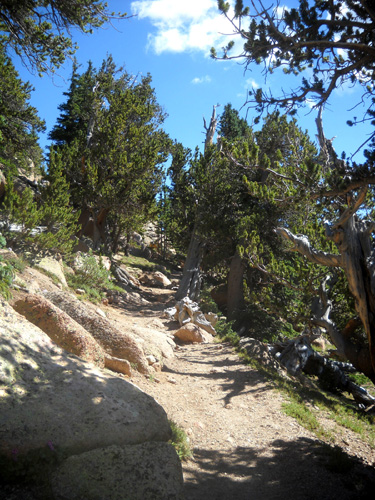
BARR CAMP TO TREE LINE
That was pretty much the end of perfect trail!
The next 3+ miles through sub-alpine forest to the tree line
(approx. 10,200 to 12,000 feet) become considerably more rocky
as the trail switchbacks toward Pike's Peak. Here's a collection of
smaller photos that depict the first part of this section:
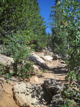
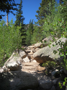
It's a pretty section, just more challenging to navigate.
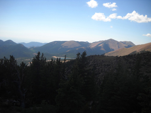
As I climbed higher I could really see the progress I'd made
from the Springs area . . .
. . . toward the Peak:
I wasn't feeling the altitude yet but it was obvious that I'd be
"running out of trees" pretty soon. They became more
sparse and stunted as I climbed higher and higher.
There were some different species, too, and more low-growing
mounds of wildflowers as I
entered sunnier terrain.
These shorter blue spruce reminded me of
Christmas trees.
I reached the Timberline Shelter at 8.62 miles on my GPS, still
over three miles to the summit. The shelter is off the Barr
Trail only a little ways but I've never gone over to it,
partly because it's downhill and I know I have to come back
up!
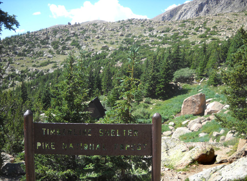
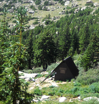
I think the primary purpose of this shelter is to provide
respite from storms. When hikers get to this point and see storm
clouds brewing over the peak, they can stay in the shelter until
it blows over. The one time I got caught in a storm here,
I was about a mile from the summit and it wasn't practical to go
up or down. I had to hunker under a rock overhang.
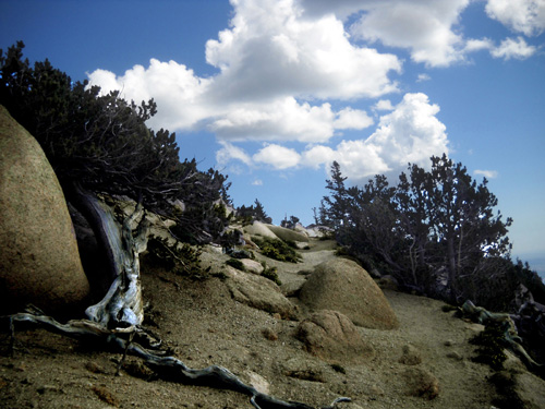
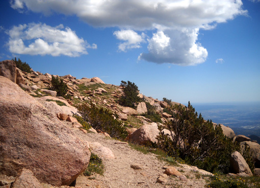
The trail continues switch-backing up the mountain through the
spruce-fir subalpine zone:
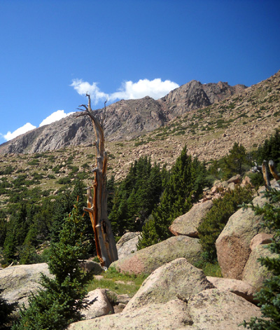
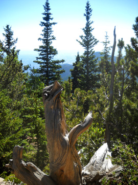
The next part of the trail is totally fascinates me as it winds
through an old burn area and the surreal Krummholtz landscape.
KRUMMHOLTZ?
Yep. Krummholtz is the German word for the dwarfed,
twisted trees
and shrubs that grow at the high end of subalpine zones close to
the tundra. These plants are subjected
to such harsh conditions that they grow very slowly and
sometimes have unusual shapes. High winds, months of sub-zero temperatures, lots of snow, and very short
summers seriously affect their growth.
The living plants
you see are true survivors.
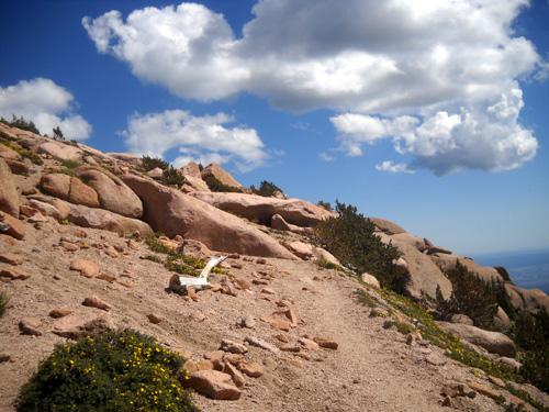
I think the trees that died (or burned) make excellent photographic subjects.
I took these shots after reaching the 9-mile mark at around
12,000 feet:
There's a lot of dead wood up here!
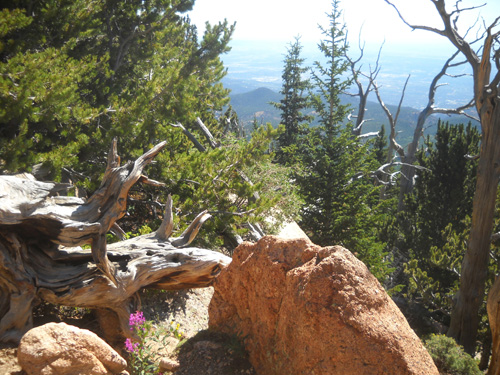
It was through this section that I first caught glimpses to the
south of the scenic Cirque and Lake Moraine:
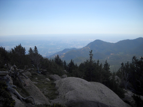
Once above the trees I was also able to get stunning views of
the Colorado Springs valley and huge plains beyond it:
I enjoyed the subalpine flowers through this section where they
get more sun:
The flowers grow in dense, low mounds to conserve both water and
warmth.
These little trees farther up are starting to look more like Krummholtz
dwarfs:
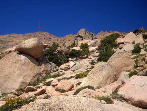
Red arrow = my goal
That was the last of the dwarf trees and shrubs. Now at
approximately 12,400 feet in elevation I'm entering a world of
miniature alpine flowers and GREAT BIG ROCKS.
Next page: the last 2˝
miles to the summit
Happy trails,
Sue
"Runtrails & Company" - Sue Norwood, Jim O'Neil,
and Cody the Ultra Lab
Previous
Next
© 2010 Sue Norwood and Jim O'Neil
