Although this particular run/hike was not mentioned by our Colorado
Springs ultra running friend John Cassidy,
it was his recommendation that we explore the trails in Williams Canyon
and the Rampart Reservoir that brought it to our attention.
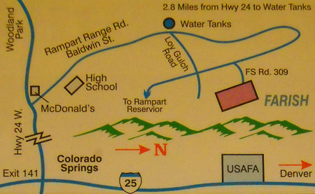
We noticed that one of the trails on the western side of the USAF
Academy grounds goes up and through the Rampart Range, shown in green on the
diagram below. Cadets and other folks
train on these trails and dirt roads, continuing past the
reservoir and onto
Farish RA property.
We did some more research and discovered that as military retirees, we
could do the same.
Note that although just about anyone can use the Academy trails and go
over the ridge to the reservoir and beyond, only active duty and retired military folks,
Reserve and National Guard, DOD and NAF civilian employees, cadets, USAFA
contractors, and immediate family members of these groups are "eligible users"
of Farish Recreation Area.
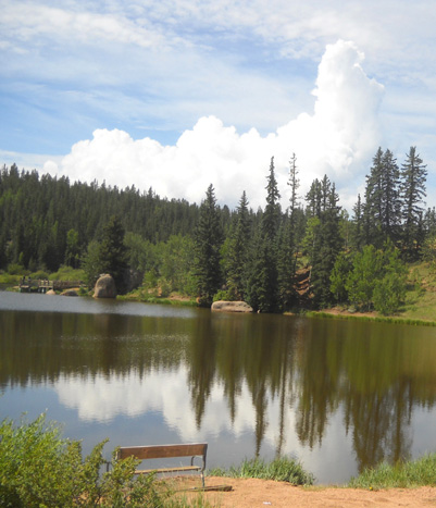
One of three nice fishing lakes in the developed
part of the recreation area
Jim didn't see any check-points on the east side of the rec area,
however. It may be that visitors are allowed to wander through the woods like
he did, just not the developed part of Farish. I did see a sign on a
gate through a fence near the trailhead that said ID was required to be
in the rec area. That fence may have been the Farish boundary, for all
we know. We were probably in the Pike National Forest most of the time.
Since we didn't know the drill, Jim carried
military ID just in case someone questioned his presence in or near Farish, and I
definitely needed my retiree spouse card when I
entered through the gate with our truck (and had to pay $4 to get in).
THE PLAN
Jim's goal was to run/hike 13-14 miles one way from our
campground on the east side of the Academy to Farish Rec Area via the
Falcon Trail, Stanley Canyon Trail, Rampart Reservoir, and
various
forest service roads, then turn around and come back for a total
of 26-28 miles.
Although Jim said he didn't need any aid on this run, I was
concerned that he wasn't carrying enough sustenance for such a
long distance in the mountains. I decided to surprise him by
driving to Farish and hiking in until I met him on the trail so
I could resupply him with fluids and calories.
I was also curious what the place was like and in need of a good
hike myself., so my motives weren't entirely altruistic!
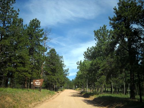
One of the dirt forest service roads I
drove to Farish; Pike National Forest sign on left
I could see from the maps that getting to Farish Rec Area by
vehicle from our campground in the Academy wasn't simply a
matter of driving over the mountains "as the crow flies."
The little map at the top of this entry didn't forget to include
a road over the Rampart Range; there is no road connecting the USAFA to Farish.
I figured that it would take me about an hour to go south on
I-25, west on US 24 to Woodland Park, and east on Rampart Range
Rd. and a couple of dirt roads to reach my destination at Farish.
Then I'd hike in as far as necessary to (hopefully) meet Jim
coming from the other direction and offer him enough
supplementary water and food to enable him to run/hike back to
the camper.
Depending on how far I'd gone, I could choose whether to keep
going farther into the mountains or turn around at that point. I
wanted five or six miles total.

Pleasant trail/road through Farish Rec Area
(or Pike National Forest)
I realized this plan could easily backfire on me so I decided not to
make it a total surprise for Jim.
I called him
after he'd been gone for about an hour and before I
started the drive over to Farish. I wanted to see how
he was doing and determine if he was still planning to go all
the way to the rec area. I wasn't so anxious to see Farish that
I'd drive all that way for a 5-mile hike if he had already
changed his mind about going there.
He was doing fine at that point, planned to go the whole way to
the rec area so he could get more water, and was happy that he'd see me
on the other side of the Rampart Range.
And he probably
began thinking about how convenient that might be for him
. . .
EXECUTION OF THE PLAN
All this worked out just fine, which is a wonder considering
neither of us had ever been on these forest roads and trails before
and did not have a very detailed map or description of the
route. The best map we had was the DeLorme Atlas for Colorado,
and even that was incomplete. However,
- Jim found all the right trails and roads from the Academy to the Rec Area
by foot.
- I
found Farish (had good driving directions to that) and parked reasonably close
to the correct trailhead (had no good information about that, even at the office).
- Then we managed to find each other a couple miles
out from the truck, despite all the intersecting dirt roads
where one or both of us could have gotten off-course.
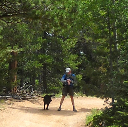
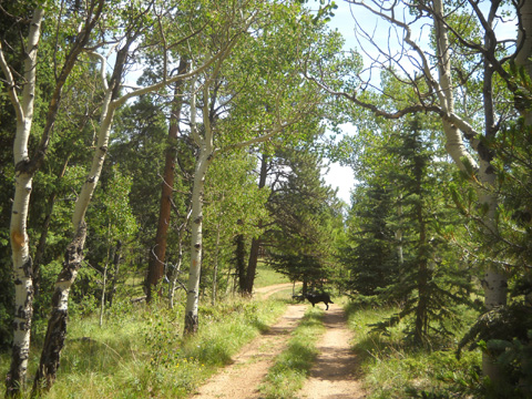
Cody runs to greet Jim, who notes on his
GPS the time we "connected."
We started laughing when we saw each other -- I don't
think either of us really thought my plan would
work!
I mean, close your eyes, separate your hands by about three
feet, and try to make your two index fingers
meet tip to tip in front of your face. That's about the kind of
shot-in-the-dark I'm talking about.
By the time we rendezvoused Jim had had enough climbing, gnarly
trails, dirt roads, and sun. He decided to ride back to the
Academy with Cody and me.
Maybe I shouldn't have made it so tempting for him! There's a
reason the cadets use Stanley Canyon and Farish RA for
military training -- it's not your ordinary walk in the
park. Thirteen-plus miles were enough of it for him.
OUR RUN/HIKE
Jim didn't take a camera with him today so the only pictures I
can show you are the ones I took. I'm not sure if they are even
in the rec area or outside its boundary and in the Pike National
Forest.
When I checked in at the building where visitors show their ID
and pay their entrance fee to Farish, I asked for a map and where to park
for the trailhead to Stanley Canyon. The two people working in the
office weren't sure, and the map they gave me isn't totally
accurate:
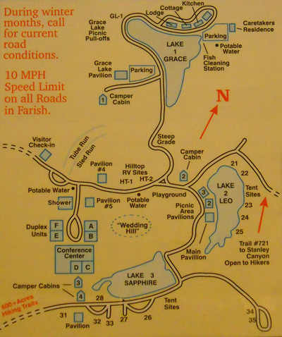
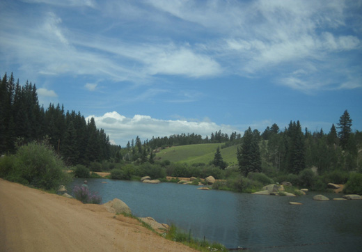
I drove back the main road and made two turns to reach a parking
area at the north end of Lake Leo. A group was gathered at one
of the pavilions and several tents were set up in sites around
the lake. It looks like a relaxing place to spend a day or
weekend if you like to picnic, fish, or tent camp.
Cody and I prepared for our hike, then walked around the end of
the lake hunting for Trail #721 to Stanley Canyon. See the red arrow on
the right on the map above? It was nice of them to mark it
prominently on the map, but it would be nicer if the map was
accurate!
There is no road or trail behind those
tent sites as shown. There is a path that goes next to the water around the lake, but not
to Stanley Canyon.
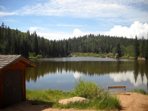
Lake Leo, where I parked sort of near the
trailhead that leads to Stanley Canyon.
Before I went more than a hundred yards I asked some folks who were
fishing near the tents where the trailhead was, and they pointed
me in the opposite direction -- up a short, steep dirt road
and to the right (that little spur on the map above Lake Leo). I couldn't
have driven up that road but I found another better road later
that does go up to another parking area -- and it's not on the map either.
No problem, really. I figure Cody and I just got some
bonus mileage.
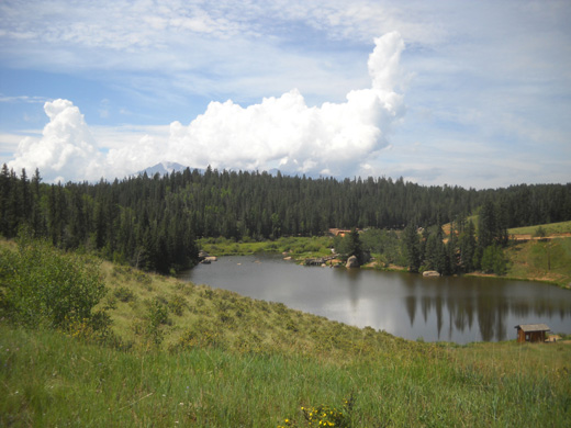
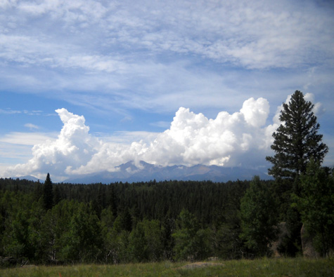
When we reached a plateau at the top of the hill I had a great
view down to Lake Leo. Pike's Peak is barely visible past the
pine trees; it remained under billowy white clouds for
several hours:
Pretty soon I came to this fence and gate, which may be the
Farish RA boundary:
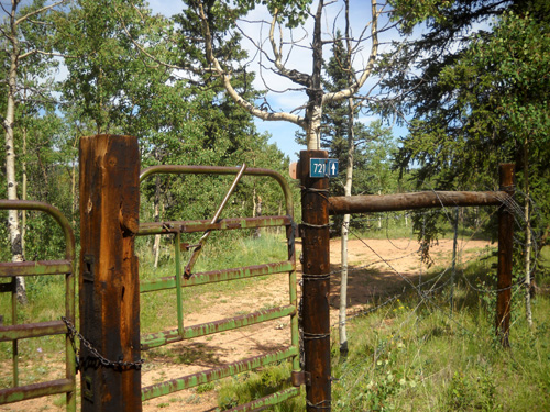
I didn't know for the next two-plus miles if I was still on
Farish property or in the national forest. The only sign about
Farish was on the other side of this gate, indicating that
people on this side of it had to be a member of one of those
eligible member groups I mentioned above.
I was glad to see the #721 sign on the gate post and at several
subsequent intersections with other little dirt roads. Jim and I
probably wouldn't have found each other if those markers hadn't
been there.
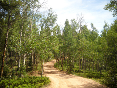
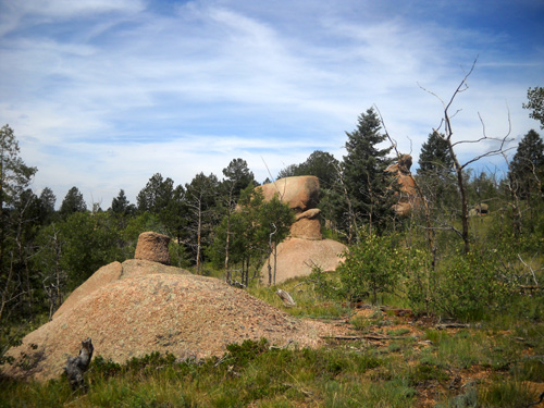
Most of the trail/road was through forested areas, with some
interesting boulders and rock formations like these:
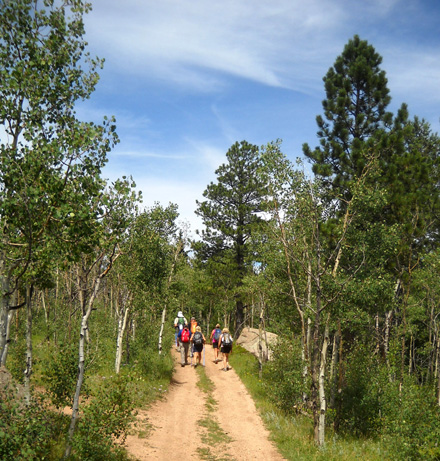
I saw several other hikers and some folks in various types of 4WD
vehicles. Although no one was camped where I walked today, I
could see fire rings in several cleared areas in the trees. That's a clue I was
probably on national forest land and not Farish property.
I had no idea what to expect on this hike. I guess my biggest
surprise was that the Farish end of it was on dirt roads and not
single-track trail. Jim was mostly on double-track and dirt roads, too.
When I was walking on the ridges I got nice views of the Rampart
Reservoir and Pike's Peak, which became more cloud-covered as
the day wore on:
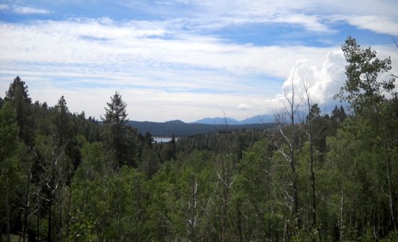
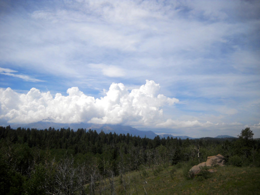
It didn't look stormy but there wouldn't have been good views
from the summit if I'd hiked that mountain today. I'm still
waiting for the right time (weather-wise and a day Jim doesn't
want to do a long run).
Today was an easy hike for me since I'm acclimated to elevations
several thousand feet higher than this. FSR 721 rolled up and down from only about 9,000 to 9,300 feet.
It's also fairly smooth = good footing.
Jim
had considerably more elevation gain and loss than I did as he
roller-coasted on the Falcon Trail, climbed up rough trail
through Stanley Canyon, down to the reservoir, and back up to Farish. His elevation range was
between 6,500 to 9,300 feet;
the total gain and loss was a lot more than that because of all the climbs and
descents. He was happy that the last couple of miles he walked with
Cody and me
were easier.
FARISH REC AREA INFORMATION FOR OUR MILITARY
FRIENDS
The first 160 acres of property at this site were donated to the USAFA by the Farish family in memory of their son, Lt. William
S. Farish, Jr., who was killed while serving as a member of the
Army Air Corps. The final 495 acres, which were
unsuccessful gold and copper mining operations and a potato
farm, were acquired in 1967.
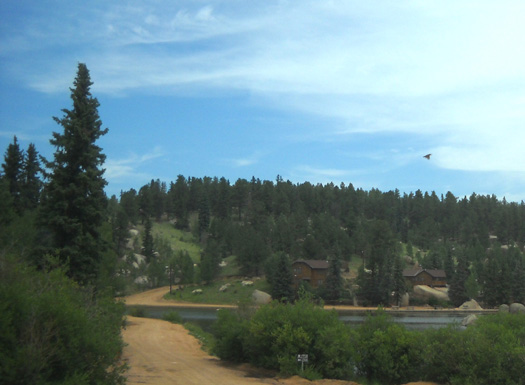
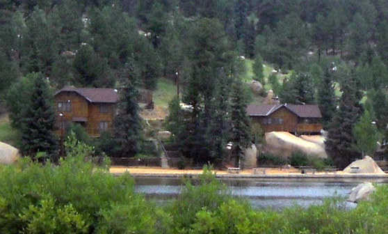
Above and below: lodge,
cottage, and kitchen at Lake Grace
The developed areas include
- three scenic lakes that are popular with picnickers, campers,
paddle boaters, and folks who fish,
- a conference center that accommodates up to 75 people,
- an historic lodge with four bedrooms,
- a furnished cottage that sleeps eight,
- six duplex lodging units,
- two camper cabins,
- seven group pavilions,
- and several camping sites for tents and RVs.
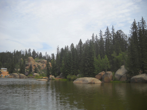
Photogenic boulders at Lake Grace
The property and facilities are managed by the USAFA Combat
Support and Community Service. Reservations are recommended for
just about everything except some day use activities.
The road winds around one side of Lake
Grace
Summer activities include hiking, although I've been unable to
determine how many miles of trails are available within the rec
area itself. On the map you
can see an arrow on the right for Trail #721, which is more dirt road
than trail; it's the route I followed toward Stanley Canyon to
meet Jim. Off to the lower left it says "600+ acres hiking
trails" but no one in the office could tell me about those
trails, which I found odd. Perhaps they are in the national
forest and not on Farish property.
Other activities include mountain biking and fishing almost
year-round, and snowshoeing , cross-country skiing, ice skating,
sledding, and ice fishing in the winter.
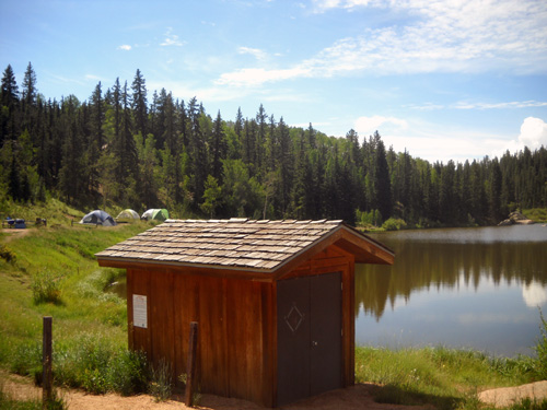
Some of the tent sites at Lake Leo
Wildflowers and wildlife are abundant from spring to fall.
Endangered wildlife includes American peregrine falcons,
southern bald eagles, and osprey. Elk, mule deer, black bears,
mountain lions, bobcats, snowshoe hares, turkeys, blue grouse,
and ptarmigans also live here.
Outdoor weddings are apparently very popular here. As I drove in
the main road late this morning I could barely wedge the truck
through dozens of vehicles parked on both sides of the narrow
road near "Wedding Hill," situated above scenic Sapphire Lake.
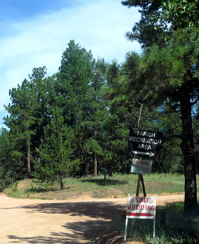
Sign to Farish and arrows for wedding
guests to follow;
outdoor weddings are popular on "Wedding Hill"
above Lake Sapphire.
Click on the Academy's
link about Farish Recreation
Area to learn more about the place. I like watching the scrolling photos at the top of the page.
WILL WE GO BACK?
I don't know if we'll ever visit Farish again. I'm curious about
that "600 acres of trails" noted on the rec area map but we need
to find more information first about the terrain and locations
of trails/roads in that direction. It's a long way over there by
vehicle from the Academy, there's a fee to get into the rec area
itself, we prefer trails to dirt roads, and Jim wasn't that
thrilled with the course he ran/hiked.
Camping options are pretty limited, too, with only two RV sites
near the entrance. They didn't appeal to us. The narrow paved
and dirt roads in the last few miles to the rec area could also
be a problem for larger RVs to negotiate.
We do want to explore the running and hiking options on
that side of the Rampart Range that John recommended to us,
including Williams Canyon and the Rampart Reservoir. It's a
beautiful area.
Next entry: Yay!! I finally get the perfect opportunity
to hike up Pike's Peak!
Happy trails,
Sue
"Runtrails & Company" - Sue Norwood, Jim O'Neil,
and Cody the Ultra Lab
Previous
Next
© 2010 Sue Norwood and Jim O'Neil
