Continued from
Page 1
GREENLEE & THE BEST PART OF THE ROUNDUP TRAIL
When I got back to the three-way intersection with the Mesa and
Greenlee trails I turned right on Greenlee and hiked down it for
2/10ths of a mile to the Roundup Trail. Greenlee is wide and
looks similar to the Mesa Trail, although more rutted. I showed
the lower part of it in a
previous entry.
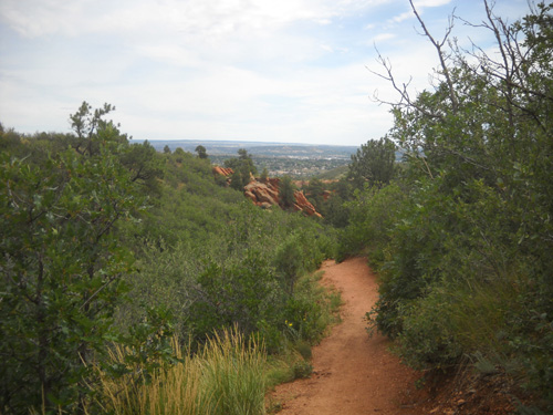
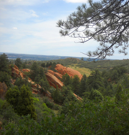
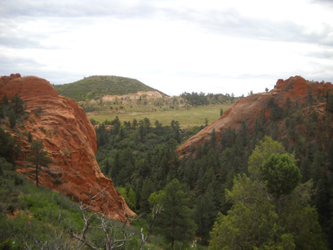
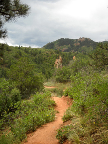
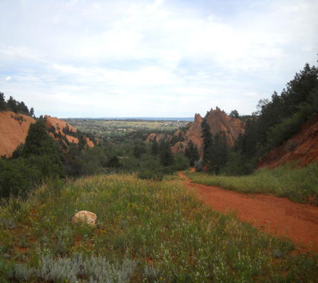
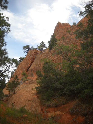
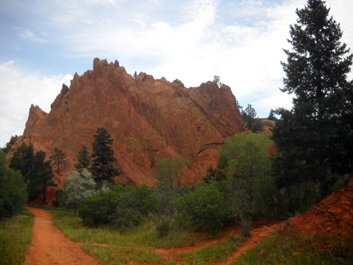
I made another right on Roundup and hiked the third and fourth
sections of that trail that were new to me. I loved it! There are
lots of undulations, twists and turns, rock formations, and good
views:
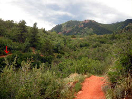
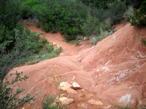
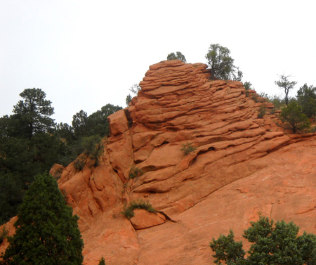
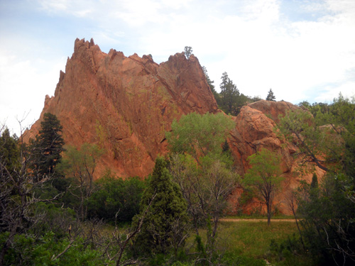
The trail winds around the end of a small
canyon; the arrow shows where it goes.
All the summer greenery is a nice contrast
to the red rocks and trails.
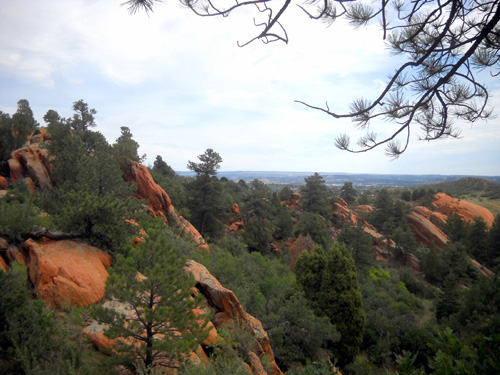
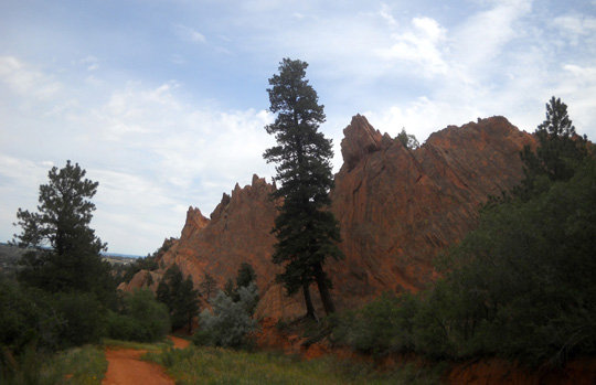
See why I like this trail so much? Jim did, too, when I showed
it to him on a subsequent hike.
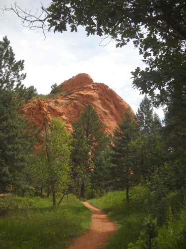
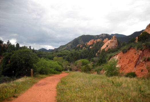
Although the Roundup Trail is listed as "advanced," it seemed pretty
tame to us after all the mountain hiking/running we've done. I think those ratings are more for cyclists than
for hikers and runners. Here's one of the more interesting
obstacles for cyclists and equestrians:
It doesn't look so difficult from this
direction . . .
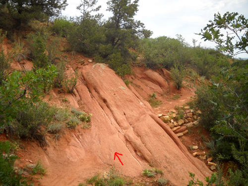
. . . but the approach going the other way
is a bit disconcerting! There is no groove above that arrow.
I even had to be careful *walking*
over that rock -- wouldn't want to do it when it's all wet.
I got a little surprise when the trail crossed an extension of
the Mesa Trail that wasn't on the map I was carrying (the one
online that I've highlighted in this series). It is on
the newer trail signs, however.
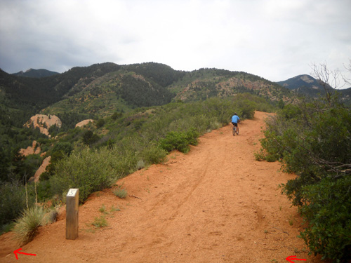
Cyclist is heading west on Mesa. I added arrows
to show where
the Roundup Trail crosses over; I was
heading to the left.
I knew the Roundup Trail continued farther; I just didn't
know Mesa came this far. Volunteers are continually extending
and adding trails to this park, which is great!
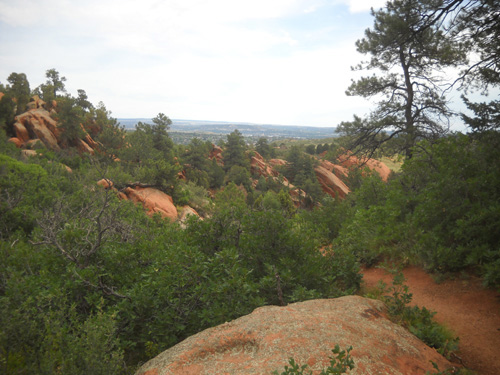
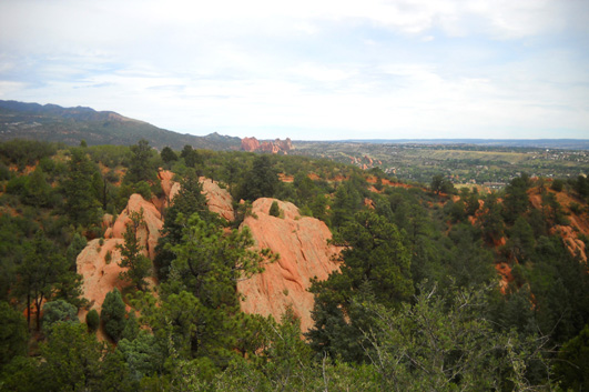
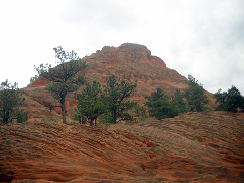
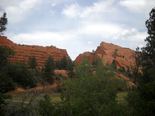
Here are three more views from this intersection:
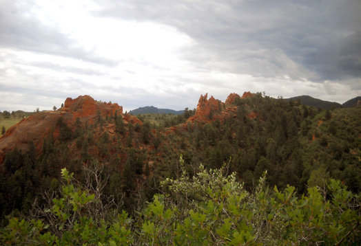
View to the south shows jagged rock
formations above the canyon where the trail goes next.
View east
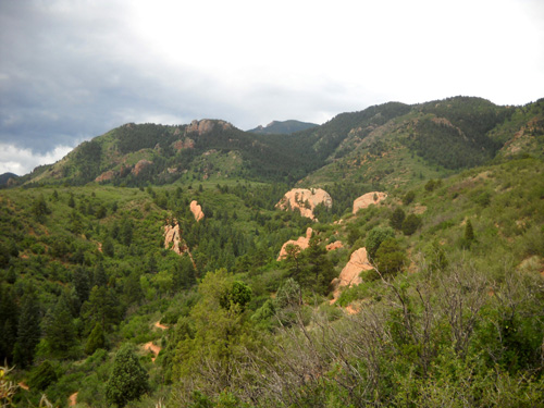
View southwest; trail squiggles down in
lower left quadrant
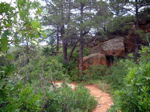
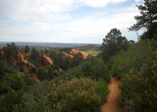
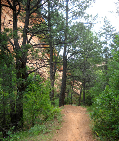
This was the beginning of another fun section of the Roundup
Trail!
I was going CCW and gradually down the winding trail into the
lower part of the canyon that I had I photographed from the
Intemann Connector and Trail:
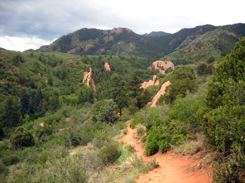
As I was descending I met a couple cyclists and runners going
up the trail. This section of Roundup is not as rocky as the
last part so it's a little easier for all types of trail users.
The canyon floor is fairly smooth and rolling as it passes
between some rock walls:
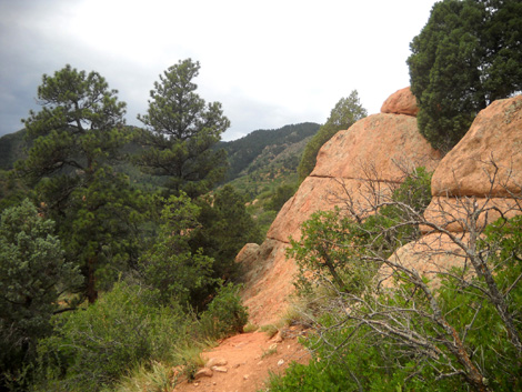
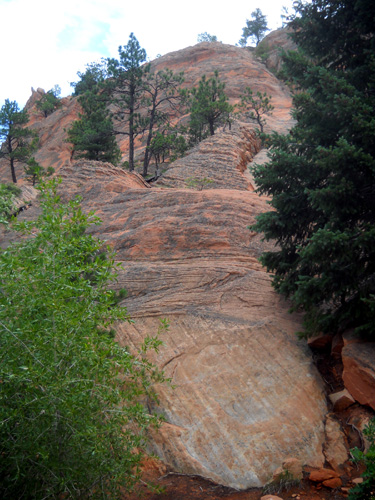
The trail curves around to the left and widens as it heads in a
northeasterly direction. There are more unusual rock formations
here:
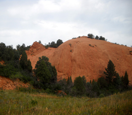
Isn't that a cool "top hat?" There are fun little
surprises like that throughout this park.
This photo looks back up the trail:
I had been conscious of the increasing gray clouds for the past
half hour but wasn't too worried. If it started raining (or
worse), I was only a little over a mile from the parking lot by
now and could run downhill to the truck if necessary.
RED ROCK RIM & HOGBACK VALLEY TRAILS
Roundup ends/begins at the intersection with the Red Rock Rim and Red
Rock Canyon trails. Curiosity made me turn right on the rim
trail for just a little while to see what was around the rocky
hill separating the two trails . . .
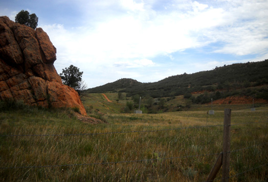
In about a quarter mile the rim trail continues north through
the meadow and the Hogback Valley Trail goes south. It
eventually loops around and returns to the parking areas via
Hogback Ridge. You can see the trail on the hillside in the next
photo:
Trail users can make a three-mile loop incorporating the two
trails.
That didn't look as appealing to me as going the other direction so I
retraced my steps back to Red Rock Canyon Trail and headed north
(downhill).
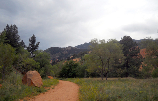
RED ROCK CANYON (RRC) TRAIL
This wide trail extends for about two-thirds of a mile and is
popular with climbers -- it's loaded with rock
walls they can climb. Hikers, runners, and cyclists like it
because it's gradual, fairly smooth, and leads them to the
quarry I talked about in a
previous entry.
This is the scenic view down RRC Trail at its intersection with
the Red Rock Rim Trail:
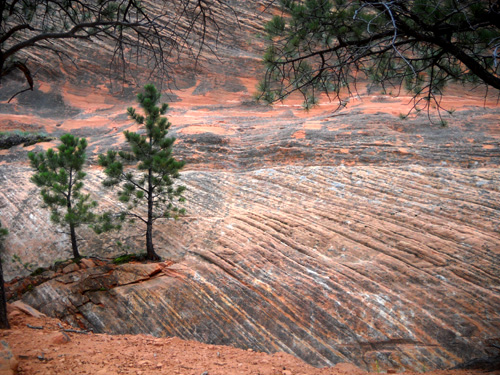
I was fascinated with the shapes, sculpting, and patterns in the
rock walls I passed going down this trail:
It's amazing where trees sometimes put down roots, like on
the exposed high ridges of these rock walls (next two photos)
and in narrow crevices (third photo down) where it
doesn't look like there is enough soil for them to survive:
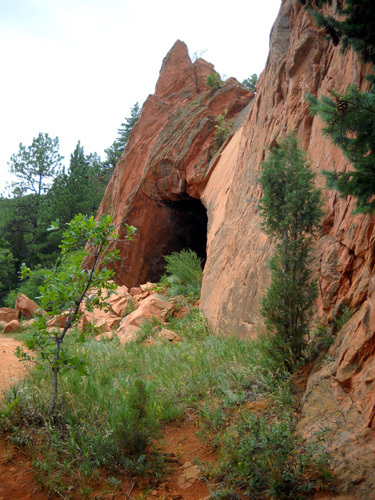
Part way down I saw this path and had to see what the attraction
was:
A vertical cave -- more nooks and crannies!
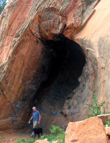
I took a picture of Jim and Cody in it later to give some
perspective on the height:
About half a mile down Red Rock Canyon Trail I came to the
quarry area and couldn't resist taking some more pictures
from a different trail than the one I'd been on the first time I
hiked here:
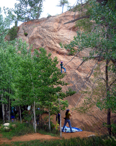
Just past the quarry are some popular climbing walls. I noticed
worn places along the trail
where they like to begin their climbs, and could see some fixed ropes up
several walls.
I saw only one climber the day I did this loop alone. He was up
about a hundred feet high. When Jim was with me another day we saw more
climbers along RRC Trail, such as this couple
and two kids who were scaling a cliff just a few feet off the
path:
This rabbit is one of the few wild critters besides birds that I've seen in three
hikes at Red Rock Canyon Open Space:
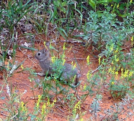
Larger wildlife like raccoons, mule deer, coyotes, and black
bears also live in the park but they are more reclusive.
One last look back at Red Rock Canyon
Trail; no, I didn't get wet that day.
I guess you can tell I enjoyed this park! There are still
several miles of trails I haven't explored yet. It's not as
dramatic as some places I hike but it's a treasure that's
accessible to more people than, say, truly remote sections of
the Colorado Trail. I've given it considerable journal space in
an effort to encourage more people to get out there and enjoy
it.
If you're an ultra runner who doesn't think there are nearly
enough miles of trails in Red Rock Canyon to satisfy your needs
during a long run, simply continue on to Section 16 and the
entire adjacent Pike National Forest!
Additional trails are planned for the Red Rock, White Rock, and
Section 16 conservation areas, including a
geologic history loop and a
human history loop. You can see
photos of some of the work the
Friends of Red Rock Canyon volunteer group is doing this summer
as they build new trails. If we lived in the area, we'd be
volunteering with them.
Next entry: mourning the loss of ultra runner Dave
Westlake and more ruminations about the risks of adventure
Happy trails,
Sue
"Runtrails & Company" - Sue Norwood, Jim O'Neil,
and Cody the Ultra Lab
Previous
Next
© 2010 Sue Norwood and Jim O'Neil
