After runners left our aid station on CO 110 AKA Engineer Pass
Rd./Alpine Loop, they followed a switch-backing trail up, up, up
Grouse Gulch toward American Basin and the highest point on the Hardrock course, Handies Peak.
Here's part of the Drake map to illustrate this little piece of
the course (only about 5% of the race):
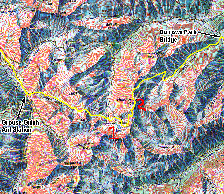
At 58˝ miles into the race,
they faced a 3,338-foot climb from 10,710 feet at the Grouse
Gulch aid station (far left on map) to 14,048 feet in
a little over five miles to the top of Handies. Along the way
they followed a pretty little stream, ran or hiked over
American-Grouse Pass, curved around the usually-snow-filled
American Basin (which I marked #1 on the map above), forded the Lake Fork of the Gunnison River and
the Sloan Lake Stream, crossed a marshy flat through the tundra,
negotiated a rock slide above Sloan Lake, and climbed on a
narrow trail to the summit of Handies Peak (#2 on map).
Cool, I thought. I want to go up there, too! I've
never been to Handies Peak in either direction on
the course.
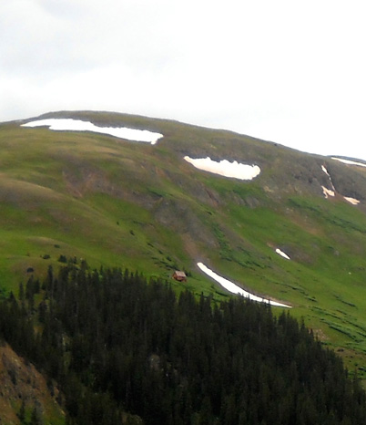
Jim has, though. He was part of a group of HRH volunteers and
folks from the Colorado Trail Initiative who worked on the trail up in the basin and
on
the peak before the 2007 race. They reached the basin by driving
up rough 4WD roads over Cinnamon Pass and toward American-Grouse
Pass. This is one of the scenic photos
he took that day, looking back down into the basin from the peak:
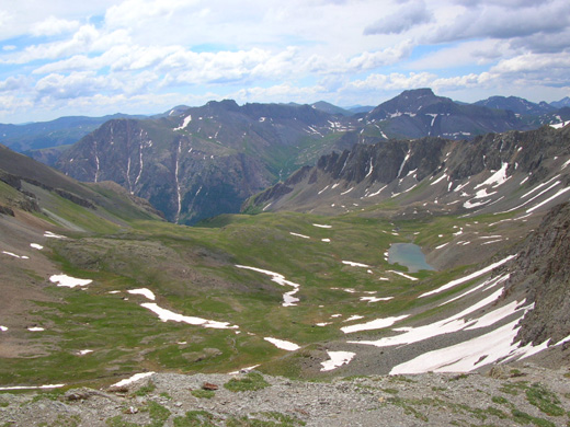
Photo Jim took of Sloan Lake and American
Basin from Handies Peak on July 7, 2007;
Grouse Gulch is down below the basin, to
the left and out of sight.
He took lots of great shots that day, which you can see in our
2007
journal at this
link.
Looking at his pictures again makes me want to
get up into that basin. Alas, it didn't happen this year either.
ASCENDING GROUSE GULCH
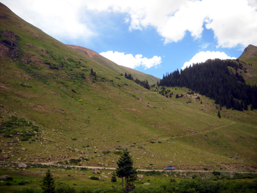
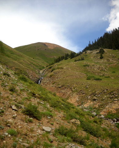
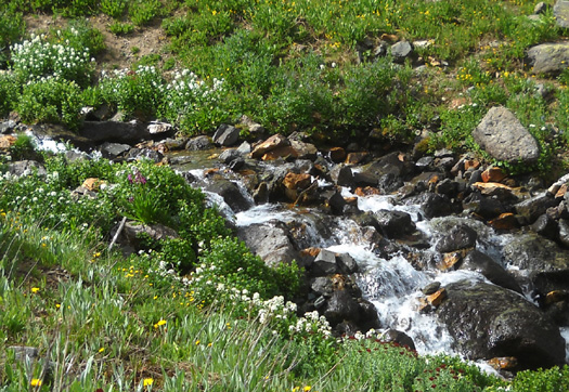
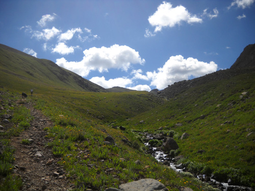
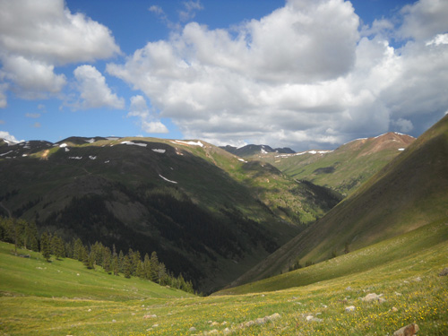
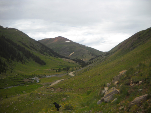
From our vantage point 'way down at the aid station we could see up into
Grouse Gulch for about a mile (next photo). As always, I wondered what it
looked like beyond our view. I love high basins and I love
climbing 14ers.
Well, this climb will have to wait until another year. By the
time Jim and I started up the gulch at 10 AM on Saturday, we were
already pretty fried from our long communications stint at
Grouse and needed sleep more than an adventure.
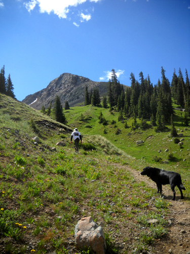
Cody and I climbed up the trail about a mile on Friday afternoon
before the runners started coming into our aid station. That
gave me more appreciation for the next challenge they faced, one
of thirteen or fourteen major climbs in the race. The grade on
the switchbacks isn't as bad as some of the other parts of the
course but nothing is "easy" after running/hiking 58+ miles on
the HRH course.
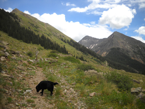
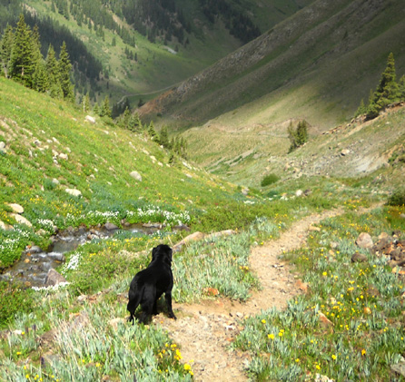
Upward hound: near the beginning of the switchbacks
That short hike just whetted my appetite for more. So I
persuaded
Jim to come along with me on Saturday morning after we got sprung from our
ham radio duties. Although he's been up to American Basin and
the summit of Handies previously he didn't get there this way,
so the terrain was new to both of us.
We didn't realistically plan to go all the way
to Handies, but I thought maybe we could at least climb up to
the highest basin.
Nope. We were too tired and the trail got steeper beyond the point I'd
gone on Friday.
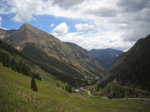
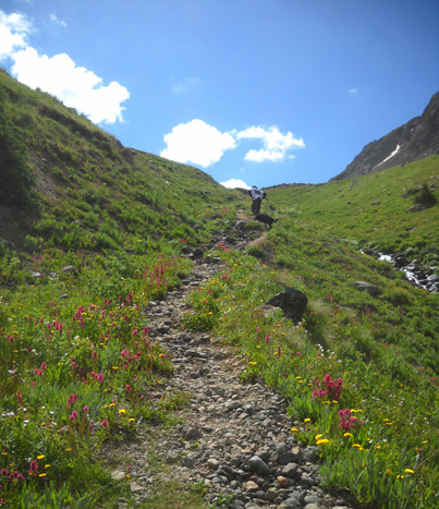
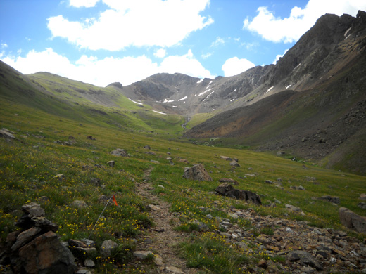
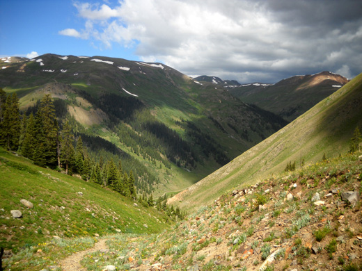
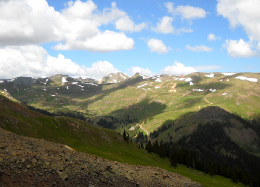
View south from the trail
We did get up to 12,029 feet in elevation in 1.4 miles (a
gain of 1,319 feet) and could see the
highest basin and Handies Peak. It didn't look that far ahead,
but it would have taken more energy than we had to climb another
three-plus miles and 2,000+ feet in elevation. We'll save it for
another time when we're more rested and can enjoy it.
When we got up to a lower basin at 12,000 feet we could see Jennifer Roach and her pacer (hubby Jerry
Roach, author of a popular Colorado 14ers book) in the distance
ahead of us. Jennifer was the last runner to leave Grouse (9:23
AM Saturday) and finish the race under 48 hours. She must have really pushed
herself because 7:30 is the average time to leave Grouse
to make it to Silverton before the final cut-off. 'Way to go, Jennifer!
Ahead of them we could also
see two other runners, probably Deb and Steve Pero. We thought
we might see someone else coming up the trail as we descended,
but the three runners who reached Grouse after Jennifer all
dropped at Grouse.
The photos in this entry are mostly in order going
eastbound up Grouse Gulch, then coming back down. That gives
potential Hardrockers an idea of what they'll see on this part
of the course, whether they're going the CW or CCW direction
(uphill is CW, as it was this year).
It also lets runners who've done this section in either
direction in the dark see what they missed. I took
some of these pictures on Friday and some on Saturday.
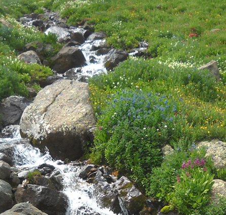
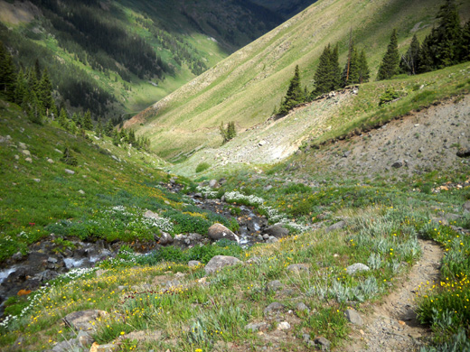
I enjoyed following the little creek up through the
gulch. It doesn't have a name on the Drake map but emanates from
the low basin where we turned around and the surrounding
drainage area.
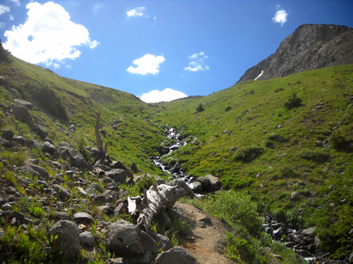
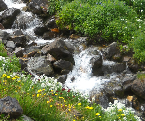
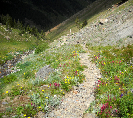
There were lots of pretty flowers along the stream, which
were a pleasant distraction when the trail got steeper in this
section:
Some parts of the trail have loose rocks to
slide on going downhill.
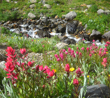
Colorful Indian paintbrush and those
ubiquitous dandelions
I was happy to have an excuse to stop periodically and take
pictures!
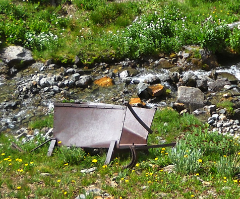
There are many reminders in the San Juan Mountains of the mines
that used to be so prevalent here. Since the Hardrock Hundred
is a tribute to the determination and strength of those original
"hardrockers," it's appropriate that the course takes runners
past many old mining relics such as this one:
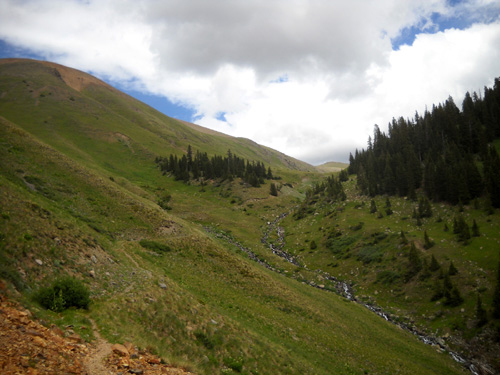
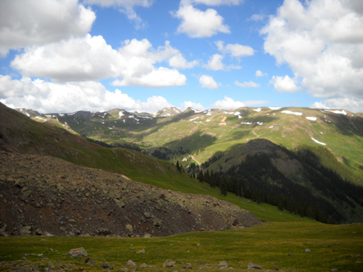
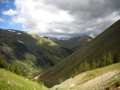
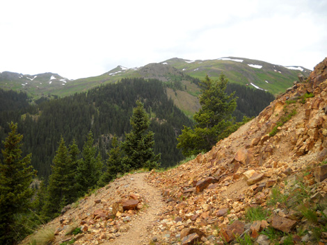
The next five photos are in and near a lower basin where we
turned around. From
here we could see American Basin, Handies Peak, and surrounding
mountain peaks but we didn't get high enough to see Sloan Lake.
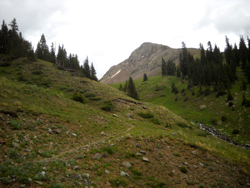
An orange HRH flag marks the course as it
approaches American Basin and Handies Peak,
in the distance. The elevation here is
12,029 feet; the summit of Handies is 14,048 feet.
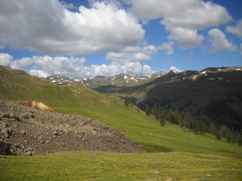
The view to the west from 12,000 feet
A little closer view of the basins to the
west
Looking more northwest
THIS TRAIL IN THE CCW DIRECTION
The remaining photos are going back down to Grouse Gulch. This
is the direction runners go in a CCW year during the race.
Most of these pictures are from Saturday morning. Both mornings
there were gray clouds building up to the northwest but we
didn't get rain where we were.
Cody looks a mile down the trail to the
road, far below. Dogs don't see very well,
but with his keen sense of smell he
probably knows that's where our truck is!
A hiker not associated with the race was
heading down to the road
near the aid station after summitting
Handies.
Almost back down to the road
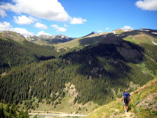
We had great views in every direction on this climb; they
gave me ideas for other hikes from this location in addition to American Basin and Handies Peak.
For example, we could see a jeep road winding up
through Picayne Gulch between the mountains to the west of us
(Eureka, Treasure, Hanson, and other peaks):
When I looked at the Drake map later I saw that it loops back
down through Placer Gulch to Animas Forks, where I could pick up
Engineer Pass Road and return to the aid station location.
There is a cabin on one of those slopes. That intrigues me, too.
Might have to check it out . . .
There are so many trails and jeep roads through the San Juans
that I can't possibly do them all in my lifetime. I like that.
Next entry: photos from the Hardrock awards brunch on
Sunday
Happy trails,
Sue
"Runtrails & Company" - Sue Norwood, Jim O'Neil,
and Cody the Ultra Lab
Previous
Next
© 2010 Sue Norwood and Jim O'Neil
