We really enjoyed a run/hike this morning through part of this
scenic natural area, originally established in 1994 after the acquisition of
almost 5,000 acres of land along Sonoita (so-no-eet' a) Creek, just downstream
from Patagonia Lake in southeastern Arizona. It has been enlarged by several thousand more acres since
then.
Both
Patagonia Lake State Park and Sonoita Creek State Natural Area (SCSNA)
are managed by Arizona's state park system. This
webpage has a good history of the
various land acquisitions and reasons for protecting this unique
environment, which lies in a transitional
zone between the Sonoran
Desert and the Chichuahuan Desert.
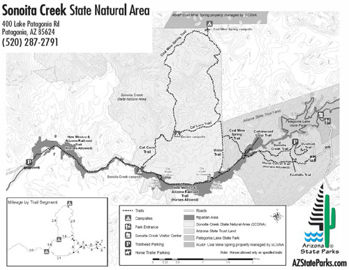
Click
here for a larger view (pdf. file) of
the Natural Area and its trails.
Patagonia Lake State Park is on the right.
Per a SCSNA brochure we picked up in the nearby Patagonia Lake SP
office, the visual and biological characteristics of the seven distinct
eco-systems within the natural area are markedly different and their
presence in a relatively small area is quite rare. I was able to
distinguish several of the different vegetative communities and have
included photos of them throughout this entry.
Sonoita Creek flows into Patagonia Lake from the northeast, over the dam at the
southeastern end of the lake, and through the SCSNA for several miles.
From there it dumps into the Santa Cruz River downstream. It is one of the few
perennial streams we saw in the area; most of the others were dry washes.
The primary management goals are to protect, maintain, and restore
the diverse native wildlife and riparian/upland habitats within the
Natural Area, to protect cultural and historical resources and
artifacts, and to provide opportunities for "appropriate" recreation,
environmental education, and scientific research.
Numerous species of mammals, reptiles, amphibians, and native and
migratory birds live in the Natural Area. Because of the unique biodiversity
the area is conserved as much as possible in its natural state.
That means lots of rules and regulations.
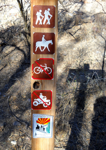
There are
strict rules about the number and types of visitors allowed in each day. Visitors
must sign up at the state park office and obtain a permit (price
included in park entry or camping fee).
Activities in the natural area are also strictly limited to those that are low-impact in
order to help preserve endangered species and native habitats.
Hikers/birders/runners may use all twenty-two miles of trails. Horses may use
only the Horse Corral Trail and the New Mexico & Arizona RR Trail,
which is built on a former
railroad bed. Dogs are allowed on leash (that surprised me a little bit). No bicycles or motorized
vehicles are allowed.
Hikers may camp in the back country (with a permit) but there are no
other camping
facilities or restrooms. Even horses are not allowed to remain overnight
in the natural area. You can camp, as we did, in the adjacent state park.
CHECK IT OUT!
Despite -- or maybe because of -- all the rules, we figured this would
be a great place to hike.
We were right. Not only was the terrain varied
and interesting, we had the place to ourselves on this beautiful weekday
morning.
Oh, there was plenty of wildlife . . . but no other humans we
could see. I loved the solitude and being able to enjoy all the sounds
of nature.
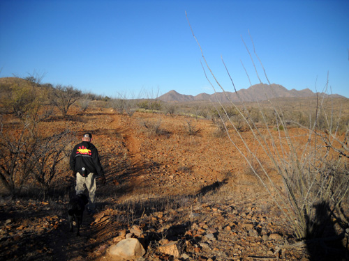
Jim, Cody, and I started this morning's hike in the Natural Area from
the trailhead parking area above the southern end of Patagonia Lake.
There is a gravel access road off the paved park road, with a corral part way
back for equestrians to begin their rides. They merge later with hikers
on the Sonoita Creek Trail.
We did not have time today to explore the entire trail system within the
Natural Area. We're pleased with the loops we chose and hope to run/hike
the rest of the trail system on a future visit.
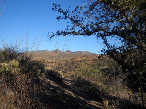
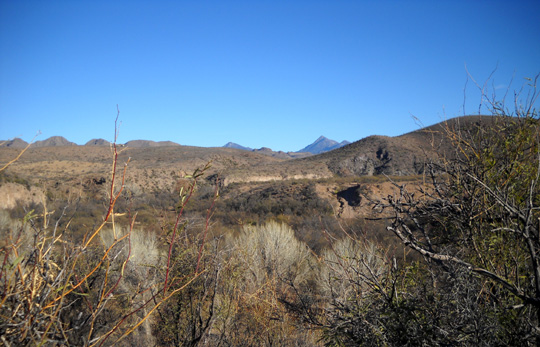
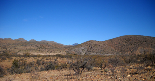
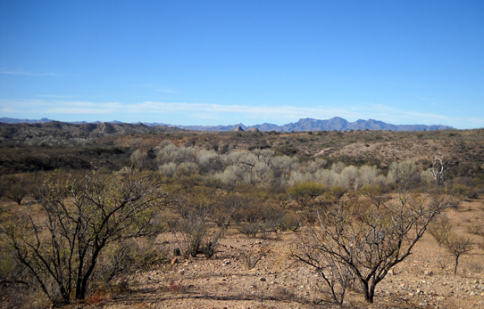
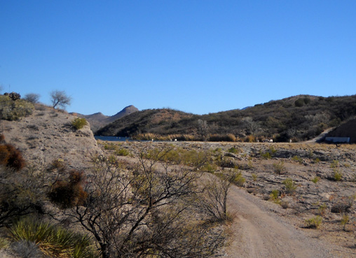
We started off together heading west on the Sonoita Creek
Trail through hilly desert terrain with views of the mountain peaks
surrounding us (below) and glimpses of the city of Nogales to our south.
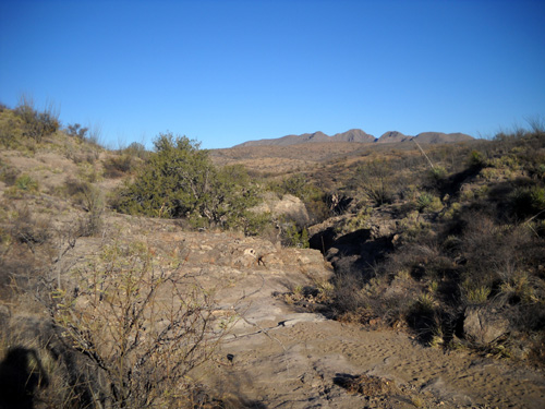
We took a short side trail to a vista point above the wide canyon cut by
Sonoita Creek through the ages. The canyon is in the middle of the next
picture:
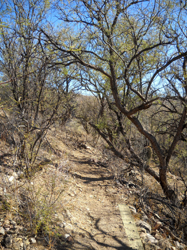
We passed through a totally different eco-system under cover of short,
twisted
trees and came to what appears to have been a concrete mill right on the
edge of a dry creek (wash):
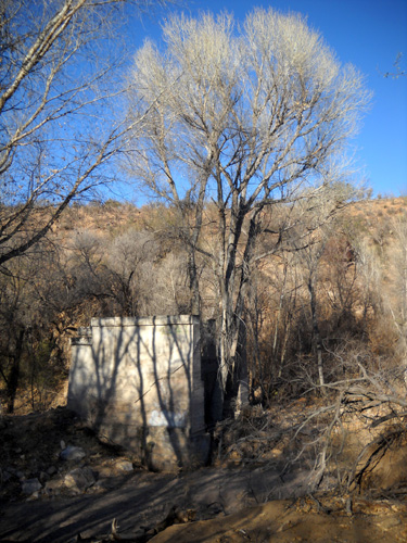
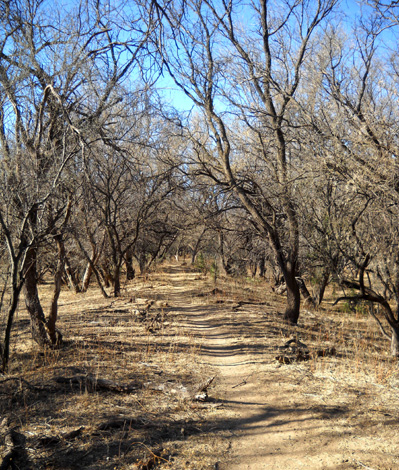
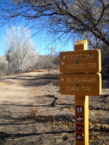
This is the location of the Cottonwood Loop trailheads and a large stand
of magnificent, tall cottonwood trees.
Jim went right
(NE) on Cottonwood and looped back in the clockwise direction to the truck on a new 2.75-mile
trail not shown on the maps in this entry, the Blackhawk Canyon Trail. I
just drew it in on the map below.
Jim did the loop on the right:
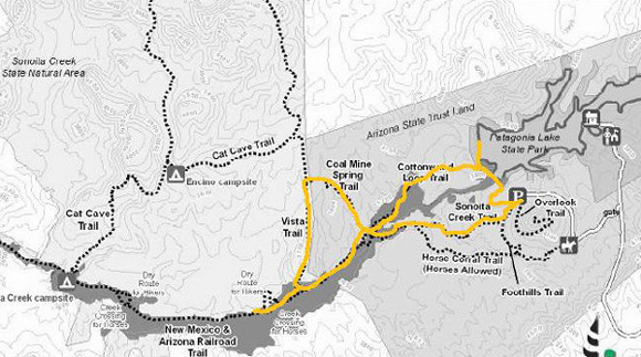
Cody and
I headed the other direction (SW) across the dry creek, across wet Sonoita Creek, up
the bank onto the old rail bed (NM & AZ Railroad Trail), and
right (N) onto several miles of trail reserved for foot
travel only (piles of horse poop indicate someone took horses into the
upland habitats anyway).
I hiked both loops in a figure-8, with several out-and-backs to
satisfy my curiosity.
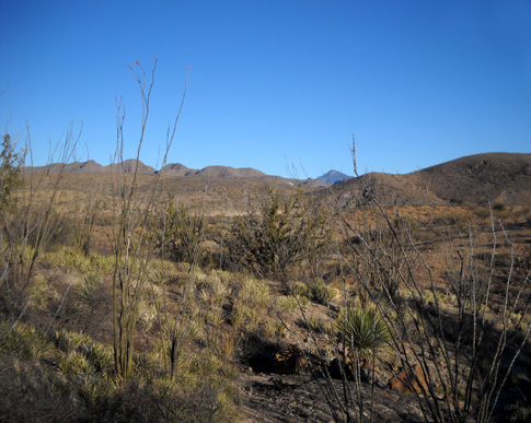
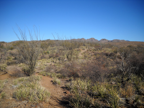
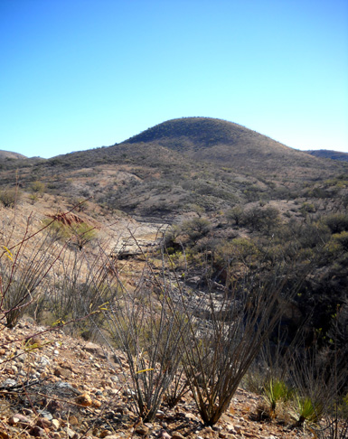
I traveled counterclockwise on the Coal Mine Spring, Vista, and rail bed
trails (left loop above) back to Cottonwood (center of the loops). It
was a steady climb from Sonoita Creek to the "top" of the loop where
Coal Mine Spring Trail intersects with the Vista Trail. The trail was
steep in places and undulated in others, but was mostly pretty smooth
as it climbed higher and higher:
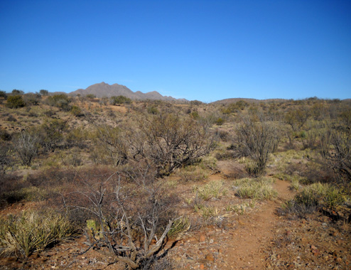
I could see some differences in the upland habitat, such as the
appearance of these green grassy plants as I ascended the ridges:
I turned left when I reached the Vista Trail and immediately wished I'd
gone the other direction on this loop. Although I had wonderful
panoramic views, the mountains behind me to the north (next photo) were
the most scenic and I had to keep stopping to turn around so I didn't
miss anything!
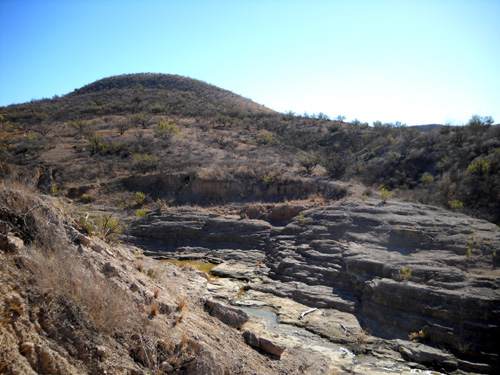
To the south I could clearly see down to the light gray cottonwood
tree branches/trunks in the canyon cut by Sonoita Creek:
The upper Vista Trail, before it begins a dramatic drop to the rail
trail and creek, is very runnable in either direction.
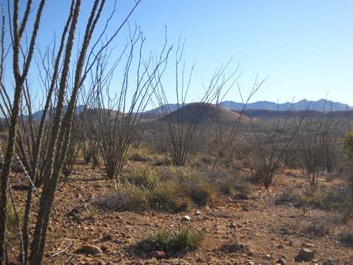
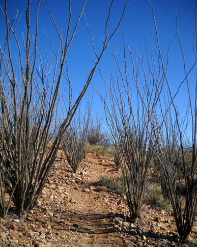
Then suddenly I came to a steep, rocky section of trail that
dropped down to the old rail bed. This view looks back up the
ridge through a stand of ocatilla cacti:
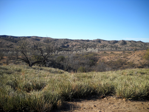
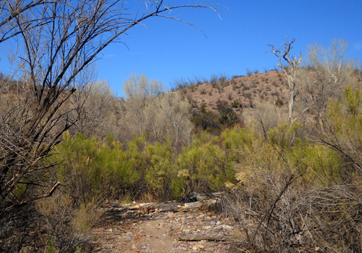
On the way downhill I entered another ecosystem of short trees
with pretty green fern-like leaves . . .
. . . and soon came out to a large wash where I "lost"
the trail for a couple minutes. All the other intersections and turns
were very well marked but I missed this one. After some false starts in
all directions I found the correct route, climbed out of the dry creek
bed, and
was back on the rail trail that equestrians share with hikers:
I turned right (west) on that trail for about half a mile before turning
around. The scenery didn't change much. The rail trail continues on for
over five miles from there. The part I saw was smooth and mostly flat,
excellent for running.
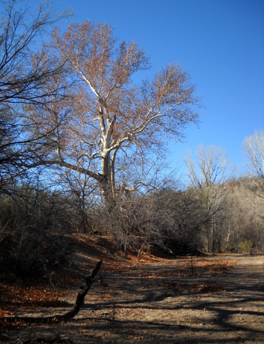
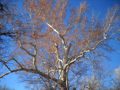
I did a 180 and followed the rail trail back east to the old mill and the
Cottonwood Loop where Jim had turned earlier. I absolutely loved all the huge cottonwood trees lining the
wet and dry creek banks in this area! Their trunks and branches glistened
almost white in the sunshine and their brown leaves were a beautiful contrast
to the deep blue sky:
The Cottonwood Loop winds through one of the seven distinct
habitats in the Natural Area. I walked around most of that loop before heading
back toward the new Blackhawk Canyon Trail.
Even though I was at about the same elevation at the beginning
of this trail, the plants became
more green as I ran and walked away from the creek and toward the next
ridge:

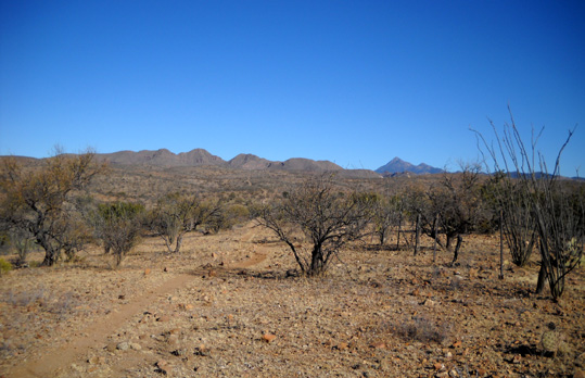
I enjoyed the views as I climbed higher and higher into more desert-y
terrain along the Blackhawk Canyon Trail:
Once again I could look south toward Nogales, near the
mountains in the photo below. I could also see the large stand of
lighter-colored cottonwood trees that I'd just enjoyed along Sonoita
Creek:
The Blackhawk Canyon Trail winds closer to the edge of the canyon than the
Sonoita Creek Trail on the other side:
The Blackhawk Canyon Trail ends at a gravel service road that runs between the
spillway (to the right) and the dam (toward the left) at the southeastern end of
Patagonia Lake.
Cody and I turned left and walked uphill for a few hundred yards to get
a closer view of the lake and dam.
The next photo looks northeast toward the lake and the state park:
Then we ran back down past the trailhead and continued
on the gravel service road toward the lower overflow (spillway) area:
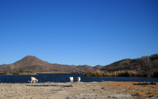
I was surprised to see about ten free-range cattle grazing on what little grass
is growing between the concrete spillway and the
lake! I don't know if they were the same herd we saw yesterday at the other end
of the lake or a different bunch. Obviously used to people, the bovines went about their business as Cody and I walked by
on the spillway:
I was almost as surprised a few minutes later when Jim picked me up to hear
that the cows weren't there 90 minutes earlier when he crossed the spillway.
They move around a lot in search of food.
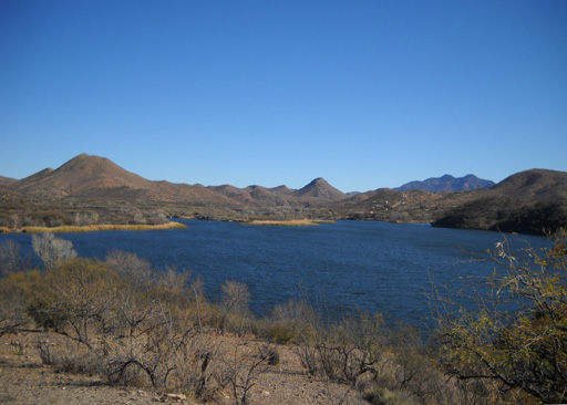
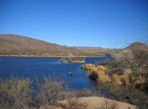
From the spillway it's a very steep hike uphill on the service road to the SCSNA parking
area. It was worth it for the views back down to the lake, however. How
beautiful! Two
anglers were trying their luck on the lake, which supports bass, bluegill,
catfish, and crappie. Trout is also stocked every three weeks from October
through March. Too bad we don't fish; fresh grilled trout is awesome!
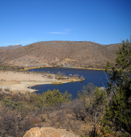
In the next photo you can see both the spillway (left of where the cows are grazing)
and the higher dam in the distance:
My double loop with several out-and-backs added up to only seven or eight miles
but it took me 2˝ hours of running (a
little) and walking (a lot) because I was distracted so many times by the
beautiful vistas, plants, and animals around me. What a great hike! It was my
favorite part of our weekend in the Patagonia area. I recommend you check it
out.
HEADING EAST
After getting cleaned up and eating lunch back at the camper, Jim and I resumed
our journey eastward this afternoon. We followed US 82 to the junction of US 90
north of Ft. Huachucha. Both roads are scenic and fast. I enjoyed the mountain
ranges on either side of four-lane US 90 as we drove north. I'd like to return
someday to visit Karchner Caverns State Park in the Whetstone Range and the
historic town of Tombstone to the east.
We hit I-10 in Benson, AZ and headed east. The only rest area that is still
open in Arizona is the scenic one near all the huge rocks at the Texas Canyon
Summit near mile marker 320. We didn't need to stop there this time. I'll talk
more about Arizona's serious fiscal problems and resultant park and rest area
closures in another entry.
We followed I-10 through southern New Mexico to the WalMart at exit 140 in Las
Cruces, where we will spend the night. The parking lot is very large;
we're sharing it with six or seven other RVs at our end and several more at the
other end.
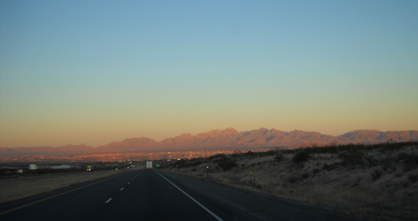
The setting sun colors the Organ Mountains as we
approach Las Cruces from the west.
We covered 299 miles today, which is fewer miles than usual when we're headed
from Point A to Point B -- much nicer than cranking out 500 miles or
more!
It was 65°F. and sunny when we left Patagonia
around noon. New Mexico is very chilly in comparison, even though it is about
the same elevation and not all that much farther north. It is supposed to dip
below freezing here tonight. Most of the country is in a deep freeze right now
and the arctic air mass is slowly heading south toward southern Texas, where
we're headed. I think our warm weather is about over!
Next entry: a brief stop at an unusual state park in Texas
Happy trails,
Sue
"Runtrails & Company" - Sue Norwood, Jim O'Neil,
and Cody the Ultra Lab
Previous
Next
© 2010 Sue Norwood and Jim O'Neil
