The Old Three Hundred . . . I've learned a bit of Texas history to
share with you! After reading the description above of McKinney Falls State
Park, I just had to do a quick internet search to see what "The Old Three
Hundred" was all about.
Briefly, the term refers to the original settlers who received land
grants for the first Anglo-American colony in the area, which was under Mexican
control in the early 1820s. Stephen Fuller Austin, for whom the city of Austin
was later named, hand-picked individuals and families from the South, mostly
Louisiana, to farm or
raise livestock on large plots of land in central Texas that had
never been claimed by either Spain or Mexico. A total of 297 titles were
granted under the original contract -- almost 300.
Because of the large interest in the project and the limited number of titles
available, Austin could be very selective in his choice of immigrants. He
wanted homesteaders who he thought would be industrious and stable. As a result,
almost all of the settlers were literate and belonged to a higher
socio-economic class than the majority of the folks who were willing to colonize
western lands in the early 19th century.
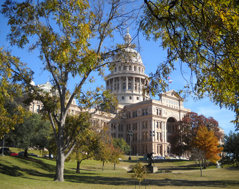
State(ly) capitol building in Austin
Apparently the project was successful. When Texas gained
statehood a few years later, the city of Austin became the state capital --
twice, in fact. Sam Houston wasn't too fond of having the capital in Austin and
he moved it to (you guessed it) Houston. He was finally overruled in 1850 and Austin has been the state capital ever
since.
HISTORY ROCKS!
History was never one of my favorite subjects when I was in school.
Oh, most of it was interesting but there were so many facts to remember! I
memorized them well enough to ace all my history courses through the end of
high school, but promptly forgot most of the dates and people and places when I
went off to college and grad school; I didn't need any history courses
for the degrees I earned and I just didn't see how history was relevant to the
career I pursued.
Funny thing, though: when I began traveling in my early twenties, one
of the most fascinating things to me was learning the history of the areas I
was visiting! It was a whole lot different when I was in the actual place where
something interesting happened.
Obviously, "history" is about much more than who, what, where, when, and
why. It was the who-what-where-when that I wasn't so interested in; I've
always remembered the main concepts, the "why's" of significant events. And for
the last forty years, even the who-what-where-when has appealed to me when I'm
visiting an area for the first time and it has a rich history.
So it is with our trip to Austin. I'm as interested in absorbing knowledge
of local culture and history as I am in exploring the trails, parks, and
streets, photographing the wide range of architecture, learning about the
transitional eco-zone between prairie and desert, visiting museums and prominent buildings, checking out
stores and restaurants unique to the area, and other touristy pursuits.
History rocks!
DISCOVERING McKINNEY FALLS STATE PARK
When we chose to make reservations at this park several months
ago we did it primarily because of its proximity to a race we
thought we might run. The description in the state parks guide
and on the internet was a close second: "bucolic
retreat," "miles of woodland trails," "popular with hikers,
cyclists, and campers," "serene beauty," "abundant wildlife."
Ahhh . . .
It was those features that made us decide to stay at McKinney SP
for over a week on our way to Phoenix even after deciding not to
run the race. It was a good choice, although the recent wet,
chilly weather has been
less than conducive to exploring the entire park (or the city of
Austin, for that matter). Afternoon temperatures have been 15-20°F.
colder than the normal 65°F. average for this time of year, with
a couple nights in the upper 20s. Brrr! (I don't expect any
sympathy from most of our readers, who are experiencing much
worse early winter weather than this.)
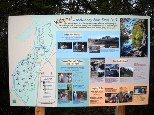
In addition to reading about the park on the internet before our
arrival, another good way for us to learn about the history of McKinney Falls' 744
acres was to browse the interpretive displays at Smith Visitor
Center. We did that soon after settling into our campsite.
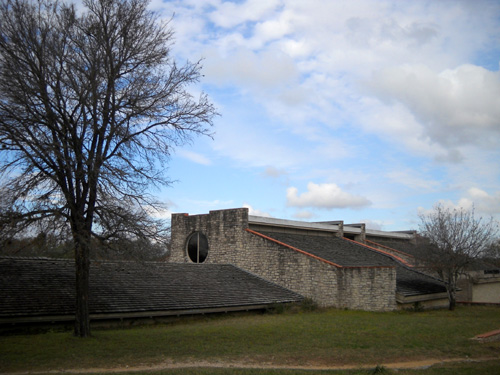
Front of the Smith Visitor Center, an
earth-sheltered structure
Both
the entrance office and the visitor center also have lots of
brochures and pamphlets with trail maps, information about the
flora and fauna in the park, interpretive programs led by the
rangers, and the cultural and geographic history
of the area. In addition, there are signs placed around the park
that describe its special features.
McKINNEY ROCKS
Rocks play a major role at McKinney Falls. Fortunately, most of
them are not on the trails, waiting to trip me up. The
trails we've seen here are quite tame.
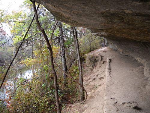
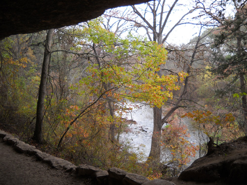
One of the unique features of the park is its rock shelters,
small to very large covered areas carved out of soft limestone cliffs
thousands of years ago by what is now Onion Creek, which winds
through
the park. Hikers can walk right through the largest of these shelters,
named the Smith Rock Shelter, on a trail about twenty feet above the creek:
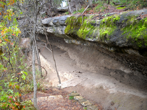
According to a display at the park, archeologists have determined that small groups of hunting and
gathering peoples lived here from 500 A.D. to the late 1700s.
Other sources say nomadic groups may have occupied the area for
over 5,000 years. The last known occupants were closely related to the
Tonkawa
tribe. Here's a second
link to that group.
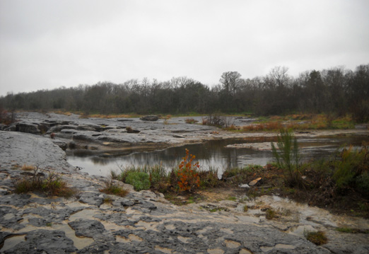
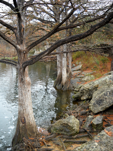
McKinney Falls is a popular place for the sport of bouldering.
Millions of years ago sediments from an ancient sea that covered
much of Texas solidified into limestone bedrock. Later, an
extinct volcano spewed softer debris over the bedrock. The
volcanic material and limestone have eroded over the eons to
form the two major falls in the park and other interesting rock
features along Onion Creek and the trails.
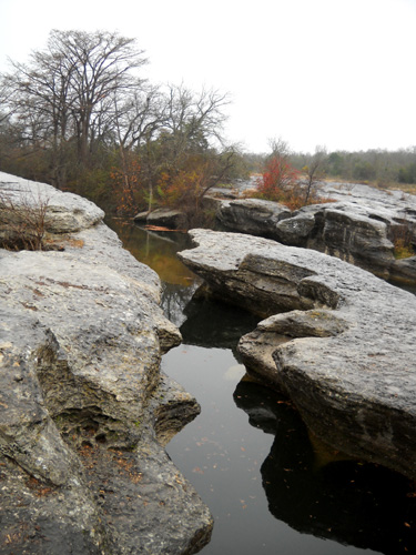
Above and below: eroded rocks along Onion
Creek a few hundred feet above the Lower Falls
Eroded rock along the Onion Creek loop
trail
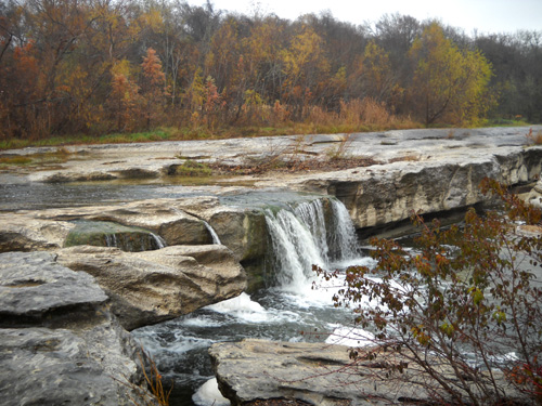
UPPER FALLS
The two main falls are the highlight of the park. Even though it
has been raining in the area quite a bit this month we haven't
seen the falls as high as the photo in the state parks book.
They are pretty cool nonetheless. You can see how water has
eroded the volcanic rock and limestone into some interesting
patterns.
Here are some photos of the Upper Falls, located near the
visitor center:
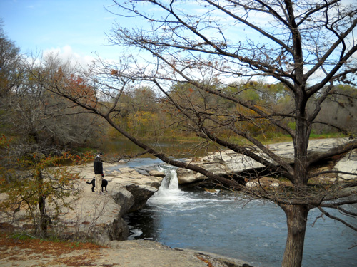
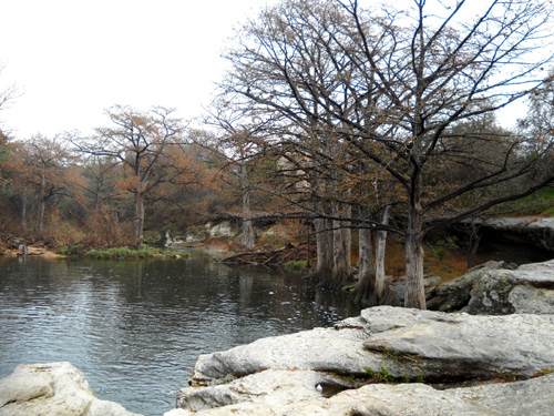
Bald cypress trees line the banks of the
pool below the Upper Falls.
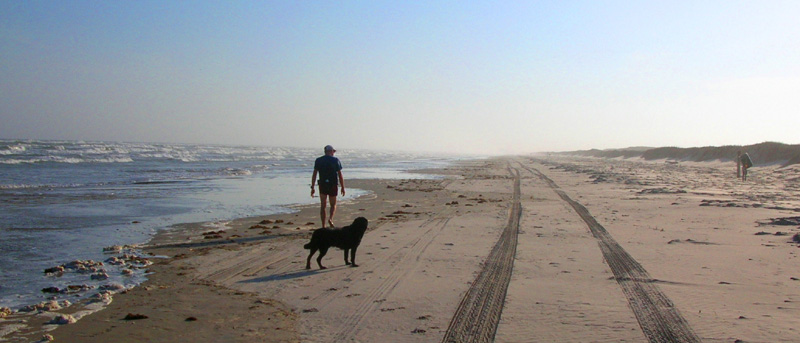
Today Cody and I were out for a run/walk on the Onion Creek Loop
Trail.
I was about thirty feet off to the side of the trail in the picnic area looking for photo ops
along the shore a short distance above the Upper Falls when I
stumbled upon two
plates full of whole apples, whole peeled hard-cooked eggs,
whole roses, and separated rose petals:
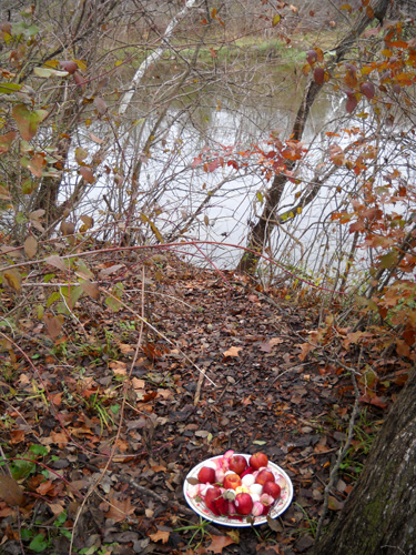
The other plate was behind a tree a couple feet to my right and
I didn't get a picture of it. Although I hadn't seen anyone
near, I was so surprised that I felt like someone must be
watching (remember the old TV show "Candid Camera?"). I was as discreet
(stealthy?) as possible.
My first thought was that someone left the apples and eggs for the deer
or other wildlife. But why would they leave it on two nice
dinner plates? And why roses?
Then I realized there was a small, burning candle in the center
of each plate. They'd obviously been lit only a few minutes
earlier. I looked around again, feeling like I was trespassing
on a sacred site and wondering if the person who left the plates
was watching.
I still didn't see anyone. This was apparently an offering or memorial of some sort.
I took one quick photo and turned back to the trail.
Cody and I hiked up the hill to the
visitor center to see if one of the rangers knew what I'd found.
The door was locked in the middle of the afternoon. Rats.
I'm still wondering. I'll have to ask another day. One guess is
that two people drowned nearby.
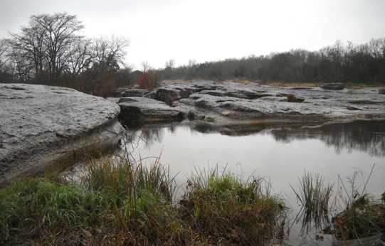
The rocks and pools of water above and below both falls are
popular recreational spots during warm weather.
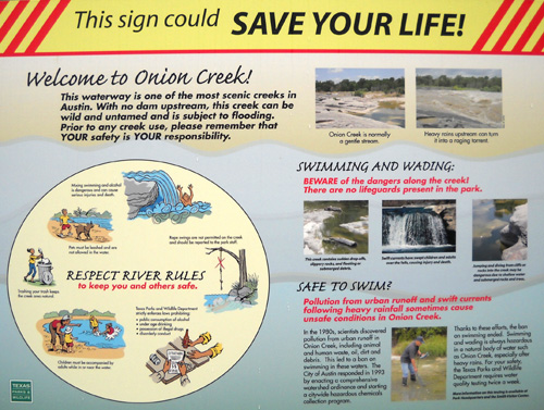
There are big warning signs (above) that wading
or swimming in Onion Creek can be quite treacherous because of
slick and hidden rocks, sudden drop-offs, floating debris, swift
currents, flooding, pollution, and other hazards. Several people
have died when they've been swept over the falls.
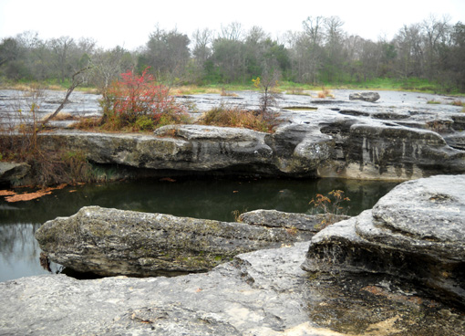
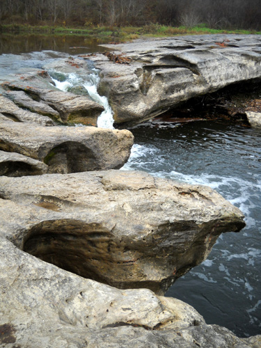
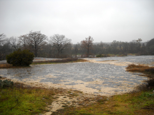
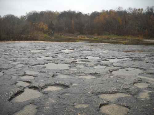
LOWER FALLS
The first time we explored the area near the lower falls we were
surprised to find a large area of exposed bedrock that is pock-marked with holes
full of rain water:
Visitors cross this large bedrock area to reach the falls but
Jim and I didn't realize that the first time we were nearby. We
were hunting for the Homestead Trail loop that day and went to
the right of the rocks, following a dirt road. When it
dead-ended and we couldn't find any other trail across the
creek, we came back, found the falls, and realized that we'd
have to cross the wide creek at or above the falls to reach the
trails on the other side.
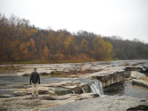
The creek crossing doesn't look that
difficult in these photos but the rocks are very slick
and the current was strong when we were
there. Crossing would be more fun on a hot summer day!
More interesting erosion; beyond the falls
is another pool of water popular for swimming.
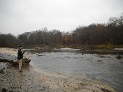
Jim considers crossing farther above the
falls. Our decision: maybe next time we are here.
A pool of deeper water a short distance
upstream from the falls
WHO IS McKINNEY, THE PARK'S NAMESAKE?
Thomas McKinney was one of Stephen Austin's "Old
Three Hundred" homesteaders that I talked about at the beginning
of this entry. During the 1820s McKinney purchased a nine-league land
grant -- almost 40,000
acres -- at 10% of what comparable acreage sold for
in the United States (remember, Texas was under Mexican control
then). Ten percent was only 12˝˘
per acre! Imagine that.
McKinney was a prominent businessman who became a Texas revolutionary figure.
He also
helped to found the city of Galveston. He sold most of his land
before settling on the property which is now McKinney Falls
State Park in 1839. There he established the area's first flour
mill and raised thoroughbred horses.
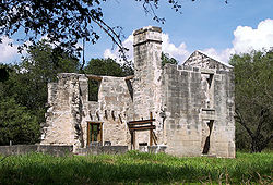
Remnants of his grist mill and the large stone
house McKinney built with slave labor in the 1850s sit near
the Lower Falls on Onion Creek -- the other side
of the creek from the photos above. The grist mill was destroyed in
a flood in 1869, the house by fire in the 1940s. This is a
picture of what's left of the
house:
Unfortunately, Jim and I haven't been across the creek yet to
see the house or gristmill -- or lots of miles of
single-track trail in the northern half of the park. Why?
Because the only way park visitors can get there is to ford the
creek. Park staff can use service roads out of the nearby state
park headquarters property, but visitors aren't allowed to cut
through that property.
Now we have no qualms about fording most creeks, but this one is
running high, wide, and very slick after all the rain Austin has
had since our arrival last week. If it recedes enough before we
leave on Friday, one or both of us may venture over there.
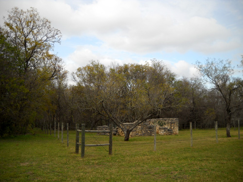
It's a lot easier for visitors to see the remnants of a two-room
cabin (below) occupied by McKinney's horse trainer, John Van Hagen --
the main park road passes in front of it.
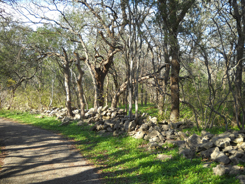
Nearby were breeding and exercise pastures enclosed with stone
fences. You can still see many of the stacked stone fences throughout
the southern half of the park from the trails and roadways:
McKinney and his wife Anna had no heirs. In 1885 they sold the
property to James W. Smith. I don't have any information about
how the Smiths used the land or where they built their house.
However, in 1971 Smith's grandson Pete donated 682 acres of the
property to the state for what is now McKinney Falls State Park.
The park opened five years later. The visitors' center and large
rock shelter are named after the Smith family.
Seems to me the park and falls should be named after the Smiths
for their generous donation, and the visitors' center and rock
shelter after the McKinneys!
CAMPING AT McKINNEY FALLS
As mentioned in the
last entry, we really like this
campground. There are 85 spacious campsites in two separate but
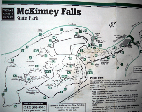
nearby loops. You can see them in this diagram of the southern
half of the park (they are the loops in the lower left
quadrant with all the little numbers around them):
We much prefer public parks over private ones because they have
larger sites and are usually more natural. They are also usually
cheaper because they don't have all the amenities many private
RV campgrounds have, amenities we probably won't use.
Public parks and lands can have their disadvantages, though:
too often we have problems finding suitable sites for our
medium-sized rig, a 32-foot 5th wheel. The roadways may be too
narrow, have tight turns, or low branches. The sites may be too
short for our camper + truck, or too narrow for slide-outs. Even
at one of our favorite state parks, Huntsville (TX), there are
only a few sites we can use. Every time we make reservations
there, we know we run the risk of not being able to find a
suitable site.
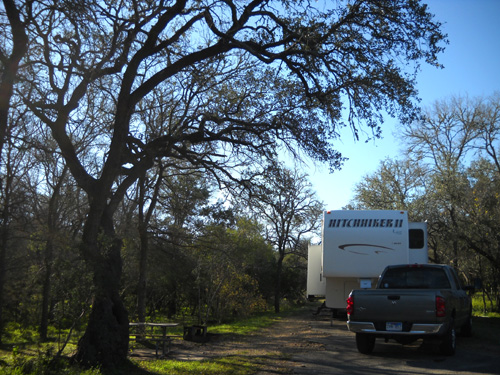
But at McKinney we can fit into 75-80% of the sites. So can
Class A motorhomes and 5th wheels or trailers that are longer
than ours. Most of the sites are back-ins; about a
quarter are pull-thrus. We chose a back-in site this week so
we'd be farther off the road.
The sites at McKinney are spacious in another way that is
important to us, too -- there is plenty of room
between most of the sites. With an occupancy rate of only
about 20% the day we arrived, we had many good choices of sites.
The one we picked is on a little loop at the end of a large
loop. Not only is there a lot of woods between us and everybody
else on that little loop, hardly anyone drives by because it's
not on the main loop. (Can you tell that we like our privacy??)
All of the sites have water and electrical hookups. Each loop
has two clean bathrooms with showers. Only the campground hosts
have sewers (that's common in public campgrounds);
everyone else can use the dump statioon on their way in and/or
out of the park. Since we're here for just a little over a week,
we've been using our own toilet and shower. We dumped our gray
and black water tanks when we came in and we'll dump them when
we leave. If we were here for the maximum of two weeks (longer
if the park isn't full) we'd have to either use the restrooms
part of the time or move the camper a mile to the dump after
10-12 days. Some people use "blue boys" (plastic tanks on
wheels) to carry their waste water from their RV to a dump
station, but we've never gotten one of those.
Like many Texas State Park campgrounds, the sites at McKinney
are only $16 per night. There is no reduced weekly fee here like
there is at Huntsville in the winter (seven nights for the price
of six). However, our state parks pass covers the $5/day per
person cost of entry into the park.
Next entry: running and hiking the trails at McKinney
Happy trails,
Sue
"Runtrails & Company" - Sue Norwood, Jim O'Neil,
and Cody the Ultra Lab
Previous
Next
© 2009 Sue Norwood and Jim O'Neil