Yesterday I had a hike with a little bit of running that made me
very happy.
It exceeded my expectations. The terrain was hillier and rougher
than I expected (or really should be doing with bad knees) but the trails were
new to me -- I love to explore new trails -- and the
scenery was much more interesting than I thought it would be.
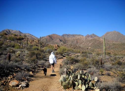
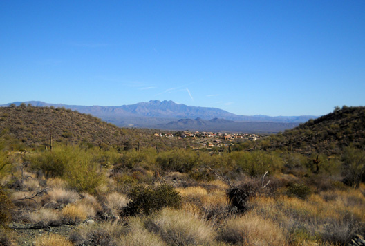
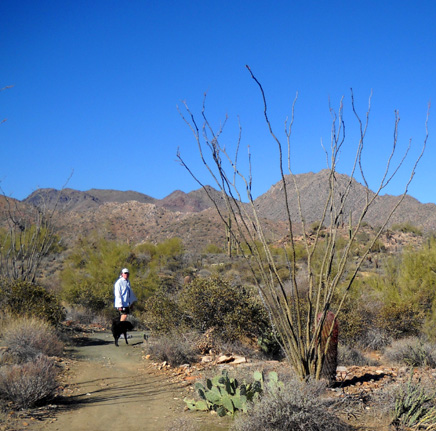
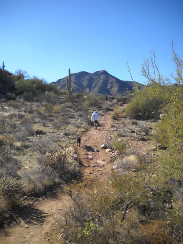
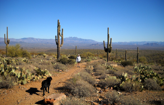
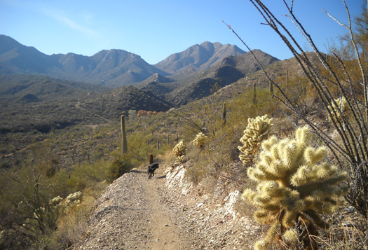
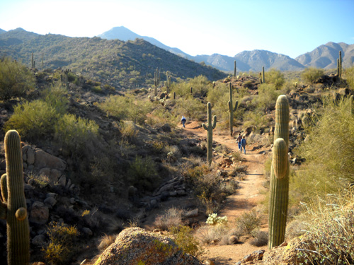
Jim and Cody on the Dixie Mine Trail, heading
toward the McDowell Mountains
It was a
splendid way to share a late December afternoon with Jim, Cody, and dozens of
other people -- and their dogs -- who wanted to enjoy the warm Phoenix-area sunshine. I was surprised so many folks were out walking, running, and
cycling on the trails.
It was Christmas Day, after all. Obviously, not everyone was at
Grandma's house!
LET'S GO CHECK OUT DIXIE MINE
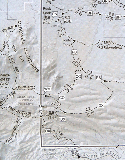
Below is the
close-up of the southwestern corner of McDowell Mountain
Park again. It shows several trails that have been built in the last year or
two inside the park (right side of map) and in the adjacent
McDowell Sonoran Preserve
(left side).
The city of Scottsdale, which has already preserved half of its proposed
36,000+ acres of open space, intends to eventually have a network
of 150 miles of trails in that area. Or so I
read
in the 2010 Arizona/New Mexico Travel & Recreation Directory
we picked up somewhere (p. 30). You can see a .pdf
map of existing trails on the
Scottsdale city
site for the preserve.
One hundred fifty miles!!! If I lived in the area I'd be
drooling about the possibilities!
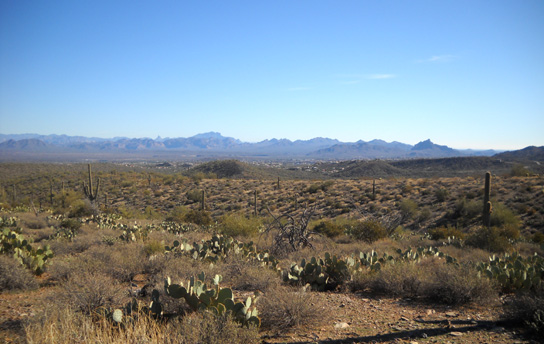
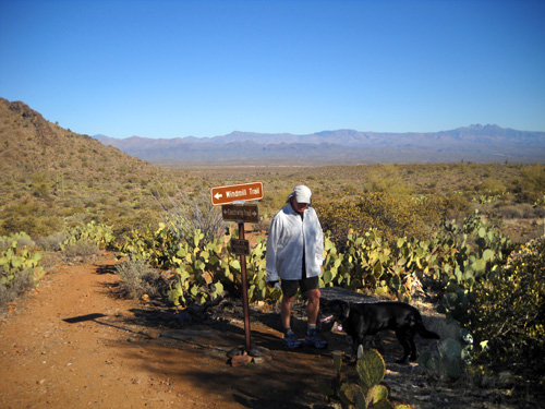
View west on Windmill Trail to the McDowell Sonoran Preserve
Meanwhile, back in McDowell Mountain Regional Park . . . Jim has ventured further into this corner of
park than I have. In
January he ran out-and-back from the Pemberton loop (PB on the map) on the Dixie Mine Trail
(DX) but he didn't see the mine from that direction. See the symbol for
the mine on the park boundary above? He also couldn't remember if
the trail was smooth or rocky.
I've never been on the Dixie Mine Trail or any of the other new trails in
that area. I wanted to explore some of them but just getting to and from that
area of the park on the Pemberton Trail from our campground is over an
eight-mile run or walk.
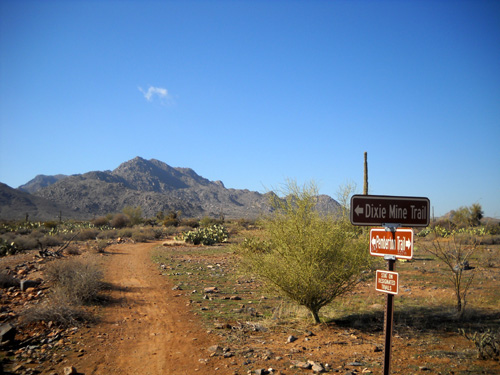
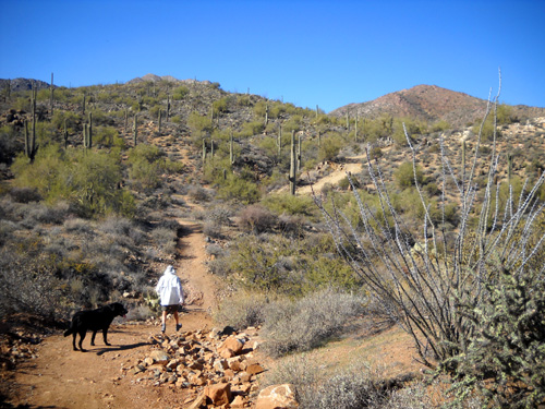
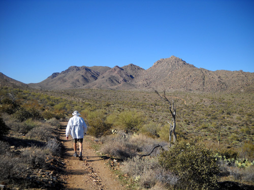
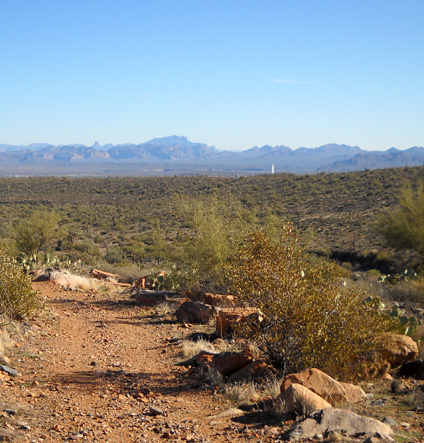
Intersection of Dixie Mine Trail with
Pemberton Trail; McDowell Mountains in background
Since my mileage isn't very high now, I knew I wouldn't be able to hike much
on the new trails by approaching them from that direction.
The most practical way for me to reach that corner of the park is from the
city of Fountain Hills, which adjoins the park to the south. See Golden Eagle
Blvd. on the map above? There is a paved 6/10ths-mile access path to the Dixie
Mine Trail from that direction. That's one reason so many people were using the
trails on Christmas Day: the easy access from town.
Fountain Hills is named for its rolling hills and a mesmerizing fountain
that is reportedly the world's tallest. I love to see it from various spots in
McDowell Mountain Park (such as the next-to-last photo in the
last entry), as well as close-up in the center of a pretty lake and
park in town. It is turned on at the top of each hour for about fifteen minutes
and is lit after dark. It's a magnet for both residents and visitors.
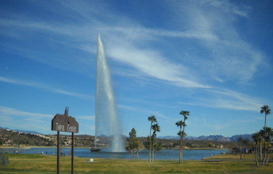
Fountain Hills' namesake fountain,
which is visible for many miles
Fountain Hills is one of those classy communities that probably has all kinds of
building restrictions to maintain its distinctive look and property values. Even the municipal
buildings and stores are quite attractive. I don't know where all the money
came from to build so many nice houses. We haven't seen as many for-sale signs
in Fountain Hills as in Mesa, Scottsdale, Paradise Valley, and other Phoenix suburbs.
I'd guess it's more stable than the general metro area, which has taken a major
hit during the recession. That makes sense;
wealthier folks tend to have more immunity to economic downturns than folks who
are in lower income brackets.
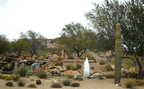
A little teaser fountain at one entrance to the city (Shea
Blvd.)
I thought I'd seen some beautiful homes driving along Palisades, Fountain
Hills, and Saguaro Boulevards through Fountain Hills. The drive to and along
Golden Eagle Blvd. to get to the Dixie Mine trailhead is even more
glamorous, reminding me of some areas in southern California. I'd like to admire the houses and yards by foot or bike someday so I
could see more architectural/landscape details. I got these shots from our
moving truck (and the two photos above, for that matter):
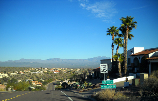
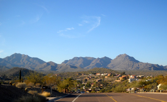
Looking east from Golden Eagle Blvd.
toward the Four Peaks (above)
and west toward the McDowell Range
(below)
About twenty parking spaces for the Dixie Mine access trail are available just before
you reach a gated community called Eagles Nest. There were a few spaces open when we arrived but it was full
by early afternoon. Water fountains and nicer-than-average public restrooms are available.
We walked into the gated community along a perfectly-landscaped
sidewalk and side street for 6/10ths of a mile to the Dixie Mine
trailhead. Fancy stone signs and eagles' feather designs in the
pavement show visitors the way so they don't stray into the
neighborhood.
It was quite a contrast to the rough-and-tumble Dixie Mine Trail!
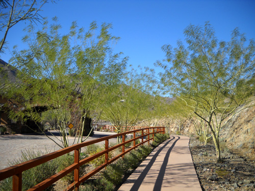
Entrance gate to Eagles Nest on left,
above; trail access is on the sidewalk.
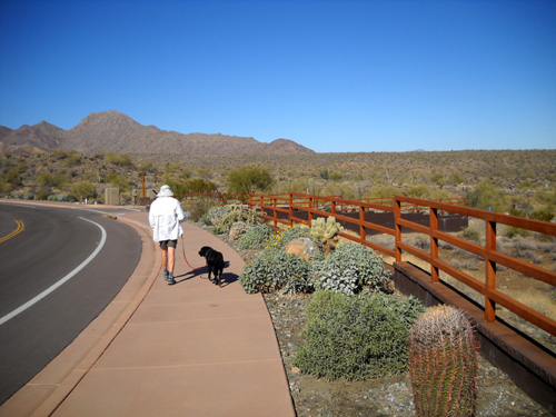
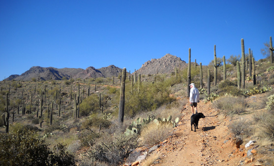
There's a nice view of Fountain Hills and the Four Peaks from
about where Jim and Cody are walking:
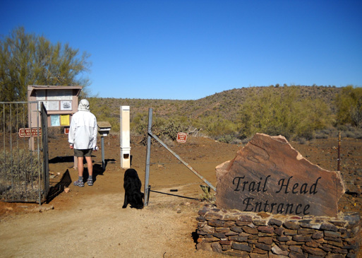
Visitors are supposed to fill out a form and pay $2 to enter
McDowell Mountain Park at this trailhead (it's $6 at the main park gate). We didn't have to pay
since the park entrance fee is included in our camping fee.
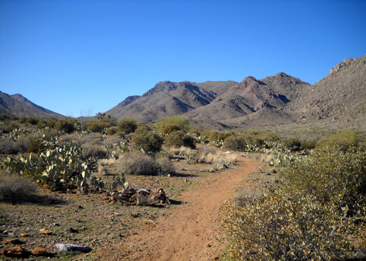
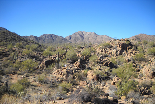
INTERESTING TERRAIN
The McDowell Mountains look much different up close in their
foothills than from the interior of the park. Even at mid-day,
the low winter sun colors the rocks a reddish color from this
approach; they're just shades of gray in my photos from
other perspectives.
This corner of the park was untouched by the large fire several
years ago that affected the interior. It's relatively lush and
colorful in some places:
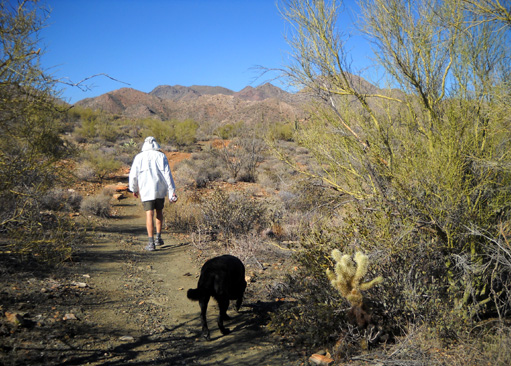
Can you see in the photo above how the trail in the foreground
is sort of green, while it's a rust color ahead of Jim? I
noticed that in several places.
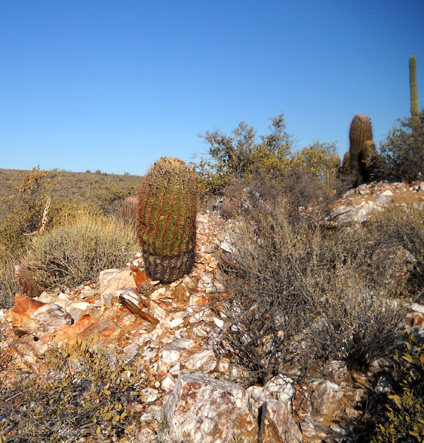
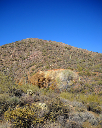
There are many small white, pink, and orange quartzite rocks
along the trails in the park but this is the only area where
I've seen large, colorful outcroppings like the one below:
Since I wasn't
trying to go fast, I really enjoyed all the twists and turns,
ups and downs, and a different perspective of Fountain Hills and
the mountains surrounding the park.
We came to Dixie Mine in 2˝ miles
but didn't take the side trail up to it. It sits right on the
park boundary with the preserve. We've seen lots of
very cool abandoned mines in the Silverton and Leadville, CO areas and
this one didn't look nearly as interesting, at least from the
trail below it.
After the mine we turned right,
continuing to follow Dixie Mine Trail up a long ridge. A little less than a mile later, on
the descent (below),
we turned left on the Coachwhip Trail (labeled CO
on the map)
and headed back toward the park boundary:
We climbed another ridge (below)
to the intersection with the
Windmill Trail (WM). There is a bench here and expansive views
in all directions. With our
various stops to take photos and give Cody water, it took us
almost 90 minutes to hike 4Ľ miles.
Jim and Cody relax by a bench in the shade
at the intersection of Coachwhip and Windmill.
We missed seeing the
fountain in Fountain Hills at close range on the Gold Mine Trail
both outbound and on the return because of
our timing and the hills between it and us, but we could see it from this
ridgeline:
From that point Jim continued on alone to our camper for another
6.77 miles on a new section of Coachwhip (CO), then Pemberton (PB),
Bluff (BF), and two connector trails to the north
campground. He ran most of that section, for a total of 11
miles.
Cody and I turned around at the Windmill Trail intersection and
returned the way we'd come.
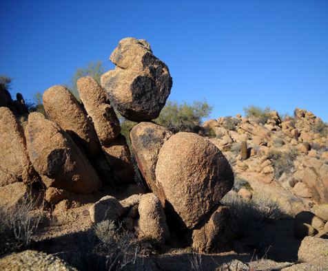
I ran some of the smoother uphills
on the way back but spent about ten minutes climbing up into some
boulders I'd admired on the way out:
Despite some running, it took me the same amount of time to get
back to the truck (almost three hours to go 8˝
miles). I saw a lot more cyclists and hikers on the way back than
we saw outbound. Jim "ran into" quite a few bikes when he was
running by himself, too.
I thoroughly enjoyed hiking these trails and look forward to
exploring more of them in the future. They are a real treasure for locals,
who have quite a variety of desert and mountain trails from which to choose
in the metro Phoenix area. And this is just the northeast side
of the valley!
Next entry: our final days at McDowell Mountain
Regional Park
Happy trails,
Sue
"Runtrails & Company" - Sue Norwood, Jim O'Neil,
and Cody the Ultra Lab
Previous
Next
© 2009 Sue Norwood and Jim O'Neil