(NOTE: this entry is heavy on photos. If you have a slow
connection, just start reading the text as the pictures load.)This year is the eleventh annual edition of the Bear 100 run, described
on the website as "a cool autumn loop through the pines, golden aspen and red maples
of the Wasatch/Bear River Range."
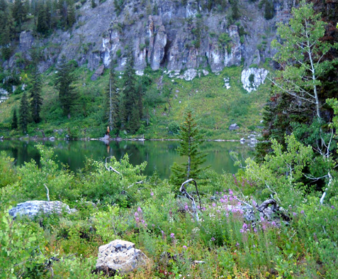
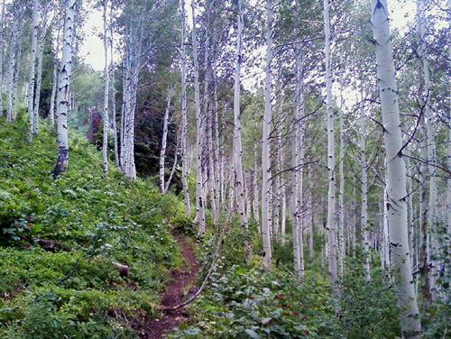
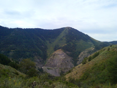
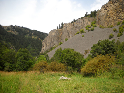
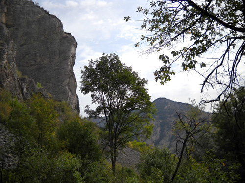
Although the course is no longer a loop, we can vouch that the fall colors are magnificent in this area in late
September. The next three photos in this entry are ones I took from the course in 2003.
OUR HISTORY WITH THE BEAR
I can't believe how fast time has flown since the race began in 1999.
Jim and I missed the inaugural year of the Bear because I was running Arkansas
Traveler 100 the next week (my first 100-mile finish). But as close as we lived
to the course at the time -- Billings, Montana -- and as nice as
it sounded the first year, we both registered for the race in 2000. We ran
together and ended up quitting at mile 50. You can read Jim's report
here.
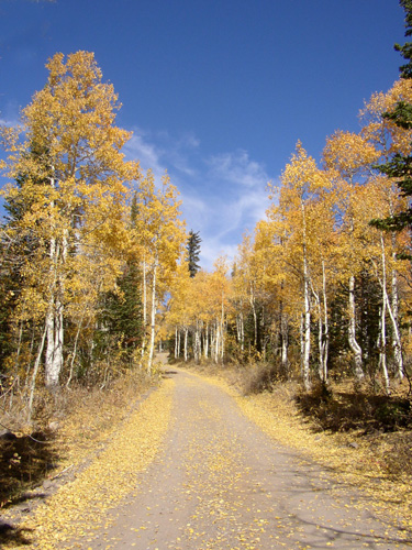
Glowing aspens along one of the crewing roads to an aid
station
in the previous course (September, 2003)
The next year Jim got his course revenge. I had gotten injured at
Western States in June and decided to crew for Jim instead of running it again.
It was fun pacing him the final ten miles as he ran to his first Bear finish.
Once again, he send an interesting report about the race to the ultra list,
which you can read at this
link.
We were busy running other races in 2002. In 2003, Jim signed up for the
Bear again but managed "only" 50 miles again. I don't think he wrote a report
about the race that year.
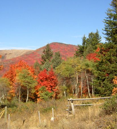
Flaming maples along the 2003 Bear course
Four months later we sold our house in Montana and moved across the country
to Virginia. Now it was a lot longer trip to get to the Bear! Despite long RV
trips to the Rockies in 2006 and 2007 the Bear didn't figure into Jim's race
schedule again until this year. It was his birthday present to himself at the
beginning of August, when he decided to send in his entry once more.
RD Leland Barker finally got permission from the relevant governmental
entities in 2008 to change the course from its original loop configuration to
his dream point-to-point format from Logan, UT to Fish Haven, ID. Almost all of
the course is in Utah now; all or most of it was in far southeastern
Idaho the first nine years.
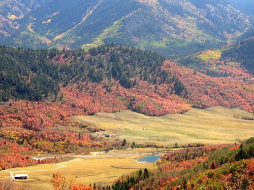
More fall color during the 2003 Bear
Although the average elevation is a little lower now (7,350 feet now
vs. 7,742 feet before), the total climb has increased from 17,007 feet to
21,986 feet. The low point is 4,860 feet at the start of the race on a terraced
hill in eastern Logan. The high point of 9,060 feet is close to the end of the race before
plunging downhill to the finish at Bear Lake. As a result, the time limit for
the race has been extended from 35 to 36 hours.
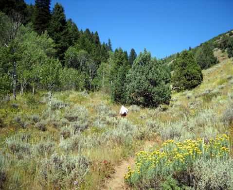
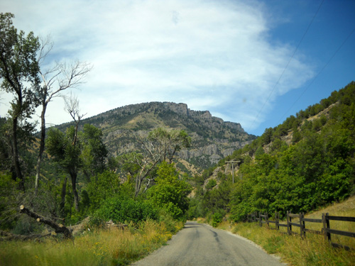
PREVIEWING THE COURSE: BLIND HOLLOW TO TONY GROVE LAKE
At some point in the last few weeks we decided to spend this week in the
Logan Canyon area to familiarize ourselves with the new
course and locations of
the aid stations, since I'll be crewing once again. If I can find
transportation from the finish to one of the aid stations in the last 20-30
miles of the course, I might pace Jim at the end.
We've made good headway the past six days. The weather has been good (warmer
than we're used to, but dry) so we've gotten out every day to run and walk on
the course or on trails close to our campground. Jim has seen the first twenty
miles of the Bear course from Logan to Leatham Hollow (point to point) and
about nine miles from Temple Fork to beyond Tony Grove Lake, for a total of 29
miles in the same direction the course goes. (He ran out and back twice in the
Blind Hollow and Bear Hollow section between Temple Fork and Tony Grove, six
miles total the first time and eighteen the second).
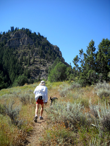
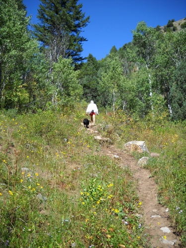
Above and below: Jim and Cody head up
the Blind Hollow Trail
past the Hwy. 89 & Temple Fork Road aid
station location.
When Jim was doing those three runs on the course, I did shorter
out-and-backs on the same trails and took most of the pictures shown here. I'll
identify the photos Jim took with his cell phone yesterday when he ran the
first twenty-mile section of the course.
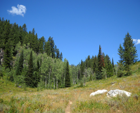
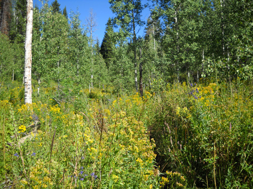
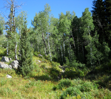
From what we've seen of the course so far, there is a nice variety of
pine forests, aspen groves, and meadows that are still full of flowers at the
end of August.
I don't know how many flowers will still be blooming a month
from now (the race is September 25-6). The leaves on the aspens, maples, and
other hardwood trees will be beautiful yellows, golds, oranges, and reds
by then -- but they might be covered in snow!
It's happened before. Jim hopes this won't be a snow year for the race.
MY LUCKY DAY
I have a "Lucky Lady" story to tell about running and hiking on the
trail through Blind Hollow.
Our first foray up the hollow from the trailhead parking area at Temple Fork
Road and Hwy. 89 was on Wednesday, our first morning in the canyon. We didn't
get an early enough start to beat the heat, so we both turned around near these
gorgeous aspens about three miles up, right after two men on horseback passed
us.
Despite all the photos I was taking (82 on that run, many of them flowers), Jim didn't beat
Cody and me by much uphill to the aspen grove. He had to have been taking it easy. I encouraged him to run
faster on the way back down to the truck, and he did. So did I.
This is the nice view in that direction, before crossing Hwy. 89 to Temple
Fork Road:
When we got back to the camper I realized I didn't have the sunglasses that
clip onto my glasses. I remembered taking them off and setting them on a
boulder when I photographed these interesting rock formations on the way up the trail,
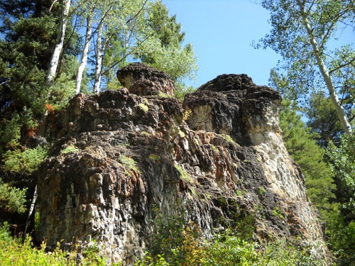
but I thought I either put them back on or put them in my shorts pocket. Jim
thought maybe I dropped them in the parking lot.
No problem -- we didn't get very far up the trail that day, so let's do it
again Thursday! That's when Jim went nine miles up and I went about seven
(then back).
We didn't go back to this trail specifically for me to hunt for my
sunglasses. They're pretty scratched up from several years of use (and abuse)
and old enough that they probably can't be replaced any more. If they could be
replaced, they are about $40, not chump change. These are my newest spare
glasses, which I'm wearing until I replace the good ones I destroyed in my bike
crash. When I get new lenses I can use the old frame and undamaged sunglasses
that fit them.
Meanwhile, it'd be nice to find the old scratched sunglasses I lost . .
.
The next morning we searched the trailhead parking lot but didn't see the
sunglasses. OK, maybe they're still on that boulder.
Nope. Well, doggone. Where could they be?
It's a significant enough climb that I had to walk all the way up through
Blind Hollow. My eyes swept the trail on both sides the entire way to the boulder and
beyond to where we turned around the day before. That was no small feat in some
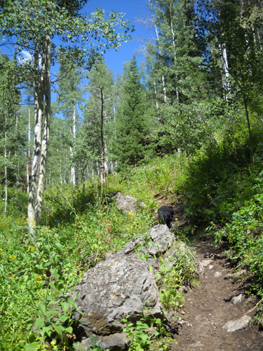
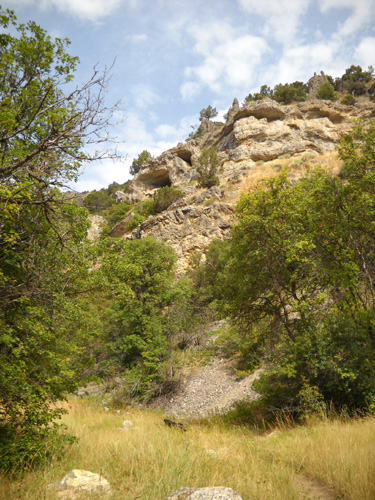
areas where the trail was seriously overgrown:
No sunglasses.
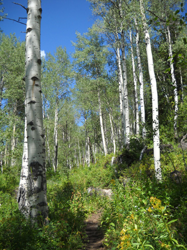
I continued toward Tony Grove Lake, admiring the flowers and trees and
distant views I hadn't seen the day before.
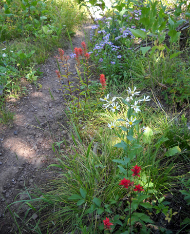
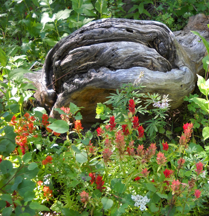
Patriotic pathway with red Indian paint brush, white
"daisies," and blue asters
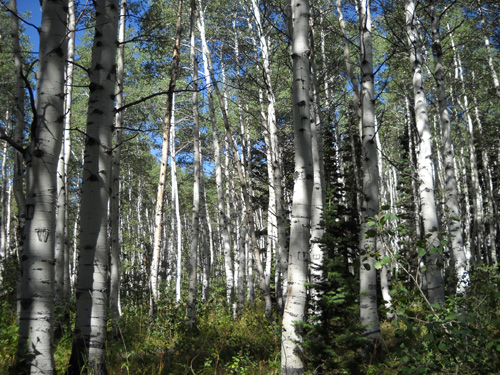
Got aspens?
After turning around at about 8,500 feet, I was able to run most of the
downhill to our truck at 5,758 feet. I was watching the trail closely for rocks
and roots so I didn't trip and fall, but I really wasn't scanning it for my
sunglasses any more after I got down to the aspen grove where we turned around on
Wednesday.
I figured they were forever lost.
But even though they weren't at the top of my priority list, and I was still
running, about halfway between the aspen grove and rock walls what should I see
but my sunglasses carefully arranged on a medium sized rock at the side of the
trail!
They could not have just fallen there and it's not the large boulder where I
last remember putting them. I have no idea how they ended up where they were, a
few hundred feet away, but I was happy to find them. I figured Jim found them
on the way up the mountain, put them on the rock so I'd see them, and would
pick them up on his way down if I missed
them.
Nope. He hadn't seen them going up.
So the mystery remains as to how they got there. It's not like this is a
heavily-traveled trail. We saw no other hikers the whole way (except at Tony
Grove Lake) on both runs, only two equestrians and evidence that a bike went up
or down before we got there on Wednesday morning. Thank you to whoever rescued
them!
WHERE AM I??
TECHNOLOGY COMES TO THE BEAR
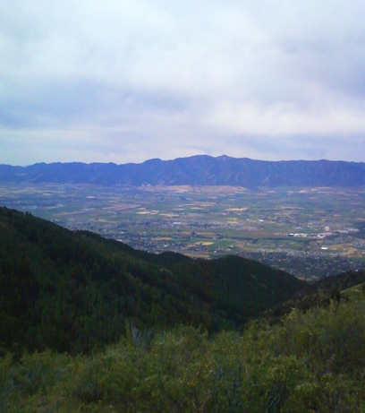
Bear runners reach the aid station at Temple Fork Rd. and Hwy. 89 just over
45 miles into the race. Jim will probably be running part or all of the next
section through Blind and Bear Hollows in the dark before reaching the next aid
station at Tony Grove Lake at approximately 52 miles into the race. We ran part
of all of it twice this week because it's convenient to reach from our
campground and has plenty of rather gradual altitude gain and loss.
Tony Grove Lake reflects the greenery surrounding it.
It was good for Jim to see what the trail is like before navigating it in
the dark. Now he knows that the elevation gain isn't as steep as it looks on
the elevation profile. He knows the surface is pretty smooth. And he knows the
turns.
This course isn't the best marked in the world; Leland knows how to
design a beautiful, challenging course but he's notoriously minimalist with
flagging and glow sticks! Hopefully, Jim can run the rest of the course in
training when we come back next week, especially the miles he'll face at night.
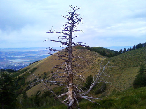
He also has technology on his side this time.
I would have missed the faint trail going up into these
trees without one of Jim's stick "arrows."
Webmaster and tech guru Phil Lowery has added some great navigational
features to the race
website since Jim last ran the race six years
ago: very detailed maps of the course and all kinds of GIS and GPS
coordinates to upload to your computer or GPS unit. Jim has put all the
waypoints into his handheld Garmin GPSMAP 60 unit and used them to navigate the course
this week. It's a good thing he did that, since it's not marked yet! The
written directions alone aren't adequate. He also wears a Garmin Forerunner 305
wristband GPS but he can't load the waypoints into that.
The waypoints helped me, too. The second time we went up Blind Hollow Jim used
his GPS to make sure I found the correct trails at several unmarked
intersections like the one below. He took time to stop and make stick arrows for me! Although I'd
memorized the turns from the course description, I wasn't wearing a GPS to
determine distances and would have walked past at least one of the faint trails
if he hadn't left markers for me. This trail was obvious and had a sign, but it
wasn't the name of the trail I remembered:
Thattaway!
Thank you, Phil and Leland, for these new features. The race and the race
website just keep getting better and better every year!
FLORA & FAUNA
Our forays onto the Bear trails indicate that Logan Canyon and the Cache
Valley could use some rain. Although there are lots of flowers in bloom and
bright green leaves are still on the shrubs and trees, some of the plants are
beginning to look crispy. Maybe it's just because summer is almost over and
they are hunkering down for fall.
Most of the small seasonal creeks we passed are dry
so Cody had to wear his water pack the second time we went farther up Blind
Hollow. He still needed additional water from my pack because it was so warm.
Jim had some trouble finding water to treat that day. I prefer to wear my
Camelbak pack and not have to bother with treating water.
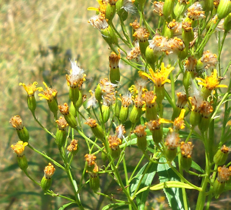
There aren't as many flowers in bloom in the Logan Canyon/Bear River Range as
in the San Juan Mountains near Silverton, but 'way more than we saw recently in
the Leadville area. Some were completely new to me, like the four-foot
tall plant below with interesting white fluff appearing to replace the yellow
flowers as they matured:
Some of the wildflowers are ones we've seen all summer at similar and higher
elevations in the mountains of Wyoming, Colorado, and Nevada:
purple asters, blue larkspur, blue lupines, purple and white wild geraniums,
brilliant orange and red Indian paintbrush (below), pink wild roses, various kinds and
sizes of yellow daisy-like flowers (arrowleaf balsamroot, mules ears, arnica,
etc.), white wild carrots, white yarrow, and many others.
And guess what else?? There are dandelions, of course! We're still in
a Dandelion Time Warp. That's eight full months now.
There are also some bright, shiny red berries along a quarter mile section of the
trail up Blind Hollow in the deep shade of stately pine trees. The 3/8" berries grow at
about 7,000 feet in elevation on small shrubs. They aren't chokecherries, which
grow profusely in the canyon, but I haven't been able to identify them yet.
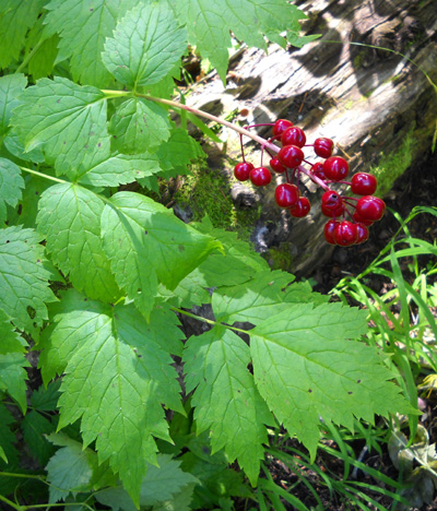
I betcha the birds and bears like the berries.
Bears?!
Yes, there are bears in the Bear River Range. Imagine that! And deer and elk
and moose, but we've seen only deer and small mammals on the trails and in the
campground this week. Here are a couple of moose we saw along the course in
2003:
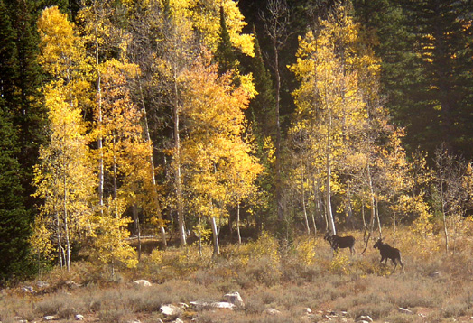
Aren't the aspens striking in the fall? I can't wait to see what they look like
a month from now.
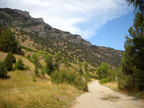
THE FIRST 20 MILES
The course
profile looks scary as all get out until you
realize how scrunched up it is from side to side. Remember that it represents
100 miles horizontally. It's waaaay out of proportion to the elevation shown
vertically in feet .
Just look at that first climb
from the start in a park on the eastern side of Logan (about 4,860 feet) to the
top of the first peak (about 8,200 feet) six miles later. That's a significant
climb, but not at the grade on the profile! After dropping down to about 7,500
feet, runners climb back up to a little over 8,.800 feet on Logan Peak at mile 12. In the
next eight miles, there is a mostly relentless drop through Millville Canyon to 5,150 feet at Leatham
Hollow at Mile 20.
Even if it isn't the grade shown below, it's still tough on your lungs and legs. And that's just one-fifth of this course.
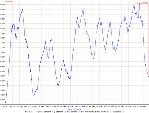
Open the link above to read the numbers on the graph.
Miles at bottom are in 5-mile increments.
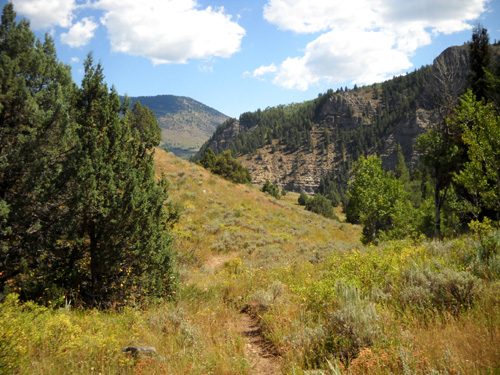
The profile from Temple Fork aid station at Mile 45 (5,7580 feet on our GPS) to a ridge near Naomi
Peak at Mile 54 (about 9,000 feet) looks equally steep, but we discovered on both
of our hikes
up and runs down Blind Hollow and Bear Hollow that the grades are more reasonable than they appear on the
profile.
Jim learned the same thing yesterday about that massive climb and descent in the
first 20 miles -- yes, they are tough, but not as impossible as they
look on the profile. Really! And he found the descent to be mostly runnable,
which helps make up time lost hiking up the first few miles.
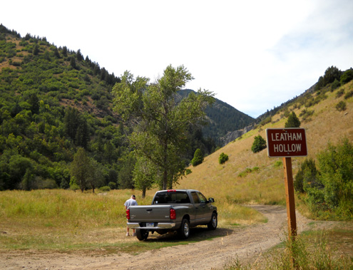
Yesterday morning I let Jim off at Hyrum Gibbons Park, below, the start of the
race. It was overcast and temperatures were in the upper 50s.
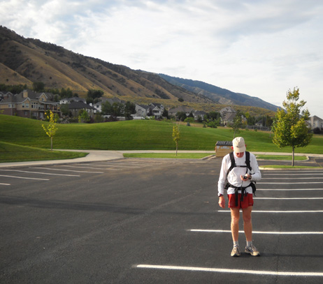
Jim makes sure he has signals on both Garmin GPS units before
going up to Logan Peak.
The first mile of the race is on city streets that take runners to the
rocky dirt road at the mouth of Dry Canyon. I took the next picture of Jim the
day before his training run when we drove out to find the start and the first
part of the course:
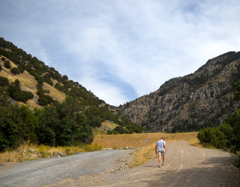
About a mile into the race, runners will head up into Dry
Canyon.
After another quarter mile, the road morphs into single-track trail as it winds
its way up to Logan Peak.
Jim's not big on carrying a camera when he runs but he knew I'd want to see
what the views look like from Logan Peak. So he took pictures on his cell
phone. Thank you, Sweetie!
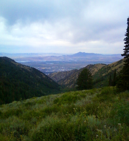
The next seven photos are ones Jim took,
in order, going up and over the peak:
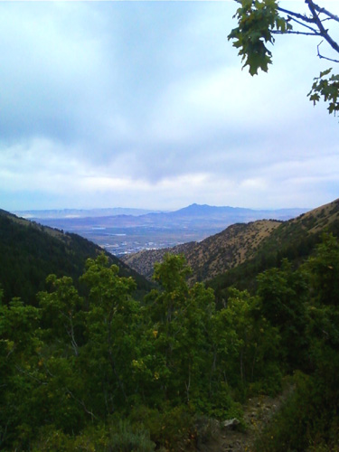
Cache Valley views, above and below
Pretty aspen grove part way up the mountain
Wellsville Range in the distance
Lonely sentinel
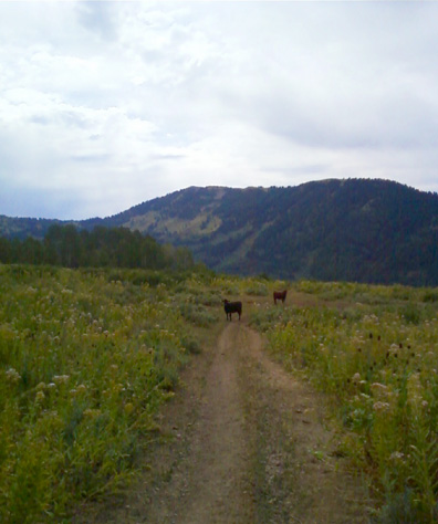
Beware the free-range cattle!
Looking into the Leatham Hollow gorge on the descent
Since I'm just making a comeback from my bike crash less than four weeks ago, I
didn't need to be out on the course very long. I still need to watch how much I
exert myself because of the ribs I fractured. Then there was that concussion
. . . I did manage to go about 13 miles on Thursday, however, and climb up
to 8,500+ feet without any problems, so I figured I could climb up several
miles from Jim's endpoint, Leatham Hollow, and back down while I was waiting
for him.
I waited too long, however, and it got hot again: mid-80s, which to us
is pretty hot after being in cooler temps most of the summer. After I let Jim
off in town, I ran some errands and walked around taking photos of the
temple
and tabernacle. It was noon by the time I got out to Leatham Hollow and on the
trail with Cody.
On race day crews will drive about a mile back this road
(Left Hand Fork) to reach Leatham AS.
Jim was carrying his Garmin Map60 GPS loaded with race waypoints to find his
way up and over Logan Peak. I didn't have that advantage, but I think I found
the correct trail going up Leatham Hollow. The next photos are ones I took on
my relatively short out-and-back run/hike.
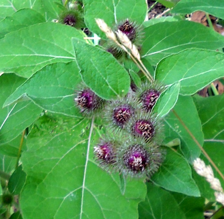
Unusual kind of thistle along the trail
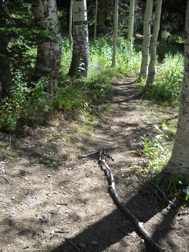
The lower part of the course through Leatham Hollow is very runnable and mostly shaded,
although the photos I'm showing here are ones that are more out in the open and
feature some of the interesting rock walls.
The trail
followed a creek part of the way and had some nice views down to the road where
I parked -- Left Hand Fork Road. Lots of roads around here are named after
creeks, or forks. Yes, there's a Right Hand Fork Road, too!
There will be an aid
station located somewhere around here during the race. This is another photo I
took the day before we ran here:
I cut my run short because I was concerned about some of the rough characters I
saw camping and roaring around recklessly in their 4WD vehicles near the
parking area. This is a dispersed camping area in the national forest where
folks pick a spot and dry camp or "boondock." There were a bunch of 'em out
there this weekend. I didn't want to come back and find a window smashed out.
Of course, I had no "weapon" to defend myself if someone decided to bother me
while I was there, and cell phones are useless in that area, but I
worried enough about the truck getting damaged or stolen that I went back to it
after I'd run only three miles.
Cody and I waited a couple hours without incident until Jim got done
mid-afternoon. I was able to park under a shade tree near Left Hand Fork (the
creek), where Cody got to swim twice. There were still some clouds in the sky
and a little bit of a breeze to stir the hot air.
This photo shows the dirt road that Bear runners follow for the next three
miles after leaving the Leatham Hollow AS:
I took that picture on Friday when we drove out to find the aid station
location. Jim wanted to make sure I found the place so the truck would be there when he got done running
on Saturday. We haven't run or driven any farther back Left Hand Fork Road
because it quickly deteriorates into a 4WD road after this point. We don't have
4WD any more.
There were
campers all over the place when we were there on Saturday, which may also
happen during the race next month = more vehicles for the runners to dodge when
running down this road.
Jim was a bit discouraged that it took him seven hours to complete this section
but we think he can do it faster in the race.
- He had to stop a few times to get
his bearings and find the right trail; the course will be marked, at
least minimally, on race day.
- He
was by himself; he'll have the incentive of keeping up with other
runners during the race.
- He took photos on this training run, but won't in the
race.
- He'll be more rested then; he did a hard 18-miler two days
before this run.
- And it should be cooler on race day.
We like what we've seen so far of the relatively new
Bear 100
course and we're looking forward to coming back soon to run and hike more of
it. Jim's pretty psyched up for this race!
Next entry: exploring other trails in Logan Canyon
Happy trails,
Sue
"Runtrails & Company" - Sue Norwood, Jim O'Neil,
and Cody the Ultra Lab
Previous
Next
© 2009 Sue Norwood and Jim O'Neil