This is a short "chapter" in our summer trip: just one week in
the Logan Canyon of northeastern Utah, general site of the Bear 100 race that
Jim will be running the weekend of September 25-26.
Our stay is rather short, but I've got plenty to say about it! Brevity has
never been one of my strong suits. The more reader response I get that thanks
me for useful and/or entertaining content, the more fun I have writing entries
and taking photos with this journal in mind.
The first two Logan Canyon entries are mostly a
travelogue about getting here, our campground, and things to do and see in this
area (for readers who are more interested in travel, destinations, and RVing
than running and hiking). Two more entries will
feature local trails we ran and hiked, including part of the Bear course.
Oh, and I'll probably include a mouse story in here, too . . .
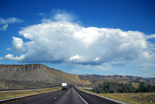
Photo tip: The first thirteen pictures in this entry are what I call
"windshield shots," ones I took from inside the truck while Jim was driving.
Our current camera, an inexpensive Nikon Coolpix L20, does a good job of
freezing action in landscape mode when I shoot scenes that are ahead of us.
Side shots tend to be fuzzy close to the road because it is "moving" faster. I
usually just crop out some of the foreground and use the middle distances and
background in side shots (e.g., the 10th and 11th photos below, taken
along Hwy. 91 between Brigham City and Logan).
Anyway, after I discovered several years ago that I could take landscape
shots in a moving vehicle it has saved a lot of time (and Jim's sanity) not
having to stop to take pictures when I want to.
WHY UTAH?
Why not?
There is a lot to see and do here; previous visits to various parts
of the state over the last 30+ years have barely scratched the surface:
the rock fantasylands of Bryce and Zion National Parks, majestic granite peaks
in the Wasatch Mountains, colorful canyons and plateaus, shimmering white salt
flats, lush green valleys and meadows with serpentine rivers like the Bear that
make you dizzy when you try to visually trace their path from a mountain
summit.
And there's so much more we haven't seen yet. Nothing makes me
happier than exploring new places, especially by foot.
We had some time to kill before Jim runs the
Grand Teton 50-miler as his last long training run for the Bear, and the Logan
area is sort of on the way up there. We wanted to familiarize ourselves with
a few miles of the Bear 100 trails and crewing locations that we have never
seen; the course has changed significantly since Jim last ran the race
in 2003. So it made sense to stop here for a few days and start checking
out the place.
Early next week we'll head up to the Idaho-Wyoming border west of the Teton
Range for the Grand Teton
Races (GTR). After a week there, we'll be
back here in the Logan Canyon area for about three weeks. Then we'll probably
head back to our house in Virginia for a couple months.
That's the tentative plan unless we change our minds! (RULE #2: Be
flexible.)***
THE VIEW FROM THE ROAD
In the last entry five days ago (Monday) we were in transit from Leadville, CO to the
Logan, UT area and had just driven 185 miles to Grand Junction, CO, where we
spent a quiet but rainy night in the Sam's Club parking lot. We still had
another 364 miles to Logan Canyon.
Tuesday morning dawned sunny and a little cooler, perfect conditions for
a ride through some more scenic territory. I don't think there is any ugly
terrain in either Colorado or Utah!
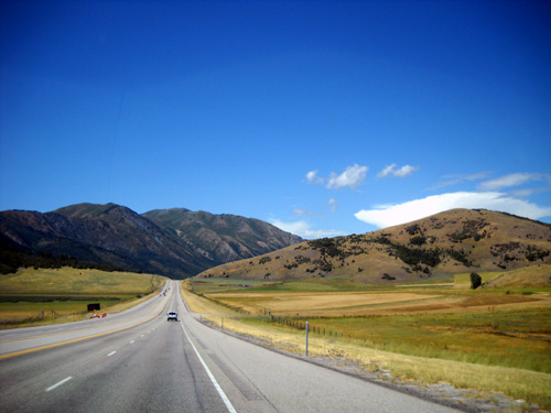
From Grand Junction we followed I-70 west into Utah to US Hwy. 6, the same
route we took to and from Salt Lake City last month when we drove to
Reno/Carson City, NV for the Tahoe Rim Trail race. This route passes through
the large Colorado Plateau area of Utah, where the Colorado and Green Rivers
snake through colorful canyons and uplifted plateaus that rise as high as 11,000 feet.
Hwy. 6 is a a fast,
efficient tangent that cuts off many miles between I-70 and 1-15 north through
Utah. Each
time we've taken this route we've been able to cruise about the same speed
(65-67 MPH) as we drive the camper on freeways. Even though it is partly
two-lane, there are passing lanes on long hills and plenty of straightaways
where you can pass slower vehicles.
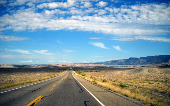
A four-lane section of Hwy. 6 through
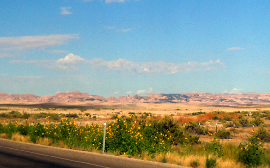
"castle country" near the town of Price
And it's scenic, too, with lava beds and vast rangelands near the road
and views of mountain ranges
to both the east and west.
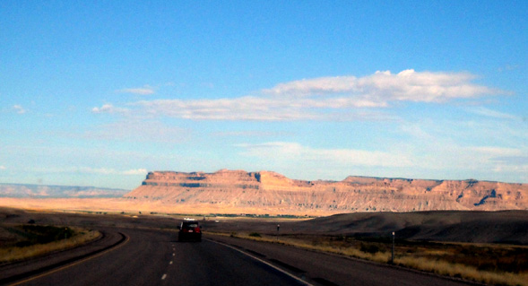
Population is very sparse along this road, especially at the southern
end (next photo). There are no towns in the forty-six miles from the
freeway to the town of Wellington, UT.
When we drive through vast areas of rangeland, mountains, or deserts
like this in the western part of the country I always think of the huge
contrast with densely populated areas. With no structures or people in
sight for mile after mile after mile, it's hard to imagine living on top
of one another in a busy, noisy, crowded city. When I'm in a crowded
city, frustrated with traffic, a cacophony of noise, and so many people
around me, it's hard to believe there are such quiet, vast open spaces
in other parts of the country!
And guess which end of that scale I prefer??
There are many people who have never seen "big sky country" (and what they
probably consider a lot of "nothingness") except on television or
in videos and movies. I wonder if they can even imagine what it's like
in person?
Sometimes even I have trouble truly understanding the
vastness of some areas in the western part of this country. Here's an example: imagine having your very own freeway exit for your ranch!
We see the ranch exit signs occasionally in various states in the West and Southwest. This
one is on I-70 in eastern Utah:
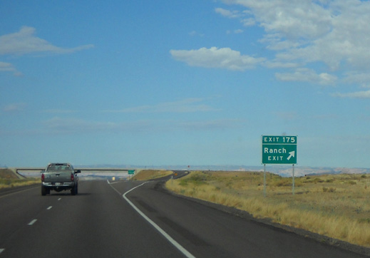
Their very own exit!
For that matter, imagine owning so many acres of land that you need
your own freeway exit!
But I digress . . .
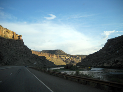
Hwy. 6
becomes more hilly and curvy as it heads north through the towns of
Wellington and Price
and into the foothills of the Wasatch Mountains between the
Uinta and Manti-La Sal National Forests.
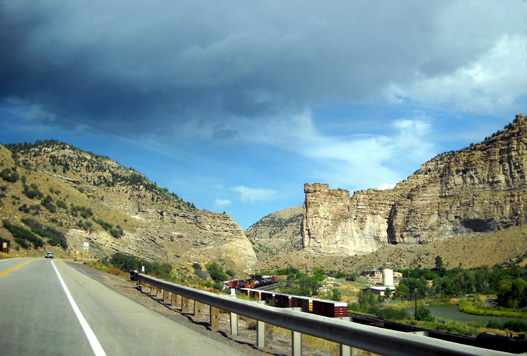
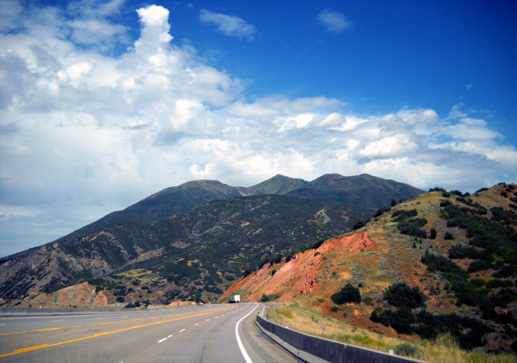
It tops out at Soldier Summit before dropping down to I-15. These
mountains are near Springville:
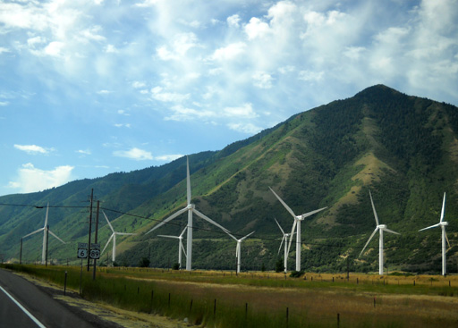
As you leave
the last canyon, these windmills are a bit of a surprise if you haven't seen
them before:
As in July, we headed north on I-15 past Provo to greater Salt Lake City but
instead of hanging a left on I-80 west, we continued north past Ogden. We had
great views of the Wasatch Mountains to the east all along this 100+ mile
stretch of freeway. Views of the vast Great Salt Lake are not as prominent on
this route as along I-80, however.
We were almost to our destination by mid-afternoon. When we reached the
Brigham City area we turned off onto US Hwy. 91 for the very scenic 24-mile drive
northeast to Logan
and the Cache (pronounced "Cash") Valley.
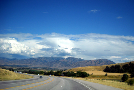
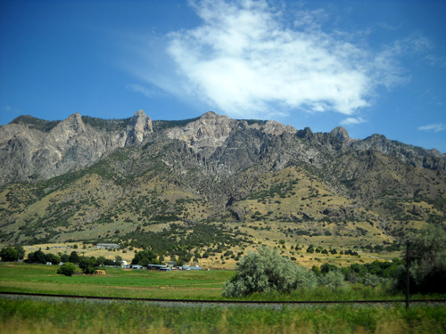
My first impression was what a beautiful area it is, full of lush farms with
the Bear River Range and Wasatch-Cache National Forest for a backdrop to the
east (above) and flanked to the west by the peaks of the Wellsville Mountain Range.
I was equally impressed with the appearance of the city of Logan itself.
I'll talk more about it in the next entry.
WHERE TO STAY?
Jim had already done some research by internet and phone of the national
forest campgrounds up Logan Canyon east of town but we'd made no reservations
yet. We needed to eyeball sites to see if they'd be big enough for our rig.
Park personnel warned us not only about tight and/or short sites, but also
narrow roads with sharp turns and low-hanging branches in most of their
campgrounds. They assured us that there are a few adequate spots for moderate
to large RVs but not many. However, they also said this isn't a crowded time
because kids would be back in school and we should be able to find some
appropriate campsites that were still unoccupied.
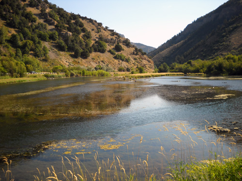
Lognn River near Spring Hollow Campground ; the scenic
byway is to the left in the background.
If you have a small camper (under 20 feet long), you're in luck in this area; there are
numerous camping options for you in the forests and meadows, and along the Logan River,
all up and down the 40+-mile long canyon.
As we came into the southern end of Logan we unexpectedly passed an attractive WalMart. Now where did that come from? It wasn't
included in the 2009 Rand
McNally road atlas that lists all the WalMart and Sam's Club stores. Turns out, it is
brand new and hasn't been open for more than a month. There's another older WalMart at the north end of town, too;
it and Sam's are in our atlas.
We pulled into the new location, not to spend the night, but to get
supplies. We also stopped at Sam's Club for other items, noting that it had
plenty of space for us to park that night if we were unable to find a suitable
national forest campground before dark.
Then we headed east on US Hwy. 89 past Utah State University to the edge of
town and visited the very nice Logan Ranger District Visitor Center that overlooks the
entire valley. What a great view from the Lady Bird Overlook! It's not as great as from one of the nearby
mountaintops (below), but just about as expansive of a view as you can get by driving
a paved road to a convenient viewing point in Logan.
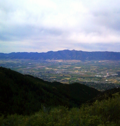
One of Jim's photos from the Bear 100 course above
Logan
We picked up some helpful maps and brochures about Cache Valley, Logan
Canyon, the Wasatch-Cache NF, hiking trails, and other recreational
opportunities in the area.
We also got some helpful advice from the ranger on duty, who kindly stayed
a few minutes past closing time (4:30 PM) for us, about the campgrounds we'd pass as we headed up
through Logan Canyon. She said there was not much dispersed (free) camping that would
be large enough for our camper until we'd driven about twenty miles. That's really
farther from Logan than we preferred to be this week but it might be suitable
when we return to the area for two or three weeks before the race. It would put
us near the last part of the race course, which we also want to check out
before race day.
The ranger confirmed Jim's hunch from his internet and phone research
that our best bet for a paid site would be at the Guinavah-Malibu Campground
five or six miles up the canyon.
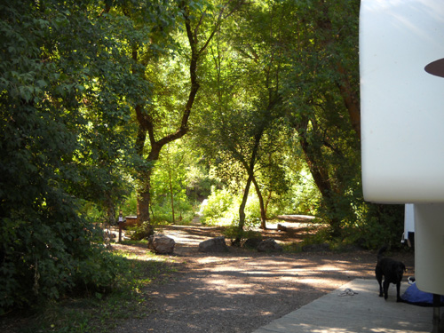
GUINAVAH-MALIBU CAMPGROUND
Since we had only a few hours of daylight left,
we decided to drive directly to the campground she recommended. We walked
around the
various loops and found severa; unreserved sites that were large enough for our
rig. We chose one far back into the Guinavah (pronounced GWIN-a-vah) loops past
a bridge over the Logan River, near the CCC-built amphitheater.
It is also near a bathroom and has a large wooded area on three sides for privacy.
Only
a few of the 40 individual campsites and none of the three group campsites were
occupied when we arrived on Tuesday. Enough folks came in this weekend to fill
half or more of the sites. If we decide to come back here for the race later in the month,
we know which site(s) we can reserve ahead of time. It will probably be busier
after the leaves start to turn; this area is renowned for its brilliant
fall colors.
Because we didn't know what any of our other camping options were, we
initially paid for only one night at Guinavah. After supper we unhooked the truck from the
camper and drove up the canyon to look at some other campgrounds and a couple
of dispersed (free) camping areas.
We soon decided that it would be
most convenient to remain at the Guinavah Campground this week. On Wednesday
morning we paid for another four nights so we could keep our spot. We continued to
investigate camping options for our return stay in the area, however. The national forest campgrounds have
two-week limits; we don't know if they enforce those off-season but since we'll
probably be here for three weeks or more, we need some alternatives.
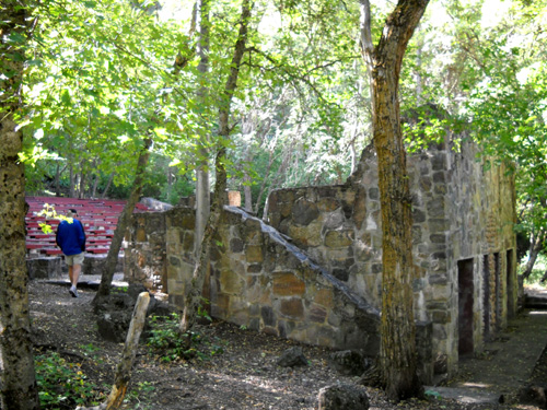
Jim checks out the unique stone amphitheater at Guinavah
Campground.
Built by the CCC in the 1930s, it has several rooms on the
lower level for use by performers, etc.
Guinavah-Malibu CG is described in the slick Logan Canyon brochure published
by the Cache Valley Visitors' Bureau as "the
best-loved campground in the Canyon." I can see why, after checking out most of
the others. It is fairly close to Logan, high enough in elevation (about
5,200 feet) to be noticeably cooler than the valley, and in a gorgeous wooded
setting that straddles the Logan River.
It also provides access to several trails; I'll talk about those in a
separate entry.
The campground provides a shady respite on a hot day.
Most of the campsites are spacious enough to provide some privacy from
neighboring campers. Ours has this huge "back yard" with a picnic table:
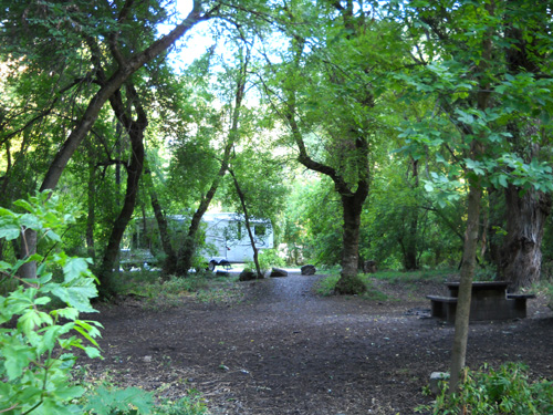
That's our camper in the background. There are no other
campsites close to us.
There is a rather complicated reservation system that even the campground
host had trouble clarifying, but basically
at least half of the campsites can be reserved online a minimum of four days
ahead of time for up to two weeks. Less than four days and you have to pick an
unreserved site, then put cash or a check in the box at the entrance board to
each campground.
Campsites at Guinavah-Malibu are $15/night. Other National Forest Service
campgrounds in the canyon range from $12 to $20, depending on location and
amenities. Guinavah-Malibu has no electrical, water, or sewer hookups.
We are close enough to a water spigot to run a hose from it to our camper's fresh water tank. There are several very clean restrooms with flush
toilets and sinks in each campground. There is no dump station.
The major downside to most of the NFS campgrounds along US Hwy. 89 through the canyon
is, surprisingly, road noise. This 41-mile stretch of road from Logan to
Garden City is a designated National Scenic Byway yet you'd be amazed how many big
road construction and commercial trucks drive this winding, mountainous road!
Not only do they use noisy air brakes going downhill to Logan, they are also
intimidating if they're tailgating your smaller vehicle in that direction.
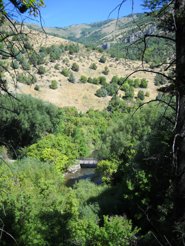
Our camper is to the right of this
bridge which crosses the Logan River.
I'm on the Riverside Trail about 100
feet above the Guinavah Campground.
The other downside to us is that any campground a mile or more up the
canyon, including Guinavah, doesn't have Verizon or other cell service. Nor do
we have TV reception.
That may be just fine for folks who are out for the weekend or a week and
want to "get away from it all" but if you practically live in your RV like we
do, it's nice when you can get online and make phone calls from home. We have
to drive down several miles to the city to make calls and get internet
connections on our laptop computer.
We use my cell phone to get online unless we can find a convenient WiFi
connection. The best one we found in Logan is at a nice Laundromat near Main Street and 5th Street North. Being able to read e-mail, upload photos, and surf the web makes doing laundry pretty painless!
(In addition, this is the least
expensive Laundromat we've found on this trip, especially after I discovered
that two of the dryers run for about an hour on a quarter! You usually get only
six or seven minutes for a quarter.)
*** Remember Rules #1 and 3 from the AT trek? Be safe and have fun! I've
tried to apply all three "rules" to my life ever since. Some times I'm more
successful than others!
Next entry: an introduction to the city of Logan and the canyon area
Happy trails,
Sue
"Runtrails & Company" - Sue Norwood, Jim O'Neil,
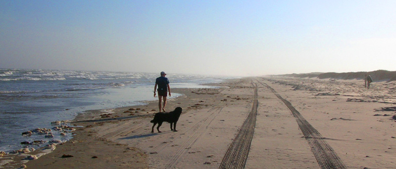
and Cody the Ultra Lab
Previous
Next
© 2009 Sue Norwood and Jim O'Neil